Arizona is the kind of place that makes you feel like you stepped into a postcard—then you turn a corner and it becomes a completely different postcard. One day you’re in saguaro desert with cotton-candy sunsets. The next you’re in pine forests, on canyon rims, or wandering a historic town that looks like it’s been waiting for you to show up.
This bucket list is built for real travelers: it mixes iconic “you have to see it once” moments with high-reward experiences that don’t require expert skills. Use it as a checklist, a trip-planning menu, or inspiration for weekends and long road trips.
Before you dive in, a quick “do this and you’ll enjoy Arizona more” tip: plan for big temperature swings, strong sun, and longer drives than the map suggests. A little preparation goes a long way here.
Arizona Bucket List Essentials: Quick Tips Before You Go
- Chase the shoulder seasons: Spring and fall are the easiest “great weather” windows statewide.
- Start early: Sunrise adventures beat crowds, parking stress, and heat.
- Plan around elevation: Northern Arizona is dramatically cooler than the desert.
- Hydrate like it’s your job: Dry air sneaks up on you, even in mild weather.
- Leave time for the unexpected: Arizona is made for spontaneous pull-offs and detours.
50 Must-Do Arizona Experiences
Iconic Natural Wonders
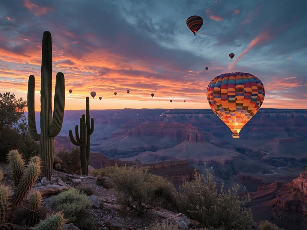
- Watch sunrise at the Grand Canyon. It’s quiet, crisp, and the shadows reveal the canyon like a slow curtain lift at Grand Canyon National Park.
- Walk a rim trail segment instead of “doing a big hike.” You’ll get nonstop views and can choose your own distance at Grand Canyon National Park.
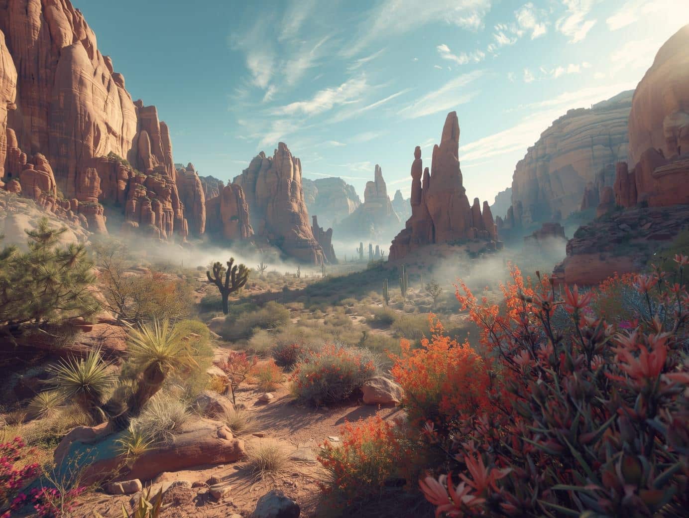
- See the desert glow at golden hour among towering saguaros. The Sonoran Desert at sunset is the definition of “Arizona magic” at Saguaro National Park.
- Take a scenic drive through saguaro country. It’s an easy, family-friendly way to get the “wow” factor without committing to a long hike at Saguaro National Park.
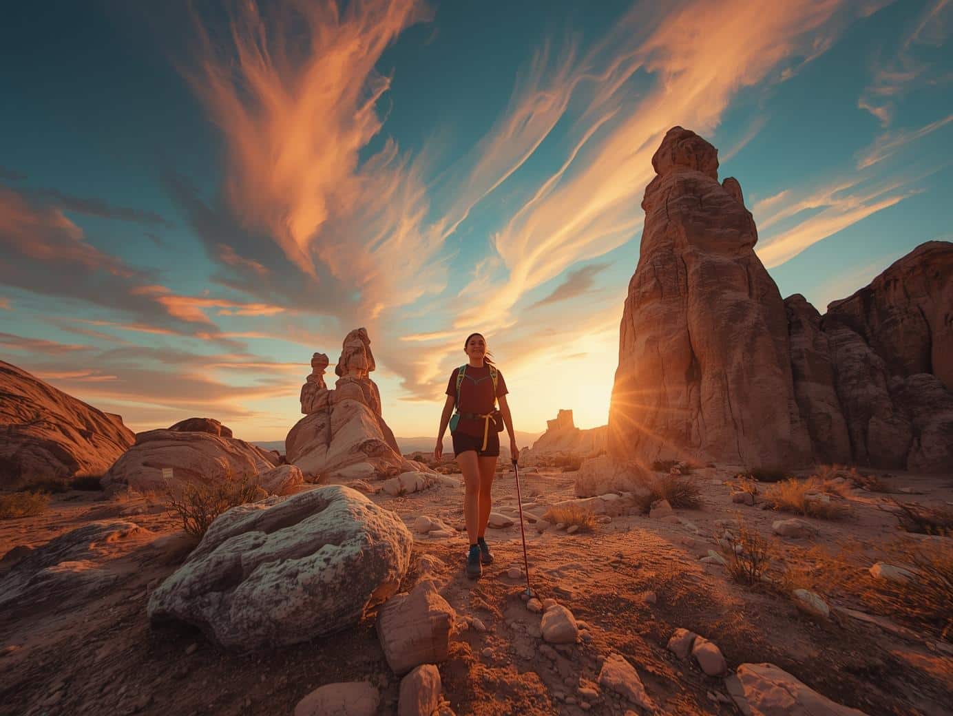
- Experience Sedona’s red rocks at sunrise. The light hits differently—warmer, softer, and wildly photogenic in Sedona.
- Do one “short trail, big view” hike in Sedona. Pick a beginner-friendly route and let the landscape do the heavy lifting in Sedona.
- Take in a monsoon-season sky show (from a safe spot). Arizona storms can be spectacular—watch from town or a covered viewpoint rather than chasing lightning in open desert.
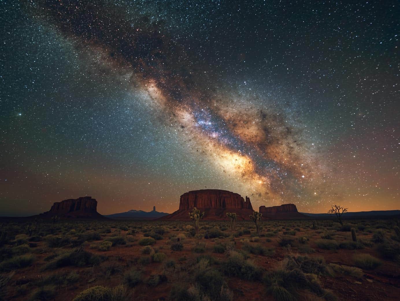
- Find a true dark-sky night and look for the Milky Way. Choose a spot away from city lights, bring a blanket, and give your eyes 20 minutes to adjust.
- Visit canyon country and soak up wide-open horizons. Base your day around viewpoints and short walks in the Page area.
- Plan a “water + sandstone” day. Canyon country feels extra surreal when you pair desert scenery with a lake day near Page.
Scenic Drives and Road Trip Moments
- Drive a classic stretch of Route 66. It’s peak Americana—signs, diners, and “why is this here?” stops along Route 66.
- Do Route 66 properly: stop often. The whole point is the micro-adventures along Route 66.
- Take a “two ecosystems in one day” drive. Start in desert, end in pines—Arizona’s elevation change is one of its best tricks.
- Pull over for the view even if it’s not on the itinerary. Arizona’s best moments are often unplanned overlooks and golden-hour surprises.
- Build a weekend road trip around red rocks + mountain air. Combine Sedona with cooler temps and forest vibes near Flagstaff.
- Drive a forest road just to feel the temperature drop. In summer, the high country around Flagstaff feels like flipping on nature’s A/C.
- Plan a “sunset drive” with a single destination viewpoint. One good viewpoint beats five rushed ones.
- Make one road trip meal stop the main event. A memorable diner, a local bakery, or a patio meal can anchor the whole day.
- Do a “desert-to-lake” day trip. It’s peak Arizona contrast and surprisingly refreshing.
- Take a scenic drive after rain (carefully). The desert looks freshly washed and dramatically colorful—just avoid flooded washes and muddy side roads.
Lakes, Water Days, and Cooling-Off Wins
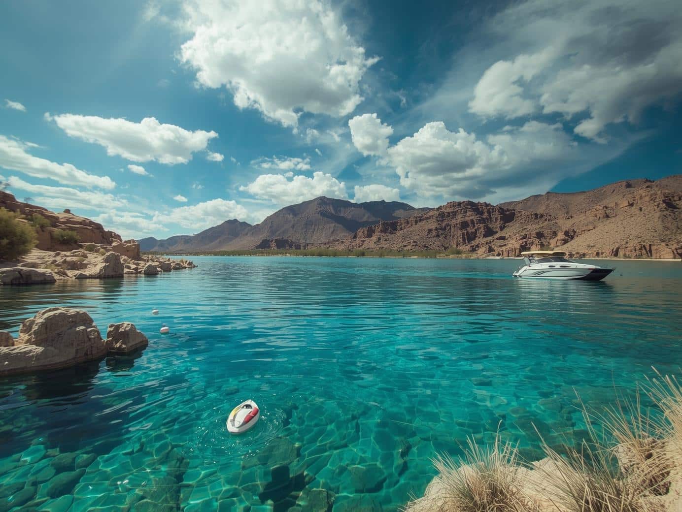
- Spend a day on a big lake with a “boat culture” vibe. For a classic Arizona water getaway, plan a trip to Lake Havasu.
- Do a sunset walk near the water. Evening at Lake Havasu can feel like a mini vacation even if you don’t boat.
- Plan a “cove day”: swim, snack, float, repeat. The best lake days are simple and unhurried.
- Try paddleboarding or kayaking somewhere calm. Early morning usually means smoother water and fewer crowds.
- Camp one night by water (or as close as you can). Desert camping feels extra special when you end the day with stars and a cooler breeze.
Desert-to-Mountain Towns and Local Favorites
- Spend a day wandering Sedona without rushing. A short hike + long lunch + a scenic drive is a perfect Sedona formula.
- Use Flagstaff as your “reset day” base. Coffee, forest walks, and cooler air make Flagstaff a top-tier change of pace.
- Take a fall weekend in the high country. Crisp mornings and warm afternoons are what Flagstaff does best.
- Plan a Tucson day for food and desert scenery. Tucson is one of Arizona’s most rewarding “eat your way through town” destinations: Tucson.
- Do a Tucson sunset drive, then a late dinner. Desert evenings feel made for slow plans in Tucson.
- Visit a small town festival or weekend market when you stumble upon one. It’s one of the quickest ways to feel “local” anywhere in Arizona.
- Do a scenic picnic instead of a rushed restaurant stop. Arizona views + simple food = unbeatable.
History, Culture, and “Only in Arizona” Stops
- Stand somewhere that makes you feel Arizona’s deep timeline. Ancient landscapes and cultural history are part of what makes the state feel bigger than a vacation.
- Visit a historic mining or railroad town. Arizona’s boom-and-bust history shows up in architecture, museums, and main streets that still carry stories.
- Take a ghost-town detour on a road trip. Even a quick stop adds a sense of mystery and context to the landscape.
- Follow a self-guided “old highways” route for a day. Arizona road history is half the fun of traveling here—especially along Route 66.
- Do a “one museum, one outdoor stop” day. It’s the perfect balance when the sun is intense or the weather is unpredictable.
- Take a guided tour when it’s available. In places with fragile environments or sensitive history, guided options often give you more access with less impact.
Adventure (Beginner-Friendly to Big-Feeling)
- Try a beginner hike with a payoff view. Arizona is great at “short trail, huge scenery,” especially around Sedona and Saguaro National Park.
- Do one sunrise hike in the desert. It’s cooler, quieter, and the light is unreal.
- Take a stargazing night seriously once. Bring chairs, warm layers, and snacks—and stay long enough to actually see the sky change.
- Ride a scenic train route or take a historic rail-themed stop. It’s a slower way to experience Arizona’s wide-open scale.
- Try a horseback ride in the desert (if that’s your thing). It’s classic Southwest and surprisingly peaceful.
- Do a “two-hour adventure” instead of an all-day push. A short hike plus a scenic drive often feels more epic than a forced marathon day.
- Book one splurge experience. A guided tour, a unique stay, or a signature activity can define an entire trip.
Food Experiences Worth Planning Around
- Eat Sonoran-style Mexican food in Tucson. Make it part of your must-do list in Tucson.
- Plan a patio meal with desert views. Arizona’s outdoor dining season is a huge quality-of-life upgrade.
- Find a small-town diner on a long drive. This is especially fun on Route 66.
- Build a “snack itinerary” for your road trip day. Coffee stop, bakery stop, fruit stop, dinner stop—simple, effective, joyful.
- End one Arizona day with something sweet and a sunset. It sounds basic, but it’s the kind of moment you remember.
How to Turn This Bucket List Into a Real Trip
If you’re planning your first “big Arizona loop,” here’s a simple approach that works:
- Pick 2 anchor destinations (example: Sedona + Grand Canyon National Park)
- Add 1 contrast stop (example: cactus desert at Saguaro National Park or a lake day at Lake Havasu)
- Add 1 “fun drive” day (example: a stretch of Route 66)
- Leave 20% of your schedule open for viewpoints, naps, weather pivots, and random discoveries
Arizona rewards travelers who don’t rush it.