The Arizonan's Guide to Arizona

San Pedro Riparian National Conservation Area

Introduction

Arizona's Desert River Sanctuary

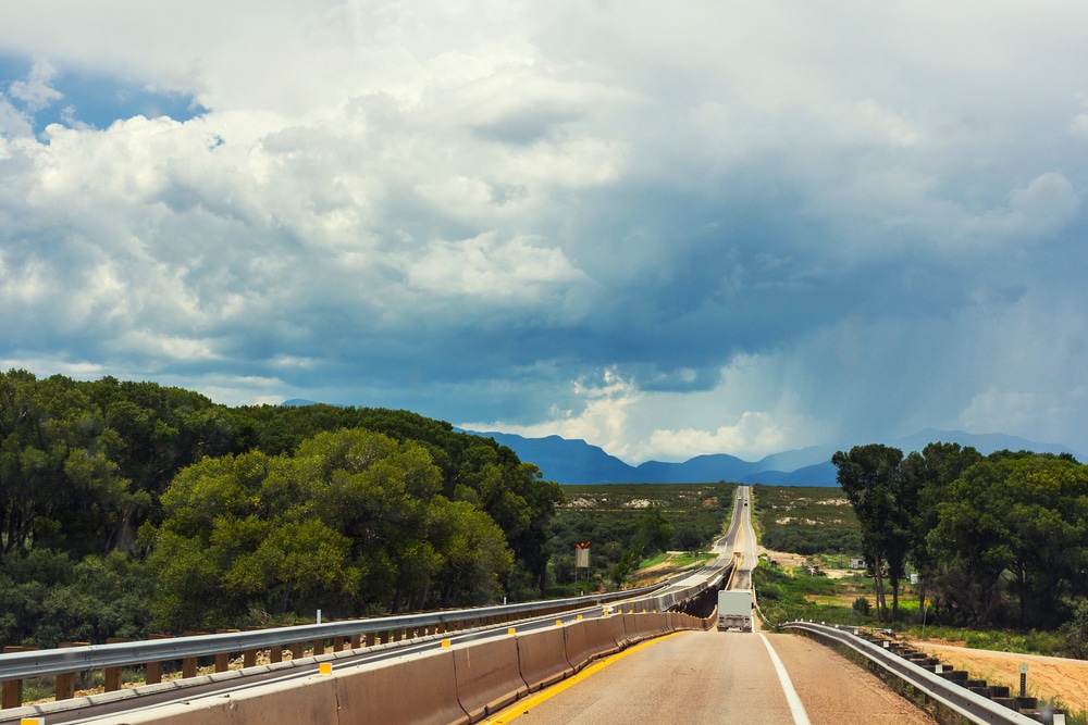
In the arid landscape of southeastern Arizona flows a remarkable natural treasure – the San Pedro River, one of the last free-flowing, undammed rivers in the American Southwest. Surrounding this vital waterway lies the San Pedro Riparian National Conservation Area (SPRNCA), a 56,000-acre protected corridor that stretches for approximately 40 miles from the US-Mexico border northward to the community of St. David. Established by Congress in 1988, this conservation area represents one of the most significant riparian ecosystems in the United States and serves as a critical migration corridor for both wildlife and birds.

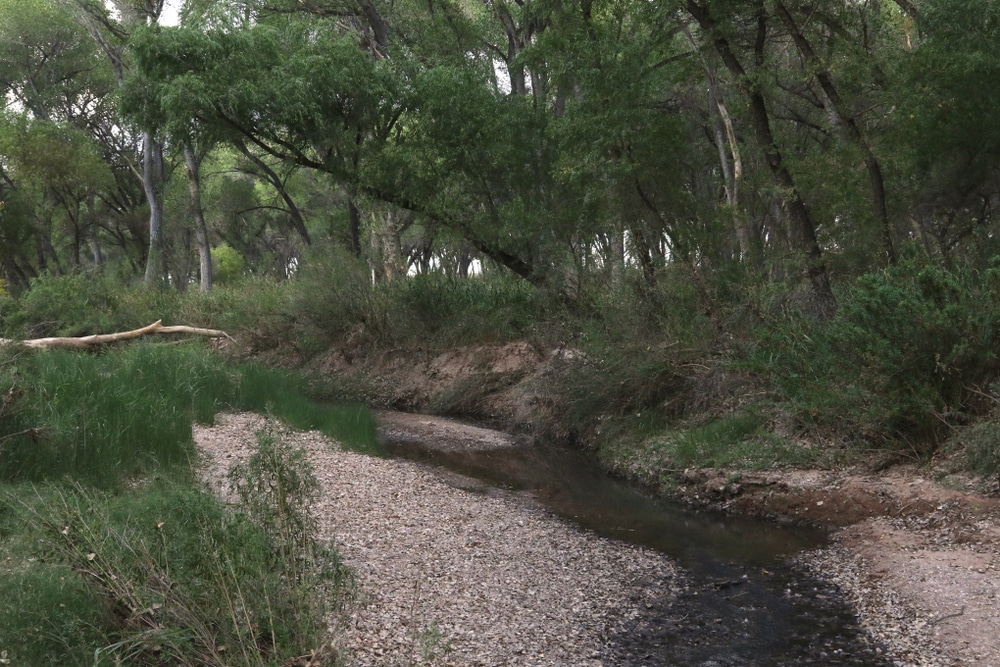
The term “riparian” refers to the lush green areas adjacent to rivers and streams, and the San Pedro supports one of the most diverse riparian ecosystems in the entire Southwest. This ribbon of green cutting through the desert creates a stark and beautiful contrast with the surrounding Sonoran and Chihuahuan desert landscapes. The conservation area encompasses not only the river and its immediate banks but also terraces, floodplains, and parts of the surrounding uplands that influence the river’s ecology.

For visitors to Arizona seeking a different kind of outdoor experience beyond the state’s famous deserts and canyons, the SPRNCA offers a unique opportunity to explore a rare desert river ecosystem. With its combination of historical significance, remarkable biodiversity, and recreational opportunities, the San Pedro Riparian National Conservation Area provides both a sanctuary for nature and a place where people can connect with one of Arizona’s most precious natural resources – water in the desert.

Road,Near,San,Pedro,Riparian,National,Conservation,Area,With,Thunderstorm
Didi You Know ?

Things To Do At San Pedro Riparian National Conservation Area, Arizona

Visit the San Pedro House

The San Pedro House serves as an excellent starting point for your visit. This historic ranch house, located near Sierra Vista, functions as an information center and gift shop. Friendly volunteers provide maps, trail recommendations, and interpretive information about the area’s ecology and history. The nearby picnic area is perfect for a relaxing break.

Wildlife Viewing

SPRNCA is home to an incredible variety of wildlife. In addition to birds, you might encounter:

  • Mule deer
  • Bobcats
  • Javelinas
  • Coyotes
  • Lizards and snakes
  • Beavers along the riverbanks

Visit at sunrise or sunset for the best chance to spot wildlife in their natural habitat.

037-boots

Hiking the Riparian Trails

The conservation area features numerous trails that allow visitors to explore the lush riparian forest, open grasslands, and desert landscapes. Popular trails include:

  • San Pedro Trail: A scenic, easy-to-moderate trail that follows the river and provides opportunities to spot wildlife and enjoy peaceful views.
  • Murray Springs Clovis Site Trail: A short trail leading to an archaeological site with interpretive signs about the ancient Clovis culture.

Hikes can range from short, family-friendly strolls to longer, more adventurous treks.

038-certificate

Explore Historic Sites

The San Pedro Riparian area is rich in history, with several fascinating sites to explore:

  • Murray Springs Clovis Site: An ancient archaeological site dating back over 13,000 years, where evidence of the Clovis culture has been discovered.
  • Fairbank Ghost Town: A historic mining and railroad town that thrived in the late 19th century. The restored schoolhouse serves as a museum with exhibits on the town’s history.
  • Presidio Santa Cruz de Terrenate: Ruins of a Spanish presidio (fort) from the late 1700s, offering a glimpse into Arizona’s colonial history.
023-camera

Photography

With its diverse landscapes, flowing river, and abundant wildlife, SPRNCA is a photographer’s dream. Capture stunning photos of:

  • Verdant riparian forests along the San Pedro River
  • Vibrant desert sunsets
  • Birds in flight or perched among cottonwood trees
  • Historic ruins and ghost towns

Spring and fall are especially photogenic seasons, with lush greenery and colorful migratory birds.

016-vest

Horseback Riding

Several trails within the conservation area are open to horseback riders. Riding along the San Pedro River is a unique way to experience the serene beauty of the riparian habitat and the surrounding desert.

005-binoculars

Birdwatching

The San Pedro River is a globally recognized birding destination, with over 350 species of birds recorded in the area. It is an important migratory corridor, making it ideal for birdwatchers year-round. Commonly spotted birds include:

  • Vermilion flycatchers
  • Yellow warblers
  • Great horned owls
  • Summer tanagers
  • Green herons

Bring binoculars and a bird guidebook to make the most of your birding experience.

Stargazing icon

Enjoy Stargazing

Thanks to its remote location and minimal light pollution, the conservation area offers excellent stargazing opportunities. Bring a telescope or simply lay out a blanket to enjoy a clear view of the Milky Way, constellations, and planets.

019-fishing

Fishing Along the San Pedro River

Fishing is allowed in parts of the San Pedro River. Check local regulations and ensure you have a valid Arizona fishing license. While fishing, enjoy the peaceful surroundings and the chance to spot wildlife along the riverbanks.

travel_campfire

Picnicking

The conservation area offers several tranquil spots for picnicking, particularly near the San Pedro House. Surrounded by towering cottonwoods and the soothing sounds of the river, it’s a perfect way to relax and recharge after a hike.

Page Content

San,Pedro,River,,San,Pedro,Riparian,National,Conservation,Area,,Sierra

Table Of Details About : San Pedro Riparian National Conservation Area, Arizona

CategoryDetails
LocationSoutheastern Arizona, near Sierra Vista and Bisbee, USA
EstablishedNovember 18, 1988
Managed ByU.S. Bureau of Land Management (BLM)
SizeApproximately 57,000 acres (23,067 hectares)
Main AttractionsSan Pedro River, historic sites, birdwatching, hiking trails
Cultural SignificanceContains archaeological sites, including prehistoric villages, petroglyphs, and Spanish colonial history
Ecological ImportanceProtects one of the last free-flowing rivers in the Southwest and its associated riparian habitat
EcosystemRiparian corridor surrounded by desert grasslands, home to diverse wildlife
WildlifeOver 350 bird species, 80 mammal species, and numerous reptiles and amphibians
Nearby LandmarksTombstone, Bisbee, Coronado National Memorial
Visitor ActivitiesBirdwatching, hiking, photography, horseback riding, and nature viewing
ClimateSemi-arid desert climate with hot summers and mild winters
AccessibilityTrails accessible from multiple entry points; some areas wheelchair accessible
Entrance FeeNo entrance fee
Fun FactThe San Pedro River is a globally recognized bird migration corridor, attracting birdwatchers from around the world.

Location and Accessibility

The San Pedro Riparian National Conservation Area is located in Cochise County in southeastern Arizona, approximately 80 miles southeast of Tucson and 190 miles southeast of Phoenix. The conservation area extends along the upper San Pedro River from the international border with Mexico to the town of St. David.

Major Access Points

The SPRNCA can be accessed from several key locations:

San Pedro House: Located 6 miles east of Sierra Vista on Highway 90, this serves as the primary visitor center with parking, trailheads, and interpretive displays.

Fairbank Historic Townsite: Situated 9 miles west of Tombstone off Highway 82, this ghost town offers a glimpse into the area’s history along with river access.

Millville/Charleston Area: Found south of Highway 82 on Charleston Road, this location provides access to both historical sites and natural areas.

Hereford Bridge: Located on Hereford Road, this southern access point is ideal for birding and wildlife viewing.

Palominas: The southernmost access point near the Mexican border offers excellent bird watching opportunities.

Murray Springs Clovis Site: An important archaeological site located near the San Pedro House.

Accessibility Information

  • Most access points have developed parking areas with informational kiosks
  • The San Pedro House serves as the main visitor center, staffed primarily by volunteers from the Friends of the San Pedro River organization
  • Wheelchair-accessible trails are available at the San Pedro House and Fairbank Historic Townsite
  • Four-wheel drive is not required to reach main access points, though some dirt roads can become impassable during monsoon season
  • No entrance fees are required to access the conservation area
  • Public transportation is not available to the conservation area; personal vehicles are necessary

Natural Features and Landscapes

The SPRNCA encompasses a remarkable diversity of landscapes created by the interaction of water and desert:

The San Pedro River

The river itself is the defining feature of the conservation area:

  • One of the last undammed, free-flowing rivers in the Southwest
  • Flows northward from Mexico (unusual direction for North American rivers)
  • Seasonal flow patterns with some sections running year-round and others flowing only during wet seasons
  • Supports extensive gallery forests along its banks
  • Features cottonwood-willow forests that provide critical shade and habitat
  • Includes various river features such as pools, riffles, and sandbars

Riparian Corridor

The verdant zone adjacent to the river creates a striking contrast with surrounding desert:

  • Cottonwood-willow gallery forests create a canopy over 90 feet tall in some areas
  • Dense understory vegetation including seepwillow, wolfberry, and various grasses
  • Mesquite bosques (woodlands) on higher terraces above the river
  • Cienegas (desert marshlands) in areas with high water tables
  • Sacaton grasslands in bottomlands that experience periodic flooding
  • Distinctive microclimate that can be 10-15 degrees cooler than surrounding areas

Desert Uplands

Beyond the riparian zone, the conservation area includes desert landscapes:

  • Sonoran Desert influences in western portions with saguaro cacti and palo verde
  • Chihuahuan Desert elements in eastern areas featuring creosote bush and whitethorn acacia
  • Desert grasslands that once dominated the region before overgrazing
  • Rolling hills with desert scrub vegetation
  • Transitional zones where desert and riparian ecosystems meet

Geological Features

The landscape showcases the area’s dynamic geological history:

  • The San Pedro Valley represents a classic basin and range formation
  • Steep escarpments of the Huachuca Mountains visible to the west
  • River terraces showing ancient floodplain levels
  • Dramatic cut banks exposing layers of geological history
  • Evidence of tectonic activity that shaped the valley
  • Fossil-bearing deposits from ancient lakes and streams

Wildlife and Plant Life

The SPRNCA is renowned for its remarkable biodiversity:

Birds

The conservation area is internationally recognized for its avian diversity:

  • Over 350 bird species documented, representing nearly half of all bird species in the United States
  • Designated as a Globally Important Bird Area by the National Audubon Society
  • Critical migratory corridor for birds traveling between Central/South America and North America
  • Important nesting habitat for rare species including Gray Hawks, Yellow-billed Cuckoos, and Southwestern Willow Flycatchers
  • Exceptional raptor diversity including Mississippi Kites, Common Black Hawks, and Zone-tailed Hawks
  • Spectacular congregation of hummingbird species during migration periods
  • Year-round residents including Vermilion Flycatchers, Bridled Titmice, and Abert’s Towhees

Mammals

The riparian corridor supports diverse mammal populations:

  • Large mammals including mule deer, white-tailed deer, javelina, and occasional mountain lions
  • Beaver have been reintroduced and are actively creating beneficial wetland habitats
  • Over 15 species of bats use the riparian corridor for feeding and roosting
  • Coatis (tropical members of the raccoon family) reach their northern range limit here
  • Desert-adapted species like jackrabbits and coyotes inhabit upland areas
  • Rare species like ocelot occasionally documented within the conservation area

Reptiles and Amphibians

The varied habitats support numerous herptiles:

  • Several species of rattlesnakes including the Mohave, black-tailed, and Western diamondback
  • Gila monsters in drier upland areas
  • Sonoran mud turtles in permanent water sections
  • Leopard frogs in backwaters and pools
  • Various lizards including the striking zebra-tailed lizard
  • Several toad species that emerge dramatically during monsoon rains

Fish

The river provides habitat for both native and introduced fish species:

  • Native species including longfin dace and desert sucker
  • Conservation efforts focus on restoring habitat for native fishes
  • Introduced species include green sunfish and mosquitofish
  • Seasonal pools serve as important refugia during dry periods

Invertebrates

The riparian ecosystem supports remarkable invertebrate diversity:

  • Over 100 species of butterflies documented
  • 20+ dragonfly and damselfly species
  • Diverse bee populations supporting riparian plant pollination
  • Seasonal emergence of millions of insects providing food for migratory birds
  • Unique aquatic invertebrates adapted to desert stream conditions

Plant Communities

The conservation area showcases multiple plant communities:

  • Fremont cottonwood and Goodding’s willow form the core riparian forest
  • Velvet mesquite dominates the bosque woodlands on higher terraces
  • Sacaton and other grasses create meadow-like bottomlands
  • Desert scrub including creosote bush and acacia in upland areas
  • Emergent vegetation like cattails and rushes in marshy areas
  • Annual wildflower displays following monsoon and winter rains
  • Ancient hackberry, sycamore, and ash trees in protected canyons

Recreational Opportunities

The SPRNCA offers diverse recreational activities for visitors:

Hiking and Walking

An extensive trail network provides opportunities for all skill levels:

  • The San Pedro Trail runs the length of the conservation area (approximately 40 miles)
  • Shorter interpretive loops at major access points
  • Cottonwood-shaded pathways along the river
  • Routes connecting historical and natural features
  • Seasonal trails that may be inaccessible during high water periods
  • Popular day hikes include the San Pedro House loop (2.5 miles) and Fairbank-Grand Central Mill route (3.5 miles)

Bird Watching

The conservation area is a world-class birding destination:

  • Best birding times include spring migration (April-May) and fall migration (August-September)
  • Dawn and dusk provide optimal viewing opportunities
  • Designated bird viewing areas with benches at strategic locations
  • Annual Christmas Bird Count consistently records remarkable diversity
  • Special birding events coordinated by local Audubon chapters and Friends of the San Pedro River
  • Uncommon species regularly documented, attracting birders from around the world

Wildlife Viewing

Beyond birds, wildlife observation opportunities abound:

  • Dawn and dusk offer best viewing times for mammals
  • Beaver activity visible at several locations along the river
  • Seasonal wildflower blooms attract butterflies and pollinators
  • Designated wildlife viewing blinds at select locations
  • Interpretive signs help visitors identify common species
  • Photography opportunities throughout the conservation area

Cultural and Historical Exploration

The area’s rich history is accessible through preserved sites:

  • Fairbank Historic Townsite includes preserved buildings and interpretive displays
  • Murray Springs Clovis Site offers a glimpse into prehistoric human occupation
  • Remnants of Spanish and Mexican ranching traditions
  • Mining history visible at Charleston and Millville sites
  • Historical cemeteries providing insights into frontier life
  • Ancient Indigenous cultural sites (visitors should respect all archaeological resources)

Educational Programs

Organized learning opportunities enhance visitor experiences:

  • Guided interpretive walks led by Bureau of Land Management staff or volunteers
  • Educational programs at the San Pedro House
  • Junior Ranger activities for children
  • Special event programs highlighting seasonal phenomena
  • School group field trip opportunities
  • Citizen science monitoring projects open to visitor participation

Horseback Riding

Equestrians can explore designated trails:

  • Several trailheads provide horse trailer parking
  • River access points for horses (important during hot weather)
  • Riders must stay on designated routes to protect sensitive habitats
  • Best during cooler months to minimize heat stress on animals
  • Special regulations apply to protect the riparian ecosystem

Hunting

Limited hunting is permitted in specific areas:

  • Restricted to designated upland zones away from high visitor use areas
  • Requirements include appropriate Arizona hunting licenses and permits
  • Special regulations apply within the conservation area
  • Focus on sustainable wildlife management
  • Prohibited near developed recreational sites and trails

Historical and Cultural Significance

The San Pedro Valley has a remarkably rich human history:

Ancient Indigenous Presence

Archaeological evidence reveals thousands of years of human occupation:

  • Clovis culture sites dating back approximately 13,000 years
  • The Murray Springs Clovis Site represents one of the most significant Paleoindian locations in North America
  • Ancient hunting sites where mammoth and other extinct megafauna were processed
  • Archaic period settlements along the river terraces
  • Hohokam and Sobaipuri O’odham agricultural communities
  • Evidence of ancient agricultural practices utilizing the river’s resources

Spanish Colonial Period

The river valley played a role in Spain’s northward expansion:

  • Father Kino traveled through the area in the late 1600s
  • Spanish missions established in the broader region
  • The San Pedro Valley formed part of El Camino Real (The Royal Road)
  • Spanish colonial ranching operations utilized the valley’s grasslands
  • Conflicts between Spanish settlers and Apache groups shaped the region’s history

Mexican Period and Early American Settlement

Following Mexican independence, the area saw new development:

  • Land grants issued by the Mexican government in the early 19th century
  • Early American settlers arrived following the Gadsden Purchase (1854)
  • Establishment of stage stops along transportation routes
  • Conflicts between settlers and Apache continued through the 1880s
  • Development of cattle ranching throughout the valley

Mining and Transportation Era

The late 19th century brought intensive development:

  • Silver mining boom led to the establishment of Charleston and Millville
  • Fairbank developed as an important transportation hub
  • Railroad construction along the river connected mining communities
  • Grand Central Mill processed ore from Tombstone’s famous mines
  • Intense wood harvesting from riparian forests to fuel mining operations
  • Significant population centers developed and later abandoned as mining declined

Ranching Legacy

Cattle ranching significantly altered the landscape:

  • Large cattle operations dominated the valley from the 1880s through the 20th century
  • Overgrazing contributed to erosion and changes in river morphology
  • Groundwater pumping for agriculture affected the river’s flow
  • Ranch structures and water developments visible throughout the conservation area
  • Transition from open range to fenced pastures changed land use patterns

Conservation Story

The establishment of the conservation area represents an important chapter:

  • Growing concerns about groundwater depletion and habitat loss in the 1970s
  • Citizen advocacy led by local conservation groups
  • Congressional designation in 1988 as the nation’s first Riparian National Conservation Area
  • Ongoing restoration efforts to heal past environmental damage
  • International conservation coordination with Mexican partners
  • Model for riparian protection throughout the Southwest

Practical Information for Visitors

Planning a visit to the SPRNCA requires attention to several factors:

Safety Considerations

The desert environment presents several challenges:

  • Summer temperatures regularly exceed 100°F (38°C); heat-related illness is a serious risk
  • Limited shade except within the riparian corridor
  • Flash flooding possible during monsoon season (July-September)
  • Drinking water not available at most trailheads
  • Visitors should carry at least one gallon of water per person per day
  • Venomous creatures including rattlesnakes, scorpions, and Gila monsters
  • Limited cell phone coverage throughout much of the conservation area
  • Sunscreen, hat, and appropriate clothing essential
  • Monsoon thunderstorms can develop rapidly with dangerous lightning

Best Times to Visit

Visitation is highly seasonal:

Spring (March-May)

Moderate temperatures, bird migration, and wildflowers

Fall (September-November)

Cooling temperatures, bird migration, and fall colors

Winter (December-February)

Mild daytime temperatures and wintering bird species

Summer (June-August)

Extremely hot but dramatic monsoon storms create lush conditions; early morning visits essential

Permits and Regulations

Visitors should be aware of conservation area rules:

  • No entrance fees required for general access
  • Camping permitted only in designated areas with a free permit
  • Fires restricted to designated areas; often prohibited during dry periods
  • Collection of plants, animals, artifacts, or rocks prohibited
  • Pets must be leashed at all times and are prohibited on some trails
  • Motorized vehicles restricted to designated roads
  • Mountain bikes permitted only on designated routes
  • Special permits required for commercial activities or group events

Visitor Facilities

Limited facilities are available:

  • San Pedro House serves as the primary visitor center with restrooms and information
  • Fairbank Historic Townsite offers restrooms and picnic facilities
  • Most trailheads have parking and informational kiosks
  • No potable water available except at San Pedro House and Fairbank
  • No developed campgrounds within the conservation area
  • Primitive camping permitted in designated areas with permit
  • Nearest services available in Sierra Vista, Benson, or Tombstone

Accessibility

The conservation area offers limited accessibility features:

  • Wheelchair-accessible trails at San Pedro House and Fairbank
  • Accessible restrooms at main visitor sites
  • Most remote trails are not developed for wheelchair access
  • San Pedro House offers accessible interpretive displays
  • Staff can provide information about current accessibility conditions

Conservation Challenges and Stewardship

The SPRNCA faces several conservation challenges:

Water Resources

The most critical issue involves water quantity and quality:

  • Groundwater pumping in surrounding areas threatens river flows
  • Development pressure in the watershed impacts aquifer recharge
  • Climate change models predict decreased precipitation and increased temperatures
  • Historic channel entrenchment continues to affect riparian processes
  • Water quality concerns from urban and agricultural runoff
  • International water management coordination essential for long-term protection
  • Legal battles over water rights impact conservation efforts

Invasive Species

Non-native species threaten ecosystem integrity:

  • Tamarisk (salt cedar) displaces native vegetation and alters soil chemistry
  • Bermuda grass creates dense mats that prevent native plant regeneration
  • Bullfrogs prey upon native amphibians and reptiles
  • Feral cattle occasionally enter from Mexico causing habitat damage
  • Lehmann lovegrass alters grassland fire regimes and composition
  • Control efforts focus on early detection and targeted removal

Climate Change

Changing climate patterns may significantly impact the ecosystem:

  • Increased temperatures stress temperature-sensitive species
  • Changed precipitation patterns affect river flow regimes
  • More frequent drought conditions threaten groundwater recharge
  • Altered fire regimes may damage riparian vegetation
  • Shifts in migratory timing for birds and other animals
  • Possible changes in vegetation communities and wildlife distribution

Border Activities

The conservation area’s location along the international border creates unique challenges:

  • Unauthorized border crossings can damage sensitive habitats
  • Law enforcement activities may impact wildlife and visitor experiences
  • Border infrastructure affects wildlife movement patterns
  • Coordination between conservation and security agencies requires ongoing attention
  • International conservation efforts crucial for ecosystem protection

Conservation Efforts

The Bureau of Land Management implements various conservation programs:

  • Riparian habitat restoration through managed grazing exclusion
  • Native vegetation planting and invasive species removal
  • Beaver reintroduction to improve wetland habitat
  • Erosion control and stream channel stabilization
  • Prescribed fire management to restore natural processes
  • Wildlife monitoring and research programs
  • Water rights acquisition and protection
  • Environmental education and outreach

Volunteer Opportunities

Visitors can contribute to conservation efforts:

  • Friends of the San Pedro River volunteer organization
  • Citizen science monitoring programs for birds, wildlife, and water conditions
  • Habitat restoration workdays
  • Trail maintenance projects
  • Educational program assistance
  • Visitor center volunteer opportunities
  • Annual river cleanup events

Conclusion

The San Pedro Riparian National Conservation Area represents one of Arizona’s most ecologically significant protected lands. As a rare desert river ecosystem in an increasingly arid Southwest, its importance extends far beyond its boundaries, influencing wildlife migration patterns, watershed health, and ecological resilience across the region.

For visitors, the SPRNCA offers a different kind of Arizona experience—one focused on water, life, and the rich historical legacy of human interaction with this precious resource. Whether watching thousands of migratory birds navigate along this crucial flyway, walking beneath towering cottonwoods that provide essential shade in the desert heat, or exploring ancient sites where humans first hunted now-extinct mammals along the river’s edge, the conservation area connects people with ecological processes that have shaped this landscape for millennia.

In a region where water increasingly represents the most valuable resource, the protection of the San Pedro River stands as an example of conservation foresight. For those willing to explore beyond Arizona’s more famous destinations, the SPRNCA offers insights into the complex relationships between water, landscape, wildlife, and human communities that define the American Southwest. Through ongoing stewardship, this desert river sanctuary will continue to serve as both an ecological refuge and a place where people can connect with one of nature’s most precious gifts—a living river in the desert.