
Cherry is a small mountain community in the Black Hills near Mingus Mountain, in central Yavapai County between Dewey-Humboldt and Camp Verde. It began as a gold-mining camp, and a post office opened on March 3, 1884. About 400 people lived and worked here at its prime. The post office closed in 1943, but Cherry was never fully abandoned. It is now a small retirement and vacation-home community in the Prescott National Forest.
Camp at Powell Springs. About 4.5 miles along Cherry Road from State Route 169, the Prescott National Forest’s Powell Springs Campground is a historic campground built by the Civilian Conservation Corps. It has 11 campsites under ponderosa pines beside Hackberry Wash, a seasonal creek. There is a vault toilet but no drinking water, and the site closes after heavy rain or snow and when the roads are icy.
Hike, ride or drive the Cherry area. The forest around Cherry is open for hiking, mountain biking, horseback riding, scenic driving and OHV riding. Trails in the Cherry area include the General Crook Trail #64, Ash Creek #9705, Medlar Springs #9706, Sheep #532 and Grapevine Gulch #9708.
Visit Jerome State Historic Park. About a dozen miles north-northwest, Jerome State Historic Park is housed in the Douglas Mansion, built in 1916 by James S. Douglas above his Little Daisy Mine. It is now a museum of the Jerome area’s mining history and the Douglas family.




Behind the weathered headstones in Cherry’s cemetery lie the stories of individuals who lived, worked, loved, and died in this mountain mining community. While specific biographical information for many residents has been lost to time, patterns in the cemetery and regional historical records provide glimpses into their lives.
The graves reflect the demographic reality of early mining camps—predominantly male, with women and children appearing in greater numbers as the community stabilized. Accident victims speak to the dangerous nature of mining work, while family plots with multiple generations suggest those who put down roots and sought to build a future in Cherry.
Among those who would have lived in Cherry were the mine owners and operators, who may have resided in larger homes near the business district or maintained residences in Prescott while overseeing operations from a distance. Professional miners, many bringing skills from earlier mining regions or from European mining traditions, would have formed the backbone of the workforce.
Supporting these mining operations were merchants, saloonkeepers, blacksmiths, teamsters, and others who provided essential services. As families established themselves, teachers, clergy, and other community figures would have appeared. The diversity of roles required to sustain even a small mining town reminds us that Cherry was not merely an industrial site but a community of individuals pursuing their own versions of the American dream.
| Category | Details |
|---|---|
| Name | Cherry, Arizona |
| Type | Historic gold-mining town / small unincorporated community |
| County | Yavapai County |
| Founded | 1880s gold camp; post office 1884 |
| Status | Still inhabited; a small retirement and vacation-home community |
| Population (Historic) | About 400 at its prime |
| Population (Current) | Small; not counted separately by the census |
| Historical Significance | Center of the Cherry Creek Mining District |
| Primary Industries (Historic) | Gold mining |
| Post Office | Established March 3, 1884; discontinued March 15, 1943 |
| Decline Factors | Mines played out; post office closed 1943 |
| Remnants Today | Historic cemetery and original buildings still in use as homes |
| Key Attraction | Historic Cherry cemetery |
| Access | Between Dewey-Humboldt and Camp Verde; check road conditions before driving |
| Geographic Setting | Black Hills near Mingus Mountain, Prescott National Forest |
| Elevation | Approx. 5,000 feet (1,524 meters) |
| Climate | High desert – hot summers, cool winters |
| Best For | History buffs and backroad drivers who respect private property |
Cherry emerged in the 1880s as prospectors found gold in the Black Hills near Mingus Mountain in Yavapai County. Located on the old stage route between Fort Verde and Fort Whipple, about a dozen miles south-southeast of Jerome and roughly 25 miles east of Prescott, Cherry was positioned in a mineral-rich region that attracted miners, entrepreneurs, and families seeking opportunity in the Arizona Territory.
While not as famous as nearby mining towns like Jerome, Cherry developed into a modest but viable community centered around several productive mines. The town was likely named for the wild cherries that grew in the vicinity, providing a touch of natural beauty in an otherwise industrious landscape focused on mineral extraction.
The exact foundation date of Cherry isn’t well-documented, but mining activity in the area intensified in the 1880s as prospectors expanded their search beyond the already established claims in Jerome and other nearby locations. As mines were established and began producing, Cherry grew organically from a small mining camp into a more structured community with essential services and amenities.
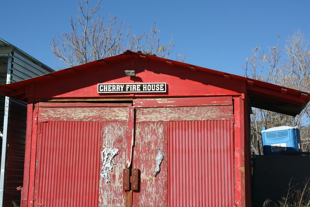
Today, Cherry is a quiet hamlet rather than an empty ruin. Several of the original buildings are still in use, and the historic cemetery holds graves from the late 19th and early 20th centuries.
Old mine openings in the Cherry area are dangerous, so stay out of them.
Cherry Road, which leaves State Route 169 about 9.5 miles from Dewey, is a dirt road that passenger cars can drive except in wet weather. Cherry is a lived-in community, so keep to the road and respect private property.
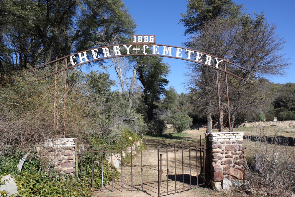
One of Cherry’s most poignant features is its historic cemetery, which holds graves from the late 19th and early 20th centuries.
The cemetery is modest in size, reflecting the scale of the community it served.
The graves tell stories of the harsh realities of frontier mining life—accident victims, casualties of disease outbreaks, and the particularly heartbreaking frequency of infant and child burials that characterized the era before modern medicine.
Today the cemetery remains both a tangible link to Cherry’s human past and a reminder of the hardships of mining-camp life.
While specific information about a separate community cemetery distinct from the pioneer burial ground is limited in historical records for Cherry, the documented pioneer cemetery likely evolved to serve broader community needs as Cherry developed from a mining camp into a more established settlement.
As was common in mining communities, burial practices evolved with the town. What might have begun as hastily established gravesites for the earliest residents would have developed more formal organization as the community stabilized. Family plots would have become more common, reflecting the transition from a population of mostly single male miners to one that included families and longer-term residents.
While specific newspapers unique to Cherry aren’t prominently documented in historical records, the community would have been served by publications from nearby larger towns such as Prescott, which hosted several newspapers during the territorial period. These regional papers would have carried news of Cherry’s mining developments, significant events, and occasionally social happenings.
Mining communities of Cherry’s size sometimes supported their own modest publications, often weekly papers that combined local news with reprinted content from larger cities. If Cherry had its own newspaper, it would have operated from a small office in the business district, possibly sharing space with another enterprise to economize on the substantial investment required for printing equipment.
The newspaper would have been vital in connecting Cherry’s residents with each other and the outside world, announcing new strikes, reporting on ore quality, covering accidents and other local events, and publishing essential information about supply deliveries, mail service, and transportation schedules. The paper would have also served as a forum for community debate, particularly regarding mining regulations, water rights, and other issues critical to the town’s prosperity.
Whether Cherry had its own dedicated newspaper or relied on regional publications, the importance of print media in maintaining community identity and connection to the broader world cannot be overstated. The eventual cessation of newspaper coverage would have been both a symptom and a catalyst of the town’s decline.
Cherry’s development was influenced by the regional transportation networks that connected it to larger economic centers. While likely lacking direct rail access given its mountainous location, Cherry would have been served by wagon roads connecting to the nearest rail lines, which expanded throughout Arizona Territory in the late 19th century.
The Atlantic & Pacific Railroad (later part of the Atchison, Topeka & Santa Fe) established a transcontinental route across northern Arizona in the 1880s, while the Prescott & Arizona Central and later the Santa Fe, Prescott & Phoenix Railway connected Prescott to this main line, creating vital transportation links for communities in the Mingus Mountain region.
For Cherry, these rail connections, though not immediate, would have been essential for shipping ore to processing facilities and bringing in the heavy equipment needed for mining operations. Wagon roads, maintained with varying degrees of quality depending on their economic importance, would have connected Cherry to these rail lines, likely with regular stage or freight service.
Transportation challenges would have shaped daily life in Cherry—mail delivery schedules, the availability of supplies, the cost of shipping ore, and the practical difficulty of travel all influencing the community’s development and ultimately contributing to its decline when economic conditions changed.
Like many mining communities in Arizona, Cherry’s fate was tied to the profitability of its mines. As mining faded, the population dwindled, and Cherry’s post office closed on March 15, 1943.
The early 20th century brought changes that challenged many small mining operations throughout Arizona. Larger, more industrialized mining operations with better transportation connections could produce minerals more efficiently, while changing national economic conditions altered the profitability of many smaller mines. Environmental factors, including water availability and quality in this mountainous region, may have presented additional challenges.
As mining activity declined, Cherry’s population would have dwindled. Businesses closed, buildings were abandoned or dismantled for materials, and community institutions faded. Some residents might have moved to more promising mining areas or to growing urban centers, while others may have remained in the region as ranchers or in other occupations.
Although mining faded, Cherry was never entirely abandoned, and it survives today as a small retirement and vacation-home community.
Cherry represents an important chapter in Arizona’s mining heritage, offering insights into the development and decline of the smaller mining communities that once dotted the state’s mountainous regions. While not as famous as boom towns like Tombstone or Jerome, communities like Cherry collectively employed thousands and produced significant mineral wealth that contributed to Arizona’s development.
The site provides archaeologists and historians with opportunities to study mining techniques, community formation, and daily life in a typical small mining town of the late 19th and early 20th centuries. Material remains—from mining equipment to household artifacts—offer tangible connections to the people who once called Cherry home.
For descendants of Cherry’s residents, the site and particularly its cemetery provide important connections to family history and Arizona’s pioneer past. These connections sometimes inspire preservation efforts aimed at documenting what remains before it is lost to further deterioration.
Cherry’s pioneer cemetery, like many in ghost towns across Arizona, faces ongoing challenges of weathering, erosion, vegetation encroachment, and occasionally vandalism. The cemetery’s remote location offers some protection from human disturbance but also makes regular maintenance difficult.
Preservation efforts have typically been led by historical societies, descendant groups, or volunteers interested in protecting Arizona’s pioneer heritage. These efforts often focus on documentation—recording grave inscriptions, creating maps of burial locations, and researching the individuals interred there—rather than extensive physical restoration, which can be costly and logistically challenging.
Occasionally, descendants or historical groups may conduct cleanup events, removing invasive vegetation, repairing damaged markers, or installing modest fencing to protect the site. These activities help preserve the cemetery as both a historical resource and a place of memorial for those buried there.
The continued existence of Cherry’s cemetery, despite the decline of mining and the passage of more than a century, speaks to the cultural importance of burial grounds as anchors of memory and community identity. Even after all other aspects of community life have ceased, the cemetery remains as a permanent marker of human presence and a tangible link to those who came before.
Visitors to Cherry and its cemetery should approach the site with respect for both its historical significance and its status as a final resting place for pioneers. The remote location requires preparation—appropriate vehicles, sufficient water, navigation tools, and awareness of weather conditions are all essential for a safe visit.
Ethical visitation practices include:
For those interested in a more informed experience, connecting with local historical societies or museums before visiting can provide valuable context and guidance.
As the sun sets behind the Mingus Mountains, casting long shadows across Cherry’s weathered remains and quiet cemetery, visitors can’t help but reflect on the impermanence of human endeavors and the enduring power of the landscape. The town that once echoed with the sounds of mining machinery, bustling commerce, and community life has returned largely to silence, now home to a small community of residents.
Yet Cherry’s legacy lives on—in the mineral wealth that contributed to Arizona’s development, in the descendants of those who lived and worked there, in the historical record of America’s mining frontier, and in the physical remains that still dot the mountainside. The pioneer cemetery, with its simple markers and untold stories, stands as perhaps the most poignant reminder of the individual lives that collectively created this community.
In Cherry, as in so many ghost towns across the American West, we find a microcosm of larger historical patterns—the quest for resource wealth, the building and abandonment of communities, the harsh realities of frontier life, and ultimately the resilience of those who ventured into uncertain territory seeking opportunity and advancement. Their stories, partially told through what remains and what has been recorded, enrich our understanding of Arizona’s complex past and the multifaceted human experience of the American frontier.
Sharlot Hall Museum, Prescott, Arizona
Contains artifacts and records related to Yavapai County mining communities
Jerome State Historic Park
Offers context for mining in the broader Mingus Mountain region
Arizona Pioneer & Cemetery Research Project
Documents and preserves information about pioneer burial grounds
Arizona Historical Society archives
Contains newspapers, photographs, and documents from the territorial period
U.S. Geological Survey historical topographic maps
Show the development and decline of mining communities
Arizona State Library, Archives and Public Records
Holds official records related to mining claims and community development
University of Arizona Mining and Geological Engineering department publications
Technical information on historical mining practices
We use cookies to improve your experience on our site. By using our site, you consent to cookies.
Manage your cookie preferences below:
Essential cookies enable basic functions and are necessary for the proper function of the website.
Statistics cookies collect information anonymously. This information helps us understand how visitors use our website.
Monetize your website by displaying targeted ads and earning revenue from clicks and impressions.
Google Analytics is a powerful tool that tracks and analyzes website traffic for informed marketing decisions.
Service URL: policies.google.com (opens in a new window)
You can find more information about our Cookie Policy and Privacy Policy.