Nestled in the sun-drenched Sonoran Desert of south-central Arizona, Eloy stands as a testament to resilience, cultural diversity, and community spirit. Located approximately halfway between Phoenix and Tucson along Interstate 10, this city of roughly 19,000 residents occupies a strategic position in Pinal County’s agricultural basin. The community’s demographic makeup reflects its rich multicultural heritage, with a significant Hispanic population (about 60%) alongside Anglo, Native American, and growing diverse populations that contribute to its unique character.
What distinguishes Eloy from other Arizona communities is its remarkable journey from a railroad stop to an agricultural hub to today’s evolving community at a crossroads of tradition and transformation. Unlike its more tourist-oriented neighbors, Eloy maintains an authentic working-class character where multiple cultures have woven together over generations, creating a tapestry of traditions that remain vibrant in daily life rather than being preserved primarily for visitors. Perhaps most notably, Eloy has transformed itself into the unexpected “Skydiving Capital of the World,” demonstrating how this modest community continues to reinvent itself while honoring its deep historical roots.
Local historian Elena Martínez has spent decades documenting the stories of Eloy’s founding families through the Eloy Historical Society. “What makes our history special is how different cultures came together around common needs – water, work, and community,” Martínez explains. Today, this history lives on through preservation efforts at the Toltec Schoolhouse Museum, community oral history projects, and annual Pioneer Days celebrations that connect younger generations to their heritage.
Long before Eloy existed on any map, the area was home to Indigenous peoples, particularly the Hohokam who ingeniously engineered canal systems throughout the region between 300 and 1500 AD. Evidence of their sophisticated agricultural practices and settlement patterns can still be found in archaeological sites throughout the area. The O’odham people, descendants of the Hohokam, maintained connections to this land even as European settlement began to transform the region.
Eloy’s modern history began with the arrival of the Southern Pacific Railroad in the 1880s, when the area served as little more than a water stop known as Cottonwood Station. The community’s true founding came in 1902 when the first permanent Anglo settlers established homesteads, attracted by the promise of agricultural prosperity once irrigation made the desert bloom. The town’s name itself has competing origin stories – some claim it came from the Spanish expression “eloi” meaning “height” or “elevation,” while others trace it to an acronym for “East Line of Yuma,” referring to its railroad position.
A pivotal moment in Eloy’s development came during the 1930s and 1940s when the construction of the Coolidge Dam and subsequent irrigation projects transformed the surrounding desert into fertile farmland. This agricultural boom drew diverse workers, particularly Mexican and Mexican-American laborers who established deep roots in the community. During World War II, the establishment of nearby training fields for military pilots also brought new influences to the area.
| Category | Information |
|---|---|
| Location | Central Arizona, between Phoenix and Tucson |
| County | Pinal County |
| Founded | 1902 (as a railroad stop) |
| Incorporated | 1949 |
| Population | Approximately 19,200 (2020 estimate) |
| Area | 113.8 square miles (294.7 km²) |
| Elevation | 1,555 feet (474 m) |
| Climate | Hot desert climate (Köppen BWh) |
| Major Industries | Agriculture, correctional facilities, transportation/logistics, skydiving tourism |
| Notable Landmarks | Skydive Arizona (world’s largest skydiving facility), Dust Bowl Theatre, Picacho Peak State Park (nearby) |
| Transportation | Interstate 10, Interstate 8 (nearby), Union Pacific Railroad |
| Education | Santa Cruz Valley Union High School District, Central Arizona College (nearby) |
| Annual Events | Eloy Cotton Festival, Skydiving competitions |
| Named After | Purportedly an acronym for “East Line of Yuma” (railroad reference) |
| Nearby Cities | Casa Grande (15 miles north), Tucson (50 miles southeast), Phoenix (65 miles northwest) |
Eloy’s cultural identity emerges from the harmonious blending of multiple traditions, creating a uniquely Southwestern character that distinguishes it from other Arizona communities. The Hispanic heritage forms a strong foundation, visible in everything from family celebrations to religious traditions centered around the historic Santa Cruz Catholic Church, which has served the community since 1931. Many families maintain traditions brought from Sonora and other regions of Mexico, including traditional healing practices, culinary arts, and musical expressions.
The Anglo agricultural traditions brought by early settlers remain evident in ranching culture, farming practices, and community structures. Native American influences, while less visible in institutional forms, persist through craft traditions, agricultural knowledge, and spiritual connections to the land that have influenced the broader community. African American residents, though smaller in number, have contributed significantly to local culture, particularly through religious traditions and civil rights advancement.
Linguistic traditions in Eloy reflect its multicultural character. Many families maintain bilingual households where Spanish and English flow seamlessly into each other, creating distinctive local expressions and terms specific to the region. Older residents recall times when language barriers created cultural separation, but today’s community celebrates its bilingual character as a strength rather than a division.
Cultural preservation efforts center around family traditions, religious institutions, and educational initiatives rather than formalized museums. The annual Fiestas Patrias celebration has evolved from a small community gathering to a major regional event celebrating Mexican heritage. Meanwhile, newer cultural programs like the Casa de la Cultura offer classes in traditional arts, dance, and music to ensure younger generations maintain connections to their cultural roots while creating new forms of expression unique to Eloy.
Eloy’s artistic traditions emerge organically from its landscape, history, and cultural diversity rather than through formal institutions. The stark desert beauty surrounding the community has long inspired visual artists who capture its dramatic light, expansive horizons, and resilient flora in distinctive Southwestern styles. Muralist Carmen Valenzuela has transformed several downtown buildings with vibrant works depicting local history and cultural celebrations, creating an outdoor gallery that tells the community’s story.
Traditional crafts maintain strong roots in Eloy, with particular strength in textile arts that blend Mexican, Native American, and Anglo traditions. The Eloy Quilters Guild preserves techniques passed through generations while creating contemporary works that often tell community stories through fabric. Local woodworker James Whitaker creates distinctive furniture and decorative pieces using mesquite and other desert hardwoods, continuing a craft tradition adapted to local materials.
While lacking formal galleries, the community celebrates art through unconventional venues. The annual Desert Bloom Art Show transforms the community center into a temporary gallery, while local businesses regularly feature rotating exhibitions by area artists. The Saturday Market showcases handcrafted items alongside local produce, creating economic opportunities for artisans while maintaining traditional skills.
Art education thrives through grassroots initiatives rather than formal institutions. The Santa Cruz Valley Arts Council provides after-school programs teaching traditional craft techniques alongside contemporary art forms. Every summer, local artists offer workshops for youth, ensuring traditions pass to new generations while encouraging fresh interpretations of community identity.
Perhaps most distinctively, Eloy’s emergence as a world-renowned skydiving destination has inspired a unique form of aerial photography and videography, with artists capturing the dramatic juxtaposition of human forms against the vast desert landscape below, creating an entirely new artistic tradition specific to this place.
Eloy’s community calendar revolves around celebrations that bind residents together while expressing the area’s multicultural heritage, agricultural traditions, and contemporary identity. These events serve as anchors throughout the year, providing economic stimulus while strengthening community bonds across generations and cultural backgrounds.
Coinciding with Mexican Independence Day in September, this two-day festival transforms downtown Eloy into a vibrant celebration of Hispanic heritage. Originating in the 1950s as a small gathering of Mexican-American families, it has evolved into a regional attraction drawing thousands. Traditional folkloric dancers perform alongside contemporary music, while food vendors prepare regional specialties from family recipes. The event culminates with the community gathering for “El Grito,” the traditional independence cry, connecting residents to their cultural roots while welcoming the broader community to participate.
This October harvest celebration honors Eloy’s agricultural foundation with events centered around cotton production. Historic farm equipment displays, cotton picking demonstrations, and competitions for the highest quality crop connect current residents to the community’s agricultural heritage. The festival features distinctive food traditions developing during cotton harvests, including pit-barbecued meats and traditional worker’s meals. Originally organized by Anglo farming families, the event now bridges cultural communities as Hispanic, Native American, and Anglo residents celebrate their shared agricultural heritage and the crops that built the community.
Established in 1993, this week-long November event celebrates Eloy’s unexpected emergence as a global skydiving destination. Centered at Skydive Arizona, the world’s largest skydiving facility, the event features spectacular aerial demonstrations, world-record attempts, and competitions drawing participants from over thirty countries. Local residents volunteer, provide housing for visitors, and showcase community hospitality. What began as a niche sporting event has become a defining cultural happening that represents Eloy’s contemporary identity and largest economic tourism driver, demonstrating how this small community continues to reinvent itself.
This April event began in 1972 during periods of cultural tension and has evolved into a beloved tradition celebrating Eloy’s diversity through service. Community organizations coordinate improvement projects throughout the city, from park cleanups to home repairs for elderly residents. The day concludes with a community meal where each cultural group contributes traditional dishes, creating a unique fusion feast. The event exemplifies Eloy’s pragmatic approach to community building through collaborative work rather than mere ceremonial recognition of diversity.
Established in 2008, this relatively new March tradition celebrates the creative spirit of Eloy against the backdrop of spring desert wildflowers. Unlike more commercial art festivals in neighboring communities, Desert Bloom emphasizes participatory arts with interactive installations, hands-on workshops, and community-created public art pieces. The event particularly engages youth through school collaborations, connecting emerging artists with traditional craftspeople. Residents value this newer tradition for showcasing Eloy’s contemporary creative identity while maintaining connections to cultural heritage.
Eloy’s residents affectionately refer to their community as the “Heart of the Desert,” a nickname reflecting both its geographic position and the warmth of its people. The unofficial slogan, “Where Cultures Bloom Together,” emerged from a community contest in 2003 and captures the cooperative spirit that defines local identity. Longtime residents speak of “Eloy time” – a relaxed approach to schedules that prioritizes relationship building over rigid punctuality, a value that sometimes confounds newcomers but embodies the community’s people-centered ethos.
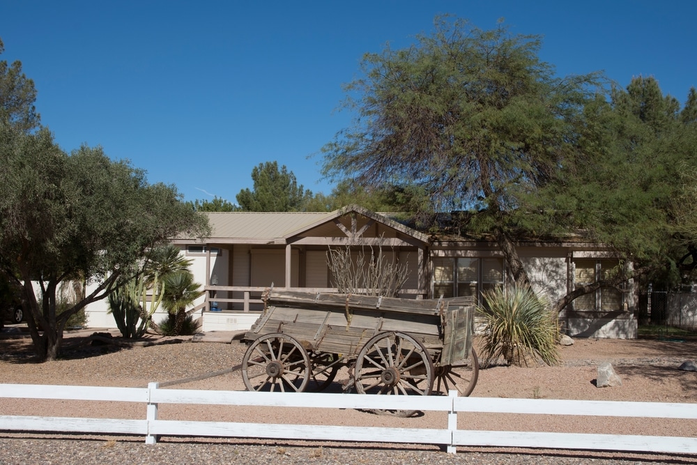
The built environment tells Eloy’s story through its varied architectural styles. The historic downtown features modest Spanish Colonial Revival buildings from the 1930s and 40s with characteristic stucco exteriors and red tile accents. Residential neighborhoods reveal the community’s evolution – from the small adobe homes in the original barrio to mid-century ranch houses in later developments to contemporary subdivisions on the outskirts. Unlike communities that enforce strict architectural codes, Eloy’s built environment has evolved organically, with residents personalizing homes through colorful paint, garden shrines, and front yard gathering spaces that extend living areas into the community.
When describing their community to outsiders, residents consistently emphasize several core values. “We’re a place where everyone knows your name and your grandmother’s name too,” explains lifelong resident Miguel Santos. This emphasis on deep interconnection across generations distinguishes Eloy from more transient Arizona communities. Residents also point to resilience as a defining characteristic, noting how the community has weathered agricultural downturns, economic challenges, and cultural transitions while maintaining its core identity.
Perhaps most distinctively, Eloy residents express pride in their community’s authenticity. “We’re not putting on a show for tourists,” says business owner Sarah Johnson. “This is a real working community where people live their cultures rather than performing them.” This genuine quality attracts those seeking connection to place and people rather than manufactured experiences.
Eloy operates under a council-manager form of government with a seven-member city council including the mayor, all elected at-large to four-year terms. This structure aims to ensure representation across the community’s diverse neighborhoods and cultural backgrounds. Council meetings feature bilingual materials and translation services to ensure all residents can participate fully in governance discussions.
The city government works closely with numerous community organizations that often implement programs beyond municipal capacity. The Eloy Community Action Network coordinates social services through a coalition of religious organizations, businesses, and civic groups. The Eloy Chamber of Commerce plays a particularly active role in community development beyond typical business promotion, leading initiatives for downtown revitalization and youth entrepreneurship programs.
Civic participation in Eloy reflects its practical, relationship-based character. While formal meeting attendance may be modest, community engagement thrives through informal networks centered around churches, schools, and established families. The Neighborhood Leadership Academy, established in 2012, trains residents in community organizing skills while connecting them with city officials and resources, creating a pipeline for new civic leaders from diverse backgrounds.
Notable community-led initiatives include the Barrio Beautification Project, where residents transformed vacant lots into community gardens, and the Youth Advisory Council that gives teenagers formal input into municipal decisions affecting young people. The Promotoras de Salud program trains community health workers from within the Hispanic community to address healthcare access issues through culturally appropriate outreach, demonstrating how Eloy develops solutions tailored to its specific population.
Eloy’s economy has undergone significant transitions throughout its history while maintaining connections to its agricultural foundations. Though cotton and other crops dominated the local economy for generations, agricultural employment has declined with mechanization and water challenges. Today, the community’s economic drivers have diversified considerably.
The emergence of Skydive Arizona as the world’s largest skydiving center has created an unexpected tourism economy, drawing over 40,000 visitors annually who support local businesses. Transportation and logistics have grown substantially due to Eloy’s strategic position along major transit corridors, with trucking companies, warehousing operations, and support services providing stable employment. Correctional facilities, though controversial among some residents, provide significant employment and municipal revenue.
Small businesses form the backbone of Eloy’s local economy, particularly family-owned restaurants, specialty shops, and service providers. The Mercado de Eloy, a cooperative marketplace established in 2015, provides affordable retail space for micro-entrepreneurs to sell handcrafted items, prepared foods, and agricultural products. The recently established Small Business Development Center offers technical assistance and micro-loans, particularly targeting Hispanic entrepreneurs who may face language or cultural barriers to accessing traditional business resources.
Distinctive local products reflect the community’s character and heritage. Casa Garcia Salsa, produced from a family recipe dating to the 1930s, has grown from a farmers market favorite to regional distribution in specialty grocers. Desert Earth Crafts creates distinctive pottery using local clay with designs blending traditional motifs with contemporary aesthetics. The Eloy Cotton Collective helps small-scale cotton farmers create value-added textile products rather than simply selling raw commodity crops.
Economic challenges remain, particularly in developing a skilled workforce for emerging industries and addressing infrastructure needs. However, recent initiatives like the Workforce Pipeline Program connecting high school students with local employers for apprenticeships demonstrates the community’s pragmatic approach to economic development rooted in local strengths and needs.
Eloy’s educational institutions serve as cultural anchors and community gathering places beyond their academic functions. Santa Cruz Valley Union High School and its feeder elementary schools provide K-12 education while incorporating local history and cultural traditions into curriculum. The district’s Dual Language Immersion Program, teaching content in both Spanish and English from kindergarten, reflects the community’s bilingual character while preparing students for broader opportunities.
Central Arizona College’s Eloy Center offers associate degree programs and vocational training tailored to regional employment needs, with particular strength in agricultural technology, logistics management, and healthcare services. The college’s Community Education program provides classes in traditional crafts, cultural practices, and language skills for adults seeking to maintain heritage connections.
Educational initiatives extend beyond formal institutions to community-based learning. The Knowledge Keepers program pairs elder residents with youth to document and preserve traditional skills from agricultural practices to culinary arts. The Eloy Historical Society’s School Outreach Program brings local history directly into classrooms through artifacts, oral histories, and interactive presentations that help students understand their community’s development.
The Eloy Public Library serves as an intergenerational learning hub beyond book lending, offering digital literacy programs for seniors, bilingual story hours for children, and community forums on local issues. Its Desert Heritage Collection preserves historical documents, photographs, and recordings that document the area’s diverse cultural evolution for researchers and community members.
The Sonoran Desert environment fundamentally shapes Eloy’s character, with residents developing distinctive relationships with this challenging but beautiful landscape. Traditional knowledge about desert plants continues to influence local practices, with families harvesting saguaro fruit, mesquite beans, and prickly pear following seasonal cycles and cultural protocols. These harvesting traditions now blend practical use with cultural maintenance as families teach younger generations sustainable practices.
Hunting traditions remain important cultural activities, particularly among rural families who maintain generational knowledge about local game movements and ethical harvesting practices. Similarly, traditional irrigation techniques adapted from both Hispanic acequia systems and Indigenous methods influence how residents approach water conservation in home gardens and community spaces, creating distinctive local approaches to desert cultivation.
Environmental conservation efforts reflect practical concerns rather than abstract environmentalism. The Eloy Groundwater Guardians focuses on water protection through education and advocacy around the critical aquifer that sustains the community. The Desert Stewardship Youth Corps engages teenagers in habitat restoration projects while teaching traditional ecological knowledge alongside contemporary scientific approaches.
Outdoor recreation embraces the desert’s distinctive character rather than attempting to recreate activities from less arid regions. The Eloy Desert Trails Association maintains hiking and mountain biking paths that showcase desert ecology while connecting to historical routes used by early settlers and Indigenous peoples. The Santa Cruz Wash Birding Area attracts both serious ornithologists and casual observers to witness remarkable diversity during migration seasons.
Eloy’s culinary heritage reflects its multicultural roots and agricultural foundations, creating a distinctive local food culture that blends traditions while adapting to desert conditions. The community’s food identity emerges most strongly from its Mexican and Mexican-American heritage, with many families maintaining recipes brought from Sonora and other regions generations ago. Distinctive local variations include flour tortillas made exceptionally large and thin, a style families trace to adaptations during difficult economic periods when ingredients needed to stretch further.
Agricultural traditions influence local cuisine, with preparations centered around crops grown in the region. Cotton worker meals – hearty, portable foods designed to sustain laborers through long days in the fields – evolved into community traditions that continue at gatherings regardless of occupation. These include distinctive chile-marinated meats slow-cooked in underground pits and substantial breakfast preparations featuring locally-grown wheat tortillas.
Several annual food-centered celebrations mark the community calendar. The Prickly Pear Festival celebrates the harvest of this native cactus fruit with competitions for traditional preparations alongside contemporary innovations. The Fiesta de la Cosecha brings families together after harvest to prepare and preserve foods for the year, maintaining cultural knowledge while creating practical food security.
Local restaurants preserve cultural food traditions while creating economic opportunity. Garcia’s Café, established in 1968, continues preparing regional Mexican dishes using recipes passed through four generations of family ownership. The Mesquite Market features vendors selling traditional preparations like carne seca (dried beef), handmade tamales, and native plant preserves that might otherwise disappear with changing food habits.
The physical spaces where Eloy residents come together reflect both historical patterns and contemporary community needs. Santa Cruz Park serves as the community’s primary public gathering space, hosting everything from quinceañeras to softball tournaments to community celebrations. Its design incorporates elements suggested by residents, including ramadas (shade structures) arranged to accommodate multigenerational family gatherings and a central plaza that references traditional Mexican community layouts.
Main Street continues to function as both commercial district and social space despite economic challenges facing many small downtowns. Saturday mornings find the street transformed by the weekly farmers’ market where agricultural commerce blends with social connection. Longtime residents recall when Main Street bustled with commerce every day, and revitalization efforts focus on restoring its role as a community hub rather than merely driving economic activity.
Informal gathering places carry equal cultural weight in community life. Garcia’s Café functions as an unofficial community center where retired farmworkers gather each morning to discuss local affairs over coffee and where political candidates know to appear during election seasons. Similarly, Ramirez Barbershop has served as a men’s gathering place for over fifty years, where conversations blend Spanish and English while maintaining cultural knowledge and community connections across generations.
Religious institutions provide important gathering spaces beyond their spiritual functions. Santa Cruz Catholic Church, First Baptist Church, and Templo Bethel not only serve their congregations but offer community meeting spaces, host cultural events, and coordinate social services. These institutions often bridge cultural differences, with shared religious identity creating connections across other social divides.
Throughout its history, Eloy has faced significant challenges that have tested community resilience while shaping its character. The agricultural economy that built the community has experienced multiple crises, from the cotton market collapse of the 1970s to ongoing water scarcity that threatens traditional farming practices. Economic transitions have brought periods of unemployment and outmigration, particularly among young people seeking opportunities elsewhere.
Social challenges include healthcare access disparities, educational achievement gaps, and the complexities of integrating new immigrants into established community structures. Unlike wealthier communities with abundant resources, Eloy has addressed these issues through creative collaboration rather than institutional solutions alone. The Community Health Worker program trains local residents to connect families with services while navigating cultural barriers, demonstrating how challenges generate innovative responses.
Stories of community perseverance abound in local memory. Residents recall how families supported each other during agricultural downturns by sharing resources and creating informal economic networks. The development of the water management collaborative after the severe drought of 2002 demonstrates how crisis catalyzed new forms of cooperation between previously competing interests. Most recently, the community’s response to the COVID-19 pandemic highlighted resilience through neighborhood support networks ensuring vulnerable residents received assistance.
“What outsiders sometimes see as limitations, we see as opportunities to work together,” explains community organizer Sophia Mendez. “We don’t wait for someone else to solve our problems.” This self-reliant approach to challenges reflects the frontier mentality that established Eloy while incorporating the communal values of its diverse cultural traditions.
Eloy approaches its future with a pragmatic balance between preservation and progress, recognizing that communities must evolve to survive while maintaining the cultural foundations that create meaning and belonging. Rather than preserving specific buildings or traditions as static artifacts, the community focuses on maintaining the underlying values and connections that have sustained it through transitions.
The recently adopted community development plan explicitly incorporates cultural sustainability alongside economic and environmental considerations. New infrastructure projects must demonstrate how they will enhance rather than disrupt community gathering patterns and cultural practices. The adaptive reuse of historic buildings prioritizes maintaining their community functions even as specific uses change, ensuring places of memory remain active in contemporary life.
Intergenerational mentoring programs formally connect elders with youth around both traditional skills and contemporary challenges, creating pipelines for knowledge transfer while encouraging innovation grounded in community values. The Youth Entrepreneurship Program specifically supports business ideas that build on cultural strengths while creating economic opportunities that might allow young people to remain in the community rather than seeking opportunities elsewhere.
Residents express hopes for a future that builds on Eloy’s distinctive character rather than simply importing development models from elsewhere. “We don’t want to become just another Phoenix suburb,” says community planner Roberto Jimenez. “Our diversity, our agricultural roots, our desert adaptation – these are strengths to build upon, not limitations to overcome.” This vision acknowledges challenges while maintaining the confident self-reliance that has characterized Eloy throughout its history.
When asked what makes their community special, Eloy residents consistently point to intangible qualities that transcend specific traditions or institutions. “It’s how everyone comes together when needed,” explains Carmen Vasquez, whose family has lived in Eloy for five generations. “We have our differences, but there’s a deeper connection that matters more.” This sentiment echoes across demographic lines, with newer residents also identifying the community’s embracing nature as its defining quality.
The soul of Eloy emerges in daily interactions rather than grand proclamations – in the way elders are respected regardless of cultural background, in how neighbors still cook for each other during difficult times, in the multilingual conversations that flow seamlessly at community gatherings. It lives in the practical compassion that leads residents to organize carpools for elderly neighbors without being asked and in the pride evident when youth perform traditional dances alongside contemporary music at community celebrations.
Ultimately, Eloy’s significance lies not in any single historical event, cultural tradition, or economic achievement, but in how this small desert community has woven diverse influences into a cohesive identity while adapting to constant change. As resident historian James Wilson observes, “Communities that last don’t just preserve the past; they continually reinterpret their heritage to meet new challenges while maintaining what matters most – the connections between people and place.” In Eloy, this living relationship between past and present, tradition and innovation, individual and community continues to create a distinctive place that residents are proud to call home.
We use cookies to improve your experience on our site. By using our site, you consent to cookies.
Manage your cookie preferences below:
Essential cookies enable basic functions and are necessary for the proper function of the website.
Statistics cookies collect information anonymously. This information helps us understand how visitors use our website.
Monetize your website by displaying targeted ads and earning revenue from clicks and impressions.
Google Analytics is a powerful tool that tracks and analyzes website traffic for informed marketing decisions.
Service URL: policies.google.com (opens in a new window)
You can find more information about our Cookie Policy and Privacy Policy.