The morning sun illuminates the stark beauty of Ajo’s landscape, casting long shadows across the open-pit mine that dominates the eastern edge of town. Unlike many of Arizona’s mining communities that flared briefly before fading into ghost towns, Ajo represents a different story—one of remarkable persistence through boom and bust cycles. Nestled in the Sonoran Desert of southwestern Arizona, approximately 43 miles from the Mexican border, this community still stands as a living testament to Arizona’s mining heritage, though much diminished from its heyday. The town’s Spanish name, meaning “garlic” (though some argue it derives from a Tohono O’odham word for paint), reflects the cultural crossroads where Anglo, Mexican, and Native American influences have converged for generations.
Goldroad is located along one of the most dramatic and scenic stretches of historic Route 66—between Kingman and Oatman. This winding, cliff-hugging drive through the Black Mountains offers breathtaking views, hairpin turns, and a real sense of Old West adventure. The road itself is one of the best reasons to visit Goldroad.
Goldroad was founded in the early 1900s during the gold rush and was home to the Gold Road Mine—one of the richest gold mines in Arizona. The town once had hundreds of residents and a bustling Main Street. Today, while much of the original town has faded, historical markers and old mining ruins still whisper tales of its golden past.
Though the mine is now closed to public tours and operates on private land, you can still see the remnants of the mining operation from Route 66. Mining equipment, tailing piles, and fenced-off shafts are visible from the roadside—offering a glimpse into the industrial heart of the old town.
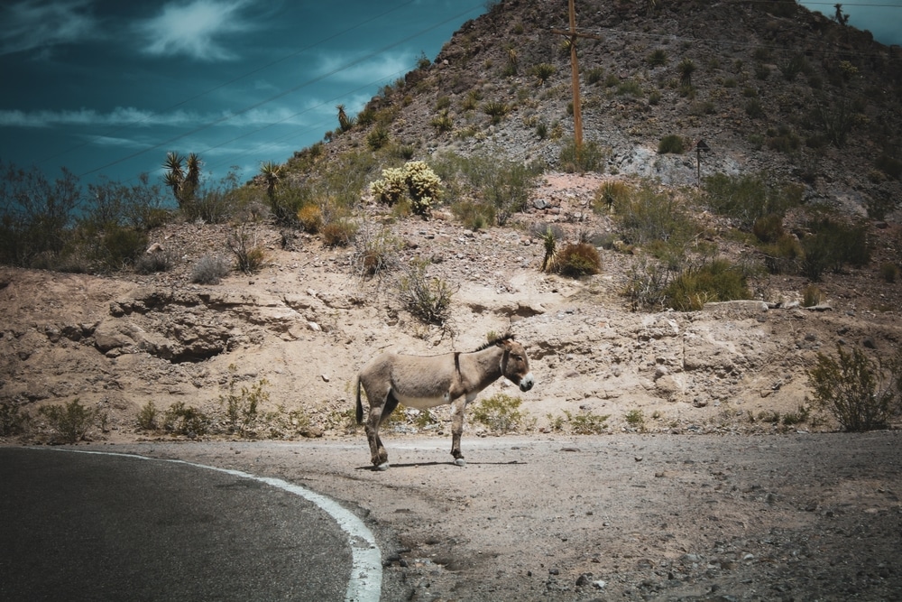
While most associated with nearby Oatman, wild burros—descendants of mining pack animals—often roam the area near Goldroad. Keep an eye out for them wandering along the road or grazing near rock outcroppings. These animals are used to tourists and make for fun roadside encounters.

The rugged beauty of the Black Mountains makes Goldroad an excellent spot for photographers. Jagged peaks, desert flora, and dramatic light patterns provide a rich palette for capturing Arizona’s natural and historic beauty.

Along the Oatman Highway near Goldroad, you’ll find occasional pullouts where you can stop, stretch your legs, and enjoy panoramic views. These make excellent picnic spots or rest stops with unforgettable photo opportunities.

The area around Goldroad is rich in desert wildlife and flora. With proper preparation, you can explore nearby trails and washes to spot lizards, desert blooms, and maybe even a desert tortoise or roadrunner.

Goldroad sits on one of the oldest alignments of Route 66. By traveling this portion of the road, you’re following in the tire tracks of early 20th-century travelers, truckers, and Dust Bowl migrants. There are several roadside markers that detail the history and hardship of traveling this route in the early days.
The cemetery contains the poignant grave of Michael Sullivan, a 27-year-old miner killed in a shaft collapse in 1910. His elaborately carved headstone, reportedly commissioned by fellow miners who took up a collection after his death, stands as testament to the dangers miners faced and the strong bonds formed in isolated communities. Sullivan’s death certificate, preserved in county records, lists him as unmarried with no known family, making the community’s effort to memorialize him particularly touching.
Another significant grave belongs to Maria Vasquez and her infant daughter, both of whom died during childbirth in 1911. Their shared grave marker represents the particular dangers faced by women in remote mining communities, where medical care was primitive and childbirth remained hazardous. The simple inscription “Beloved Wife of Carlos Vasquez – Gone to Angels” encapsulates the personal tragedies that punctuated life in frontier towns.
Newspaper accounts from Kingman mention Thomas Wheeler, Goldroad’s only physician during its peak years, who reportedly treated everything from mining injuries to infectious diseases with limited supplies and equipment. Wheeler’s own grave in the main cemetery features a caduceus symbol, marking his profession even in death. His handwritten medical logs, portions of which are preserved in the Mohave Museum, document the health challenges faced by residents, including outbreaks of influenza and tuberculosis that periodically swept through the community.
Among the notable individuals associated with Goldroad was Henry Lovin, the enterprising businessman who developed the Goldroad Mine from a prospector’s discovery into a significant operation. While not buried in the Goldroad cemetery (he later became a prominent citizen of Kingman), Lovin’s influence shaped every aspect of the community’s development. County records show he served as both mine owner and community leader, establishing the town’s first store and post office while advocating for road improvements and other infrastructure.

| Category | Details |
|---|---|
| Name | Goldroad, Arizona |
| Type | Ghost town |
| County | Mohave County |
| Founded | 1902 (mining discovery and town established) |
| Status | Abandoned; some ruins and mine buildings remain |
| Population (Historic) | ~400–500 during peak operations |
| Population (Current) | None |
| Historical Significance | Gold mining town developed along the Gold Road Mine |
| Main Industry | Gold mining |
| Major Mine | Gold Road Mine — one of Arizona’s richest early 20th-century producers |
| Post Office | Operated from 1906 to 1942 |
| Decline Factors | Ore depletion, WWII mine shutdown, shift in traffic from Route 66 to I-40 |
| Modern Revival Attempts | Brief gold mining revival in the 1990s–2000s (then closed again) |
| Remnants Today | Mining ruins, tunnels, tailings, old roadbeds |
| Nearby Attractions | Close to Oatman, AZ — just a few miles to the west |
| Access | Off Historic Route 66 between Kingman and Oatman |
| Elevation | Approx. 3,400 feet (1,036 meters) |
| Climate | High desert – hot summers, cool winters |
| Best For | Ghost town enthusiasts, mining history buffs, Route 66 travelers |
Goldroad came into existence in 1900 when prospector José Jerez discovered gold in the Black Mountains, though the area’s significant development began in 1902 when Henry Lovin took control of the claims. Unlike many Western mining camps that boomed briefly before disappearing, Goldroad experienced several distinct phases of prosperity tied to mining technology advancements and changing economic conditions.
The settlement grew rapidly after 1902 when the Goldroad Mining and Exploration Company established operations. The company constructed a stamp mill and cyanide plant to process ore from the newly-opened Goldroad Mine, which produced remarkably rich gold ore with veins sometimes visible to the naked eye. This initial development phase established Goldroad as more than a temporary camp, with permanent structures soon replacing canvas tents and brush shelters.
Within the broader context of Arizona’s development, Goldroad represented part of the second great wave of mining activity that followed the territory’s initial silver boom. The town developed at a time when Arizona was transitioning from rough frontier to organized territory moving toward statehood. By the time Arizona achieved statehood in 1912, Goldroad was a well-established mining community contributing significantly to the new state’s mineral wealth.
While exact population figures aren’t precisely documented, historical accounts suggest Goldroad reached its peak in the 1910s with approximately 1,500-2,000 residents. The town’s fortunes were directly tied to the Goldroad Mine’s productivity, which yielded over $7 million in gold during its operations—equivalent to well over $200 million in today’s currency.
Modern visitors to Goldroad encounter a landscape where nature has reclaimed much of what humans built. Located on a winding section of Historic Route 66 between Oatman and Kingman, the site presents scattered concrete foundations, stone walls, and the substantial remains of the mine’s processing facilities. The most prominent features are the concrete platforms that once supported the stamp mill and cyanide plant, their massive bolts still protruding from the weathered surfaces.
Several mine adits (horizontal entrances) are visible in the hillsides, though most have been sealed for safety. Rusted machinery parts, from ore cart rails to massive gears, lie half-buried in the rocky soil. At the site’s center, the collapsed remains of what was once the company store and post office offer the clearest indication of the town’s former layout.
Just off the main road, a series of leveled areas mark where miners’ cabins and boardinghouses once stood. These residential sections have largely returned to desert, with only occasional stone foundations and scattered artifacts hinting at their former purpose. More substantial ruins mark the former assay office and mine administration building, where high-grade ore samples were once evaluated and mining operations planned.
Accessibility to Goldroad is relatively good compared to many Arizona ghost towns, as the site sits directly on the historic alignment of Route 66. While the road is narrow and winding, it is paved and maintained for tourism to nearby Oatman. However, exploring beyond the roadside requires careful navigation of uneven terrain.
No formal preservation efforts currently protect the Goldroad site, though its location within a broader historic corridor has spared it from complete destruction. The buildings that once lined the road have largely disappeared, with materials salvaged for use elsewhere after the mine’s closure.
Perched on a gentle slope overlooking the former townsite, Goldroad’s small cemetery stands as perhaps the most poignant reminder of the community that once thrived here. Established around 1902 when the mining operations began in earnest, the cemetery contains approximately three dozen visible graves, though local historians believe additional unmarked burials may exist.
The cemetery reflects the harsh realities of early 20th century mining life, with numerous graves dating to the 1900s-1910s when mining accidents and disease regularly claimed lives. Gravestones range from formal marble headstones to simple wooden markers and rock cairns. Many markers have deteriorated significantly, with inscriptions rendered illegible by over a century of exposure to the elements.
Notable features include several ornate iron fences surrounding family plots, suggesting some Goldroad residents had achieved sufficient prosperity to afford such elaborate memorials. Several stones feature Masonic symbols, indicating the presence of fraternal organizations that were common in mining communities as support networks for members.
The cemetery’s condition reflects both the harsh desert environment and decades of neglect. Many wooden markers have disappeared entirely, while stone monuments have suffered from vandalism and natural erosion. Despite this deterioration, the cemetery remains one of the most intact features of Goldroad, offering tangible connections to individual lives that contributed to the town’s brief history.
While Goldroad’s primary cemetery served most of the community, historical records indicate a second, smaller burial ground existed approximately a half-mile from the main settlement. This secondary cemetery appears to have been used primarily by Mexican and Native American miners who worked in Goldroad but often faced segregation in death as in life.
This secondary burial ground contains simpler markers, primarily rock cairns and wooden crosses, few of which have survived intact. Archaeological surveys have documented approximately twenty graves, though ground-penetrating radar studies suggest additional unmarked burials may exist. The cultural differences between the two cemeteries are evident in burial traditions, with the secondary cemetery featuring distinctive grave decorations and orientations reflecting non-Anglo cultural practices.
Unlike the main cemetery, which remained in use until the town’s abandonment, the secondary burial ground appears to have been used primarily during the initial mining phase (1902-1910), suggesting that as the community became more established, burial practices may have become more integrated or that demographic changes affected the workforce composition.
The secondary cemetery has received even less preservation attention than the main burial ground, with many graves now identifiable only to trained archaeologists. However, its existence provides important insights into the social structure and cultural diversity of Goldroad during its heyday.
While no copies of Goldroad newspapers are known to have survived, historical references indicate the town supported at least one publication during its most prosperous period. The “Goldroad Miner” reportedly began publication around 1909, operating from a small office adjacent to the company store. Like many mining town newspapers, it likely served both as a community information source and as a promotional tool to attract additional investment and settlement.
References to the Goldroad Miner appear in surviving editions of the Mohave County Miner (published in Kingman) and several California newspapers that reported on Arizona mining activities. These external sources indicate the paper was published weekly, with content focused heavily on mining operations, ore quality reports, and new strikes in the surrounding district.
The paper’s publisher appears to have been James Kearney, previously associated with newspapers in Prescott and Jerome. Historical accounts describe Kearney as an enthusiastic booster for mining interests who used his editorial position to advocate for infrastructure improvements, particularly better roads connecting Goldroad to Kingman and the railroad.
The newspaper likely ceased publication around 1916 when the original mining company suspended operations, though it may have briefly resumed when mining restarted in the 1920s. Without surviving copies, the actual voice of Goldroad’s community has largely been lost, though mentions in regional papers help reconstruct some aspects of daily life and significant events in the town.
Unlike some more fortunate mining communities, Goldroad never secured direct rail access, which significantly impacted its development and ultimately contributed to its economic challenges. The nearest railroad connection was at Kingman, approximately 20 miles northeast, where the Santa Fe Railroad maintained a station and freight facilities.
Transportation between Goldroad and Kingman initially relied on wagon roads that followed tortuous routes through the Black Mountains. These primitive roads made shipping ore and bringing in heavy equipment extremely expensive, limiting the mine’s profitability during its early years. The road to Kingman was eventually improved around 1910, allowing for more efficient transportation, but still represented a significant logistical challenge.
The lack of direct rail access meant that all ore from the Goldroad Mine needed to be processed on-site to reduce shipping costs. The company invested heavily in processing facilities, including a 20-stamp mill and cyanide plant, to extract gold before transporting the concentrated product to Kingman. Similarly, all supplies, machinery, and materials needed for mining operations and community life had to be hauled in by wagon or early motor trucks.
Interestingly, while Goldroad never had a railroad, it played a role in transportation history through its position on what would later become Route 66. The road connecting Goldroad to Oatman and eventually to the Colorado River crossing at Needles, California became incorporated into the national highway system in the 1920s, bringing a brief second life to the area after initial mining operations had declined.
Goldroad’s decline began around 1916 when the original mining company ceased operations after the most accessible high-grade ore had been extracted. While some mining continued on a smaller scale, many residents departed during this initial downturn, leaving the town significantly reduced in population and economic activity.
A brief revival occurred in the mid-1920s when new owners applied more advanced mining techniques to extract lower-grade ore that had previously been uneconomical to process. This second phase of mining brought a modest population increase, though the town never regained its former size or prosperity. Operations continued sporadically until 1942, when Executive Order L-208 (which shuttered non-essential gold mines during World War II) forced final closure of the Goldroad Mine.
Unlike some mining towns that transitioned to other economic activities, Goldroad had few options for survival once mining ceased. Some residents found work catering to travelers on Route 66, operating small gas stations or cafes, but these enterprises proved insufficient to maintain a viable community. By the late 1940s, most buildings stood empty, with only a handful of die-hard residents remaining.
The final chapter in Goldroad’s physical decline came in the 1950s, when most remaining structures were demolished or salvaged for building materials. The rerouting of Route 66 to a more direct alignment in later years further isolated the site, removing even the passing traffic that had sustained the last businesses.
Today, Goldroad represents an important example of Arizona’s early 20th century mining heritage. While never as famous as boomtowns like Tombstone or Jerome, Goldroad typifies the hundreds of mining communities that flourished briefly across Arizona, contributing significantly to the territory’s development and eventual statehood.
The site has never been formally excavated by professional archaeologists, though its location on historic Route 66 has generated interest from preservationists focused on highway history. The Goldroad Mine site itself has been documented in mining engineering publications as an example of early 20th century gold processing techniques.
No formal historical designation currently protects Goldroad, though proposals have occasionally been made to include it in broader Route 66 preservation efforts. The Mohave County Historical Society maintains records related to the community, while the Mohave Museum of History and Arts in Kingman displays some artifacts and photographs from Goldroad’s heyday.
For the Hualapai and other indigenous peoples whose traditional territories encompass the Black Mountains, the Goldroad site represents a complex legacy. The mining operations dramatically altered landscapes with cultural significance, while providing employment opportunities but also introducing environmental impacts that continue to this day.
The condition of Goldroad’s cemeteries reflects the challenges facing many abandoned mining town burial grounds across Arizona. Natural erosion, plant growth, and animal activity have degraded many markers, while human impacts have ranged from neglect to occasional vandalism. Without regular maintenance, both burial grounds continue to deteriorate, though their remote location has spared them from some of the more severe damage seen at more accessible sites.
Sporadic preservation efforts have occurred over the decades, primarily organized by historical enthusiasts and descendants of Goldroad residents. These volunteer initiatives typically involve documenting remaining grave markers, performing basic cleanup, and occasionally repairing damaged monuments. The Arizona Pioneer & Cemetery Research Project has cataloged visible graves, creating a permanent record of inscriptions before they become completely illegible.
Unlike some ghost town cemeteries that continue to see occasional new burials or regular memorial events, Goldroad’s burial grounds receive few visitors beyond curious tourists and history researchers. No regular maintenance schedule exists, and both cemeteries continue to slowly merge back into the desert landscape as markers deteriorate and desert vegetation reclaims the sites.
Those wishing to visit Goldroad should approach with respect for both historical preservation and the sanctity of burial grounds. The site sits on a combination of public land and private mining claims, creating a complex ownership situation. Visitors should:
Winter and spring represent the safest seasons for exploration, offering milder temperatures and better visibility of ground features. Visitors should carry adequate water, inform others of their plans, and consider exploring with companions rather than alone.
As the setting sun casts long shadows across Goldroad’s scattered ruins and quiet cemetery, the impermanence of human endeavors becomes starkly apparent. For a brief moment in history, this remote hillside hummed with activity as miners extracted millions in gold from the resistant earth. The community built homes, businesses, and lives; they celebrated births, mourned deaths, and worked tirelessly in pursuit of prosperity.
Today, their efforts remain primarily as weathered foundations and fading grave markers—physical reminders that even our most substantial works eventually return to the landscape. Yet Goldroad’s story isn’t merely one of abandonment or loss. It represents the courage and determination of Arizona’s pioneers who established communities in unlikely places, contributing to the territory’s growth toward statehood.
The cemetery, with its silent testimony to lives lived and lost, perhaps best captures the human dimension of Goldroad’s history. Each marker represents not just a death but a life—complete with hopes, relationships, and contributions to a community that, while temporary, formed an important thread in Arizona’s historical tapestry.
By understanding and preserving places like Goldroad, we honor not only those who rest in its cemetery but also the complex story of how Arizona transformed from territory to state. In the end, ghost towns remind us that communities aren’t defined by permanence but by the human connections, struggles, and triumphs that occur within them—however briefly they might exist on the landscape.

We use cookies to improve your experience on our site. By using our site, you consent to cookies.
Manage your cookie preferences below:
Essential cookies enable basic functions and are necessary for the proper function of the website.
Statistics cookies collect information anonymously. This information helps us understand how visitors use our website.
Monetize your website by displaying targeted ads and earning revenue from clicks and impressions.
Google Analytics is a powerful tool that tracks and analyzes website traffic for informed marketing decisions.
Service URL: policies.google.com (opens in a new window)
You can find more information about our Cookie Policy and Privacy Policy.