Arizona’s landscape is defined by its remarkable federal lands, which cover approximately 38% of the state’s total area. These protected territories showcase some of the world’s most spectacular natural wonders, from the awe-inspiring depths of the Grand Canyon to the ancient petrified forests and towering saguaro cacti that have become iconic symbols of the American Southwest.
Four primary federal agencies manage these diverse lands: the National Park Service (NPS), which preserves landscapes of exceptional natural and cultural significance; the Bureau of Land Management (BLM), overseeing vast multiple-use territories; the U.S. Forest Service (USFS), maintaining forests and watersheds; and the U.S. Fish and Wildlife Service (USFWS), protecting critical wildlife habitat. Each agency brings a distinct management philosophy, creating a mosaic of recreational opportunities and conservation approaches across the state.
| Name | Location | Est. Date | Size (acres) | Key Features |
|---|---|---|---|---|
| Grand Canyon National Park | Northern AZ | 1919 | 1,217,403 | One of world’s natural wonders; 277-mile canyon carved by Colorado River |
| Petrified Forest National Park | Northeastern AZ | 1962 | 221,390 | Ancient petrified wood, colorful badlands, archaeological sites |
| Saguaro National Park | Southern AZ (Tucson) | 1994 | 91,440 | Iconic saguaro cacti; divided into Rincon Mountain and Tucson Mountain districts |
| Canyon de Chelly National Monument | Northeastern AZ | 1931 | 83,840 | Steep canyon walls with ancient cliff dwellings; managed with Navajo Nation |
| Organ Pipe Cactus National Monument | Southern AZ | 1937 | 330,689 | UNESCO biosphere reserve; diverse Sonoran Desert ecosystem |
| Sunset Crater Volcano National Monument | Northern AZ | 1930 | 3,040 | Cinder cone from eruption ~900 years ago |
| Walnut Canyon National Monument | Northern AZ | 1915 | 3,580 | Ancient cliff dwellings along canyon walls |
| Wupatki National Monument | Northern AZ | 1924 | 35,422 | Red-rock pueblos built by ancestral Puebloan people |
| Montezuma Castle National Monument | Central AZ | 1906 | 1,177 | Well-preserved cliff dwelling |
| Tuzigoot National Monument | Central AZ | 1939 | 811 | Hilltop pueblo ruins |
| Pipe Spring National Monument | Northern AZ | 1923 | 40 | Historic fort and spring; Mormon pioneer and Native American history |
| Hubbell Trading Post National Historic Site | Northeastern AZ | 1965 | 160 | Oldest operating trading post on Navajo Nation |
| Tonto National Monument | Central AZ | 1907 | 1,120 | Well-preserved cliff dwellings in Sonoran Desert |
| Casa Grande Ruins National Monument | Central AZ | 1918 | 472 | Ancient Hohokam farming community ruins with four-story “Great House” |
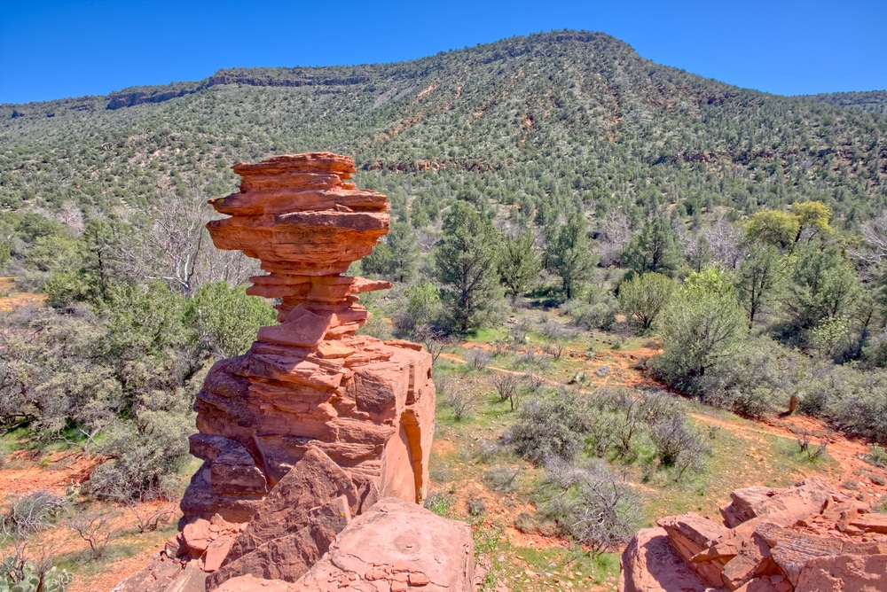
| Chiricahua National Monument | Southeastern AZ | 1924 | 12,025 | “Wonderland of Rocks” with dramatic pinnacles and balanced rocks |
| Coronado National Memorial | Southern AZ | 1941 | 4,750 | Commemorates Francisco Coronado’s expedition; cave and mountain views |
| Fort Bowie National Historic Site | Southeastern AZ | 1964 | 1,000 | Historic fort from Apache Wars |
| Glen Canyon National Recreation Area | Northern AZ/UT | 1972 | 1,254,429 | Lake Powell and Colorado River recreation |
| Lake Mead National Recreation Area | Northwestern AZ/NV | 1964 | 1,495,806 | Largest reservoir in US; water recreation |
| Parashant National Monument | Northwestern AZ | 2000 | 1,048,325 | Remote, rugged landscape co-managed with BLM |
| Name | Location | Est. Date | Size (acres) | Key Features |
|---|---|---|---|---|
| Apache-Sitgreaves National Forest | Eastern AZ | 1908 | 2,661,000 | Mountain forests, lakes, Mogollon Rim |
| Coconino National Forest | Northern AZ | 1908 | 1,856,000 | Diverse landscapes from desert to mountains; red rock country |
| Coronado National Forest | Southern AZ | 1902 | 1,718,000 | “Sky island” mountain ranges rising from desert |
| Kaibab National Forest | Northern AZ | 1909 | 1,542,000 | Surrounds Grand Canyon on north and south rims |
| Prescott National Forest | Central AZ | 1898 | 1,257,000 | Diverse terrain from desert to ponderosa pine forests |
| Tonto National Forest | Central AZ | 1905 | 2,873,000 | Arizona’s largest national forest; Sonoran Desert to pine forests |
| Name | Location | Est. Date | Size (acres) | Key Features |
|---|---|---|---|---|
| Vermilion Cliffs National Monument | Northern AZ | 2000 | 293,689 | Colorful sandstone formations; The Wave, Paria Canyon |
| Sonoran Desert National Monument | Southern AZ | 2001 | 496,337 | Diverse Sonoran Desert ecosystem |
| Ironwood Forest National Monument | Southern AZ | 2000 | 129,055 | Desert landscape with ancient ironwood trees |
| Agua Fria National Monument | Central AZ | 2000 | 71,100 | Prehistoric sites, riparian areas |
| Grand Canyon-Parashant National Monument | Northwestern AZ | 2000 | 1,048,325 | Remote wilderness co-managed with NPS |
| Arizona Strip | Northern AZ | Various | ~2,800,000 | Remote lands north of Grand Canyon |
| BLM Arizona General Lands | Statewide | Various | ~12,200,000 | Multiple use lands including recreation, grazing, mining |
| Name | Location | Est. Date | Size (acres) | Key Features |
|---|---|---|---|---|
| Buenos Aires National Wildlife Refuge | Southern AZ | 1985 | 117,464 | Grasslands; endangered masked bobwhite quail habitat |
| Cabeza Prieta National Wildlife Refuge | Southwestern AZ | 1939 | 860,010 | Desert wilderness; endangered Sonoran pronghorn |
| Cibola National Wildlife Refuge | Western AZ | 1964 | 18,444 | Colorado River wetlands; migratory birds |
| Havasu National Wildlife Refuge | Western AZ | 1941 | 37,515 | Colorado River habitat; Topock Marsh |
| Imperial National Wildlife Refuge | Southwestern AZ | 1941 | 25,125 | Lower Colorado River riparian habitat |
| Kofa National Wildlife Refuge | Southwestern AZ | 1939 | 665,400 | Desert bighorn sheep habitat; rugged mountains |
| Leslie Canyon National Wildlife Refuge | Southeastern AZ | 1988 | 2,770 | Riparian habitat; endangered fish |
| Bill Williams River National Wildlife Refuge | Western AZ | 1941 | 6,105 | Unique riparian habitat where Bill Williams River meets Colorado |
| San Bernardino National Wildlife Refuge | Southeastern AZ | 1982 | 2,369 | Wetlands and riparian areas; endangered fish |
| Name | Location | Est. Date | Size (acres) | Key Features |
|---|---|---|---|---|
| Barry M. Goldwater Air Force Range | Southwestern AZ | 1941 | 1,700,000 | Military training range; restricted access |
| Fort Huachuca | Southern AZ | 1877 | 73,272 | Army installation; intelligence and communications center |
| Yuma Proving Ground | Southwestern AZ | 1943 | 1,307,000 | Army testing facility; restricted access |
| Luke Air Force Base | Central AZ | 1941 | 4,198 | Fighter pilot training base |
| Davis-Monthan Air Force Base | Tucson | 1925 | 10,700 | Home of 355th Fighter Wing; aircraft boneyard |
| Marine Corps Air Station Yuma | Southwestern AZ | 1928 | 4,800 | Marine Corps aviation training facility |

Arizona’s federal lands span remarkable ecological diversity, from low desert environments to alpine forests, representing six distinct biotic communities and housing over 3,600 plant species and hundreds of wildlife species. These protected areas serve as living laboratories for scientific research, vital wildlife corridors, and repositories of cultural heritage spanning thousands of years of human history.
The designation and management of federal lands have profoundly shaped Arizona’s development, balancing conservation with economic uses like sustainable forestry, grazing, and mineral development while safeguarding these treasures for future generations to explore and enjoy.
Arizona hosts three magnificent national parks that showcase the state’s most extraordinary landscapes. Grand Canyon National Park, a UNESCO World Heritage Site, protects one of Earth’s most spectacular geological wonders—a mile-deep chasm carved by the Colorado River over millions of years. Petrified Forest National Park preserves one of the world’s largest concentrations of petrified wood alongside colorful badlands of the Painted Desert. Saguaro National Park, divided into east and west districts flanking Tucson, protects forests of the nation’s largest cactus within the Sonoran Desert ecosystem.
Complementing these parks are 17 national monuments, each preserving unique natural and cultural treasures. From the ancient pueblos of Wupatki to the towering red cliffs of Vermilion Cliffs, these monuments protect specific features of scientific or historical importance. Unlike national parks, which typically require Congressional designation, monuments can be established by Presidential proclamation under the Antiquities Act, allowing for more responsive protection of threatened resources.
Many of Arizona’s federal lands hold International Dark Sky designations, offering some of the world’s finest stargazing opportunities. Grand Canyon National Park’s South Rim receives nearly 5 million annual visitors, while remote monuments like Grand Canyon-Parashant offer solitude and wilderness experiences with minimal infrastructure, demonstrating the spectrum of visitation patterns across Arizona’s protected landscapes.
Six national forests blanket Arizona’s higher elevations, covering over 11 million acres of diverse woodland and mountain terrain. The Coconino National Forest surrounds Flagstaff with ponderosa pine forests and dramatic red rock formations. The vast Tonto National Forest protects watersheds crucial to central Arizona’s water supply while spanning six ecological zones from desert to pine-covered mountains. The Apache-Sitgreaves National Forests offer cool retreats along the Mogollon Rim, while the Coronado National Forest consists of isolated “sky island” mountain ranges rising dramatically from the desert floor. The Kaibab and Prescott National Forests round out this system of forested public lands.
Unlike more restrictive designations, national forests operate under a multiple-use mandate, balancing recreation, wildlife habitat, watershed protection, sustainable timber harvesting, and grazing. These forests contain 36 designated wilderness areas where development and mechanized travel are prohibited to preserve natural conditions.
National forests offer Arizona’s most extensive network of hiking trails, campgrounds, and recreational facilities, with activities ranging from downhill skiing at Arizona Snowbowl to bass fishing at Woods Canyon Lake. Seasonal considerations significantly impact forest recreation, with summer bringing monsoon thunderstorms and fire restrictions, while winter snow limits access to higher elevations but creates opportunities for winter sports.
The Bureau of Land Management administers approximately 12.2 million acres of Arizona’s public lands—generally lower-elevation desert and semi-desert landscapes surrounding the national forests. These vast, open territories represent America’s truly multiple-use public lands, managed under a balanced approach that permits diverse activities from recreation to responsible resource development.
BLM lands offer some of Arizona’s most accessible public recreation opportunities, with minimal restrictions for activities like dispersed camping, target shooting in designated areas, and off-highway vehicle use on established routes. Popular recreation areas include Hot Well Dunes near Safford, the Parker Strip along the Colorado River, and the Table Mesa Recreation Area north of Phoenix.
The agency designates Special Recreation Management Areas for concentrated visitor use while managing nine National Conservation Areas and seventeen wilderness areas that receive higher levels of protection. The San Pedro Riparian National Conservation Area protects one of the Southwest’s last free-flowing rivers and its crucial migratory bird habitat, while Las Cienegas preserves rare grassland ecosystems.
BLM lands support traditional uses including livestock grazing, mining claims, and energy development under careful environmental review. This balanced approach makes these territories working landscapes where conservation coexists with economic activities supporting rural communities.
Arizona’s nine National Wildlife Refuges protect critical habitat for migratory birds, endangered species, and native wildlife across 1.7 million acres of diverse ecosystems. These refuges, managed by the U.S. Fish and Wildlife Service, prioritize wildlife conservation while offering compatible recreational opportunities.
The expansive Cabeza Prieta National Wildlife Refuge in southwestern Arizona protects 860,000 acres of Sonoran Desert habitat for the endangered Sonoran pronghorn and more than 275 bird species. Along the Colorado River, a chain of refuges including Havasu, Bill Williams River, Cibola, and Imperial protect crucial desert riparian ecosystems. The Buenos Aires National Wildlife Refuge in southern Arizona features rare desert grasslands supporting the endangered masked bobwhite quail, while the remote San Bernardino refuge protects critical water resources and native fish species.
These protected areas serve as essential stopover points along the Pacific Flyway, supporting millions of migratory birds annually. Visitor activities focus on wildlife observation, photography, environmental education, and limited hunting opportunities that align with conservation objectives.
Management emphasizes habitat restoration, invasive species control, and maintaining natural water resources increasingly threatened by drought and climate change. Unlike other federal lands, visitor access and activities may be restricted seasonally to protect nesting birds, prevent disturbance during critical life cycles, or preserve sensitive habitats.
Arizona’s federal lands share boundaries with 22 federally recognized Native American tribes, whose ancestral territories often encompass these protected areas. This proximity has fostered innovative co-management arrangements that honor indigenous connections to these landscapes while enhancing conservation efforts.
Canyon de Chelly National Monument exemplifies this relationship, where the National Park Service and Navajo Nation cooperatively manage a landscape that remains home to Navajo families. Similarly, at Pipe Spring National Monument, the NPS works with the Kaibab Paiute Tribe to interpret a landscape with significance to both settler and indigenous history.
Federal land managers increasingly incorporate traditional ecological knowledge into resource management, recognizing that indigenous practices often supported healthy ecosystems for thousands of years. The protection of cultural resources and sacred sites remains a priority across federal lands, with agencies consulting tribal nations on management decisions that may affect cultural sites or traditional use areas.
Visitors should understand that access to certain areas, particularly on tribal lands adjacent to federal properties, may require special permits obtained from tribal governments. This includes the internationally famous Havasu Falls within Havasupai tribal lands near Grand Canyon National Park, where limited permits are available through the tribe’s reservation system.
Arizona’s dramatic elevation differences—ranging from 70 feet above sea level along the Colorado River to 12,633 feet at Humphreys Peak—create remarkable seasonal variations across federal lands. Understanding these patterns is essential for planning safe, enjoyable visits.
Lower desert areas, including Organ Pipe Cactus National Monument and lower elevations of Saguaro National Park, offer ideal conditions from October through April, when temperatures range from pleasantly cool to moderately warm. Summer brings extreme heat, with temperatures regularly exceeding 110°F, making these areas potentially dangerous without proper preparation.
Mid-elevation federal lands (2,000-5,000 feet), including many BLM territories and portions of Tonto National Forest, provide comfortable conditions during spring and fall, with moderately hot summers and occasional winter freezes. The summer monsoon season (July-September) brings spectacular but potentially dangerous thunderstorms, flash flooding, and heightened wildfire risk.
High-elevation areas, including the Kaibab and Coconino National Forests, offer pleasant summer conditions when desert areas are scorching. Winter brings snow and sub-freezing temperatures, with many forest roads becoming impassable from December through April.
Peak visitation occurs during spring break (March), summer vacation periods, and holiday weekends, when popular destinations like Grand Canyon’s South Rim require advance planning. Permit systems manage visitor numbers in sensitive or high-demand areas, including Paria Canyon within Vermilion Cliffs National Monument and Aravaipa Canyon Wilderness, often requiring applications months in advance.
Arizona’s federal lands offer an extraordinary range of recreational opportunities across diverse landscapes:
Over 5,000 miles of trails cross Arizona’s federal lands, from easy nature walks to challenging wilderness routes. Signature experiences include rim-to-river hikes in Grand Canyon National Park, the challenging Chiricahua Peak Trail through towering rock formations, and the Wilderness of Rocks Trail in the Santa Catalina Mountains. Difficulty ranges from wheelchair-accessible paved paths at parks like Montezuma Castle to demanding routes like Humphreys Peak in the Coconino National Forest.
Options range from developed campgrounds with amenities in national forests and parks to primitive backcountry camping and dispersed camping permitted across most BLM lands. Reservation systems operate for popular campgrounds, while wilderness camping typically requires permits with quotas in sensitive areas.
Despite its desert reputation, Arizona offers surprising water recreation opportunities including whitewater rafting through Grand Canyon, kayaking on the Verde Wild and Scenic River, and boating on Lake Powell within Glen Canyon National Recreation Area. Permits for river running are highly competitive, with weighted lotteries determining Colorado River access through Grand Canyon.
Designated OHV routes cross BLM and national forest lands, from technical four-wheel-drive trails to maintained dirt roads suitable for passenger vehicles. Popular areas include the Table Mesa Recreation Area north of Phoenix and the Hot Well Dunes near Safford.
Additional activities include rock climbing at locations like Queen Creek Canyon, wildlife viewing at sites like Whitewater Draw Wildlife Area, hunting on national forest and BLM lands (requiring Arizona Game and Fish Department licenses), and world-class stargazing at designated Dark Sky sites throughout the state.
Planning for Arizona’s federal lands requires understanding the different management systems and regulations across agencies:
The America the Beautiful Interagency Pass ($80 annually) covers entrance fees for most federal lands. Individual parks and monuments typically charge $15-35 per vehicle for 7-day access. Many BLM and Forest Service areas have no entrance fees, though developed recreation sites may charge day-use or camping fees.
Various activities require permits across federal lands:
Developed campgrounds in popular areas like Oak Creek Canyon and Grand Canyon require reservations through Recreation.gov, often available up to six months in advance. The Havasu Falls area within Havasupai tribal lands requires reservations that open February 1 and typically sell out within hours for the entire year.
Federal lands feature varying levels of accessibility, with national parks offering the most accessible facilities including paved trails, accessible viewpoints, and specialized services. The “Access Pass” provides free lifetime entrance to federal lands for U.S. citizens with permanent disabilities.
Cell service remains limited or nonexistent across much of Arizona’s federal lands. Visitors to remote areas should carry satellite communication devices, inform others of itineraries, and recognize that emergency response times may exceed several hours in wilderness areas.
Federal land management in Arizona balances preservation with sustainable use through science-based approaches adapted to each ecosystem’s unique needs. Conservation strategies vary by designation and managing agency:
National Parks and Monuments emphasize preservation of natural and cultural resources in unimpaired condition, with restoration projects addressing past impacts from development or invasive species. The Grand Canyon National Park’s California Condor reintroduction program represents one of North America’s most successful endangered species recovery efforts.
Forest Service lands employ active management including strategic thinning and prescribed fire to restore forest health after a century of fire suppression created dangerously dense conditions. The Four Forest Restoration Initiative represents the largest forest restoration project in the nation, ultimately aiming to treat 2.4 million acres across Arizona’s ponderosa pine forests.
BLM territories focus on watershed health, native plant communities, and habitat connectivity while permitting sustainable grazing and resource use. Innovative approaches include cooperative management with ranchers to improve riparian areas while maintaining working landscapes.
Wildlife Refuges prioritize habitat enhancement for target species, with projects ranging from controlled burns in grasslands to maintenance of water resources in desert environments.
Volunteers contribute significantly to federal land management through programs like the Site Steward Program protecting archaeological sites and the Tonto National Forest’s Adopt-a-Trail program. Visitors can practice Leave No Trace principles by staying on designated trails, properly disposing of waste, minimizing campfire impacts, respecting wildlife, and leaving natural and cultural features undisturbed.
Arizona’s federal lands form an interconnected system protecting the state’s most extraordinary landscapes while offering lifetime opportunities for exploration and discovery. From the depths of the Grand Canyon to the sky island forests of the Coronado, these diverse territories share a common heritage as America’s public lands—owned by and accessible to all.
Plan your journey across jurisdictional boundaries to experience the full spectrum of Arizona’s natural wonders. Follow the path of ancient peoples from Wupatki National Monument through the Coconino National Forest to Walnut Canyon. Trace the Colorado River’s journey from Glen Canyon National Recreation Area through Grand Canyon National Park and into Lake Mead. Explore ecological transitions from saguaro-studded BLM lands near Tucson up through the Coronado National Forest to the cool pine forests atop Mount Lemmon.
For more detailed information on specific destinations, permits, and seasonal conditions, connect with individual land management agencies:
Begin your exploration of Arizona’s federal lands today and discover why these protected landscapes remain the Grand Canyon State’s greatest treasures.
We use cookies to improve your experience on our site. By using our site, you consent to cookies.
Manage your cookie preferences below:
Essential cookies enable basic functions and are necessary for the proper function of the website.