The morning commute along Loop 101 tells Arizona’s modern story in motion. As sunrise paints the McDowell Mountains gold, thousands of vehicles flow through the Valley’s arterial highways—tech workers heading to Chandler’s semiconductor plants, healthcare professionals bound for Phoenix’s medical corridor, teachers navigating to schools in suburban Peoria. This daily migration across metropolitan Phoenix represents just one thread in Arizona’s complex transportation tapestry, where interstate highways cross ancient trade routes and light rail lines parallel paths once traveled by stagecoaches.
Transportation in Arizona shapes more than commute times—it defines lifestyle possibilities, determines housing choices, and connects communities across vast distances. The state where you can drive two hours without leaving metropolitan Phoenix also contains stretches where gas stations stand 100 miles apart. Understanding how Arizona moves means grasping both the efficiency of modern highway systems and the reality of distances that would swallow Eastern states whole. For those considering Arizona home, transportation becomes not just logistics but a fundamental factor in designing daily life.
| Category | Details |
|---|---|
| Primary Transportation Mode | Driving is the dominant mode statewide. Most residents rely on personal vehicles due to large distances and limited transit outside major cities. |
| Major Highways | • I-10 (runs east–west, from CA to NM; key Phoenix–Tucson route) • I-17 (Phoenix to Flagstaff) • US-60, Loop 101, Loop 202, Loop 303 (Phoenix metro loops) • I-40 (northern AZ, through Flagstaff) |
| Commuting Times | • Phoenix Metro: Average 28–32 minutes • Tucson: 22–26 minutes • Rural areas: Usually 15–20 minutes Peak congestion occurs in Phoenix along I-10, I-17, and key loops. |
| Public Transit Systems | • Valley Metro (Phoenix) – buses, light rail, streetcar • Sun Link Streetcar (Tucson) • Sun Tran (Tucson) – bus system Public transit coverage strong in city cores but limited in suburban and rural areas. |
| Light Rail (Phoenix Metro) | Valley Metro Light Rail spans Phoenix, Tempe, and Mesa. Expansions underway to connect more suburbs and the state capitol area. |
| Streetcar Systems | • Tempe Streetcar (connected to light rail) • Sun Link (Tucson) connects UA, downtown, and entertainment districts |
| Airports | • Phoenix Sky Harbor International Airport (PHX) – one of the busiest in the U.S. • Phoenix-Mesa Gateway Airport – low-cost carriers • Tucson International Airport • Regional airports in Flagstaff, Yuma, Prescott |
| Rideshare & Microtransit | Uber, Lyft widely available. Bird/Lime scooters common in Tempe, Phoenix, and Tucson near campuses and city centers. |
| Biking & Pedestrian Infrastructure | Growing networks in Phoenix, Scottsdale, Tempe, and Tucson. Scottsdale and Tempe are considered bike-friendly. Rural areas have fewer dedicated lanes. |
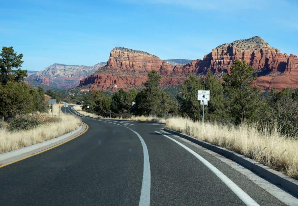
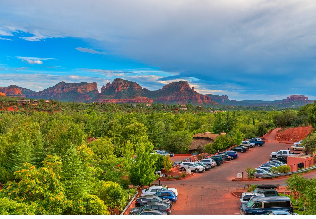
| Traffic & Congestion Patterns | • Phoenix freeways experience heavy morning/evening rush. • Tucson traffic lighter, but I-10 corridor can back up. • Weekend traffic spikes around tourist areas (Sedona, Flagstaff). |
| Gas Prices | Typically $3.60–$4.10 per gallon, slightly below West Coast states but above Texas/New Mexico. |
| Electric Vehicles & Charging | Strong EV adoption in Phoenix/Scottsdale. Charging networks expanding quickly—Tesla Superchargers, EVgo, Electrify America stations widely available. |
| Rail & Intercity Travel | • Amtrak: Southwest Chief (Flagstaff), Sunset Limited (Tucson) • Greyhound, FlixBus, and regional shuttles (e.g., Phoenix↔Tucson, Phoenix↔Flagstaff) |
| Walkability | Most Arizona cities are car-centric. Most walkable cities: Tempe, Scottsdale, Flagstaff due to downtown density and campus areas. |
| Future Transportation Projects | • Phoenix light-rail extensions (north and south) • Freeway expansions on Loop 303, I-10 widening • Potential long-term Phoenix–Tucson rail discussions |
Interstate 10 serves as Arizona’s spine, carrying commerce and travelers 390 miles from California to New Mexico. Morning light reveals its personality changes—from the agricultural checkpoints near Blythe through Phoenix’s sometimes-frantic interchanges to the long, contemplative stretches approaching Las Cruces. The highway that connects Los Angeles to Jacksonville finds its Arizona segment handling 250,000 vehicles daily through central Phoenix, making it the state’s most traveled corridor. Yet beyond metropolitan areas, I-10 offers the meditative experience of desert driving, where cruise control locks in at 75 mph and the horizon shimmers with heat mirages or mountain silhouettes.
Interstate 17 performs a different magic, climbing from Phoenix’s desert floor to Flagstaff’s pine forests in just 144 miles. This vertical journey through five life zones represents one of America’s most dramatic elevation changes along an interstate. The highway that begins among saguaro cacti ends surrounded by ponderosa pines, gaining 6,000 feet while treating drivers to views of the Mogollon Rim and red rocks of Sedona visible to the east. Weekend traffic tells its own story—Phoenix residents escaping to cooler climates, Flagstaff students heading home, tourists bound for the Grand Canyon.
Interstate 40 crosses northern Arizona like a ruler line, following much of historic Route 66’s path. The 360-mile Arizona segment connects Kingman through Flagstaff to the New Mexico border, serving as the primary east-west corridor for commercial traffic. Truckers know every grade and gas station, while tourists discover remnants of America’s Mother Road in Williams and Holbrook. Winter brings complexity here—snow and ice close the highway several times annually, reminding desert-dwelling Arizonans that their state includes serious winter driving conditions.
The Loop 101 and Loop 202 system transformed Phoenix from a city requiring cross-town surface street navigation to one with true beltway bypass options. Loop 101 circles three-quarters of the Valley, connecting Scottsdale’s resorts to Glendale’s sports complexes to Chandler’s tech corridor. Loop 202 completes the circuit, with the recent South Mountain extension finally connecting the West Valley to the East Valley without traversing downtown. These highways, some featuring HOV lanes and peak-hour restrictions, handle the bulk of metropolitan Phoenix’s internal circulation.
State routes provide the connective tissue linking Arizona’s dispersed communities. Highway 89 winds from Wickenburg through Prescott to Flagstaff, offering an alternative to interstate monotony with mountain curves and authentic Western towns. Highway 60 crosses the state’s midsection, passing through Superior’s copper mining country and the Salt River Canyon’s dramatic gorges. Highway 95 parallels the Colorado River, serving river communities and snowbird destinations. Each route maintains its own character—some engineering marvels, others seemingly unchanged since territorial days.
The Arizona Department of Transportation maintains 6,835 miles of highway with remarkable efficiency given climate extremes and vast distances. Summer heat buckles pavement, requiring special high-temperature asphalt mixes. Monsoon flooding washes out sections annually, demanding rapid repair responses. Winter snow in high country necessitates plowing and salting operations. Despite these challenges, Arizona’s highways remain in notably good condition, with smooth surfaces that make long-distance driving surprisingly comfortable. ADOT’s real-time traffic apps and variable message signs help navigate congestion and weather-related closures.
Valley Metro’s light rail changed Phoenix’s transportation paradigm when operations began in 2008. The current 28-mile system connects Mesa through Tempe and Phoenix to north Phoenix, with extensions underway. Morning trains carry Arizona State University students, downtown workers, and airport travelers. The air-conditioned cars provide relief from parking hassles and summer heat, though limited routes mean light rail serves only a fraction of potential riders. Still, the sight of trains gliding past gridlocked traffic validates the system’s worth for those along its corridor.
Bus systems across Arizona vary dramatically in coverage and frequency. Valley Metro buses serve metropolitan Phoenix with routes ranging from high-frequency rapid lines to once-hourly neighborhood circulators. The challenge lies in distances—a bus commute feasible in compact cities becomes untenable when involving 20-mile journeys across suburban sprawl. Yet for those without vehicles or preferring public transit, the bus system provides essential connectivity. Real-time tracking apps help navigate schedules, while park-and-ride lots enable hybrid commutes.
Sun Tran serves Tucson with a hub-and-spoke system centered on downtown and major commercial centers. The Sun Link streetcar adds three miles of rail through downtown and the University of Arizona campus. Flagstaff’s Mountain Line provides both urban routes and regional connections to Northern Arizona University. Yuma County Area Transit and smaller systems serve other communities, though coverage remains limited outside major cities. The universal challenge across Arizona’s transit systems: serving sprawling, car-oriented development patterns with financially sustainable public transportation.
Phoenix Sky Harbor International Airport anchors Arizona’s air connectivity, ranking among America’s ten busiest airports with 45 million annual passengers. The morning push reveals Sky Harbor’s dual personality—business travelers racing for first flights out, leisure visitors arriving for desert adventures. Four terminals connected by PHX Sky Train handle flights to 130 destinations, with particularly strong service to West Coast and Mexican cities. The airport’s location just three miles from downtown Phoenix proves remarkably convenient, though flight paths over residential neighborhoods generate ongoing noise concerns.
Sky Harbor’s economic impact extends far beyond passenger convenience. The airport generates $38 billion in annual economic activity, employing 58,000 people directly and indirectly. Cargo operations move 340,000 tons annually, connecting Arizona businesses to global markets. The observation that Phoenix truly became a major city when non-stop flights reached London and Frankfurt reflects aviation’s role in economic development. Competition among airlines keeps fares relatively reasonable, though summer heat occasionally causes flight delays when extreme temperatures affect aircraft performance.
Tucson International Airport serves Southern Arizona with a more relaxed atmosphere handling 3.5 million annual passengers. The single terminal’s efficiency means parking-to-gate times rarely exceed 30 minutes. Direct flights reach 20 destinations, with connections through Phoenix or other hubs accessing worldwide destinations. Military aircraft from Davis-Monthan Air Force Base share runways, occasionally providing dramatic displays of aviation variety. Tucson’s airport particularly serves snowbirds, with seasonal routes to cold-weather cities increasing winter capacity.
Phoenix-Mesa Gateway Airport emerged from Williams Air Force Base’s closure as metropolitan Phoenix’s relief valve. Allegiant Air’s hub operations offer low-cost flights to 50 destinations, particularly smaller cities lacking Sky Harbor service. The East Valley location serves Mesa, Gilbert, and Chandler residents who might otherwise face hour-long drives to Sky Harbor. Gateway’s growth trajectory suggests eventual emergence as a major commercial airport, though current operations remain fraction of Sky Harbor’s volume.
Regional airports dot Arizona’s landscape, providing essential connectivity for remote communities. Flagstaff Pulliam Airport offers daily flights to Phoenix and Dallas, crucial for Northern Arizona’s economy. Lake Havasu City, Prescott, and Show Low maintain airports serving general aviation and occasional commercial service. Grand Canyon National Park Airport handles tour flights and private aircraft accessing the park. These smaller airports might seem inconsequential until weather closes highways—then their role as lifelines becomes apparent.

The average commute in metropolitan Phoenix runs 27 minutes, slightly above the national average but reasonable given the area’s size. Yet averages hide dramatic variation—Scottsdale to Chandler might take 45 minutes while Central Phoenix to Midtown requires just 10. The pattern reflects Arizona’s employment dispersion, with job centers scattered rather than concentrated downtown. This multipolar development creates complex commute patterns, with rush hour traffic flowing multiple directions rather than simply in and out of city centers.
Morning commutes begin early in Arizona, particularly during summer when temperatures dictate schedules. The 5:30 AM traffic surge reflects workers avoiding afternoon heat and companies accommodating four-day workweeks. Evening rush stretches longer than morning, from 3 PM to 7 PM, as staggered schedules and after-work activities spread departure times. Friday afternoons bring particular challenges as weekend travelers join commuters, clogging highways leading to recreation destinations.
Tucson’s average 23-minute commute reflects its smaller size and less severe congestion. The city’s grid street pattern provides multiple route options, reducing bottleneck impacts. However, Tucson’s east-west orientation creates sunrise and sunset driving challenges, with blinding glare causing regular accidents. The absence of extensive freeway systems means surface streets handle most traffic, creating different dynamics than Phoenix’s highway-dependent patterns.
Flagstaff and smaller cities enjoy sub-20-minute average commutes, one attraction for those fleeing metropolitan congestion. The tradeoff comes in limited job options potentially requiring longer-distance commuting to find suitable employment. Some Flagstaff residents commute to Phoenix—a 140-mile journey made feasible by remote work arrangements allowing twice-weekly rather than daily drives. These super-commuters represent growing trends as housing costs and lifestyle preferences reshape traditional proximity-to-work calculations.
Traffic congestion costs Arizona drivers approximately $1,000 annually in lost time and fuel, below national averages but still significant. The worst bottlenecks concentrate at specific interchanges—I-10 and Loop 202, U.S. 60 and Loop 101, I-17 and Loop 101. ADOT’s continuous improvement projects address these chokepoints, though construction itself creates temporary congestion. The pandemic-induced remote work shift reduced traffic 20-30%, though levels creep back toward pre-2020 patterns as offices reopen.
Cycling in Arizona presents paradoxes—perfect weather eight months annually yet challenging summer conditions, scenic beauty but sprawling distances, growing trail networks but car-dominated roads. The morning ride along Scottsdale’s Indian Bend Wash greenbelt reveals cycling’s potential here—dedicated paths separated from traffic, mountain views, and dozens of fellow riders. Phoenix and Tucson rank among America’s more bike-friendly cities, with expanding protected bike lanes and trail systems. Yet cycling remains primarily recreational rather than utilitarian for most, with distances and heat limiting commute cycling.
The Loop—Tucson’s 137-mile car-free pathway circling the city—demonstrates infrastructure investment in alternative transportation. Similar systems develop in Phoenix, with the Grand Canal, Arizona Canal, and Western Canal paths providing cross-valley routes. Mountain biking brings its own culture, with South Mountain, McDowell Mountain, and hundreds of other trail systems attracting riders globally. Electric bikes increasingly bridge the gap between recreation and transportation, making longer distances and summer heat more manageable.
Ride-sharing transformed Arizona transportation patterns, particularly in entertainment districts and around airports. Uber and Lyft operate throughout metropolitan areas and increasingly in smaller cities. The weekend night economy in Old Town Scottsdale or Mill Avenue depends heavily on ride-sharing, reducing drunk driving while enabling car-free evenings. Sky Harbor’s dedicated ride-share pickup areas streamline airport connections. Costs remain reasonable—$20-30 for most metropolitan trips—though surge pricing during major events can triple fares.
Electric scooters appeared suddenly on Arizona streets, with Bird, Lime, and other companies deploying thousands of devices. Initial chaos led to regulations limiting speeds, requiring sidewalk parking, and establishing geo-fenced no-ride zones. Scooters now provide last-mile connectivity from transit stops and short-trip alternatives to driving. Arizona State University’s campus particularly embraces scooters, with students zipping between classes. Safety concerns persist—emergency rooms report increasing scooter-related injuries—but their convenience ensures continued presence.
Walking might seem impossible in Arizona’s sprawling cities, yet walkable neighborhoods exist and thrive. Downtown Phoenix’s Roosevelt Row, Tempe’s Mill Avenue, and Tucson’s Fourth Avenue create pedestrian-friendly zones where cars become unnecessary. The morning dog-walking parade in Scottsdale’s Old Town or evening strolls through Flagstaff’s historic downtown show walking’s viability in appropriate contexts. New developments increasingly emphasize walkability, recognizing market demand for less car-dependent lifestyles. Still, most Arizona residents find vehicles essential for navigating daily life.

Choosing where to live in Arizona inherently involves transportation decisions. The family selecting suburban Gilbert accepts longer commutes for newer schools and larger homes. The young professional choosing downtown Phoenix prioritizes light rail access and walkable amenities. The retiree settling in Green Valley values minimal traffic and proximity to services over employment access. Each choice creates different daily transportation experiences—from highway warriors logging 100 miles daily to downtown dwellers walking most errands.
Vehicle selection in Arizona requires specific considerations. Air conditioning shifts from luxury to necessity when temperatures reach 118°F. All-wheel drive serves those accessing mountain communities in winter or exploring unpaved backroads. Fuel efficiency matters when commutes stretch 30 miles each way. Electric vehicles gain popularity with expanding charging infrastructure, though range anxiety persists for intercity travel. The universal requirement: reliable transportation in a state where vehicle breakdowns can prove dangerous in remote areas or extreme heat.
Transportation costs impact household budgets significantly. Average monthly vehicle payments, insurance, gas, and maintenance approach $800 per vehicle. Families commonly operate two or three vehicles, making transportation their second-largest expense after housing. Public transit provides minimal savings given limited coverage—monthly Valley Metro passes cost $64 but serve only those along fixed routes. The calculation shifts for those able to reduce vehicle ownership, though this requires careful residential location selection.
Navigation technology proves essential for Arizona driving. GPS apps provide real-time traffic updates crucial for avoiding congestion or accidents. Weather apps warn of dust storms, flash floods, or snow conditions affecting travel. Gas station apps matter when crossing remote stretches where fuel stations spread 50+ miles apart. Highway patrol apps alert to speed enforcement areas. This digital infrastructure transforms driving from uncertain adventure to managed routine, though cellular dead zones remind travelers that technology has limits.
Future transportation developments promise to reshape Arizona’s mobility landscape. Valley Metro’s light rail extensions will reach 50 miles by 2035. Interstate 11 between Phoenix and Las Vegas advances through planning stages. Autonomous vehicles test on Arizona streets, with Waymo operating driverless taxis in limited areas. Electric vehicle adoption accelerates with charging stations proliferating. High-speed rail proposals perpetually emerge though funding remains elusive. These possibilities suggest Arizona’s transportation future might differ dramatically from its car-centric present.
For those relocating to Arizona, transportation preparation proves essential. Research commute times during actual travel periods, not just distances. Understand toll road locations and costs if relevant to your routes. Prepare vehicles for extreme temperatures with coolant system maintenance and sun shades. Build emergency kits with extra water, particularly for summer driving. Consider transportation costs when evaluating housing options—the cheaper house requiring lengthy commutes might prove more expensive overall. Most importantly, embrace the reality that Arizona life typically requires reliable personal vehicles while remaining open to emerging alternatives.
The transportation story in Arizona ultimately reflects broader themes of distance, growth, and adaptation. The same highways enabling metropolitan sprawl also connect remote communities to urban services. The challenge of serving dispersed populations with public transit drives innovation in mobility solutions. The necessity of crossing vast distances creates appreciation for good roads and reliable vehicles. Understanding and accepting these transportation realities transforms potential frustration into successful navigation of Arizona’s expansive landscape.

We use cookies to improve your experience on our site. By using our site, you consent to cookies.
Manage your cookie preferences below:
Essential cookies enable basic functions and are necessary for the proper function of the website.
Statistics cookies collect information anonymously. This information helps us understand how visitors use our website.
Marketing cookies are used to follow visitors to websites. The intention is to show ads that are relevant and engaging to the individual user.