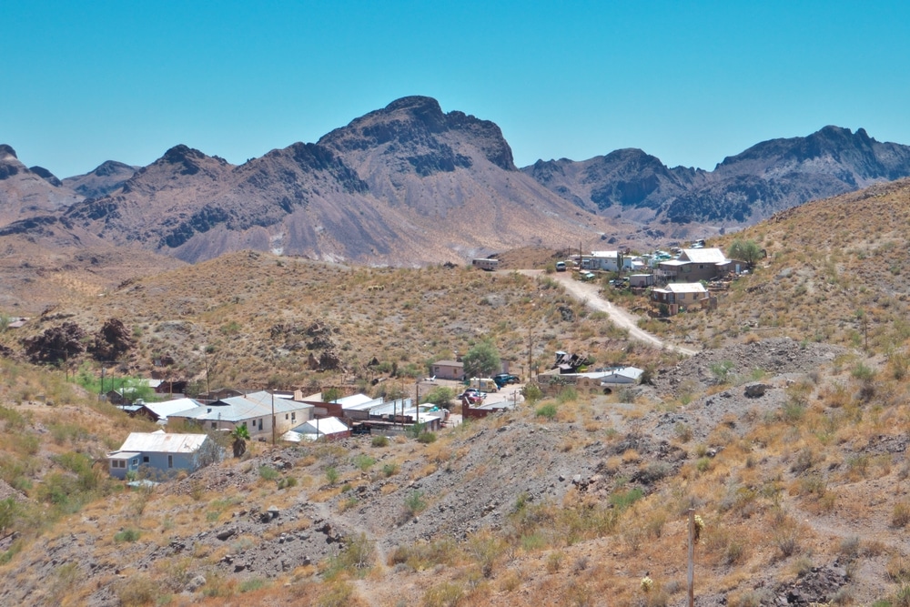
The sun beats down on weathered wooden storefronts that line a dusty main street, where wild burros roam freely, approaching visitors with a boldness born from generations of handouts. Unlike many of Arizona’s ghost towns, Oatman refuses to fully surrender to time and abandonment. Nestled in the Black Mountains of Mohave County, this former gold-mining boomtown clings tenaciously to life, a living museum where the past and present converge in fascinating ways. A short drive from Route 66, Oatman sits in stark isolation, surrounded by rugged desert landscape that seems to stretch endlessly in all directions. Beyond the tourist-frequented main street, the Pioneer Cemetery rests quietly on a hillside, its weathered markers bearing silent testimony to the dreamers and schemers who came seeking fortune in these unforgiving mountains. Through its historic buildings, cemetery grounds, abandoned mines, and the echoes of its newspapers and railroad, Oatman offers us a tangible connection to Arizona’s gold rush era—a time when fortune could appear overnight and disappear just as quickly, leaving behind the bones of dreams in the desert sun.
Oatman’s most beloved residents are its wild burros, descendants of pack animals used by miners over a century ago. They roam freely through town, often nudging visitors for treats (available in local shops). These friendly animals are a hallmark of the Oatman experience.
Twice a day, Oatman’s main street transforms into a mini Old West showdown. Costumed gunfighters from the Oatman Ghost Rider Gunfighters troupe entertain crowds with free performances, reenacting humorous and dramatic outlaw scenes. It’s a fun way to experience a piece of frontier theater.
Oatman lies directly on one of the most scenic and winding stretches of Route 66. Enjoy the drive into town with panoramic views of the Black Mountains, and explore the vintage shops and buildings that keep the spirit of the Mother Road alive.
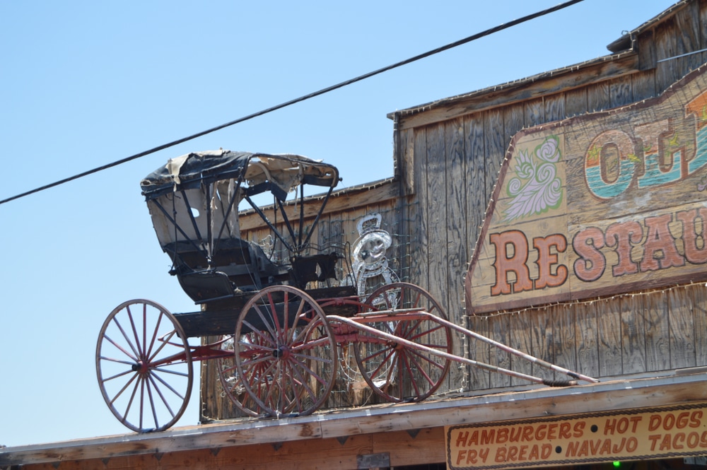
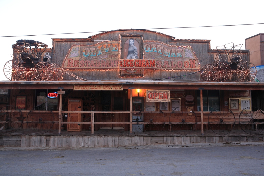
Built in 1902, the Oatman Hotel is the town’s most iconic building. It’s famously where Clark Gable and Carole Lombard spent their honeymoon in 1939. The upstairs museum features memorabilia from that visit, as well as exhibits on Oatman’s mining and Hollywood connections.

Oatman’s main street is lined with quirky gift shops, antique stores, and art galleries. You’ll find handcrafted jewelry, Native American crafts, Route 66 memorabilia, and Old West-themed trinkets—perfect for picking up a one-of-a-kind souvenir.

Gold was discovered here in the early 1900s, and remnants of Oatman’s mining boom can still be explored. Some businesses offer guided tours into old mines or historical explanations of mining equipment and life in the boomtown era.

Adventure seekers can explore the trails that wind through the Black Mountains. The Oatman to Sitgreaves Pass route offers breathtaking views and is a great hike for those looking to combine history with Arizona’s rugged beauty.

Though most attractions are daytime affairs, Oatman is a known hotspot for ghost stories and alleged hauntings, particularly at the Oatman Hotel. Some tour operators offer paranormal tours or guided storytelling sessions in the evening.
Behind Oatman’s weathered storefronts and faded grave markers lie the stories of individuals who lived, worked, dreamed, and died in this remote mining community. Their experiences, pieced together from cemetery records, newspaper accounts, and oral histories, provide a human dimension to the town’s rise and fall.
One such story belongs to Anna Johnson (1889-1918), whose grave in the Pioneer Cemetery bears the simple inscription “Beloved Schoolteacher – Victim of Influenza.” According to accounts in the Oatman Miner, Johnson arrived in 1916 from Chicago to establish the town’s first formal school. Initially teaching 37 children of various ages in a tent, she later oversaw the construction of a proper schoolhouse in 1917. When the Spanish flu epidemic struck Oatman in late 1918, Johnson volunteered to care for sick families, eventually contracting the disease herself. Her funeral reportedly drew over 200 mourners, with the Miner noting that “even the hardest miners shed tears for the woman who had taught their children and given her life in service to this community.”
The story of Hank Williams (no relation to the famous singer) presents a different aspect of Oatman life. Williams came to Oatman in 1915 as a 22-year-old miner and quickly gained a reputation as both a skilled worker and a troublemaker. The Gold Belt News documented his frequent appearances before the local justice of the peace for fighting and public drunkenness throughout 1916-1917. However, by 1919, Williams had transformed his reputation, opening a successful assay office and becoming a respected business owner. His grave in the Pioneer Cemetery, marked by a substantial granite headstone, indicates he died in 1947 at age 54, having remained in Oatman long after many others had departed. His obituary in the final year of the Gold Belt News described him as “a true Oatman pioneer who saw both the wild early days and the quieter times, adapting to each with characteristic resilience.”
From the smaller burial ground near the United Eastern Mine comes the story of Elizabeth Carter (1876-1924), wife of mine superintendent Robert Carter. Letters preserved in the Mohave Museum collection reveal her initial dismay at Oatman’s harsh conditions and isolation. “I find myself constantly dusting,” she wrote to her sister in Boston in 1917. “The fine desert sand infiltrates everything, and civilized company is as rare as rain.” Yet later correspondence shows her growing attachment to the community and her efforts to establish a women’s social club, a small library, and a garden demonstration project to help miners’ wives grow vegetables in the challenging desert environment. Her sudden death from a heart condition in 1924 prompted the mining company to establish a small medical clinic in her memory.
The Mexican laborers’ burial ground contains the grave of Miguel Sanchez, identified in company records as “Powder Man, 1888-1921.” Though largely overlooked in official histories, skilled powder men like Sanchez played crucial roles in mining operations, using their expertise with explosives to blast new tunnels and access ore bodies. The dangerous nature of this work is reflected in the cause of death listed in company records: “accidental detonation while setting charges.” His simple grave marker, a wooden cross with his name painted in now-faded letters, stands as a reminder of the immigrant workers whose labor built much of the American West but whose stories often went unrecorded in official histories.
These individual narratives, while representing just a small fraction of Oatman’s former population, help humanize the town’s history beyond statistics about gold production and population changes. They reveal a community that, despite its temporary nature and economic focus, developed the full range of human relationships, aspirations, triumphs, and tragedies found in more permanent settlements.
| Category | Details |
|---|---|
| Name | Oatman, Arizona |
| Type | Living ghost town / tourist destination |
| County | Mohave County |
| Founded | Circa 1906 (gold strike), though nearby mining began earlier in the 1860s |
| Status | Populated by a small community (~100 residents); active tourism hub |
| Population (Historic) | ~3,500+ during peak in the 1910s |
| Population (Current) | ~100 permanent residents (many involved in tourism) |
| Historical Significance | Gold mining boomtown; once part of a rich mining district with U.S. Gold Road and Tom Reed mines |
| Name Origin | Named after Olive Oatman, a pioneer girl kidnapped by Yavapai and adopted by Mojave tribe |
| Main Industry (Historic) | Gold mining — over $40 million extracted by the 1940s |
| Decline Factors | Gold exhausted; WWII War Production Board closed non-essential mines in 1942 |
| Modern Appeal | Historic buildings, reenactments, gift shops, quirky attractions |
| Famous Features | Wild burros roaming the streets, Oatman Hotel, gunfight shows, Route 66 kitsch |
| Notable Visitors | Clark Gable & Carole Lombard honeymooned at the Oatman Hotel |
| Geographic Setting | Along historic Route 66, in the Black Mountains |
| Access | Scenic drive via Route 66 between Kingman and Topock, AZ |
| Elevation | Approx. 2,700 feet (823 meters) |
| Climate | Hot desert – very hot summers, mild winters |
| Preservation Status | Well-preserved and revitalized as a heritage and tourism site |
| Best For | Families, Route 66 travelers, photographers, Old West fans, history lovers |
Oatman’s story begins with gold. Though the area had seen small-scale prospecting since the 1860s, Oatman proper didn’t emerge until 1915, when two prospectors, Ben Taddock and Jim Eardley, discovered a rich gold vein that would become the Tom Reed mine. Word of the discovery spread rapidly, triggering one of Arizona’s last major gold rushes. Within a year, Oatman transformed from a tiny mining camp to a bustling boomtown with a population of approximately 3,500 people.
Named after Olive Oatman, a young woman who had been captured by Native Americans in the 1850s and later rescued near the town site, Oatman became the center of a mining district that would ultimately produce more than $40 million in gold (equivalent to over $700 million today).
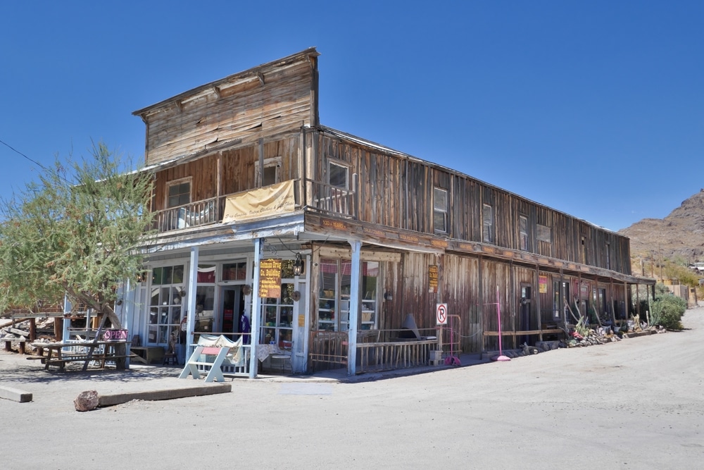
The town developed rapidly, with wooden buildings lining the main street and tents and makeshift housing spreading across the surrounding hillsides. By 1916, Oatman boasted hotels, saloons, restaurants, boarding houses, and all the other businesses necessary to support a mining community. The most famous of these establishments, the Oatman Hotel (originally called the Durlin Hotel), was built in 1902 and remains standing today.
Oatman’s growth coincided with significant developments in the broader American West. The early 20th century marked the tail end of the frontier era, with automobiles beginning to replace horse-drawn transportation and Arizona achieving statehood in 1912. Oatman represented one of the last genuine boomtowns of the Old West, straddling the divide between frontier roughness and modern amenities.
The town reached its pinnacle of prosperity in the early 1920s, becoming one of the largest gold producers in the American West. However, like all mining communities, Oatman’s fortunes were tied to its mineral wealth and the economic forces that governed it.
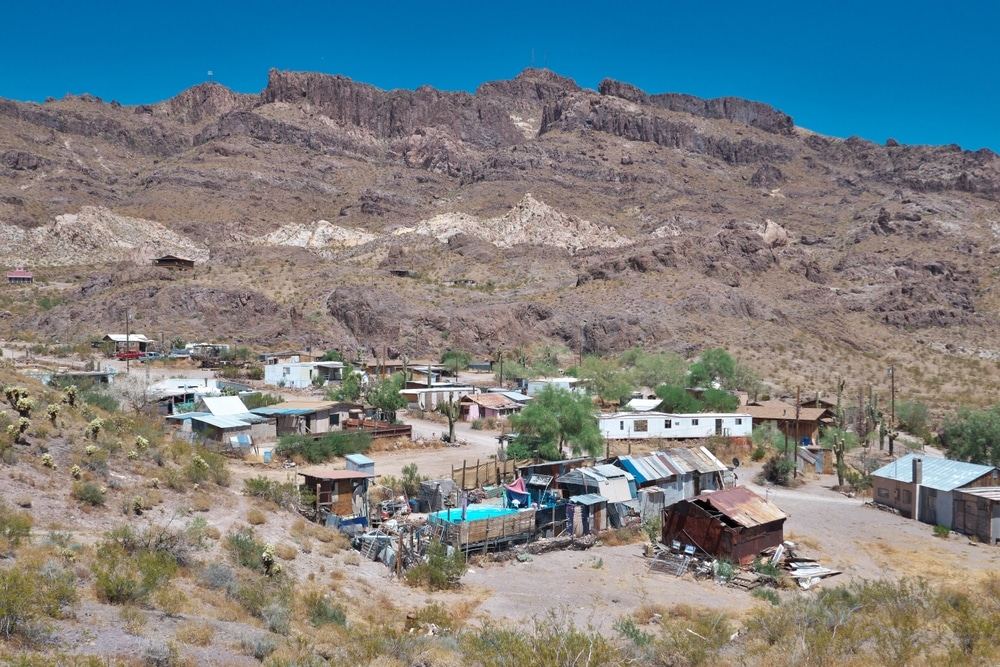
Modern Oatman exists in a curious limbo between ghost town and tourist attraction. Unlike many abandoned mining settlements that have been reclaimed by the desert, Oatman’s main street remains largely intact, its wooden storefronts preserved and repurposed as gift shops, saloons, and museums catering to tourists seeking a taste of the Old West.
The town’s most prominent landmark, the two-story Oatman Hotel, stands as it has for over a century, though its interior has been transformed into a restaurant and museum. Its walls are famously decorated with thousands of dollar bills signed by visitors, a tradition that reportedly began when miners would stick money to the walls as insurance for their next drink or as a form of safekeeping.
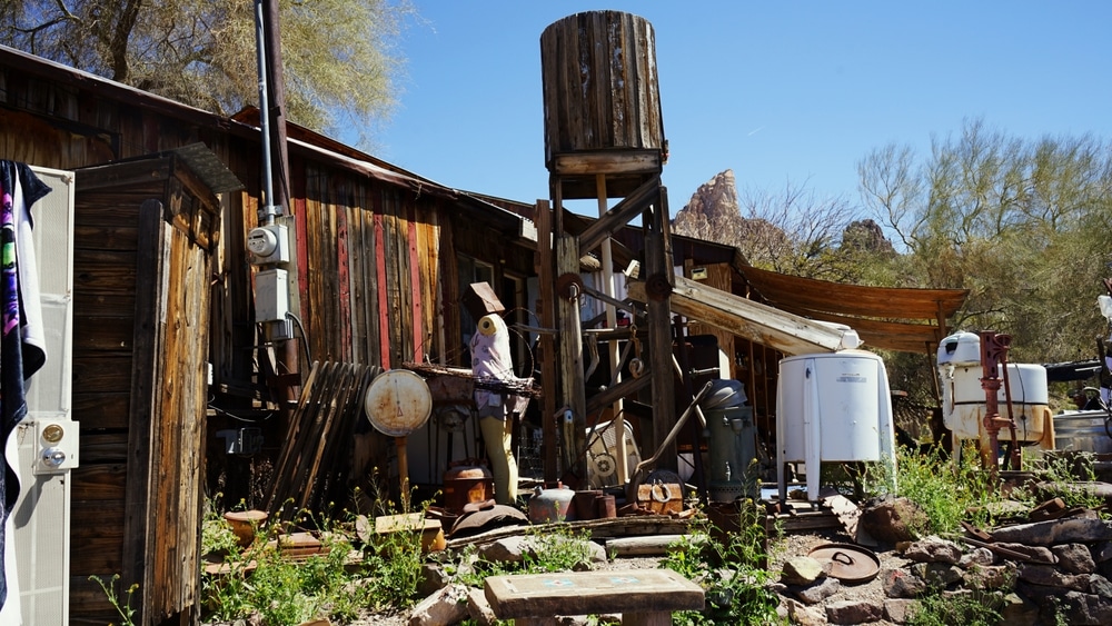
Several other historic structures remain visible, including the old jail (now a small museum), a handful of miners’ cabins, and the foundations of the town’s larger mining operations. The Glory Hole mine entrance is visible from town, though safely sealed to prevent accidents.
Beyond the preserved main street, evidence of Oatman’s former size can be found in the scattered ruins that extend into the surrounding hills. Stone foundations, rusted machinery, and the occasional collapsed wooden structure mark the locations of homes and businesses that once formed a much larger community.
The wild burros that freely roam the streets are descendants of the pack animals used by miners and abandoned when the mines closed. Now protected as part of the Black Mountain Herd Management Area, they have become Oatman’s unofficial mascots and a major tourist attraction.
Accessibility to Oatman has improved significantly since its mining days. The town is located just off Historic Route 66, approximately 30 miles southwest of Kingman. The winding mountain road that approaches Oatman from either direction offers spectacular desert views but can be challenging to navigate in larger vehicles or during inclement weather.
Unlike many ghost towns that require permission to visit or lie on private property, Oatman is open to the public year-round, with most businesses operating daily, though hours may be reduced during the hot summer months.
Perched on a rocky hillside approximately a quarter-mile north of town, the Oatman Pioneer Cemetery provides a poignant contrast to the commercial bustle of the main street. Reached by a narrow, unmarked path that winds up the slope, the cemetery occupies approximately one acre of rugged terrain, its boundaries defined more by the natural contours of the land than by any formal enclosure.
Established in 1915 shortly after the town’s founding, the cemetery contains approximately 60 visible graves, though historical records suggest the actual number of burials may be higher, as some markers have been lost to time and the harsh desert environment.
The gravestones range from professionally carved marble headstones to simple wooden crosses and rough stone cairns. Many markers have weathered to near illegibility, their inscriptions faded under decades of sun and seasonal flash floods that occasionally sweep down the hillside. The earliest identifiable burial dates to November 1915—”Thomas Wilson, age 42, lost to mining accident”—while the most recent dates to 1949, several years after the town’s major mines had closed.
The cemetery reveals much about the harsh realities of life in an early 20th-century mining town. Nearly a third of the marked graves belong to men who died in mining accidents, their headstones often noting specific incidents: “cave-in,” “explosion,” or simply “killed in mine.” Another significant percentage belongs to victims of disease, particularly the influenza epidemic of 1918-1919, which struck Oatman as it did communities worldwide.
Children’s graves are notably present, comprising approximately 20% of the identifiable burials. These small markers, often decorated with lamb or dove motifs symbolizing innocence, testify to the high infant and child mortality rates common in remote mining communities with limited medical care.
The cemetery’s organization reflects both the practical considerations of its creation and the social structure of the community it served. The northern section contains the most elaborate markers, generally belonging to mine owners, businessmen, and their families. The southern and western sections hold the simpler graves of miners and laborers, while a small area in the southeastern corner contains several unmarked burials believed to be those of prostitutes and others considered social outcasts.
Today, the Pioneer Cemetery suffers from neglect and exposure to the elements. Many wooden markers have rotted away completely, and stone monuments lean at precarious angles due to soil erosion. However, occasional volunteer efforts by historical preservation groups have documented the remaining graves and conducted limited restoration work.
Unlike many mining towns that maintained separate “pioneer” and “community” burial grounds, Oatman appears to have consolidated most of its burials in the single Pioneer Cemetery described above. Historical records and archaeological surveys have not identified a second formal cemetery site associated specifically with the town.
However, several smaller burial clusters exist in the vicinity, reflecting both the practical challenges of transport in the rugged terrain and the social divisions common in early 20th-century mining communities.
Approximately one mile east of town, near what was once the United Eastern Mine compound, lies a small fenced area containing approximately 15 graves. According to local historical accounts, this site served the mining company’s executives and their families, who lived in a separate residential compound away from the main town. The graves here are generally more elaborate than those in the Pioneer Cemetery, with several featuring marble monuments imported from California.
Another small burial ground, now barely discernible among the desert vegetation, exists two miles south of town near a former Mexican laborers’ camp. This area contains approximately 20 simple graves marked primarily by wooden crosses and stone piles. Few inscriptions remain legible, but those that can be read bear Hispanic surnames and dates ranging from 1916 to 1932.
These separate burial locations reflect the socioeconomic and ethnic stratification common in mining communities of the era, where company officials, American miners, and immigrant laborers often lived in distinct areas with limited interaction outside the workplace.
The distinction between these burial grounds gradually blurred as Oatman’s population declined in the 1930s and 1940s. Later burials, regardless of social status, were generally placed in the main Pioneer Cemetery, which had become established as the town’s primary burial ground.
Oatman’s rapid growth and economic importance supported two competing newspapers during its heyday: the Oatman Miner, established in February 1916, and the Oatman Gold Belt News, which began publication six months later. Both were weekly publications, typically running 8-12 pages, combining mining news, local events, and national headlines.
The Oatman Miner, founded by Joseph H. Mattes, a veteran journalist who had previously run newspapers in several other Western mining towns, operated from a small wooden building on the eastern end of Main Street. The structure, which housed both editorial offices and a printing press, was destroyed in a fire in 1921 but quickly rebuilt. The Miner positioned itself as the voice of the mining industry, with extensive coverage of new strikes, production figures, and stock prices for the various mining companies operating in the district.
The Gold Belt News, established by brothers Thomas and William Hodgson, operated from a more substantial stone building near the center of town, adjacent to the assay office. This strategic location gave the News reporters early access to information about ore quality and new discoveries. The paper developed a reputation for more critical coverage of mining operations, including discussions of safety concerns and labor conditions that were generally absent from its competitor’s pages.
Both papers devoted considerable space to community life, documenting everything from school activities and church services to social gatherings and sporting events. The papers’ society columns provide valuable insights into Oatman’s development from rough mining camp to established community, with increasing attention to women’s activities, children’s education, and cultural events as the town matured.
The editorial stances of the two papers reflected different visions for Oatman’s development. The Miner consistently advocated for policies favorable to mining companies, including limited regulation and taxation. The Gold Belt News, while still pro-mining, pushed for infrastructure improvements, better schools, and the establishment of a hospital and fire department to serve the growing community.
Both papers documented the town’s transition from boom to bust. The Oatman Miner ceased publication in 1930 as declining advertising revenue made the business unsustainable. The Gold Belt News continued on a reduced schedule until 1934, its final years filled with increasingly desperate articles promoting new mining techniques and potential discoveries that might revive the town’s fortunes.
The physical locations of both newspaper operations are still identifiable in Oatman today. The rebuilt Miner building now serves as a gift shop, while the more substantial former Gold Belt News building houses a small museum with displays including several preserved copies of both publications.
Surviving copies of both newspapers are limited but provide invaluable windows into Oatman’s past. The most comprehensive collection exists in the Mohave Museum of History and Arts in Kingman, which maintains bound volumes covering approximately 60% of the Miner’s run and 40% of the Gold Belt News’ publication history. Additional fragmentary collections can be found in the Arizona Historical Society archives in Tucson and the University of Arizona Special Collections.
Unlike many mining communities that developed around railroad access, Oatman never had direct rail service to the town itself. The rugged terrain of the Black Mountains made constructing a rail line directly to Oatman prohibitively expensive, even during the height of the gold boom.
Instead, Oatman relied on a combination of transportation methods, with the nearest rail connection being the Santa Fe Railroad’s main line through Kingman, approximately 30 miles northeast. From Kingman, supplies and passengers traveled to Oatman via a combination of roads—first by automobile or wagon to the base of the mountains, then by a steep, winding road up to the mining district.
This transportation challenge significantly impacted Oatman’s development and operations. Mining companies had to factor in the substantial cost of hauling ore down the mountain to the railroad in Kingman, then shipping it to processing facilities elsewhere in Arizona or California. This expense made it economically viable to mine only the richest ore bodies, leaving lower-grade deposits unexploited.
By 1920, a more direct road connection had been established between Oatman and Topock, a small community on the Colorado River where the Santa Fe Railroad had a station. This 18-mile route, while still challenging, provided a somewhat more efficient path for shipping ore and receiving supplies.
The construction of the National Old Trails Road (later designated as part of Route 66) in the early 1920s significantly improved Oatman’s accessibility. This highway passed directly through town, bringing increased automobile traffic and tourism to supplement the declining mining economy. The famous Oatman Hotel became a popular stopping point for travelers on the new highway, and reportedly hosted Clark Gable and Carole Lombard on their honeymoon night in 1939.
Physical evidence of Oatman’s transportation infrastructure remains visible today. The original wagon road that connected the town to Kingman can still be traced in sections, identifiable by its narrower width and stone retaining walls. Several loading platforms where ore was transferred from mule teams to motorized vehicles exist on the outskirts of town, their wooden components long rotted away but their stone foundations still intact.
A significant change came in 1952 when Route 66 was realigned to bypass Oatman entirely, taking a flatter, more direct route between Kingman and Topock. This rerouting, combined with the already declining mining activity, led to a near-complete abandonment of the town throughout the 1950s and 1960s.
Today, the old section of Route 66 through Oatman has been designated a historic byway, drawing nostalgia-seeking travelers and keeping the town alive as a tourist destination long after its mining operations ceased. The winding mountain road, with its hairpin turns and steep grades, offers visitors an authentic experience of early automotive travel in the American West.
Oatman’s decline began gradually in the late 1920s and accelerated in the 1930s, driven by a combination of depleted ore bodies and economic factors beyond the town’s control. Unlike some mining communities that collapsed suddenly following a single event, Oatman’s transition from boomtown to ghost town occurred in stages over approximately 20 years.
The initial signs of decline appeared around 1924, when several smaller mining operations closed after exhausting their economically viable ore deposits. The town’s population, which had peaked at approximately 3,500 in 1916, had already decreased to around 2,000 by 1925 as miners moved on to more promising locations.
A more significant blow came in 1932 when the United Eastern Mine, one of the district’s largest employers, ceased operations. As documented in the Gold Belt News, the closure idled over 300 workers directly and affected numerous support businesses from assay offices to boarding houses. The same year, the Tom Reed mine reduced its workforce by half, focusing only on the richest remaining ore bodies.
The town might have collapsed entirely during this period if not for two factors that temporarily sustained it. First, the Depression-era increase in gold prices (from $20.67 to $35 per ounce following the Gold Reserve Act of 1934) briefly made it economical to rework lower-grade ore and tailings from earlier operations. Second, Oatman’s location on Route 66 brought a steady stream of travelers who patronized the town’s hotels, restaurants, and service stations.
This reprieve proved temporary, however. By 1938, even the reworking of old mines became unprofitable, and the Tom Reed mine—the last major operation in the district—finally closed in 1942. A more decisive blow came during World War II when the government issued Order L-208, which classified gold mining as a non-essential industry and directed mining resources toward metals needed for the war effort.
Oatman’s population plummeted in the early 1940s, falling to fewer than 500 residents by 1945. The Gold Belt News had already ceased publication, but accounts from nearby communities documented the town’s contraction, with buildings being dismantled for materials or abandoned to the elements.
The final chapter in Oatman’s decline came in 1952 when Route 66 was realigned to bypass the town entirely. Without either mining or highway traffic to sustain it, Oatman lost most of its remaining businesses within two years. By 1960, the population had dwindled to fewer than 50 permanent residents, most of them elderly former miners living on pensions or small-scale prospectors still hoping for a lucky strike.
The newspapers, already shuttered for decades, were unavailable to document this final phase of abandonment. However, oral histories collected in the 1980s from former residents describe the eeriness of a once-bustling main street reduced to a handful of occupied buildings surrounded by vacant, deteriorating structures.
Both cemeteries fell into neglect during this period. The main Pioneer Cemetery saw its last recorded burial in 1949, though local tradition suggests unofficial interments may have continued for some years afterward. Maintenance of the grounds effectively ceased, with desert vegetation gradually reclaiming the hillside and weathering taking its toll on the markers.
Most former residents relocated to Kingman, Bullhead City, or other communities in Mohave County. Some found work in copper mining or other extractive industries, while others left mining altogether. Their dispersal effectively ended Oatman as a functional community, though it never reached the point of complete abandonment that characterized many other mining ghost towns.
Today, Oatman occupies a distinctive place in Arizona’s cultural landscape, significant for both its historical role in the state’s mining history and its current status as a living ghost town that continues to evolve.
The town’s mining history has been recognized by historians as representative of Arizona’s last major gold rush. The Oatman Mining District, which ultimately produced more than $40 million in gold (approximately $700 million in modern values), represents a significant chapter in the state’s economic development. Archaeological surveys conducted by Northern Arizona University in the 1990s documented the remains of more than 20 major mine sites in the surrounding hills, providing valuable data on early 20th-century mining techniques and technology.
Oatman’s development coincided with Arizona’s transition from territory to state (achieved in 1912) and reflects the broader patterns of resource extraction that characterized Western settlement. Unlike earlier mining booms that occurred in relative isolation, Oatman’s growth was documented in newspapers, photographs, and government records, providing historians with detailed information about community formation in frontier settings.
The town has been listed in the National Register of Historic Places since 1983, with particular emphasis on the Oatman Hotel and several other structures along Main Street. This designation has helped preserve the town’s remaining historic buildings while acknowledging their cultural significance.
For the Mohave and other indigenous communities of the region, Oatman represents a complex legacy. The Black Mountains had been traditional hunting and gathering territory before mining development displaced native uses. Some archaeological evidence suggests the area may have contained sites of cultural significance that were destroyed during mining operations. However, oral histories also indicate that some Native Americans found employment in the mining district, particularly as guides and suppliers of food to the early camps.
Today, Oatman has found new significance as a heritage tourism destination. The town attracts approximately 500,000 visitors annually, drawn by its authentic Old West atmosphere, historic buildings, and the famous wild burros. This tourism economy has preserved Oatman from the complete abandonment that befell many similar mining communities, while creating a new chapter in its cultural history.
The town features prominently in Route 66 heritage tourism, with its stretch of the historic highway considered among the most scenic and challenging. Automobile clubs and historic preservation organizations have worked to maintain the road’s original character, including its narrow width and unpaved shoulders.
For researchers and historians, Oatman provides a valuable case study in how former mining communities can be repurposed for heritage tourism while maintaining historical authenticity. Unlike some “ghost town” attractions that were largely reconstructed or heavily modified for tourists, Oatman retains much of its original character, with adaptations made within historic structures rather than through new construction.
The condition and treatment of Oatman’s cemeteries reflect broader patterns in how Western communities remember their mining heritage, with periods of neglect interspersed with renewed interest and preservation efforts.
The Pioneer Cemetery experienced almost complete abandonment from the 1950s through the 1970s. During this period, natural erosion damaged many grave sites, while some markers were reportedly removed by souvenir hunters or vandals. The isolated location protected the cemetery from complete destruction but also made maintenance impractical as the town’s population dwindled.
A turning point came in 1978 when the newly formed Oatman Historical Society initiated efforts to document and preserve the cemetery. Volunteers cleared overgrowth, recorded inscriptions from remaining markers, and installed a simple fence to deter wildlife and casual trespassing. These efforts accelerated in the 1980s as Oatman began attracting increasing numbers of tourists interested in the town’s history.
In 1992, a more comprehensive restoration project was undertaken through a partnership between the Historical Society, Mohave County, and several descendants’ organizations. This project included archaeological mapping of the cemetery, stabilization of damaged headstones, and installation of a commemorative plaque listing all known burials, including those whose markers had been lost. Similar but smaller-scale efforts addressed the secondary burial grounds near the United Eastern Mine and the Mexican laborers’ camp.
The Pioneer Cemetery now receives basic maintenance several times annually, with more extensive restoration work performed as funding permits. A notable challenge has been balancing preservation needs with the cemetery’s remote location and limited access to utilities like water for landscape maintenance.
Memorial practices at the cemeteries have evolved over time. From the 1990s onward, an annual Miners’ Memorial Day ceremony has been held at the Pioneer Cemetery each November, coinciding with the anniversary of Arizona’s statehood. This event typically involves a simple service honoring those buried in the cemetery, readings from historical accounts of life in Oatman, and occasionally the dedication of new interpretive materials.
For descendants of Oatman residents, the cemeteries provide important connections to family history. Several extended families with ancestors buried in the Pioneer Cemetery make annual pilgrimages to maintain specific graves and pass family stories to younger generations. These private remembrances occur throughout the year but are particularly common during traditional memorial holidays.
The Oatman Historical Society maintains a registry of descendants and has worked to connect families with their ancestors’ burial locations. This effort has proven challenging, as many former residents scattered widely after leaving Oatman, and subsequent generations often lost detailed knowledge of family connections to the town.
Conservation challenges continue to affect all of Oatman’s burial grounds. The desert environment, with its extreme temperature fluctuations, occasional flash floods, and persistent wind erosion, takes a constant toll on grave markers and landscaping. Limited resources for maintenance mean that preservation efforts must be prioritized, with greatest attention given to graves with historical significance or active family connections.
Despite these challenges, the cemeteries have been increasingly integrated into Oatman’s identity as a heritage tourism destination. Guided tours now include respectful visits to the Pioneer Cemetery, where interpreters discuss burial practices, symbolism in grave markers, and the life stories of notable individuals interred there. These interpretive efforts help transform the cemetery from a neglected relic to an important component of the community’s historical narrative.
Visitors to Oatman can experience a unique blend of authentic ghost town atmosphere and tourist-oriented activities, but should approach the site with respect for both its historical significance and the small community of current residents who call it home.
The town is accessible year-round via Historic Route 66, though summer temperatures regularly exceed 100°F, making spring and fall the most comfortable seasons for exploration. The road approaching Oatman from either direction (Kingman to the east or Topock to the west) features steep grades and sharp curves that can be challenging for large RVs or trailers.
Oatman’s Main Street is lined with gift shops, restaurants, and small museums housed in historic buildings. The Oatman Hotel, continuously operated since 1902, offers dining and displays of historical photographs and artifacts, though it no longer provides overnight accommodations. Several daily events cater to tourists, including mock gunfights performed by volunteers in period costume and scheduled feedings of the wild burros that roam the streets.
Visitors interested in exploring beyond the commercial area should be aware that much of the surrounding land is administered by the Bureau of Land Management. Hiking trails of varying difficulty lead to viewpoints overlooking the town and to safely observable (though sealed) mine entrances. Summer hiking is not recommended due to extreme heat and limited shade.
Those wishing to visit the Pioneer Cemetery should prepare for a moderate uphill walk on unmarked and sometimes unstable terrain. The cemetery is accessible via a dirt path beginning near the eastern end of town; local business owners can provide specific directions. Visitors should approach the cemetery with appropriate respect, avoiding walking directly on graves, refraining from moving stones or markers, and not removing any items as souvenirs.
Photography is generally welcome throughout Oatman, including in the cemetery, though photographers should be mindful of composition that respects the dignity of burial sites. Commercial photography may require permits from the Bureau of Land Management.
Several small museums in Oatman provide additional historical context. The Gold Camp Museum, housed in a former assay office, displays mining equipment, photographs, and interpretive materials explaining gold extraction and processing. The Glory Hole Interpretive Center, established in a former miner’s cabin, focuses on daily life in the mining community.
Visitors seeking more comprehensive historical information should consider combining their Oatman visit with a stop at the Mohave Museum of History and Arts in Kingman, which maintains extensive archives, photographs, and artifacts related to mining communities throughout the county, including a dedicated Oatman exhibit.
As with any historic site, ethical visitation of Oatman involves leaving no trace and taking only photographs and memories. The town’s continued existence as both a historic site and tourist destination depends on visitor respect for physical structures, cemetery grounds, and the surrounding natural environment.
As the sun sets behind the Black Mountains, casting long shadows across Oatman’s weathered buildings and silent cemetery, the visitor can almost hear the echoes of a bustling mining town—the clang of pickaxes, the rumble of ore carts, the animated conversations spilling from saloon doors, the laborious chugging of stamp mills crushing rock in search of gold flecks. In this moment between day and night, Oatman exists simultaneously in past and present, neither fully abandoned nor completely alive.
The story of Oatman embodies the boom-and-bust cycle that characterized so much of Western American development. In barely three decades, this remote canyon transformed from empty desert to thriving town to declining outpost. The gold that drew thousands of hopeful miners has largely been extracted, the newspapers that chronicled community life have fallen silent, and many of the people who built and sustained the town now rest in the hillside cemetery overlooking their former home.
Yet unlike many ghost towns that have been reclaimed entirely by the desert, Oatman persists, adapting to changing circumstances while maintaining connections to its mining heritage. The same spirit of entrepreneurship that once drove prospectors to search these hills for gold now animates small business owners who cater to tourists seeking authentic Western experiences. The buildings constructed for mining-era commerce now house museums and gift shops. Even the burros, once essential workers in the mining industry, have found new purpose as beloved attractions.
This resilience speaks to broader patterns in Arizona’s history—the capacity to reinvent and repurpose in response to economic and environmental challenges. From indigenous communities who adapted to desert conditions over millennia to mining towns that transformed into tourist destinations, the story of Arizona has always involved finding new ways to derive value from seemingly inhospitable landscapes.
For today’s visitors, Oatman offers something increasingly rare: a tangible connection to the mining frontier that shaped so much of the American West. Walking its streets, exploring its cemetery, and reading fragments of its newspapers provides an experience that goes beyond abstract historical knowledge to create a sensory understanding of the past. The heat, dust, and isolation that challenged Oatman’s original residents remain palpable to modern visitors, as does the grandeur of the landscape that attracted prospectors despite these hardships.
As we leave Oatman—whether headed east toward Kingman or west toward the Colorado River—we carry with us not just souvenirs and photographs but a deeper appreciation for the complex history written on this landscape. The story of this place, preserved in buildings and burial grounds, in newspaper archives and oral histories, reminds us that even the most ambitious human endeavors exist within cycles of growth and decline, permanence and change. In its partial preservation and ongoing adaptation, Oatman invites us to consider how we too might balance remembrance of the past with resilience in the face of change—a lesson as valuable as any gold once pulled from these rugged mountains.
We use cookies to improve your experience on our site. By using our site, you consent to cookies.
Manage your cookie preferences below:
Essential cookies enable basic functions and are necessary for the proper function of the website.