The morning sun casts long shadows across the juniper-dotted landscape of northern Arizona, illuminating a subtle depression that winds through the high desert plateau. To the untrained eye, this shallow groove appears to be just another natural feature of the rugged terrain. But to those who know where to look, this faint trace represents something profound—the remnants of the Beale Wagon Road, one of Arizona’s first federally funded highways and a pioneering route that helped open the Southwest to American settlement.
The story of the Beale Wagon Road begins in the aftermath of the Mexican-American War, when the newly acquired territories of the American Southwest remained largely unmapped and inaccessible. As the nation expanded westward, driven by the doctrine of Manifest Destiny and the California Gold Rush, the need for reliable transportation routes across the continent became increasingly urgent.
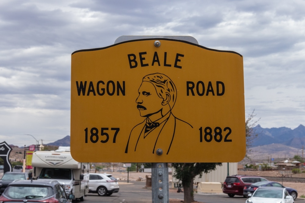
In 1857, Navy Lieutenant Edward Fitzgerald Beale received a remarkable commission from the War Department: to survey and build a wagon road along the 35th parallel from Fort Defiance in present-day eastern Arizona to the Colorado River. Beale’s expedition would also serve as a scientific experiment of sorts, testing the viability of camels as pack animals in the American desert—a concept that seemed promising but ultimately proved impractical in the rocky terrain of the Southwest.
The expedition, which included a caravan of wagons, 25 camels, numerous mules, and a diverse crew of American and foreign workers, departed in August 1857. Over the next year, Beale’s team would blaze a trail across northern Arizona, crossing landscapes that few non-Indigenous people had ever seen. They mapped water sources, cataloged plants and animals, recorded Indigenous settlements, and transformed a conceptual line on a map into a physical pathway that would change the region forever.
| Aspect | Details |
|---|---|
| Location | The Beale Wagon Road passed near the site of present-day Kingman, Arizona, in Mohave County. |
| Established | Surveyed by Edward F. Beale in 1857-1858 as part of a government project to establish a wagon route across the Southwest. |
| Significance in Kingman | – The route passed through the Hualapai Valley and nearby mountainous terrain. |
| – It later influenced the development of Kingman as a transportation hub due to its location along key routes. | |
| Terrain Challenges | – The area around Kingman presented rugged terrain, including mountains and dry desert landscapes. |
| – Beale’s team had to navigate the arid environment, locating water sources for both people and animals. | |
| Role in Expansion | – The road helped bring settlers, miners, and traders to the region. |
| – It also supported early military movement and supply lines during westward expansion. | |
| Connection to Railroads | – The route later influenced the placement of the Atlantic and Pacific Railroad (later part of the Santa Fe Railway). |
| Modern Legacy | – Portions of the Beale Wagon Road near Kingman overlap with Historic Route 66 and Interstate 40. |
| – Some sections are preserved as historical landmarks and trails in the Kingman area. | |
| Cultural Significance | – The road is part of the broader history of migration and exploration in northern Arizona. |
| – It also represents early interactions between settlers and Native American tribes, such as the Hualapai people. |
The Arizona segment of the Beale Wagon Road traversed some of the territory’s most dramatic landscapes, passing near what would later become Flagstaff, Williams, and Kingman. The route deliberately followed traditional Indigenous pathways that connected reliable water sources—a necessity in the arid Southwest. From Fort Defiance, the road headed westward, crossing the Little Colorado River near present-day Winslow before winding through the San Francisco Peaks and continuing west toward the Colorado River.
Beale’s meticulous journals describe the challenges and wonders encountered along the way. Near present-day Flagstaff, he marveled at the “magnificent pine forest” and the “beautiful valleys covered with the richest grasses.” At what would become Peach Springs, his party discovered refreshing natural springs that had long been used by the Hualapai people. And as they approached the formidable barrier of the Colorado River, they encountered the steep, treacherous terrain that would later pose significant engineering challenges.
Construction of the actual wagon road was a monumental task, accomplished with nothing more than hand tools, draft animals, and human labor. The work included clearing brush and trees, removing boulders, building crude bridges over washes, and creating ramps down steep slopes. Where necessary, the road was improved with rudimentary grading and drainage features, though it remained primitive by modern standards.
By 1859, the basic route had been established, and Beale declared the road complete—the first federally constructed highway through Arizona. The total cost was approximately $210,000 (about $6.8 million in today’s currency), considered a bargain for creating a passable route across hundreds of miles of challenging terrain.
The Beale Wagon Road quickly became a critical transportation artery through the Southwest. Unlike the more southerly routes that suffered from extreme desert heat and Apache raids, the 35th parallel route offered relatively mild conditions and more consistent water sources. The road saw its first significant use during the Civil War, when Union forces used it to move troops and supplies between California and New Mexico Territory.
Following the war, the road facilitated an influx of settlers, prospectors, and entrepreneurs into northern Arizona. Communities began to spring up along its path, many beginning as simple way stations serving travelers. Postal routes followed the road, creating the first regular mail service across northern Arizona. Stagecoach lines established regular service, with Beale’s carefully documented water sources becoming stops where horses could be rested and passengers could find basic accommodations.
The mining booms of the 1870s and 1880s brought even more traffic to the road. Prospectors heading to the gold fields near Prescott or the mineral deposits around Kingman used the route as their primary access. Commercial freighting increased dramatically, with massive wagon trains hauling supplies to mining camps and settlements, then returning with ore bound for distant processing facilities.
At its peak in the 1880s, the Beale Road hummed with activity. Freight wagons, stagecoaches, military patrols, cattle drives, and individual travelers created a steady stream of movement across the northern Arizona plateau. Way stations like Navajo Springs, Lithodendron Wash, Brigham City, and Beale Springs evolved into small communities serving this constant flow of humanity.
The Beale Wagon Road directly contributed to the birth of several settlements that later became ghost towns, their fates inextricably linked to changing transportation patterns. These forgotten communities strung along the historic route tell the story of how transportation infrastructure both creates and abandons places as technologies and economic patterns evolve.
Beale Springs, located near present-day Kingman, began as a natural water source documented by Beale’s expedition in 1857. By the 1870s, it had developed into a small settlement with a trading post, stage stop, and military outpost protecting travelers along the road. The spring’s reliable water made it an essential stop for anyone crossing this stretch of desert. However, when the Atlantic & Pacific Railroad was constructed in 1883, following roughly the same route as the Beale Road but passing a few miles south of Beale Springs, the settlement quickly declined. By 1890, it was largely abandoned, with most residents having relocated to the booming railroad town of Kingman.
Brigham City represents another community created by the road that later vanished. Founded in 1876 by Mormon pioneers at a crossroads where the Beale Road met routes to Mormon settlements in southern Utah, this planned agricultural community initially thrived by providing food and services to travelers. With irrigation ditches drawing water from the Little Colorado River, the settlement grew to include approximately 200 residents living in a fort-like adobe structure with a communal dining hall, workshop, and schoolroom. When recurring floods destroyed their irrigation system and the railroad bypassed them, the community disbanded by 1881. Today, only eroded adobe walls and foundation outlines remain visible near present-day Winslow.
Navajo Springs Station began as a natural water source and camping site along the eastern portion of the Beale Road. It developed into a stage stop with a small trading post and basic overnight accommodations. After briefly serving as the temporary territorial capital when Arizona was first separated from New Mexico Territory in 1863 (the place where the first territorial governor actually took his oath of office), the site declined in importance as official functions moved to Prescott. The station continued serving travelers until railroad construction redirected traffic away from the area. Today, archaeological remains and a small historical marker are all that indicate this historically significant location.
These ghost towns along the Beale route illustrate a common pattern in western transportation history—places born from one transportation technology often died when newer, faster transportation methods rendered them obsolete.
The Beale Wagon Road’s significance began to diminish in the early 1880s with the arrival of its technological successor: the railroad. The Atlantic & Pacific Railroad (later the Atchison, Topeka & Santa Fe) closely followed Beale’s route across northern Arizona, recognizing the practical wisdom of his careful path-finding. The railroad surveys explicitly referenced Beale’s earlier work, and many of his documented water sources became railroad water stops.
When the first trains steamed across northern Arizona in 1883, they represented a transportation revolution. What had been a journey of weeks by wagon could now be accomplished in days by rail. Freight costs plummeted, passenger comfort increased dramatically, and the reliable year-round service made the seasonal challenges of wagon travel obsolete.
The impact on the Beale Road was immediate and devastating. Stagecoach lines discontinued service, freight companies went bankrupt, and way stations saw their customer base evaporate. The road remained in use for local traffic and for reaching areas not directly served by the railroad, but its role as a major transportation corridor had ended.
Communities along the road faced a stark choice: relocate closer to the railroad or face likely extinction. Some settlements, like Flagstaff, successfully transitioned when the railroad passed nearby. Others, like Beale Springs, withered when the rails bypassed them by a few critical miles. This pattern of railroad-driven consolidation repeated across the western landscape, as the new technology reshaped settlement patterns according to its own linear logic.
Today, the Beale Wagon Road exists as a ghost highway—a once-vital transportation corridor that has largely faded back into the landscape from which it was carved. Unlike abandoned railways with their more substantial infrastructure, wagon roads leave subtler traces across the land. Yet with informed eyes, modern explorers can still discover remarkable evidence of this pioneer pathway.
Interstate 40 roughly parallels the old Beale Road across much of northern Arizona, often within a few miles of the historic route. In some places, like the approach to the Colorado River near Topock, the modern highway directly overlays portions of the original road. But venture away from the interstate, and more authentic segments can be discovered.
East of Flagstaff, observant travelers along SR-87 can spot segments where the shallow depression of the old road remains visible, running roughly parallel to the modern highway. Near Winslow, remnants of the road can be found crossing the Little Colorado River at a natural ford that Beale’s expedition improved for wagon traffic. West of Flagstaff, Forest Service roads occasionally follow or cross the historic route, particularly in the vicinity of Garland Prairie.
Some of the best-preserved segments lie in the remote areas between Seligman and Kingman, where the lack of development has allowed portions of the road to remain remarkably intact. Here, the parallel wheel ruts carved by countless wagons can still be seen cutting across the landscape. Occasional stone cairns that once served as route markers still stand sentinel along isolated stretches.
The most visible physical remnants are often at water stops, where structures were built to support travelers. At Navajo Springs, archaeological remains of the stage station can still be identified. Near Peach Springs, stone foundations mark where a way station served travelers. And at various points along the route, carved inscriptions on rock faces record the passing of military units and emigrant parties.
Modern exploration of the Beale Road offers a unique window into pioneer travel experiences. By following portions of the old road on foot, today’s visitors can connect physically with the challenges faced by 19th-century travelers—the steep grades, the rocky terrain, the vast distances between water sources, and the breathtaking landscapes that haven’t changed in over 160 years.
The story of the Beale Wagon Road cannot be completely told without acknowledging its impact on the Indigenous nations whose ancestral territories it traversed. For the Navajo, Hopi, Havasupai, Hualapai, and Mojave peoples, Beale’s expedition represented not discovery but incursion—not progress but the beginning of profound displacement.
Many segments of the Beale Road followed Indigenous pathways that had been used for centuries or millennia. The water sources that Beale documented were traditional gathering places for Native peoples, whose knowledge of the region’s hydrology was far more sophisticated than most American officials recognized. The expedition relied heavily on Indigenous guides, whose expertise made the project possible but who received little historical recognition.
The road’s construction set in motion dramatic changes for Indigenous communities. Increased American traffic through previously remote areas disrupted traditional movements and resource gathering. Military forts established to protect the road became staging areas for campaigns against Indigenous resistance. The settlements that grew along the route encroached on lands that had been used communally for generations.
For the Navajo, whose territory included the eastern portions of the road, the years following Beale’s expedition brought particular hardship. The establishment of Fort Defiance and the increased military presence along the new road contributed to escalating tensions that culminated in the devastating Long Walk of 1864, when thousands of Navajo people were forcibly removed from their homeland to Bosque Redondo in eastern New Mexico.
The Hualapai, whose territory encompassed much of the western portion of the road, saw their water sources increasingly claimed by American travelers and settlers. Conflicts over these critical resources led to the Hualapai War of 1865-1869, after which many Hualapai were confined to a reservation representing only a fraction of their traditional lands.
Contemporary perspectives from tribal historians offer important counterpoints to the triumphalist narratives that have dominated transportation history. These perspectives emphasize that the Beale Road, while representing American expansion westward, simultaneously represented constriction of Indigenous sovereignty and mobility across their traditional territories.
Despite its historical significance, the Beale Wagon Road has received less preservation attention than other historic routes like the Santa Fe Trail or the Oregon Trail. However, a growing recognition of its importance has spurred efforts to document, protect, and interpret what remains.
The Beale Wagon Road Historic Trail Committee, composed of historians, archaeologists, and community advocates, has worked since the early 2000s to document the exact route using historical records, archaeological surveys, and GIS technology. Their comprehensive mapping project has identified previously unknown segments and created the first complete modern map of the route across Arizona.
The National Park Service has supported research through its National Historic Trails office, though the Beale Road has not yet received official National Historic Trail designation—a status that would bring additional resources for preservation and interpretation. Several segments have been listed on the National Register of Historic Places, including the well-preserved section near Seligman.
Local museums along the route, including the Mohave Museum of History and Arts in Kingman and the Old Trails Museum in Winslow, maintain exhibits about the road’s role in regional development. The Flagstaff Pioneer Museum features artifacts recovered from archaeological investigations of way stations along the route.
Physical interpretation remains limited but is expanding. Historic markers at Navajo Springs, near Winslow, and at Beale Springs outside Kingman provide basic information about the road’s history. The Peach Springs area, on Hualapai tribal land, includes interpretation that specifically addresses Indigenous perspectives on the route’s impact.
Perhaps the most significant preservation challenge is the ephemeral nature of wagon road remains. Unlike railroads with their substantial grades and infrastructure, or even early highways with their engineered surfaces, wagon roads were often little more than cleared paths across the landscape. Time, erosion, and development have obscured many segments, making comprehensive preservation difficult.
Digital preservation has emerged as an important complementary approach. The Arizona Memory Project has digitized Beale’s journals and expedition reports, making these primary sources widely available to researchers and the general public. Three-dimensional scanning of preserved road segments has created a digital record of the road’s physical characteristics before they disappear to natural erosion or development.
For modern travelers interested in experiencing this historic route, several accessible sections offer authentic connections to the pioneer past. While much of the original road crosses private land or challenging terrain, the following sites provide meaningful access points to this ghost highway:
This 15-mile segment maintained by the Kaibab National Forest follows the original route through beautiful ponderosa pine forest. Interpretive signs explain construction techniques and the natural features that influenced Beale’s routing decisions. Accessible via Forest Road 141, this moderate hiking trail is suitable for day trips.
Located just west of Kingman, this natural spring served as a crucial water stop for Beale’s expedition and subsequent travelers. A short interpretive trail explains the spring’s historical significance and its importance to both emigrant travelers and the Indigenous Hualapai people. The nearby foundations of the stage station provide tangible connections to the road’s heyday.
Near the Arizona-New Mexico border, this modest site marks where the first territorial officials raised the American flag over Arizona Territory in 1863. Though limited facilities exist, a historic marker explains the site’s significance in transportation and political history.
Located on Hualapai tribal land, this facility offers interpretation of the Beale Road from Indigenous perspectives, explaining how the route affected traditional lifeways and transformed the region. The center’s exhibits place the road within the longer continuum of human movement through this landscape.
Visitors attempting to follow the Beale Road should approach with appropriate respect and preparation. Much of the route crosses fragile desert environments where impacts from vehicles or even foot traffic can persist for decades. Some segments traverse tribal lands where special permissions may be required. And the remote nature of many preserved sections demands proper desert safety preparations, including abundant water, navigation tools, and emergency communications equipment.
For those seeking a more accessible experience, the journey along Interstate 40 from Winslow to Kingman roughly parallels the historic route. While certainly not replicating the pioneer experience, this drive crosses the same landscapes and connects many of the same natural features that shaped Beale’s path-finding decisions over 160 years ago.
The Beale Wagon Road represents much more than a forgotten path across the Arizona landscape. It stands as a physical embodiment of the nation’s westward expansion, with all the complexity, triumph, and tragedy that process entailed. For a brief but pivotal moment in history, this rugged trail served as the main street of America’s southwestern frontier, carrying the people and goods that would transform Arizona Territory from a remote periphery to an integrated part of the expanding nation.
The road’s legacy lives on in unexpected ways. Modern transportation corridors—the railroad, Historic Route 66, and Interstate 40—all follow roughly the corridor that Beale pioneered, creating a layered transportation palimpsest across northern Arizona. Communities that began as stops along the wagon road, like Flagstaff and Kingman, have grown into significant regional centers. And the multicultural character of northern Arizona owes much to the diverse populations that first arrived via this pioneering pathway.
Perhaps most importantly, the Beale Road reminds us that transportation infrastructure is never neutral or natural. Routes are chosen, constructed, and maintained through human decisions that reflect larger social, economic, and political priorities. The ghost of this pioneer highway challenges us to consider what we value in our transportation networks—efficiency or experience, speed or sustainability, novelty or continuity with the paths that came before.
As you stand in the quiet desert beside the faint depression of this historic road, listening to the distant hum of trucks on Interstate 40, the connection between past and present becomes palpable. The modern eighteen-wheelers carrying goods across the continent follow essentially the same path as Beale’s experimental camel caravans, both responding to the eternal geographic realities of the southwestern landscape. The ghost highway may have faded, but its legacy continues to shape movement across Arizona to this day.
We use cookies to improve your experience on our site. By using our site, you consent to cookies.
Manage your cookie preferences below:
Essential cookies enable basic functions and are necessary for the proper function of the website.