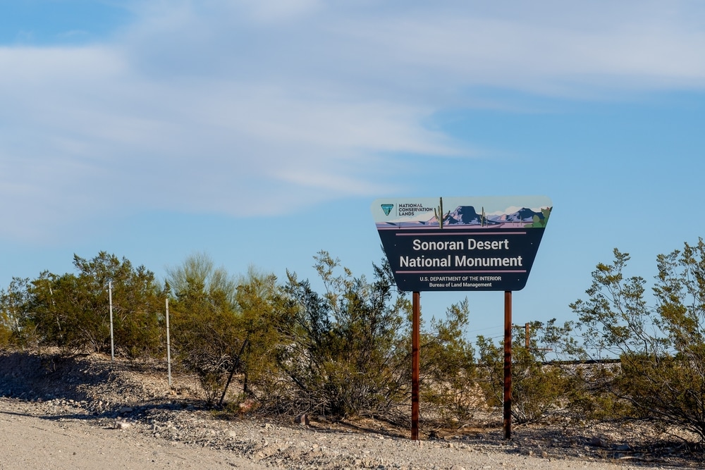
Established by Presidential Proclamation on January 17, 2001, the Sonoran Desert National Monument represents one of America’s most significant protected desert ecosystems. Encompassing approximately 496,400 acres of pristine Sonoran Desert landscape southwest of Phoenix, this monument preserves a remarkable slice of the most biologically diverse desert in North America. The monument was created specifically to protect the exceptional array of plant and animal communities that have adapted to this challenging environment over millennia.
Unlike many of Arizona’s more famous public lands, the Sonoran Desert National Monument remains relatively undiscovered by mainstream tourism, offering a more solitary and authentic desert experience for those willing to venture beyond the beaten path. Here, visitors can immerse themselves in vast expanses of undisturbed desert, where iconic saguaro forests stand sentinel over ancient volcanic mountains, rugged canyons, and expansive valleys.
The monument is administered by the Bureau of Land Management (BLM) and encompasses three distinct mountain ranges—the Maricopa, Sand Tank, and Table Top Mountains—as well as the Sand Tank Mountains Wilderness, the North Maricopa Mountains Wilderness, and the Table Top Wilderness. These wilderness areas represent some of the most ecologically intact desert landscapes remaining in the American Southwest.
For visitors seeking to understand the true character of the Sonoran Desert beyond the more developed recreational areas, the monument offers an unparalleled opportunity to experience this unique ecosystem in its natural state. Whether traveling the historic Juan Bautista de Anza National Historic Trail that crosses the monument, hiking to remote archaeological sites, or simply witnessing the spectacular spring wildflower displays, the Sonoran Desert National Monument provides a window into one of North America’s most distinctive and fragile environments.
The monument offers numerous trails, ranging from easy strolls to more challenging hikes. Popular trails include:
These trails take you through diverse desert ecosystems, showcasing unique plant life, rock formations, and expansive views.
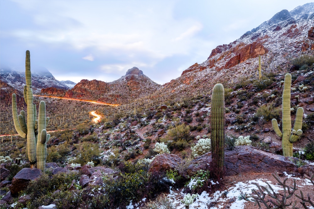
The Sonoran Desert is famous for its iconic saguaro cacti, and the monument is one of the best places to see them. Wander through vast forests of these towering cacti, some of which are hundreds of years old. Sunrise and sunset are the best times to photograph the cacti as the golden light enhances their beauty.

The monument’s dramatic landscapes are a photographer’s dream. Capture the beauty of:
The early morning and late afternoon light create ideal conditions for photography.

The Sonoran Desert has been home to Native American communities for thousands of years. While visiting, take time to appreciate the cultural significance of the area. Look for evidence of ancient habitation, such as petroglyphs, pottery shards, or rock shelters. Be respectful of these sites, and remember to leave them undisturbed.

This designated wilderness area within the monument offers incredible opportunities for solitude and exploration. The rugged terrain includes deep canyons, rocky hills, and desert washes. Hiking and backpacking in this area allow you to experience the untouched beauty of the desert.

The monument has several dirt roads and trails suitable for off-road vehicles. Popular routes include:
Make sure your vehicle is equipped for rough terrain, and always check weather and road conditions before heading out.

The monument is home to a rich variety of desert wildlife. Keep an eye out for:
Dawn and dusk are the best times to spot animals, as many desert creatures are most active during cooler parts of the day.

Sonoran Desert National Monument offers primitive, dispersed camping opportunities, allowing you to fully immerse yourself in the desert’s tranquility. With minimal light pollution, the monument is perfect for stargazing. On clear nights, you can see countless stars, constellations, and even the Milky Way.

The historic Butterfield Overland Mail route runs through the monument, offering a glimpse into the area’s history as a key travel corridor in the 19th century. This route was used to transport mail and passengers between Missouri and California. Drive or hike parts of the route to connect with the region’s past.
| Category | Details |
|---|---|
| Location | South-central Arizona, USA, near Gila Bend and Casa Grande |
| Established | January 17, 2001 |
| Managed By | U.S. Bureau of Land Management (BLM) |
| Size | Approximately 496,337 acres (200,893 hectares) |
| Main Attractions | Saguaro cactus forests, historic trails, North Maricopa Mountains, Sand Tank Mountains |
| Cultural Significance | Contains ancient petroglyphs, remnants of Hohokam culture, and historic trails like the Juan Bautista de Anza National Historic Trail |
| Ecosystem | Sonoran Desert with diverse flora and fauna, including saguaros, palo verde trees, desert tortoises, and Gila monsters |
| Recreation Activities | Hiking, camping, photography, wildlife viewing, and horseback riding |
| Nearby Landmarks | Organ Pipe Cactus National Monument, Gila Bend, and Casa Grande Ruins |
| Climate | Hot summers, mild winters; average rainfall is less than 10 inches annually |
| Accessibility | Accessible via dirt roads; high-clearance or 4WD vehicles recommended for some areas |
| Entrance Fee | No entrance fee |
| Safety Considerations | – Bring plenty of water and prepare for extreme heat in summer.<br>- Be cautious of remote, rugged terrain and limited cell service. |
| Fun Fact | The monument protects one of the most biologically diverse deserts in North America, home to more than 60 species of mammals and 100 species of birds. |
The Sonoran Desert National Monument is located approximately 35 miles southwest of Phoenix, Arizona, in Maricopa and Pinal Counties. The monument is bordered by Interstate 8 to the south, State Highway 85 to the west, and the Gila River to the north, making it relatively accessible from major population centers despite its remote character.
From Phoenix, travel west on Interstate 10 to Avondale, then south on State Route 85 through Gila Bend. Multiple dirt roads provide access to the northern sections of the monument.
From Tucson, travel northwest on Interstate 10, then west on Interstate 8. Several exits between Gila Bend and Casa Grande provide access points to the southern portion of the monument.
From Casa Grande, travel west on Interstate 8 with access points at the Vekol Valley Road and Freeman Road exits.
It’s important to note that unlike many national parks and monuments, the Sonoran Desert National Monument has minimal developed infrastructure. Most roads within the monument are unpaved and may require high-clearance or four-wheel-drive vehicles, particularly after rainfall. There are no entrance stations, developed campgrounds with amenities, or visitor centers within the monument boundaries.
The nearest communities with services include:
The BLM Phoenix District Office in Phoenix serves as the administrative headquarters for the monument and can provide the most current information regarding access conditions and restrictions.
The Sonoran Desert National Monument preserves one of the most ecologically diverse portions of the Sonoran Desert, known globally for its remarkable biological richness compared to other desert ecosystems. This diversity stems from the unique combination of rainfall patterns—with precipitation occurring in both winter and summer—creating conditions that support an exceptional variety of plant and animal species.
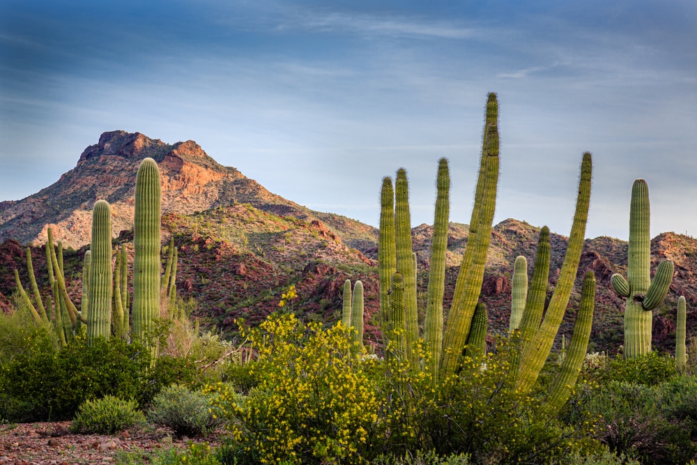
The monument is famous for its extensive saguaro cactus forests, particularly in the Sand Tank and Table Top Mountains. These forests include not only the iconic saguaro (Carnegiea gigantea) but also complex communities of associated species that have evolved together over thousands of years.
Saguaro-Palo Verde Forests: These upland communities feature the majestic saguaro cactus growing alongside foothill palo verde (Parkinsonia microphylla) and ironwood (Olneya tesota) trees, creating a distinctive woodland-like structure despite the arid conditions.
Creosote-Bursage Flats: The lower elevation valleys are dominated by creosote bush (Larrea tridentata) and white bursage (Ambrosia dumosa), plants adapted to extreme drought and heat.
Xeroriparian Corridors: The dry washes that lace the monument transform during rainfall events, supporting denser vegetation including desert willow (Chilopsis linearis), blue palo verde (Parkinsonia florida), and mesquite (Prosopis spp.).
Desert Grasslands: At higher elevations, particularly in the Sand Tank Mountains, remnant desert grasslands support species like desert needlegrass (Stipa speciosa) and tobosa grass (Pleuraphis mutica).
The monument is particularly known for:
The monument supports an extraordinary diversity of wildlife species adapted to desert conditions:
The monument provides habitat for desert bighorn sheep, mountain lions, bobcats, javelinas (collared peccaries), kit foxes, coyotes, mule deer, and numerous species of bats and small mammals.
Over 200 bird species have been documented, including Gambel’s quail, Gila woodpeckers, cactus wrens, greater roadrunners, Harris’s hawks, and seasonal migrants that follow the Pacific Flyway.
The diverse reptile community includes the iconic Gila monster, desert tortoise, western diamond-backed rattlesnake, tiger whiptail lizard, and many others that have developed specialized adaptations for desert survival.
Thousands of invertebrate species inhabit the monument, including scorpions, tarantulas, velvet ants, a variety of butterflies, and many pollinator species critical to desert plant reproduction.
The monument showcases remarkable geological diversity that tells the story of millions of years of earth history:
The three principal mountain ranges (Maricopa, Sand Tank, and Table Top) consist primarily of volcanic materials, with the Table Top Mountain featuring a distinctive flat-topped mesa rising dramatically from the desert floor.
This major drainage system cuts through the monument, revealing geological strata and supporting riparian vegetation crucial to wildlife.
Ancient lava flows and volcanic features are visible throughout the monument, particularly in the Table Top Mountain area.
Well-developed desert pavement—tightly packed arrangements of small stones covering finer particles below—can be observed in many areas, representing thousands of years of gradual formation.
Despite its undeveloped character, the Sonoran Desert National Monument offers numerous recreational opportunities for well-prepared visitors seeking authentic desert experiences.
While the monument lacks a developed trail system with signage and facilities, it offers outstanding opportunities for cross-country hiking and backpacking for experienced desert travelers:
One of the few established paths in the monument, this challenging 3.5-mile (one-way) trail climbs approximately 2,000 feet from the desert floor to the summit of Table Top Mountain, offering spectacular panoramic views.
This remote region in the western portion of the monument provides opportunities for experienced hikers to explore canyons, ridgelines, and historic sites, though navigation skills are essential.
The broad Vekol Valley offers easier cross-country hiking opportunities with views of surrounding mountain ranges.
Backcountry camping is permitted throughout the monument, though visitors should practice Leave No Trace principles and be prepared for complete self-sufficiency, as there are no developed water sources.
The monument provides exceptional opportunities for wildlife observation and photography, particularly:
The periods around sunrise and sunset offer the best opportunities to observe desert wildlife as animals become active during cooler temperatures.
Spring wildflower displays (typically February-April, depending on winter rainfall) create spectacular photography opportunities, while summer monsoon season brings dramatic storm clouds and green-up of desert vegetation.
Xeroriparian areas (desert washes) attract the greatest diversity of bird species, particularly during migration periods in spring and fall.
The monument’s distance from urban light pollution creates excellent conditions for night photography and astronomical observation.
Limited OHV use is permitted on designated routes within portions of the monument:
Located in the northern portion of the monument, this area provides designated routes for OHV enthusiasts.
To protect sensitive resources, certain areas may have seasonal restrictions, particularly during breeding seasons for protected wildlife.
Visitors should check current regulations before planning OHV activities, as management policies continue to evolve to balance recreational access with resource protection.
The monument’s open terrain and network of primitive roads and washes make it suitable for horseback riding, though riders must bring all necessary supplies for both themselves and their animals, as no facilities exist within the monument boundaries.
The Sonoran Desert National Monument contains a rich historical record of human presence spanning thousands of years, from ancient indigenous peoples to Spanish explorers, Mexican settlers, and American pioneers.
The monument contains numerous archaeological sites that document human adaptation to the desert environment over millennia:
The Hohokam culture occupied the region from approximately 300 BCE to 1450 CE, developing sophisticated irrigation systems and trade networks. Rock art, pottery fragments, and structural remains can be found throughout the monument.
Evidence of historic mining activities dating from the late 19th and early 20th centuries can be observed in several locations, particularly in the Table Top and Maricopa Mountains.
Ancient trail systems crisscross the monument, some still visible as linear features marked by rock cairns that connected water sources and settlement areas.
Visitors should note that all archaeological resources are protected by federal law, and collection or disturbance of artifacts is strictly prohibited.
A portion of the Juan Bautista de Anza National Historic Trail, which commemorates the 1775-1776 Spanish expedition from Mexico to San Francisco, crosses through the monument. This historic route represents an important chapter in the European exploration of the American West and the establishment of Spanish settlements in California.
The monument includes portions of the historic Butterfield Overland Mail Route, which served as an important transportation corridor in the mid-19th century. During World War II, portions of what is now the monument were used for military training exercises, and observant visitors may still find evidence of this military presence.
The monument lies within the traditional territories of several indigenous peoples, including the Tohono O’odham, Akimel O’odham (Pima), and Maricopa tribes. These cultures maintain spiritual and cultural connections to this landscape, which provided them with essential resources for thousands of years before European contact.
Unlike many national monuments, the Sonoran Desert National Monument has minimal developed facilities, reflecting its management as a primitive desert recreation area rather than a conventional tourist destination.
There is no dedicated visitor center within the monument boundaries. The nearest BLM office providing information is the Phoenix District Office in Phoenix.
There are no developed campgrounds with amenities like picnic tables, fire rings, or restrooms within the monument. Dispersed camping is permitted throughout most of the monument, subject to regulations.
Boundary signs mark the monument perimeter, but internal signage is minimal. Visitors should not expect directional signs or interpretive displays except at a few key access points.
There are no developed water sources anywhere in the monument. Visitors must bring all water needed for their activities.
Visitors planning to explore the Sonoran Desert National Monument should prepare carefully:
Detailed topographic maps or GPS devices with loaded routes are essential, as cell service is unreliable throughout much of the monument.
High-clearance vehicles are recommended for most internal roads, and four-wheel drive may be necessary in some areas, particularly after rain events.
Plan to carry at least one gallon (4 liters) of water per person per day, with additional water for emergency situations.
The intense desert sun necessitates broad-brimmed hats, sunscreen, sunglasses, and lightweight, long-sleeved clothing.
Consider carrying satellite communication devices, as cell phone coverage is unreliable or non-existent in most of the monument.
Unlike many national parks and monuments, there are no entry fees for the Sonoran Desert National Monument.
Dispersed camping is allowed for up to 14 days in a 28-day period. No permits are required for regular recreational camping.
Seasonal fire restrictions may be implemented, particularly during high fire danger periods. Check current restrictions before planning to have a campfire.
Commercial activities, organized group events, and certain research activities require special use permits from the BLM.
The extreme desert climate creates distinct seasonal variations that dramatically affect the visitor experience in the Sonoran Desert National Monument.
Fall represents one of the best seasons to visit as temperatures moderate from summer extremes. Daytime highs typically range from 75-90°F (24-32°C), with cool nights that can drop into the 50s°F (10-15°C). This season offers excellent hiking conditions and wildlife viewing opportunities, as many desert animals resume more active patterns after the summer heat.
Winter brings mild daytime temperatures ranging from 60-75°F (15-24°C), making it ideal for longer hikes and exploration. Night temperatures can drop below freezing at higher elevations, particularly in the mountain ranges. Winter rains, when they occur, set the stage for spring wildflower displays. This season offers the best conditions for extended backcountry trips, though visitors should be prepared for occasional cold fronts that can bring surprisingly chilly conditions.
Spring is the most popular season for good reason. Moderate temperatures—typically 70-85°F (21-29°C)—combine with the possibility of spectacular wildflower displays if winter rains have been sufficient. The exact timing of wildflower blooms varies annually, but typically peaks in March. Desert trees and cacti also bloom during this period, with the iconic saguaro cacti generally flowering in late April through May. Wildlife activity increases as breeding seasons commence for many species.
Summer brings extreme heat, with daytime temperatures regularly exceeding 100°F (38°C) and occasionally reaching 115°F (46°C) or higher. These dangerous conditions make summer visits challenging and potentially hazardous. However, the summer monsoon season (typically July-September) brings dramatic thunderstorms and temporary transformations of the desert as dormant plants spring to life. Those who visit during summer should limit activities to early morning hours and carry abundant water.
The remote and undeveloped nature of the Sonoran Desert National Monument, combined with extreme environmental conditions, creates significant safety challenges for visitors.
Heat represents the most serious threat to visitors, particularly from May through September:
Symptoms of heat-related illness can progress rapidly from thirst and discomfort to disorientation, unconsciousness, and death. Visitors should drink water regularly regardless of thirst sensations.
Carry at least one gallon (4 liters) of water per person per day, with additional reserves for emergency situations.
During hot periods, plan all physical activities for early morning hours (before 10:00 AM) and rest in shade during peak heat.
Desert hiking is more strenuous than many visitors anticipate, and heat magnifies the physical challenges.
The monument’s undeveloped character creates significant navigation challenges:
Few trails or roads are marked with directional signs, making navigation entirely dependent on visitor preparation.
Desert landscapes can appear remarkably similar, making it easy to become disoriented, particularly in areas away from distinctive landmarks.
Unmarked roads may become impassable after rainfall events, potentially stranding unprepared visitors.
Visitors should carry paper maps and compass in addition to any electronic navigation devices, as electronics can fail in extreme heat.
While dangerous wildlife encounters are uncommon, visitors should be aware of potential hazards:
Western diamond-backed rattlesnakes, scorpions, and black widow spiders inhabit the monument. Visitors should check shoes and equipment before use and avoid placing hands or feet where they cannot see.
Many desert plants have thorns, spines, or irritating sap as defense mechanisms. Particularly notable are teddy bear cholla cacti, whose deceptively fuzzy-looking segments easily detach and embed in skin and clothing.
During summer monsoon season and after winter storms, normally dry washes can transform into raging torrents within minutes:
Be alert for the sound of rushing water, sudden changes in water clarity, or debris floating in waterways.
Never camp in washes or low areas that could channel runoff during storms.
Never attempt to drive through flowing water, as even shallow flows can sweep vehicles away.
The Sonoran Desert National Monument faces several significant conservation challenges that threaten its unique resources:
Despite regulations limiting vehicle use to designated routes, illegal off-road driving continues to damage fragile desert soils and vegetation in some areas. Once damaged, desert soils can take decades or even centuries to recover. The BLM continues to address this challenge through improved signage, barriers at key access points, and enforcement patrols.
Non-native plants like buffelgrass (Pennisetum ciliare) and Sahara mustard (Brassica tournefortii) threaten to transform native ecosystems by outcompeting native plants and altering fire regimes. Desert ecosystems evolved with infrequent fires, but invasive grasses can create continuous fuel loads that support more frequent and intense burns, potentially devastating native plant communities adapted to fire-free conditions.
The monument’s proximity to the U.S.-Mexico border creates management challenges related to unauthorized cross-border traffic, including trash accumulation, creation of unauthorized trails and roads, and habitat disturbance.
Rising temperatures and changing precipitation patterns threaten to alter the delicate balance of the desert ecosystem. Some plant species are already showing stress at their lower elevation limits, and the timing of flowering and fruiting is shifting, potentially disrupting ecological relationships that evolved over thousands of years.
The monument’s proximity to the rapidly growing Phoenix metropolitan area creates increasing pressure from urban development along its boundaries, threatening wildlife movement corridors and the monument’s natural soundscape and dark night skies.
Visitors can help protect this fragile desert ecosystem by:
The Sonoran Desert National Monument represents one of Arizona’s most significant protected landscapes—a vast expanse of pristine desert that preserves the extraordinary biological diversity and cultural heritage of the Sonoran Desert. While lacking the developed facilities and name recognition of Arizona’s national parks, the monument offers something increasingly rare in our modern world: the opportunity to experience a wild desert landscape much as it has existed for thousands of years.
From the stately forests of saguaro cacti to the rugged volcanic mountains, from ancient indigenous trails to historic mining sites, the monument contains endless opportunities for discovery for those willing to venture beyond the boundaries of conventional tourism. The monument’s undeveloped character is both its greatest challenge and its greatest asset, requiring visitors to approach it with respect, preparation, and self-sufficiency.
As climate change, urban development, and recreational pressures continue to transform the American Southwest, the importance of protected areas like the Sonoran Desert National Monument only grows. These lands serve not only as recreational resources but as living laboratories where we can better understand desert ecology and the remarkable adaptations that allow life to thrive in one of Earth’s most challenging environments.
Whether you come to witness the spectacular spring wildflower displays, hike to the summit of Table Top Mountain, or simply experience the profound silence of a desert night under star-filled skies, the Sonoran Desert National Monument offers an authentic desert experience that remains with visitors long after they depart—a reminder of the surprising abundance and resilience to be found in what at first glance might appear a harsh and unforgiving landscape.
We use cookies to improve your experience on our site. By using our site, you consent to cookies.
Manage your cookie preferences below:
Essential cookies enable basic functions and are necessary for the proper function of the website.