The Old Spanish National Historic Trail, often described as “the longest, crookedest, most arduous pack mule trail in the history of America,” represents one of Arizona’s most fascinating yet lesser-known historical treasures. This remarkable route spans approximately 2,700 miles across six states—New Mexico, Colorado, Utah, Arizona, Nevada, and California—linking the communities of Santa Fe and Los Angeles. Designated by Congress as a National Historic Trail in 2002, it preserves a crucial chapter in the development of the American Southwest.
The trail commemorates the commercial trade routes established in the early 19th century, particularly following Antonio Armijo’s pioneering 1829-1830 expedition. His successful journey opened vital economic connections between the isolated interior settlements of what was then northern Mexico and the coastal missions and communities of California. These routes facilitated the exchange of New Mexican textiles and crafts for California horses and mules, creating a flourishing trade network that operated primarily between 1829 and 1848.
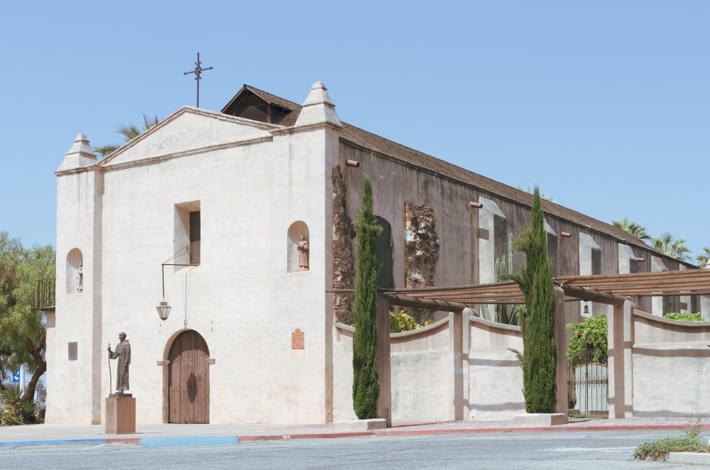
Numerous historic sites along the trail interpret the history of the Old Spanish Trail. Some key locations include:
Parts of the Old Spanish Trail can be traced along modern roads, offering scenic drives through stunning landscapes:

While much of the Old Spanish Trail overlaps with modern highways, some segments allow for hiking and biking:

The trail passes through lands historically inhabited by Native American tribes, including the Utes, Navajo, Pueblos, and others. Many interpretive sites along the trail highlight the interactions between traders and Native Americans, as well as the impact of the trail on Indigenous communities.
Key places to visit:

Look for Old Spanish Trail markers along highways and in towns to learn more about the route’s history. Some notable markers include:
| Category | Details |
|---|---|
| Location | Spans six U.S. states: Arizona, California, Colorado, Nevada, New Mexico, and Utah |
| Established | Designated as a National Historic Trail on December 4, 2002 |
| Managed By | National Park Service, in partnership with federal, state, and local agencies |
| Length | Approximately 2,700 miles (4,345 kilometers) |
| Historical Significance | A 19th-century trade route linking Santa Fe, New Mexico, to Los Angeles, California |
| Cultural Significance | Used by traders, settlers, and Native American tribes, blending Spanish, Mexican, and Indigenous cultures |
| Main Attractions | Historic sites, interpretive markers, museums, and preserved trail segments |
| Trail Route | Traverses rugged deserts, mountains, and river valleys, including the Mojave Desert and San Juan Mountains |
| Popular Sites Along the Trail | – Santa Fe, NM: Starting point of the trail- Grand Junction, CO: Gateway to the Colorado River- Mojave Desert, CA: Known for its challenging terrain- Los Angeles, CA: Trail’s western terminus |
| Recreation Activities | Hiking, horseback riding, historical tours, and educational programs |
| Ecosystem | Includes deserts, grasslands, and mountain ecosystems with diverse flora and fauna |
| Nearby Landmarks | Mesa Verde National Park, Zion National Park, Mojave National Preserve |
| Accessibility | Many sites are accessible by car; some trail segments allow hiking or horseback riding |
| Fun Fact | The trail was primarily used to transport wool and woven goods from New Mexico to California, and horses and mules in the opposite direction. |
Unlike many national park sites with clearly delineated boundaries, the Old Spanish National Historic Trail represents a corridor of history passing through diverse landscapes—from high mountains and deep canyons to arid deserts. While few visible traces of the original trail remain today, its legacy lives on in countless place names, historic sites, and the cultural connections it fostered between communities across the Southwest.
This guide provides comprehensive information about the trail’s historical significance, its routes through Arizona, recreational opportunities, and practical visitor information. Whether you’re a history enthusiast, outdoor adventurer, or cultural explorer, the Old Spanish National Historic Trail offers a unique window into the enterprising spirit and diverse cultural exchanges that shaped the American Southwest before the age of railroads.
The quest for an overland route connecting New Mexico and California preoccupied Spanish authorities for nearly 200 years before the successful establishment of the Old Spanish Trail. This challenging endeavor stemmed from Spain’s desire to create a reliable supply link between its provincial capitals in northern New Spain and the Pacific Coast.
While Spanish explorers had ventured into parts of the region as early as the late 16th century, it was not until the early 19th century that serious progress was made. Several important expeditions contributed to the eventual development of the trail:
Juan Maria de Rivera (1765): Explored the eastern sections that would later become part of the trail, including areas in southwest Colorado and southeast Utah.
Domínguez-Escalante Expedition (1776): Franciscan missionaries Francisco Atanasio Domínguez and Silvestre Vélez de Escalante attempted to reach California but only made it as far as Utah Lake before returning via the Arizona Strip. Their detailed records provided valuable information for future travelers.
Francisco Garcés and Juan Bautista de Anza: Explored southern portions of the region, establishing connections with indigenous peoples and identifying potential routes.
However, the true breakthrough came decades later, after Mexico had gained independence from Spain in 1821.
In 1829, Antonio Armijo, an enterprising merchant from Santa Fe, led an expedition of approximately 60 men and 100 pack mules westward, successfully establishing the first commercial route between New Mexico and California. His journey took a relatively direct southern route through what is now Arizona, leading to Los Angeles, where he traded woolen goods and other New Mexican products for horses and mules.
Armijo’s expedition proved the feasibility of regular trade between these distant Mexican territories, yielding substantial profits and inspiring others to follow. His route, now known as the Armijo Route, represents the southernmost and most direct path of what would become the Old Spanish Trail network.
Following Armijo’s success, other traders and travelers developed additional routes, creating what became a network of interrelated paths collectively known as the Old Spanish Trail. The main variants include:
The Main Branch: A more northerly route that twisted through western Colorado and southern Utah, crossing the extreme northwest corner of Arizona before continuing through Nevada to southern California.
The Northern Branch: Split into East and West Forks, this mountainous route provided alternatives depending on seasonal conditions and traveler preferences.
The Armijo Route: The southernmost and most direct path, though it traversed particularly challenging desert terrain.
These various routes developed in response to seasonal conditions, water availability, relationships with Indigenous peoples, and evolving knowledge of the landscape. Rather than a single path, the Old Spanish Trail represents a corridor of human movement that adapted to the harsh realities of the southwestern environment.
From approximately 1830 to 1848, the Old Spanish Trail served as the primary commercial link between New Mexico and California. The trail saw annual caravans of traders making the arduous journey, typically completing one round trip per year due to the extreme conditions and seasonal constraints.
The primary goods transported westward included:
Eastbound traders brought back:
This commercial exchange had profound economic impacts on both regions. New Mexican textiles found eager markets in California, while the horses and mules brought east became essential working stock for miners, farmers, military operations, and transportation throughout the expanding United States.
Beyond economic exchange, the trail facilitated cultural connections between diverse populations. Spanish-speaking settlers, indigenous peoples, American traders, and later Mormon colonizers all utilized portions of the route, creating a complex web of cultural interaction across the Southwest.
Several factors contributed to the declining use of the Old Spanish Trail as a major commercial route:
The Mexican-American War (1846-1848): The conflict disrupted established trade patterns and eventually led to the transfer of the entire trail region to the United States through the Treaty of Guadalupe Hidalgo.
The California Gold Rush (1848-1855): While initially stimulating demand for livestock, particularly sheep driven to California markets, the Gold Rush ultimately shifted economic patterns throughout the region.
The Railroad Era: By 1869, the transcontinental railroad provided a faster, safer, and more reliable transportation option, making the arduous pack mule caravans obsolete for long-distance trade.
While portions of the Old Spanish Trail continued to serve local transportation needs, sometimes evolving into wagon roads, the era of cross-country mule caravans had effectively ended by the mid-19th century.
The Old Spanish National Historic Trail winds through six states, covering approximately 2,700 miles in its various branches. The primary routes include:
The Main Branch: Beginning in Santa Fe, this route travels northwest through Colorado and Utah before turning southwest through Arizona and Nevada, ultimately reaching Los Angeles.
The Northern Branch: Dividing into East and West Forks, this more mountainous variation provided alternatives depending on seasonal conditions.
The Armijo Route: The southernmost and most direct path, though particularly challenging due to desert conditions.
Within Arizona, the Old Spanish Trail primarily traverses the extreme northwestern corner of the state, though it has significant historical connections to broader regional development. Key Arizona segments include:
Arizona Strip Region: The Main Branch crosses through the remote Arizona Strip—the portion of Arizona lying north of the Colorado River. This isolated region features rugged desert terrain and was traversed by traders seeking to avoid the impassable gorges of the Colorado River.
Colorado River Crossings: Critical river crossings occurred near present-day Page and in the vicinity of modern-day Lake Mead, though the exact locations varied according to seasonal conditions and the specific route being followed.
Virgin River Corridor: Portions of the trail followed the Virgin River and its tributaries, providing crucial water sources in an otherwise arid landscape.
These Arizona segments represent some of the most challenging portions of the entire trail network, featuring harsh desert conditions, limited water sources, and difficult terrain. While the trail passes through only a relatively small portion of Arizona, these sections were vital links in the overall route between New Mexico and California.
Several notable geographical features guided travelers along the Arizona portions of the Old Spanish Trail:
These natural landmarks would have been critical navigation aids for travelers on the Old Spanish Trail, who relied on detailed knowledge of the landscape rather than maps or marked routes.
Unlike many historic trails with clear, continuous routes accessible to hikers, the Old Spanish National Historic Trail exists primarily as a historical corridor rather than a clearly marked path. Few visible traces of the original trail remain, as most have been reclaimed by nature or altered by subsequent development. However, visitors can still experience aspects of the trail through several approaches:
Auto Tour Routes: Highways and roads roughly parallel portions of the historic trail, allowing travelers to follow the general corridor by car. In Arizona, these primarily include routes through the northwestern corner of the state.
Historic Sites and Museums: Various museums, visitor centers, and historic sites along the trail corridor interpret its history and significance.
Landscape Viewing: Many of the natural landmarks and landscapes that guided historical travelers can still be observed, providing a connection to the experiences of those who traversed the trail.
Mobile Mapping Tools: The BLM and NPS have developed interactive mobile maps that help visitors locate points of interest and interpret the trail’s history.
It’s important for visitors to understand that the Old Spanish Trail represents a historical concept more than a physical path available for continuous hiking. However, this does not diminish its significance or the potential for meaningful visitor experiences.
While the Arizona portion of the trail passes through remote areas with limited facilities, several sites offer interpretation related to the Old Spanish Trail:
Bureau of Land Management Arizona Strip Field Office (St. George, Utah/Arizona Strip): Provides information about the trail segments crossing the Arizona Strip.
Lake Mead National Recreation Area Visitor Centers: Offer context for the trail’s relationship to the Colorado River and surrounding landscape.
Pipe Spring National Monument: While not directly on the trail, this site provides important context for understanding historical travel and cultural exchange in the Arizona Strip region.
Since the Arizona segments of the trail pass through particularly remote areas, visitors may find more extensive interpretation at facilities in neighboring Utah and Nevada.
While not a continuous hiking trail, recreation opportunities related to the Old Spanish Trail in Arizona include:
Scenic Driving: Following highways and backroads that roughly parallel the historic route, particularly in the Arizona Strip region.
Photography: Capturing the dramatic landscapes and natural features that challenged historical travelers.
Historical Tourism: Visiting museums and historic sites that interpret the trail’s history and significance.
Land-Based Recreation: Hiking, camping, and exploring public lands in the vicinity of the historic trail corridor, though these activities are not necessarily on the exact historical route.
Colorado River Recreation: Experiencing the critical waterway that played such an important role in the trail’s development.
Many of these recreational opportunities exist on public lands managed by the Bureau of Land Management and National Park Service, which cooperatively administer the trail.
Several educational resources enhance understanding of the Old Spanish National Historic Trail:
National Park Service Website and Publications: Provide historical information, maps, and visitor guidance.
Bureau of Land Management Resources: Offer additional interpretation, particularly for trail segments crossing BLM-managed lands.
Old Spanish Trail Association: This nonprofit partner organization promotes research, preservation, and public awareness of the trail through publications, events, and advocacy.
Mobile Mapping Application: The Old Spanish National Historic Trail Mobile Map provides interactive information about points of interest along the trail, helping bring the historical route to life for modern visitors.
These resources help visitors connect with the trail’s history and significance despite the limited physical traces remaining visible in the landscape.
Due to the trail’s extensive length and the remote nature of many segments, particularly in Arizona, advance planning is essential for a meaningful visit. Consider these approaches:
Research and Orientation: Begin by exploring the National Park Service and Bureau of Land Management websites to understand the trail’s routes and significant sites.
Focus Area Selection: Rather than attempting to cover the entire trail, focus on specific segments or sites of particular interest.
Map Acquisition: Obtain detailed maps of the regions you plan to visit, as many trail segments pass through remote areas with limited cellular service.
Mobile Tools: Download the Old Spanish National Historic Trail Mobile Map application before traveling to remote areas, as it works offline once downloaded.
Local Information: Contact visitor centers or management offices in advance for current conditions, accessibility information, and recommendations.
The discontinuous nature of the trail means that a successful visit requires thoughtful planning rather than simply following a marked route.
Arizona’s climate significantly impacts the best times to visit portions of the Old Spanish Trail:
Spring (March to May) and Fall (September to November): These seasons offer the most moderate temperatures in northwestern Arizona, making them ideal for exploration.
Summer (June to August): Extreme heat in Arizona’s desert regions can create dangerous conditions, with temperatures frequently exceeding 100°F (38°C). If visiting during summer, plan activities for early morning, carry ample water, and take appropriate precautions.
Winter (December to February): While temperatures are milder in lower elevations, higher elevations along the trail corridor may experience snow and freezing conditions, potentially limiting access.
These seasonal considerations reflect the same environmental challenges that historical travelers faced, though they had less flexibility in scheduling their journeys according to optimal conditions.
The remote nature of many trail segments in Arizona requires careful attention to safety:
Water: Carry ample water for any excursion, even short ones. The arid environment and high temperatures create high risk for dehydration.
Vehicle Preparation: Ensure your vehicle is in good condition and appropriate for the roads you plan to travel, as many access points require high-clearance or four-wheel-drive vehicles.
Communication: Cell service is extremely limited or non-existent in many areas along the trail corridor. Consider carrying satellite communication devices for emergencies.
Notification: Always inform someone of your planned itinerary and expected return time when venturing into remote areas.
Weather Awareness: Check forecasts and be prepared for extreme conditions, including sudden storms, flash floods, and temperature fluctuations.
Navigation Tools: Carry maps, GPS devices, and compasses, as many areas lack clear signage or obvious landmarks.
These precautions are particularly important in the Arizona Strip region, which remains one of the most remote and sparsely populated areas in the continental United States.
The Old Spanish Trail corridor crosses a complex patchwork of land designations, each with different management policies and access considerations:
Bureau of Land Management Lands: Much of the Arizona portion of the trail crosses BLM-managed public lands, which generally allow public access but may have specific regulations regarding camping, vehicle use, and resource protection.
National Park Service Areas: Portions of the trail relate to NPS-managed areas such as Lake Mead National Recreation Area, which have their own access policies and entrance fees.
Private Lands: Some segments of the historic trail corridor cross private property, where public access is not permitted without landowner permission.
Tribal Lands: Certain areas near the trail corridor may be under tribal jurisdiction, requiring special permits or permissions for access.
Visitors should research the specific ownership and management of areas they plan to visit, respecting all closures, permit requirements, and usage restrictions.
Since its designation as a National Historic Trail in 2002, various entities have worked to preserve, interpret, and promote the Old Spanish Trail:
National Park Service and Bureau of Land Management: These federal agencies jointly administer the trail, collaborating on research, interpretation, and resource protection.
Old Spanish Trail Association: This nonprofit partner organization advocates for trail preservation, conducts research, and promotes public awareness through publications, events, and volunteer programs.
State and Local Governments: Various state and local agencies contribute to preservation efforts, particularly for trail-related resources within their jurisdictions.
Academic Institutions: Universities and research organizations conduct historical and archaeological studies that enhance understanding of the trail and inform preservation strategies.
These collaborative efforts focus on identifying, documenting, and protecting the limited physical remnants of the trail while developing interpretive materials that help the public understand its historical significance.
While visible traces of the trail itself are limited, various archaeological resources provide tangible connections to its history:
Historic Inscriptions: Some rock faces along the trail corridor bear inscriptions or petroglyphs potentially related to historical travelers.
Trail Remnants: In certain areas, packed and eroded ground still marks the original route where hundreds of mules and travelers once passed.
Artifact Scatters: Archaeological sites containing trade goods, camp debris, or other materials may be found along the trail corridor, though these are protected by federal law from disturbance or collection.
Historic Structures: Buildings, ruins, and other structures in communities along the trail corridor may have connections to the trade and travel facilitated by the Old Spanish Trail.
Visitors should remember that all archaeological resources are protected by law. Observe but do not disturb any artifacts or features you might encounter, and report any significant findings to land management agencies.
Several opportunities exist for those interested in contributing to the preservation and interpretation of the Old Spanish Trail:
Old Spanish Trail Association Membership: Joining this organization provides opportunities to participate in research, advocacy, and educational programs.
BLM and NPS Volunteer Programs: Both agencies occasionally offer volunteer positions related to trail research, maintenance, or interpretation.
Citizen Science Projects: Some initiatives engage volunteers in documenting trail resources or contributing to historical research.
Local Historical Societies: Community organizations in towns along the trail corridor may have projects related to local connections to the trail.
These volunteer opportunities allow individuals to contribute meaningfully to the ongoing effort to understand, preserve, and interpret this significant historical corridor.
The Old Spanish Trail traversed lands occupied by numerous Indigenous peoples, creating complex relationships and interactions:
Ute Nations: Much of the northern branches of the trail passed through traditional Ute territories in what is now Colorado and Utah.
Southern Paiute Bands: The Arizona Strip and adjacent regions were home to Southern Paiute peoples, who often served as guides or trading partners for travelers.
Mohave and Other Colorado River Communities: Indigenous peoples along the Colorado River played crucial roles in facilitating (or sometimes preventing) river crossings.
Navajo and Puebloan Peoples: The eastern portions of the trail network had significant interactions with Navajo and Pueblo communities.
These Indigenous groups often provided essential guidance, traded with travelers, or in some cases resisted encroachment on their territories. The relationship between the trail and Native peoples represents an important dimension of its history, too often overlooked in earlier historical accounts.
Today, tribal nations maintain connections to lands crossed by the trail, and their perspectives are increasingly incorporated into its interpretation through collaborative programs with the National Park Service, Bureau of Land Management, and other entities.
The Old Spanish Trail represents an important chapter in Hispanic heritage across the Southwest:
Spanish Colonial Legacy: Though established after Mexican independence, the trail built upon earlier Spanish exploration and settlement patterns.
Mexican Period Development: The trail’s primary period of use (1829-1848) occurred during the Mexican governance of the Southwest, reflecting Mexican commercial and territorial ambitions.
Hispanic Communities: Towns like Santa Fe served as critical hubs for the trail, while Hispanic merchants and muleteers formed the backbone of the trading caravans.
Ongoing Cultural Legacy: Hispanic cultural practices, place names, and heritage remain evident throughout the trail corridor today.
These connections make the Old Spanish Trail an important element of Hispanic cultural heritage in the Southwest, complementing other historical routes like El Camino Real de Tierra Adentro and the Santa Fe Trail.
While developed primarily as a commercial route, portions of the Old Spanish Trail later served Mormon colonization efforts:
Utah Settlement: After establishing Salt Lake City in 1847, Mormon pioneers utilized portions of the trail network for travel between Utah and California.
Colonization Efforts: Mormon settlers established communities throughout the region, including areas near the trail corridor in southern Utah and the Arizona Strip.
Mountain Meadows: Located near the trail in southern Utah, this site has complex historical associations with both the trail and Mormon settlement history.
These connections illustrate how the trail network served multiple purposes beyond its initial commercial function, facilitating diverse settlement patterns across the Southwest.
While the Old Spanish Trail itself passes primarily through the remote northwestern corner of Arizona, several related sites enhance understanding of the historical context:
Grand Canyon National Park: Though not directly on the trail, the Canyon represents a formidable barrier that shaped travel patterns throughout the region.
Lake Mead National Recreation Area: Encompasses areas near where the trail crossed the Colorado River.
Pipe Spring National Monument: Provides insights into travel, settlement, and cultural exchange in the Arizona Strip region.
Hubbell Trading Post National Historic Site: Though developed later than the trail’s primary period, this site illustrates the trading traditions that characterized the region.
These sites, along with museums and historical societies in communities throughout Arizona, provide valuable context for understanding the trail’s significance.
The Old Spanish Trail exists within a network of historic routes that collectively shaped the Southwest:
El Camino Real de Tierra Adentro: Connected Mexico City to Santa Fe, forming a crucial link in the larger trade network that included the Old Spanish Trail.
Santa Fe Trail: Linked Missouri to Santa Fe, creating connections between the eastern United States and the southwestern territories.
Mormon Pioneer Trail: Connected the Midwest to Salt Lake City, with extensions that sometimes utilized portions of the Old Spanish Trail.
Butterfield Overland Mail Route: Later stagecoach route that crossed portions of the Southwest, sometimes paralleling sections of the Old Spanish Trail.
Together, these historic routes created a transportation network that facilitated the economic and cultural development of the American Southwest.
The Old Spanish National Historic Trail represents a remarkable chapter in the history of the American Southwest—a testament to human ingenuity, commercial enterprise, and cultural exchange across challenging landscapes. While its physical traces may be limited, particularly in Arizona’s remote northwestern corner, the trail’s legacy lives on in the communities, landscapes, and cultural patterns it helped shape.
From Antonio Armijo’s pioneering 1829 expedition to the flourishing trade network that followed, the Old Spanish Trail connected distant regions of what was then northern Mexico, creating economic opportunities and facilitating cultural exchanges that continue to influence the Southwest today. The trail’s designation as a National Historic Trail ensures that this significant story remains part of our shared national heritage.
For modern visitors, experiencing the Old Spanish Trail requires imagination, research, and respect for the challenging environments it traverses. Whether following approximate auto tour routes, visiting interpretive centers, or exploring the dramatic landscapes that confronted historical travelers, contemporary adventurers can connect with this fascinating historical corridor in meaningful ways.
As ongoing research, preservation efforts, and interpretive programs continue to enhance our understanding of the Old Spanish Trail, opportunities for public engagement will expand. Through these efforts, this “longest, crookedest, most arduous pack mule trail in the history of America” will continue to inspire appreciation for the diverse peoples and enterprising spirit that shaped the American Southwest.
For the most current information about accessible trail segments, interpretive programs, and visitor opportunities, contact the National Park Service, Bureau of Land Management, or the Old Spanish Trail Association.
We use cookies to improve your experience on our site. By using our site, you consent to cookies.
Manage your cookie preferences below:
Essential cookies enable basic functions and are necessary for the proper function of the website.