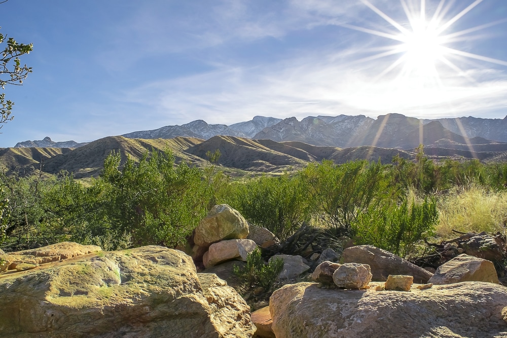
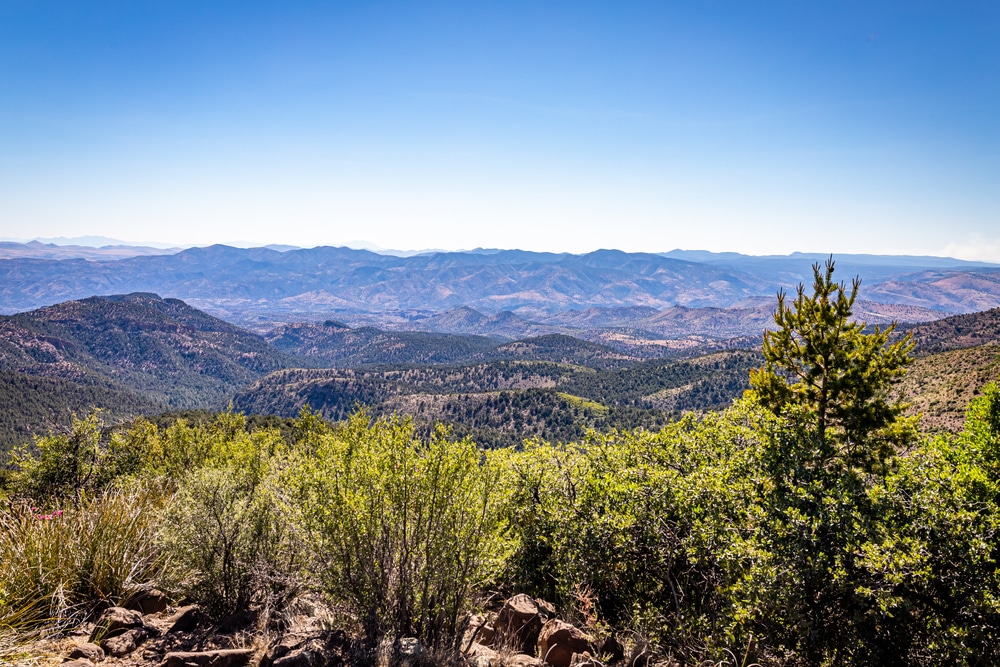
The Coronado National Forest spans approximately 1.78 million acres across southeastern Arizona and a small portion of southwestern New Mexico, encompassing some of the most biologically diverse landscapes in the United States. Named after Spanish explorer Francisco Vasquez de Coronado, who journeyed through parts of this region in 1540, the forest is characterized by spectacular “sky islands” — isolated mountain ranges that rise dramatically from the surrounding desert floor.
These mountain ranges, separated by valleys and grasslands, create a remarkable ecological phenomenon where visitors can experience multiple ecosystems in a single day. As the elevation changes from approximately 3,000 feet to over 10,700 feet, so too does the environment — from saguaro-dotted desert landscapes to alpine forests reminiscent of Canada. This dramatic variation allows visitors to “experience all four seasons during a single day’s journey” as they move through different elevations and microclimates.
The forest is divided into five ranger districts, each managing distinct mountain ranges and offering unique recreational opportunities. With eight designated wilderness areas totaling over 338,000 acres, Coronado National Forest provides crucial habitat for an astonishing variety of wildlife, including many species found nowhere else in the nation.
For outdoor enthusiasts, the forest offers nearly limitless recreational opportunities — from hiking and camping to birdwatching, fishing, rock climbing, and even skiing in winter months. The forest’s proximity to Tucson and other population centers makes it an accessible escape for both locals and visitors seeking natural beauty and outdoor adventure.
This guide provides comprehensive information about Coronado National Forest’s various districts, recreational activities, facilities, and important visitor information to help you plan an unforgettable journey through this remarkable landscape.

With over 1,100 miles of trails, Coronado National Forest offers hikes for all skill levels. Some of the most popular trails include:
Tip: Bring plenty of water, especially for desert hikes, and check trail conditions before heading out.

The forest has numerous campgrounds, ranging from developed sites to primitive backcountry spots. Popular options include:
Backcountry Camping: Permits may be required for dispersed camping in some areas, so check with the local ranger district.

The Coronado National Forest is rich in history, with sites that tell the story of Native American tribes, Spanish explorers, and early settlers:

The forest is a popular destination for climbers, offering routes for all skill levels:
Be sure to check local climbing regulations and bring appropriate gear.

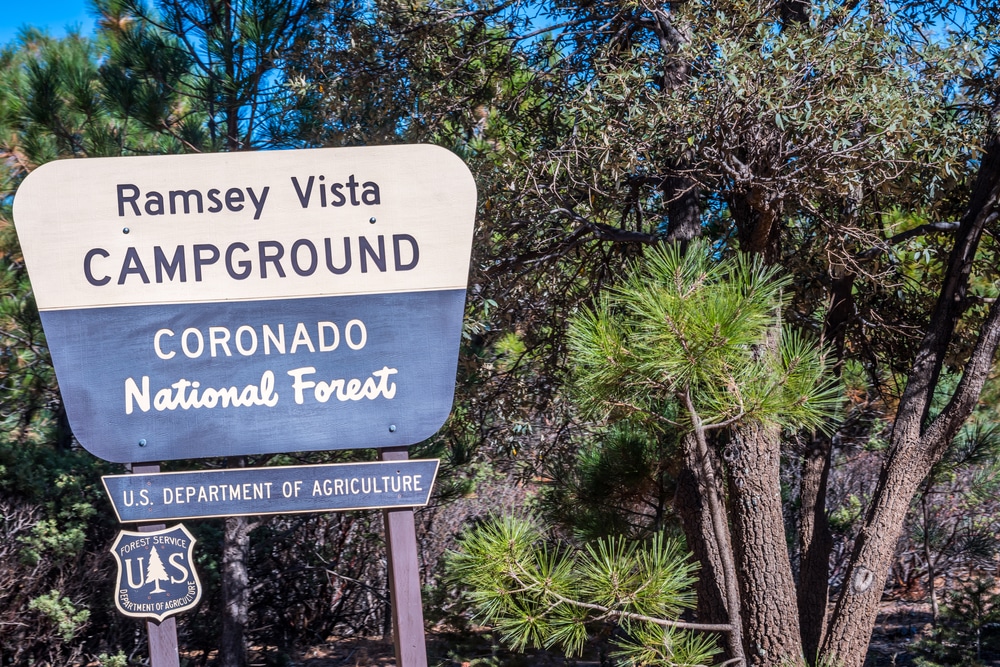
Coronado National Forest is a birdwatcher’s paradise, especially in areas like Madera Canyon, Ramsey Canyon, and the Chiricahua Mountains. Unique species to look for include:
Bring binoculars and visit during migration seasons for the best birdwatching opportunities.
The remote location of Coronado National Forest makes it an excellent destination for stargazing. With minimal light pollution, visitors can see:
Bring a telescope or simply lay back and enjoy the dark skies.

The forest’s winding mountain roads offer some of the most breathtaking scenic drives in the region:
Tip: Some roads require high-clearance or 4WD vehicles. Check conditions before driving.
| Category | Details |
|---|---|
| Location | Southeastern Arizona and southwestern New Mexico, USA |
| Established | April 11, 1902 |
| Managed by | U.S. Forest Service |
| Area | Approximately 1.78 million acres |
| Primary Features | Sky Islands (isolated mountain ranges), including the Santa Catalina, Chiricahua, Huachuca, and Pinaleño Mountains |
| Nearest Cities | Tucson, Sierra Vista, Nogales, Douglas, and Safford, Arizona |
| Activities | Hiking, camping, birdwatching, rock climbing, horseback riding, mountain biking, and hunting |
| Topography | Mountain ranges rising dramatically from surrounding desert basins, deep canyons, and high-elevation forests |
| Wildlife | Black bears, mountain lions, javelinas, white-tailed deer, coatis, and over 200 bird species, including hummingbirds and raptors |
| Vegetation | Ranges from desert plants like cacti and mesquite to high-elevation pine and aspen forests |
| Climate | Varies by elevation: desert areas are hot and arid, while mountain areas have cooler, temperate conditions |
| Significance | Known for its biodiversity due to the Sky Islands, which connect desert and mountain ecosystems, and for its rich cultural history |
| Wilderness Areas | Includes 12 designated wilderness areas, such as the Chiricahua Wilderness, Pusch Ridge Wilderness, and Huachuca Mountains Wilderness |
| Visitor Centers | – Sabino Canyon Visitor Center (Tucson)<br> – Douglas Ranger District (Douglas)<br> – Sierra Vista Ranger District (Hereford) |
| Popular Attractions | Sabino Canyon, Mount Lemmon, Madera Canyon, Chiricahua National Monument (managed separately but within the region) |
| Website | U.S. Forest Service – Coronado National Forest |
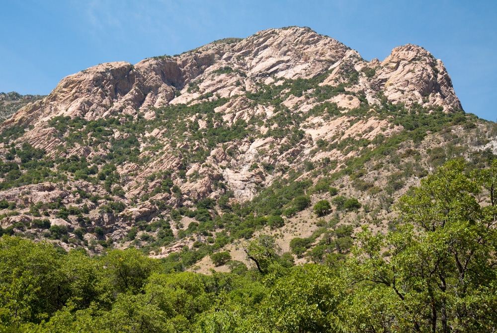
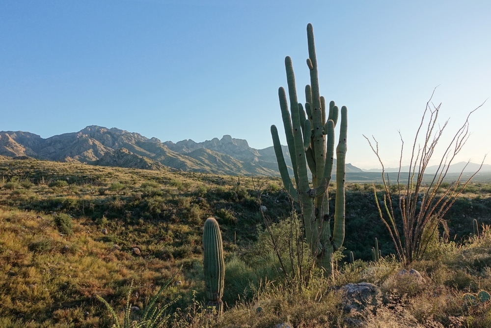
The defining feature of Coronado National Forest is its “sky islands” — isolated mountain ranges rising dramatically from the surrounding desert valleys. These ecological islands create one of the most biodiverse regions in North America, where species from both temperate and tropical zones converge.
The Coronado National Forest encompasses twelve distinct mountain ranges spread across five ranger districts:
Santa Catalina Ranger District: Located near Tucson, this district includes the Santa Catalina and Rincon Mountains. Mount Lemmon, at 9,159 feet, is the highest point in the Santa Catalinas and offers a popular escape from the desert heat.
Safford Ranger District: This district manages five mountain ranges surrounding Safford: the Pinaleño, Galiuro, Santa Teresa, Winchester, and Greasewood Mountains. Mount Graham in the Pinaleños, rising to 10,720 feet, is the highest peak in southern Arizona.
Nogales Ranger District: Located north and west of Nogales, this district includes the Santa Rita, Tumacacori, Pajarito, and San Luis Mountains. Mount Wrightson, in the Santa Rita Mountains, stands as one of southern Arizona’s tallest peaks at 9,456 feet.
Douglas Ranger District: Comprising the Chiricahua, Dragoon, and Peloncillo Mountains in southeastern Arizona and extending into New Mexico, this district features dramatic rock formations and rich biodiversity.
Sierra Vista Ranger District: This district manages the Huachuca, Patagonia, and Whetstone Mountains west of Sierra Vista, including Miller Peak, the highest point in the Huachucas.
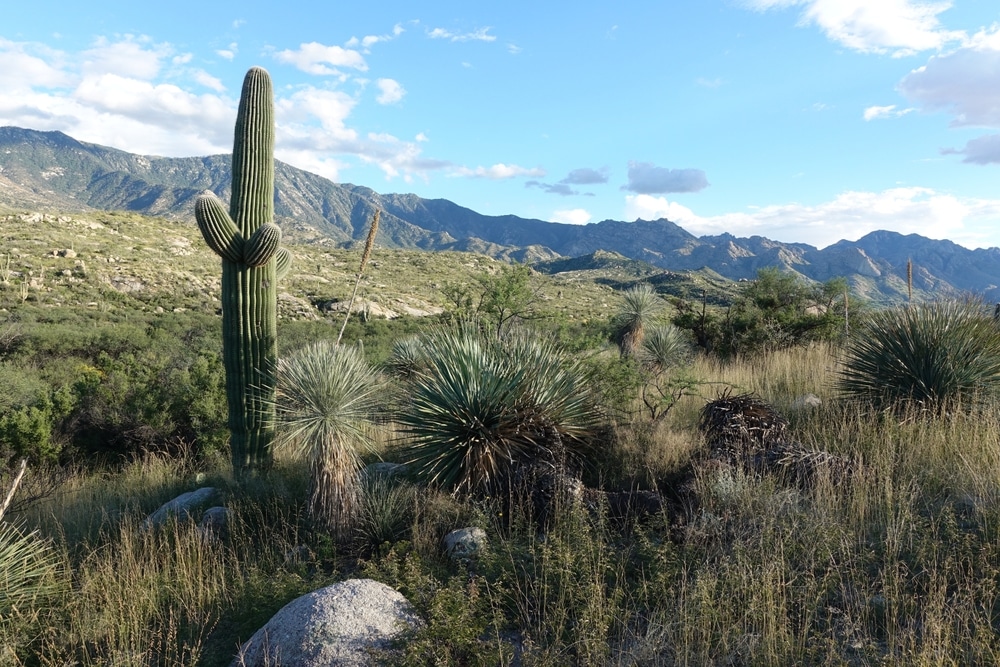
The dramatic elevation changes within the sky islands create a stunning array of ecological zones. At the lowest elevations, visitors encounter the iconic saguaro cactus and other Sonoran Desert vegetation. As elevation increases, desert scrub gives way to oak woodlands, then to pine forests, and finally to spruce-fir forests at the highest elevations.
This vertical stacking of ecosystems results in exceptional biodiversity. The Coronado National Forest supports more than 576 species of mammals, birds, reptiles, and amphibians — some found nowhere else in the United States. The forest’s position at the crossroads of several major biological provinces (the Sonoran and Chihuahuan Deserts, the Rocky Mountains, and the Sierra Madre Occidental) contributes to this rich diversity.
The forest’s varied waterways, from seasonal streams to man-made lakes, further enhance this ecological richness. Though there are no natural lakes within the forest boundaries, several man-made reservoirs provide important aquatic habitat and recreational opportunities.
Climate change presents significant challenges to these fragile sky island ecosystems, with rising temperatures and altered precipitation patterns threatening to shift ecological boundaries and impact vulnerable species.
Coronado National Forest offers a remarkable range of recreational activities throughout the year, taking advantage of its diverse landscapes and ecosystems. From desert adventures to alpine experiences, visitors can enjoy numerous outdoor pursuits across the forest’s various districts.
With over 1,100 miles of trails traversing diverse terrains and ecosystems, Coronado National Forest is a paradise for hikers of all skill levels. Popular hiking destinations include:
Sabino Canyon: Located in the Santa Catalina Ranger District near Tucson, this area features both paved walking paths and more challenging wilderness trails. The Seven Falls Trail in Bear Canyon is particularly popular, leading to a series of waterfalls in a desert setting.
Mount Lemmon: The Catalina Highway (also known as the Mount Lemmon Highway) provides access to numerous trailheads as it winds from the desert floor to the summit at over 9,000 feet. Trails range from easy nature walks to challenging summit ascents.
Madera Canyon: Located in the Santa Rita Mountains, this world-renowned birding destination offers excellent hiking opportunities through oak woodlands and pine forests.
Mount Wrightson: For experienced hikers, the Old Baldy Trail to the summit of Mount Wrightson provides challenging terrain and spectacular views. At 9,456 feet, Mount Wrightson is one of southern Arizona’s highest peaks.
Chiricahua Mountains: The rugged trails in this mountain range offer opportunities to explore unique rock formations and diverse ecosystems.
The forest’s eight wilderness areas provide particularly pristine hiking experiences, though they require careful preparation as motorized equipment and vehicles (including bicycles) are prohibited.
Camping options in Coronado National Forest range from developed campgrounds with amenities to primitive backcountry sites. Campsites are available at elevations from 3,000 to 9,000 feet, offering year-round opportunities and diverse environments to choose from.
Notable campgrounds include:
Rose Canyon Campground: Located on Mount Lemmon, this popular campground offers 73 sites in a cool, high-elevation setting with opportunities for hiking, wildlife viewing, and fishing.
Parker Canyon Lake Campground: This lakeside campground provides easy access to fishing and the 5-mile Lakeshore Trail.
Riggs Flat Campground: Located at over 9,000 feet in the Pinaleño Mountains, this campground offers a cool summer escape and access to Riggs Lake for fishing.
Most developed campgrounds include basic amenities such as toilets, potable water, fire pits, and picnic tables. Reservations are recommended for popular sites, especially during peak seasons.
For those seeking solitude, dispersed camping is permitted in most areas of the forest, though restrictions apply in certain locations, particularly during periods of high fire danger.
The extraordinary biodiversity of Coronado National Forest makes it a premier destination for wildlife enthusiasts. The forest’s varied habitats support an impressive array of species, including black bears, mountain lions, coatimundi, white-tailed deer, javelina, and numerous smaller mammals.
Birdwatching is particularly rewarding, with several internationally recognized birding destinations:
Madera Canyon: Known worldwide for its exceptional bird diversity, with over 230 species recorded, including sought-after specialties like the elegant trogon, various hummingbirds, and numerous migrant warblers.
Cave Creek Canyon: Located in the Chiricahua Mountains, this area is famous for its concentration of birds and relatively easy viewing opportunities.
Visitors should remain alert to the presence of larger wildlife, particularly black bears, which inhabit many areas of the forest. Proper food storage and wildlife awareness are essential for safety.
Despite its desert surroundings, Coronado National Forest offers surprising opportunities for water-based recreation thanks to several man-made lakes and seasonal streams.
While the forest contains no natural lakes, several man-made reservoirs provide popular destinations for fishing, boating, and shoreline activities:
Parker Canyon Lake: This 160-acre lake in the Huachuca Mountains offers fishing, boating (electric motors only), and a 5-mile shoreline trail. A marina provides boat rentals, bait, and basic supplies.
Riggs Lake: Located at high elevation in the Pinaleño Mountains, this smaller lake provides a cool retreat and good fishing opportunities.
Rose Canyon Lake: This small lake on Mount Lemmon is stocked with trout and offers shoreline fishing (no boats permitted).
Peña Blanca Lake: Located in the Nogales Ranger District, this lake is managed for both recreational fishing and wildlife habitat.
Fishing is popular throughout the forest, with most lakes and larger streams stocked by the Arizona Game and Fish Department. Common catches include:
Anglers should note that an Arizona fishing license is required for anyone 14 years of age or older. Special regulations may apply in certain waters, so checking current requirements is advisable.
Many canyons throughout the forest feature seasonal streams that flow during spring snowmelt and the summer monsoon season. Sabino Canyon, for example, offers summer swimming holes when water is flowing, though visitors should be cautious of flash floods during monsoon season (typically July through September).
Water safety is particularly important in desert environments where flash flooding can occur quickly. Visitors should check weather forecasts before venturing into canyons and be prepared to move to higher ground if storms develop.
While much of Arizona is known for mild winter weather, the high elevations of Coronado National Forest’s sky islands offer true winter conditions and associated recreational opportunities.
Mount Lemmon Ski Valley: Located near the summit of Mount Lemmon, this is the southernmost ski area in the continental United States. Though modest in size compared to northern ski resorts, it offers a surprising alpine experience just an hour’s drive from Tucson. The area typically operates from late December through March, conditions permitting, with approximately 20 runs and varying difficulty levels.
Sledding and Snow Play: When snowfall is sufficient, designated snow play areas on Mount Lemmon provide opportunities for sledding and general winter recreation. These areas can become quite busy on winter weekends following significant snowfall.
Many forest trails remain accessible during winter, offering a different perspective on the landscape. At lower elevations, winter brings mild temperatures ideal for desert hiking, while higher elevations may require winter equipment such as traction devices or snowshoes.
The Catalina Highway (Mount Lemmon Highway) is typically kept open year-round, providing access to winter recreation areas, though temporary closures may occur during or immediately after snowstorms.
Visitors planning winter activities should keep in mind:
Winter in the sky islands provides a unique opportunity to experience the full range of seasons in this diverse forest, from snow-covered peaks to blooming desert valleys below.
The lands within Coronado National Forest have been inhabited or utilized by humans for thousands of years, resulting in a rich cultural heritage that complements the natural wonders of the region.
Archaeological evidence indicates human presence in the region dating back at least 10,000 years. Various indigenous groups, including ancestors of the Hohokam, O’odham, Apache, and other tribes, have lived in or traveled through these landscapes over the millennia.
While many archaeological sites are not publicly promoted to protect these sensitive resources, visitors may encounter evidence of past occupation such as bedrock mortars (grinding holes), rock art, or structural remains. These cultural resources are protected by federal law, and visitors should observe but never disturb such sites.
The mountains of Coronado National Forest experienced significant mining activity in the late 19th and early 20th centuries, with prospectors seeking gold, silver, copper, and other minerals. Remnants of this era can be seen in:
Kentucky Camp: This historic mining camp in the Santa Rita Mountains dates to the 1904 gold rush. Several restored buildings are available as rental properties through the Forest Service’s cabin rental program.
Greaterville Mining District: Established after gold was discovered in 1874, this area in the Santa Rita Mountains was once home to hundreds of miners.
Abandoned mines: Numerous abandoned mines dot the forest landscape. While historically significant, these features can be extremely dangerous and should never be entered.
Several historic administrative sites provide glimpses into the early days of forest management:
Palisades Ranger Station: Built by the Civilian Conservation Corps in the 1930s, this historic site on Mount Lemmon now serves as a visitor center.
Fire lookout towers: Several mountains throughout the forest feature historic fire lookout towers, some of which remain in service during fire season.
Visitors interested in historical sites should check with ranger district offices for information about accessibility and interpretive programs. Some sites may require special arrangements or permits to visit.
The Coronado National Forest is accessible via numerous highways and forest roads:
Most popular areas have paved road access, though many scenic destinations require travel on unpaved forest roads. High-clearance vehicles are recommended for more remote areas, and four-wheel drive may be necessary after wet weather or in winter conditions.
Many recreation sites within Coronado National Forest charge day-use fees, typically $8 per vehicle per day. The forest maintains 29 day-use fee sites, including popular destinations such as:
Various passes are available for frequent visitors, including:
Passes can be purchased at ranger district offices, at some on-site fee stations, or through Recreation.gov.
The diverse environments of Coronado National Forest present varying safety considerations:
Desert Safety: At lower elevations, heat can be extreme from May through September. Visitors should carry ample water (at least one gallon per person per day), wear appropriate sun protection, and avoid strenuous activity during the hottest hours.
Mountain Safety: Higher elevations can experience rapidly changing weather conditions, including afternoon thunderstorms in summer and snow in winter. Layered clothing and rain gear are advisable year-round.
Wildlife Awareness: Black bears inhabit many forested areas. Proper food storage is essential in campgrounds and while backpacking. Rattlesnakes, while generally not aggressive, require caution and awareness, particularly in warmer months.
Flash Flood Awareness: During monsoon season (approximately July-September), rapid thunderstorm development can lead to dangerous flash floods in canyons and washes. Always check weather forecasts and have evacuation routes in mind when in canyon bottoms.
Certain activities require special permits:
Group Events: Organized group activities involving 75 or more people require a special use permit.
Commercial Activities: Any business operations within the forest require appropriate permits.
Wilderness Camping: While permits are not generally required for wilderness camping, group size is limited to 15 people in most wilderness areas.
Fire restrictions are common during dry periods, particularly in late spring and early summer before the monsoon season. Current fire restriction information should be checked before any visit involving campfires or cooking.
The Coronado National Forest faces numerous conservation challenges as it balances recreational access with protection of its remarkable natural and cultural resources.
The U.S. Forest Service works with partners on various conservation initiatives:
Forest Health Management: Projects addressing forest overgrowth, invasive species, and fire risk through carefully planned treatments.
Watershed Protection: Efforts to maintain and improve water quality and quantity in the forest’s critical watersheds.
Wildlife Habitat Conservation: Programs focused on preserving and enhancing habitat for threatened, endangered, and sensitive species.
Shared Stewardship: Collaborative agreements with the State of Arizona to reduce wildfire risk and improve forest health across jurisdictional boundaries.
Climate change poses significant threats to the forest’s sky island ecosystems:
Visitors can contribute to conservation efforts through responsible recreation:
The forest has established agreements with numerous conservation partners, including the National Forest Foundation, Sky Island Alliance, and local Friends groups, which provide opportunities for public involvement in stewardship activities.
The Coronado National Forest stands as a testament to the extraordinary biological and geographical diversity of the American Southwest. Its sky islands—mountains rising dramatically from desert valleys—create a remarkable patchwork of ecosystems supporting an astonishing variety of plants and wildlife.
From the iconic saguaro cactus forests at lower elevations to the alpine meadows and spruce-fir forests of the highest peaks, these varied landscapes offer a lifetime of exploration opportunities. Visitors can experience the equivalent of traveling from Mexico to Canada in ecological terms, all within a single day’s journey through the forest.
Beyond its natural wonders, the forest provides critical ecological services, including watershed protection, wildlife habitat, and climate buffering. It also offers invaluable recreational opportunities that connect people with nature and foster appreciation for wild places.
As pressures from climate change, development, and increasing recreational use continue to mount, the stewardship of this remarkable landscape becomes ever more important. By visiting responsibly and supporting conservation efforts, each of us can help ensure that the Coronado National Forest’s mountains, canyons, grasslands, and forests continue to thrive for generations to come.
Whether you seek adventure, solitude, or a deeper connection with the natural world, the Coronado National Forest awaits with its breathtaking vistas, dramatic seasons, and endless opportunities for discovery.
We use cookies to improve your experience on our site. By using our site, you consent to cookies.
Manage your cookie preferences below:
Essential cookies enable basic functions and are necessary for the proper function of the website.
Statistics cookies collect information anonymously. This information helps us understand how visitors use our website.
Marketing cookies are used to follow visitors to websites. The intention is to show ads that are relevant and engaging to the individual user.