
Cibola is a small farming community in La Paz County, on the east bank of the Colorado River across from California. The 2020 census counted 198 residents.
Situated beside the Colorado River, Cibola formed in 1898, when settlers began building a 16-mile canal to bring river water to their fields, and its fortunes have always been tied to the river and to agriculture. Cibola National Wildlife Refuge, set aside in 1964, protects marshes and backwaters along this stretch of the river.
While birding takes center stage, Cibola is also home to desert mule deer, coyotes, bobcats, jackrabbits, and reptiles like desert tortoises and lizards. Keep a respectful distance, and you might witness quiet interactions between species as they gather near water sources or roam the refuge’s desert edges.
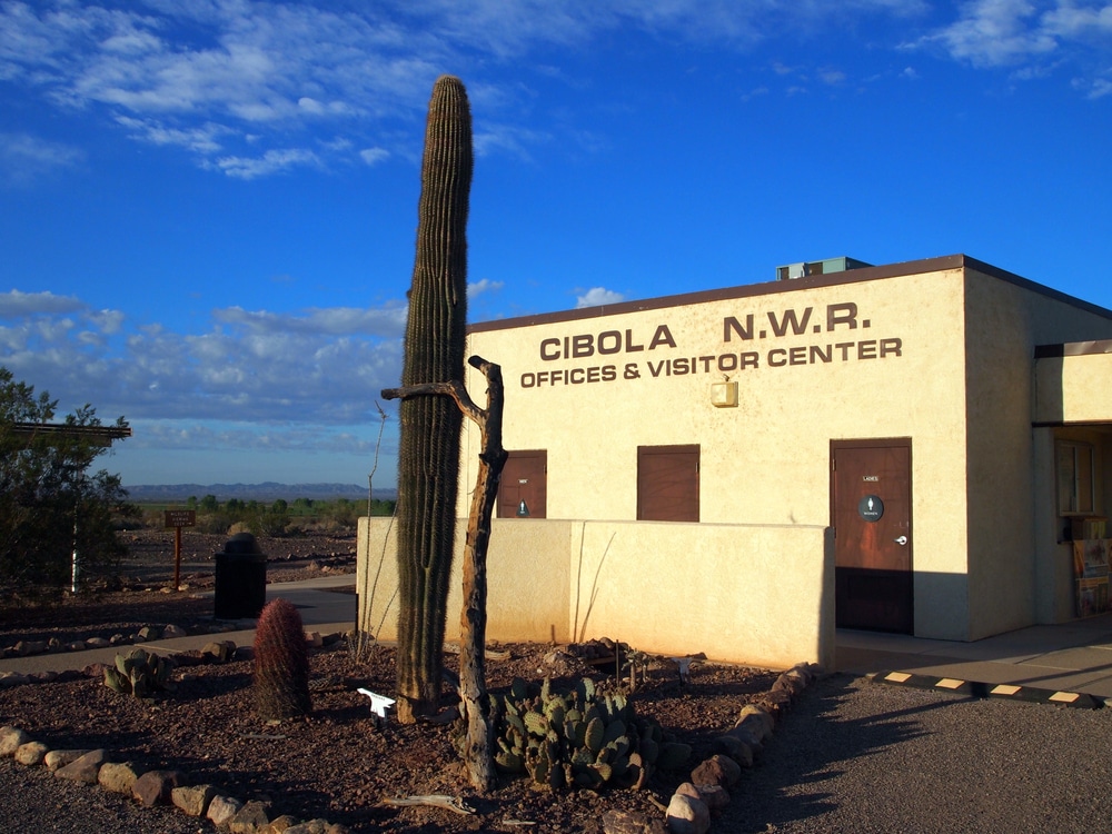
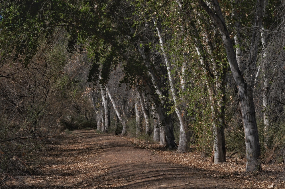
The crown jewel of the area is the Cibola National Wildlife Refuge, a protected oasis that supports an abundance of wildlife in the lower Colorado River Valley. The refuge covers 18,444 acres and is best known for its birding, especially in fall and winter, when Canada geese, snow geese and other waterfowl arrive. An auto tour route and hiking trails lead through the refuge’s riparian woodlands, wetlands and desert uplands.

Cibola offers primitive camping on surrounding BLM (Bureau of Land Management) land. Visitors often set up RVs or tents along the riverbanks, enjoying the open sky, quiet nights, and access to fishing or paddling. Facilities are minimal, so it’s essential to bring your own water, supplies, and waste disposal materials.

The nearby Colorado River provides opportunities for recreational boating, kayaking, and canoeing in peaceful, scenic surroundings. Anglers can fish for catfish, bass, bluegill, and carp in the backwaters and sloughs near Cibola. With limited boat traffic and beautiful desert-mountain backdrops, it’s a perfect spot for relaxed water recreation.

The mix of river, wetland, farmland, and desert offers an exceptional canvas for photographers and artists. Whether capturing a hawk in flight, a golden-lit mountain range, or a mirror-still pond reflecting cottonwood trees, Cibola’s light and landscape inspire creativity.

Cibola is one of Arizona’s premier birdwatching destinations. Cottonwoods and willows along the river serve as rookeries for great blue herons and egrets, western and Clark’s grebes raise their chicks along the shoreline, and migrating songbirds such as the vermilion flycatcher pass through each spring and fall. Photographers and nature lovers can spend hours along the refuge trails or observation decks, capturing stunning images of animals in their natural habitat.

The drive into Cibola along the River Road (Cibola Road from Ehrenberg) takes travelers through serene desert terrain and agricultural fields, offering a glimpse into Arizona’s rural heartland. This scenic route is especially beautiful in the early morning or late afternoon, when the light casts a golden hue over the landscape.

With minimal light pollution, Cibola offers outstanding stargazing. On a clear night, visitors can enjoy sweeping views of the Milky Way, meteor showers, and constellations. Stargazing here is best enjoyed during the cooler months or on moonless nights for maximum clarity.
| Category | Details |
|---|---|
| Name | Cibola, Arizona |
| Type | Rural unincorporated community (not a ghost town) |
| County | La Paz County (formerly Yuma County) |
| Founded | 1898, when work began on a 16-mile irrigation canal |
| Status | Active; small population |
| Population (Current) | 198 (2020 U.S. Census) |
| Historical Significance | Named after the legendary “Seven Cities of Cibola” sought by Spanish explorers |
| Nearby Historical Context | Area inhabited by Native peoples; visited by early Spanish expeditions |
| Primary Economy | Agriculture, seasonal tourism, river recreation |
| Nearby Features | Cibola National Wildlife Refuge, Colorado River, border with California |
| Remnants Today | No historic ruins; site is active and modern |
| Access | Via rural roads from Ehrenberg or Blythe, CA; off the beaten path |
| Elevation | Approx. 250 feet (76 meters) |
| Climate | Hot desert – extremely hot summers, mild winters |
| Best For | Birdwatching, kayaking, RV camping, off-grid exploration |
Cibola’s origins are tied to the lifeline of the Southwest—the Colorado River. The name “Cibola” itself carries historical weight, echoing the legendary “Seven Cities of Cibola” that Spanish explorers sought in the 16th century, chasing tales of gold and riches. While the mythical cities of gold never materialized, the real Cibola emerged in the late 19th century as settlers recognized the agricultural potential of the Colorado River Valley.
The settlement took formal shape in 1898, when settlers began digging a 16-mile canal to carry Colorado River water to their farms. Unlike many Arizona boom towns driven by mining, Cibola’s economy centered primarily on agriculture, with farmers cultivating the rich alluvial soil deposited by the river’s seasonal floods.
Cibola’s history parallels the broader story of Western expansion, representing the agricultural frontier rather than the more celebrated mining or cattle frontiers. This phase of Arizona’s development was crucial, as these farming communities helped feed the growing population in more specialized towns focused on resource extraction or transportation.
The community weathered significant challenges, including devastating floods of the unpredictable Colorado River, periodic droughts, and the economic hardships that afflicted rural America in the late 19th and early 20th centuries. Through it all, the small community persevered through determination and adaptation.
Unlike many Arizona settlements that owed their existence to the railroad, Cibola developed primarily due to its river access. The community never gained direct rail service.
Though never among Arizona’s most prominent settlements, Cibola represents an important chapter in the state’s agricultural pioneer history. The community exemplifies the small farming settlements that developed along Arizona’s waterways, providing a counterpoint to the mining camps and railroad towns that often dominate frontier narratives.
For the Colorado River Indian Tribes and other Native peoples of the lower Colorado, the river valley around Cibola is part of a much older ancestral landscape.
The story of Cibola reminds us that not all Western settlements followed the romanticized boom-and-bust narrative of mining camps or became the thriving cities along railroad corridors. Cibola, built on a canal that carried Colorado River water to its fields, has endured instead as a small farming community beside the river.
As modern Arizona continues its rapid transformation, these quiet corners of pioneer history offer valuable perspective on the cyclical nature of human settlement and the relationship between communities and their environments.
Lingenfelter, Richard. “Steamboats on the Colorado River, 1852-1916.” University of Arizona Press, 1978.
We use cookies to improve your experience on our site. By using our site, you consent to cookies.
Manage your cookie preferences below:
Essential cookies enable basic functions and are necessary for the proper function of the website.
Statistics cookies collect information anonymously. This information helps us understand how visitors use our website.
Monetize your website by displaying targeted ads and earning revenue from clicks and impressions.
Google Analytics is a powerful tool that tracks and analyzes website traffic for informed marketing decisions.
Service URL: policies.google.com (opens in a new window)
You can find more information about our Cookie Policy and Privacy Policy.