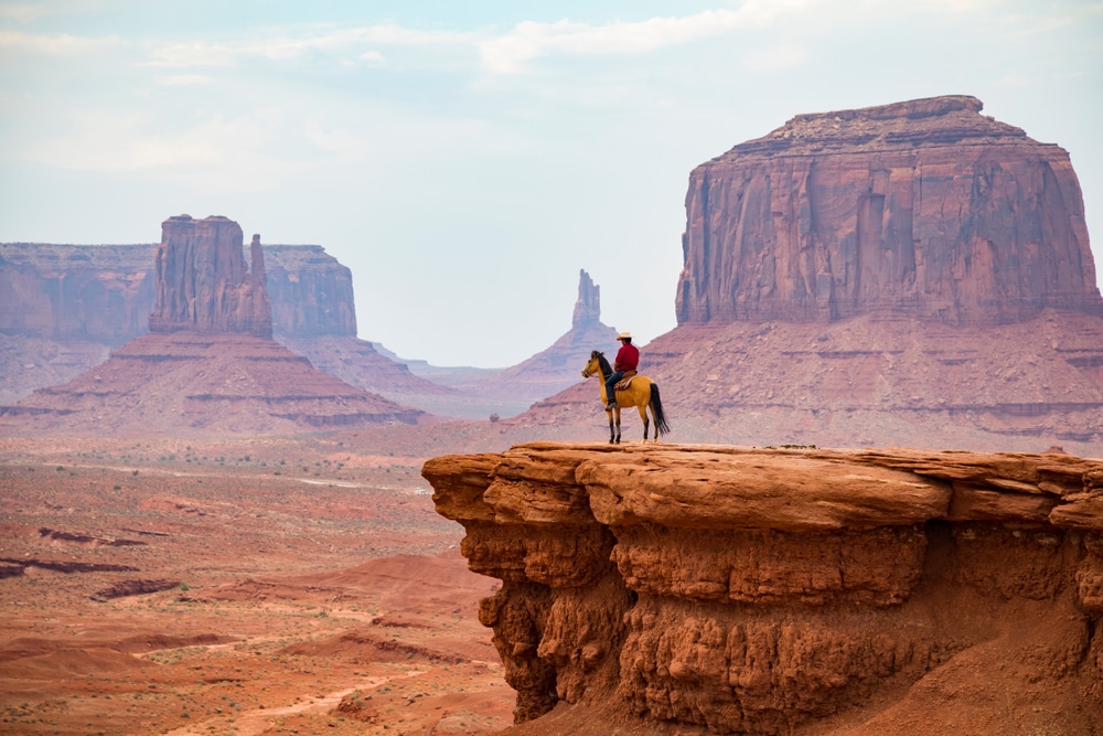
Arizona’s State Park system preserves some of the Southwest’s most spectacular landscapes and significant cultural sites across more than 30 unique destinations. From the iconic red rock formations near Sedona to hidden desert oases, from prehistoric dwellings to territorial-era landmarks, these parks protect Arizona’s rich natural and cultural heritage while providing unparalleled recreational opportunities for residents and visitors alike.
Established in 1957, Arizona’s State Park system has grown to encompass over 64,000 acres of protected lands spanning the state’s remarkably diverse geography. Unlike many state park systems concentrated in a single bioregion, Arizona’s parks showcase dramatic environmental diversity—from saguaro-studded desert landscapes and riparian corridors to mountain forests and high-country lakes. This ecological range enables visitors to experience completely different environments within just a few hours’ drive.

What truly distinguishes Arizona’s parks is their remarkable ability to combine recreational access with preservation. Many parks feature exceptional natural features alongside cultural and historical significance, creating multidimensional destinations that appeal to outdoor enthusiasts, history buffs, and families alike. Whether seeking a refreshing swim in a desert lake, a journey through Arizona’s territorial history, or a challenging hike with panoramic vistas, the state park system offers experiences that capture the essence of the Southwest’s natural beauty and cultural complexity.
From the internationally recognized cave formations at Kartchner Caverns to the poignant Granite Mountain Hotshots Memorial, these carefully preserved lands tell the ongoing story of Arizona—a tale written in ancient rock formations, flowing waters, historic structures, and living ecosystems.
Arizona’s desert parks showcase the stunning beauty and surprising diversity of the Sonoran Desert ecosystem—home to the iconic saguaro cactus and countless other specialized desert species. Parks like Lost Dutchman, Catalina, and Picacho Peak preserve some of the most spectacular desert landscapes in North America, where dramatic geological formations create unforgettable silhouettes against Arizona’s famous blue skies.
Lost Dutchman State Park, nestled at the base of the legendary Superstition Mountains, combines mysterious folklore with breathtaking desert scenery. During spring wildflower season, the desert floor transforms into a canvas of vibrant colors as poppies, lupines, and brittlebush bloom across the landscape. Nearby, Catalina State Park showcases the biological diversity of the Sonoran Desert with exceptional hiking trails that wind through dense stands of saguaros and offer panoramic mountain views.
Perhaps most recognizable from Interstate 10, Picacho Peak’s distinctive profile marks the site of the westernmost battle of the Civil War. Today, its challenging trails reward hikers with sweeping desert vistas. For cave enthusiasts, Kartchner Caverns presents a completely different desert wonder—a living limestone cave system with spectacular formations that continues to grow through active water seepage.
The desert parks are especially magnificent during the cooler months from October through April, when comfortable temperatures make hiking and exploration ideal. During summer, early morning visits are recommended to avoid afternoon heat, though the monsoon season (July-September) brings dramatic cloud formations and the chance to witness desert renewal following brief but intense rain events.
Arizona’s history comes alive through a remarkable collection of state historic parks that preserve pivotal chapters in the region’s development—from prehistoric settlements to Spanish colonial outposts, mining boomtowns, and territorial governance sites.
The Tubac Presidio State Historic Park protects Arizona’s oldest European settlement, where visitors can explore the remnants of the Spanish colonial fort established in 1752 and tour Arizona’s first newspaper press. In southern Arizona, the Tombstone Courthouse State Historic Park houses artifacts and exhibits from the town’s famous silver mining era and lawless reputation, including detailed accounts of the events surrounding the infamous gunfight at the O.K. Corral.
Jerome State Historic Park occupies the former mansion of mining magnate James Douglas, offering a glimpse into Arizona’s copper mining heritage with stunning views of the Verde Valley from its mountainside perch. In central Arizona, Fort Verde State Historic Park preserves one of the best-remaining examples of an Indian Wars-era military post, with authentic furnishings and regular living history demonstrations.
Many of these historic parks feature meticulously restored buildings, comprehensive museums, and interpretive programs that bring the past to life. The Riordan Mansion State Historic Park in Flagstaff showcases an extraordinary example of Arts and Crafts architecture, while the Yuma Territorial Prison State Historic Park allows visitors to step inside the cells of one of the Old West’s most notorious institutions.
These parks offer year-round insights into Arizona’s multilayered history, with special events often coinciding with significant historical anniversaries or seasonal celebrations that feature period costumes, traditional crafts, and demonstrations of historical skills and technologies.
In a state defined by its arid climate, Arizona’s riparian parks protect crucial water resources that have sustained life in the region for thousands of years. These parks showcase the striking contrast between flowing water and desert landscapes, creating biological hotspots that support remarkably diverse plant and animal communities.
Dead Horse Ranch State Park serves as the centerpiece of the Verde River Greenway, preserving a lush riverside habitat with excellent opportunities for bird watching, fishing, and paddling. Further south, Patagonia Lake provides a surprising oasis amid rolling grasslands, where visitors can enjoy boating, fishing, and swimming in one of southern Arizona’s few natural lakes.
Along the Colorado River, parks like Lake Havasu, Cattail Cove, and Buckskin Mountain offer access to the state’s western water playground with developed beaches, boat launches, and scenic shoreline trails. These parks are particularly popular during the cooler months when visitors from colder regions flock to Arizona’s milder winter climate.
The riparian parks undergo dramatic seasonal changes throughout the year. Spring brings vibrant wildflowers and increased water flow, while summer offers refreshing respite from desert heat. Fall transforms riverside cottonwoods and willows into corridors of gold, creating spectacular scenery for hikers and photographers. During winter, these parks become crucial habitats for migratory birds, making them premier destinations for wildlife viewing.
Park facilities at these water-centered destinations typically include boat ramps, fishing docks, swimming areas, and riverfront camping sites. Many offer canoe and kayak rentals, allowing visitors to experience Arizona’s waterways from a completely different perspective.
While many associate Arizona with desert landscapes, the state’s mountain parks offer surprisingly lush forests, cool mountain streams, and alpine-like conditions that provide welcome relief during summer months and snow-covered landscapes in winter.
Fool Hollow Lake Recreation Area near Show Low exemplifies this high-country experience with its pine-studded shores and excellent fishing opportunities at 6,300 feet elevation. During summer, temperatures here often run 20-30 degrees cooler than Phoenix, making it a popular destination for desert dwellers seeking respite from the heat.
Oracle State Park serves as a transitional zone between desert and mountain environments, protecting a diverse “sky island” ecosystem where visitors can explore oak woodlands and grasslands with spectacular views of surrounding mountains. The park also serves as an International Dark Sky Park, offering exceptional stargazing opportunities.
Perhaps no mountain park captures visitors’ imagination quite like Slide Rock State Park near Sedona, where Oak Creek has carved a natural water slide through red sandstone, creating one of Arizona’s most beloved summer destinations. Nearby, Red Rock State Park offers a more contemplative environment with its system of interpretive trails showcasing the area’s distinctive geology and riparian habitat.
These higher-elevation parks typically experience four distinct seasons, with access sometimes limited by winter snow at the highest elevations. Summer brings mild temperatures perfect for hiking and water activities, while fall transforms these parks with spectacular foliage displays as aspens, maples, and oaks change color against evergreen backdrops.
Arizona’s state parks offer year-round recreation opportunities, but understanding seasonal patterns can greatly enhance your experience. The state’s dramatic elevation differences—ranging from around 500 feet along the Colorado River to over 7,000 feet in the mountains—create distinct climate zones that follow different seasonal rhythms.
This is prime time for desert parks, with comfortable daytime temperatures ideal for hiking and exploration. River and lake parks along the Colorado River remain popular with visitors escaping colder climates. Higher elevation parks may have limited access due to snow, though some offer winter activities like cross-country skiing. Historical parks maintain regular operations with fewer crowds.
The desert comes alive with wildflower blooms typically peaking in March and April, making this perhaps the most photogenic season for parks like Lost Dutchman and Picacho Peak. Water levels are often highest in riparian parks, and temperatures remain comfortable throughout most of the state. This shoulder season offers excellent conditions before summer heat arrives.
While desert parks become extremely hot during daytime hours, they offer unique dawn and dusk experiences. This is the perfect season to visit mountain parks like Fool Hollow Lake, where elevations provide natural air conditioning. Water-based parks see peak visitation as temperatures climb. The monsoon season (typically July-September) brings dramatic afternoon thunderstorms and desert rejuvenation.
Considered by many the ideal season for experiencing Arizona parks, fall brings cooler temperatures to desert locations while higher elevations display colorful foliage. Water levels in lakes and rivers may be lower, but comfortable temperatures make for excellent hiking and camping conditions throughout the system.
For the most enjoyable experience, desert parks are best visited in early morning during summer months, while winter afternoons offer comfortable exploration. Conversely, mountain parks shine during summer days but can experience freezing temperatures in winter.
Arizona’s state parks offer an extraordinary range of recreational opportunities across diverse environments, allowing visitors to customize their outdoor experiences based on personal interests and abilities.
From easy interpretive walks to challenging summit trails, the park system features hundreds of miles of trails. Standout hiking experiences include the challenging Hunter Trail at Picacho Peak, the waterside paths at Dead Horse Ranch, and the forested routes at Tonto Natural Bridge. Many parks offer ranger-led interpretive hikes focusing on geology, plant identification, and wildlife tracking.
Despite its desert reputation, Arizona’s parks offer surprising aquatic opportunities. Patagonia Lake, Alamo Lake, and Lake Havasu provide excellent conditions for swimming, fishing, and boating, with designated beaches and boat launches. Several parks rent canoes and kayaks for exploring peaceful waterways, while Slide Rock offers its famous natural water slide during warmer months.
More than half of Arizona’s state parks offer camping facilities ranging from developed RV sites with full hookups to primitive tent areas. Popular camping destinations include Catalina State Park with its saguaro-studded campsites, the lakeside spots at Lyman Lake, and the riparian settings at Roper Lake with views of Mount Graham. Many parks now offer cabin rentals for those seeking additional comfort.
The diverse ecosystems within Arizona’s parks support remarkable wildlife viewing opportunities. Red Rock State Park features a bird feeding station attracting numerous species, while river parks like Verde River Greenway offer prime habitat for herons, eagles, and waterfowl. Desert parks come alive with wildlife during cooler morning and evening hours.
Throughout the year, parks offer structured educational experiences ranging from night sky programs at Oracle and Kartchner Caverns to living history demonstrations at Fort Verde and Tubac Presidio. Many parks feature junior ranger programs specifically designed for younger visitors, along with visitor centers housing informative exhibits on natural and cultural history.
The park calendar includes hundreds of annual events ranging from star parties and wildlife festivals to historical reenactments and cultural celebrations. Highlights include the Civil War reenactment at Picacho Peak, native plant sales at Boyce Thompson Arboretum, and archaeological demonstrations at Homolovi and Tubac.
Planning an enjoyable visit to Arizona’s state parks is straightforward with these helpful resources and practical considerations:
Daily entrance fees typically range from $5-$15 per vehicle, depending on the park. For frequent visitors, the Annual State Park Pass ($85) provides excellent value with unlimited day-use entry to all state parks except for Kartchner Caverns tours. Discounted passes are available for veterans and seniors. Some historical parks charge per-person rather than per-vehicle fees.
Camping reservations can be made up to 12 months in advance through the Arizona State Parks website or by calling 1-877-MY-PARKS. Reservations are strongly recommended for weekend camping year-round and for all visits during peak winter and spring seasons. Kartchner Caverns cave tours require advance reservations, as do special educational programs and guided adventures at various parks.
Most Arizona State Parks provide accessible facilities including visitor centers, restrooms, picnic areas, and viewpoints. Many parks have developed accessible trails suited for wheelchairs and visitors with mobility considerations. The Arizona State Parks website details specific accessible features for each park, and staff can provide additional information on current conditions and accommodations.
With few exceptions, leashed pets are welcome in Arizona’s state parks, making them ideal destinations for families traveling with four-legged companions. Designated pet-friendly trails, camping areas, and even some designated swimming areas allow for inclusive family adventures. Pets are not permitted in buildings, on beaches, or inside Kartchner Caverns.
Arizona’s diverse environments require different safety preparations. Desert parks necessitate plenty of water, sun protection, and awareness of heat-related risks. Mountain parks may require preparation for rapid weather changes and higher altitudes. All parks post current conditions and safety advisories at entrance stations. Cell service varies significantly between parks, with remote locations having limited or no coverage.
The official Arizona State Parks app provides offline maps, facility information, and trail guides for navigating the park system. Many individual parks offer interpretive audio tours accessible through QR codes on trailside markers, enhancing the educational experience without requiring cell service.
Arizona’s state parks represent a commitment to preserving the state’s natural and cultural resources for future generations. Beyond protecting scenic landscapes, these parks serve as crucial wildlife corridors, watershed safeguards, and living repositories of the state’s biodiversity.
Conservation efforts across the park system include native plant restoration projects, invasive species management, and wildlife monitoring programs. At Kartchner Caverns, extraordinary measures protect the living cave environment, including specialized airlock doors and misting systems that maintain the delicate humidity balance essential for continued formation growth. Along riparian corridors, parks like Sonoita Creek State Natural Area and Verde River Greenway implement erosion control measures and reintroduce native vegetation to support healthy waterways.
The Arizona State Parks system balances conservation priorities with recreational access through thoughtfully designed infrastructure, seasonal usage adjustments, and educational outreach that fosters a culture of stewardship among visitors. This approach is particularly evident at sensitive cultural sites like Homolovi State Park, where archaeological resources receive protection while remaining accessible for educational purposes.
Visitors can directly contribute to conservation efforts through volunteer programs operating throughout the park system. Opportunities range from habitat restoration projects and trail maintenance to cultural site preservation and visitor education. The Site Steward Program trains volunteers to monitor archaeological sites, while citizen science initiatives invite visitors to contribute to wildlife surveys and plant inventories using simple smartphone applications.
By implementing sustainable practices—from water conservation and energy efficiency to dark sky lighting standards—Arizona’s state parks demonstrate environmental leadership while preserving the authentic outdoor experiences that make these special places worth protecting.
Arizona’s state park system offers an unparalleled window into the state’s remarkable natural diversity and rich cultural heritage. From the fascinating underground world of Kartchner Caverns to the peaceful waters of Patagonia Lake, from the historic adobe walls of Tubac Presidio to the towering saguaros of Catalina, these protected lands invite exploration and discovery.
Consider planning your park adventures around themed experiences that showcase the system’s diversity:
Whether you’re seeking adventure, education, relaxation, or inspiration, Arizona’s state parks offer accessible gateways to the authentic Southwest. Each park preserves a unique piece of Arizona’s natural and cultural mosaic, waiting to be discovered one visit at a time.
| Park Name | Location | Established | Size (acres) | Elevation (ft) | Key Features | Activities |
|---|---|---|---|---|---|---|
| Alamo Lake State Park | Western AZ near Wenden | 1969 | 3,500 | 1,230 | Desert lake, wildlife habitat | Fishing, boating, camping, stargazing |
| Boyce Thompson Arboretum State Park | Superior | 1925 | 392 | 2,400 | Oldest and largest botanical garden in AZ | Hiking, birdwatching, botanical tours |
| Buckskin Mountain State Park | Parker | 1967 | 1,677 | 450 | Located on Colorado River | Boating, swimming, camping, hiking |
| Kartchner Caverns State Park | Benson | 1988 | 550 | 4,700 | Living limestone cave with active formations | Cave tours, camping, hiking, exhibits |
| Catalina State Park | Tucson | 1983 | 5,500 | 2,700 | Foothills of Santa Catalina Mountains | Hiking, biking, equestrian trails, camping |
| Cattail Cove State Park | Lake Havasu City | 1970 | 2,000 | 450 | Colorado River shoreline | Boating, swimming, fishing, camping |
| Dead Horse Ranch State Park | Cottonwood | 1977 | 423 | 3,300 | Verde River access, lagoons | Fishing, hiking, biking, camping |
| Fool Hollow Lake Recreation Area | Show Low | 1994 | 800 | 6,300 | Mountain lake in ponderosa pines | Fishing, boating, camping, wildlife viewing |
| Fort Verde State Historic Park | Camp Verde | 1970 | 10 | 3,160 | Best-preserved Indian Wars fort in AZ | Historical tours, living history events |
| Homolovi State Park | Winslow | 1986 | 4,000 | 4,900 | Ancient Hopi archaeological sites | Cultural exhibits, hiking, camping |
| Jerome State Historic Park | Jerome | 1965 | 0.2 | 5,000 | Douglas Mansion, mining history | Museum exhibits, historical tours |
| Lake Havasu State Park | Lake Havasu City | 1967 | 928 | 450 | Beach on Lake Havasu | Swimming, boating, camping, fishing |
| Lost Dutchman State Park | Apache Junction | 1977 | 320 | 2,000 | Superstition Mountains access | Hiking, camping, ranger programs |
| Lyman Lake State Park | St. Johns | 1961 | 1,200 | 6,000 | Large lake with no size restrictions on boats | Boating, water skiing, fishing, camping |
| McFarland State Historic Park | Florence | 1979 | 0.5 | 1,500 | 1878 courthouse, later a hospital | Historical exhibits, walking tours |
| Oracle State Park | Oracle | 1985 | 4,000 | 4,500 | Wildlife refuge, environmental education center | Hiking, stargazing, environmental programs |
| Patagonia Lake State Park | Patagonia | 1975 | 2,658 | 3,750 | Man-made lake in rolling hills | Fishing, boating, camping, birdwatching |
| Picacho Peak State Park | Picacho | 1968 | 3,747 | 1,500 | Distinctive peak, Civil War battle site | Hiking, wildflower viewing, camping |
| Red Rock State Park | Sedona | 1986 | 286 | 3,900 | Oak Creek riparian area, red rock views | Hiking, educational programs, birdwatching |
| Riordan Mansion State Historic Park | Flagstaff | 1979 | 5 | 7,000 | 1904 Arts & Crafts style mansion | Historical tours, museum exhibits |
| River Island State Park | Parker | 1981 | 37 | 450 | Colorado River access | Camping, boating, swimming, fishing |
| Rockin’ River Ranch State Park | Camp Verde | 2018 | 209 | 3,150 | Verde River access (under development) | Future: Hiking, camping, river recreation |
| Roper Lake State Park | Safford | 1972 | 338 | 3,130 | Warm lake with mountain views, hot springs | Swimming, fishing, camping, soaking |
| Slide Rock State Park | Sedona | 1987 | 43 | 4,930 | Natural water slide in Oak Creek | Swimming, hiking, picnicking, historical farm |
| Sonoita Creek State Natural Area | Patagonia | 1994 | 9,539 | 3,750 | Riparian area, connected to Patagonia Lake | Hiking, birdwatching, wildlife viewing |
| Tombstone Courthouse State Historic Park | Tombstone | 1959 | 0.4 | 4,540 | 1882 courthouse, now a museum | Historical exhibits, walking tours |
| Tonto Natural Bridge State Park | Payson | 1990 | 150 | 4,530 | Largest natural travertine bridge in world | Hiking, photography, picnicking |
| Tubac Presidio State Historic Park | Tubac | 1958 | 11 | 3,210 | Arizona’s first state park, Spanish colonial presidio | Museum exhibits, archaeological site |
| Verde River Greenway State Natural Area | Cottonwood | 1986 | 480 | 3,300 | Riparian corridor along Verde River | Hiking, birdwatching, kayaking |
| Yuma Territorial Prison State Historic Park | Yuma | 1961 | 10 | 141 | Infamous frontier prison | Museum exhibits, historical tours |
We use cookies to improve your experience on our site. By using our site, you consent to cookies.
Manage your cookie preferences below:
Essential cookies enable basic functions and are necessary for the proper function of the website.