As dawn breaks over the high desert of northwestern Arizona, the first rays of sunlight illuminate the weathered remains of Hackberry—a once-thriving railroad stop now largely reclaimed by the desert it briefly tamed. Wind whistles through abandoned structures, carrying whispers of a boisterous past when steam engines thundered through daily, miners sought their fortunes in the nearby hills, and cattle drives stirred dust along the town’s single main street. Amid the remnants of human ambition, the Hackberry Pioneer Cemetery stands as a solemn testimonial to those who lived, labored, and died in this unforgiving landscape, its weathered markers tilting beneath the weight of time.
Located along Historic Route 66 in Mohave County, approximately 30 miles east of Kingman, Hackberry occupies a distinctive place in Arizona’s transition from territory to state. Not quite a typical mining boom town, nor merely a railroad whistle-stop, Hackberry emerged at the intersection of multiple frontier economies—mining, ranching, and transportation—each leaving indelible marks on its development and ultimate decline.
The town’s pioneer cemetery, tucked into a gentle slope overlooking what remains of the settlement, offers a poignant record of the community’s short-lived prosperity. Its weathered markers and family plots reveal patterns of hardship, resilience, and the multicultural makeup of this frontier outpost. Through examining this ghost town, its cemeteries, newspaper accounts, and railroad connections, we uncover not just Hackberry’s unique story, but broader insights into how transportation networks, resource extraction, and human determination shaped Arizona’s pioneer past.
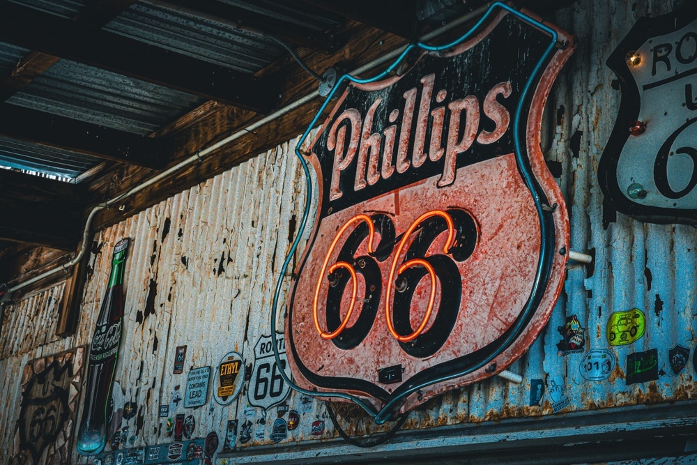
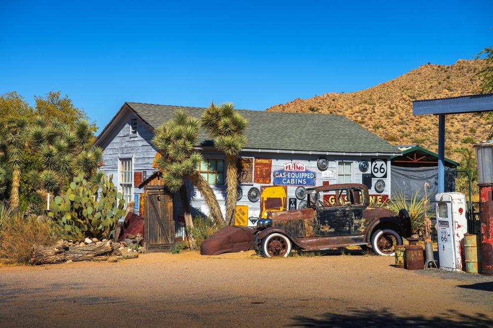
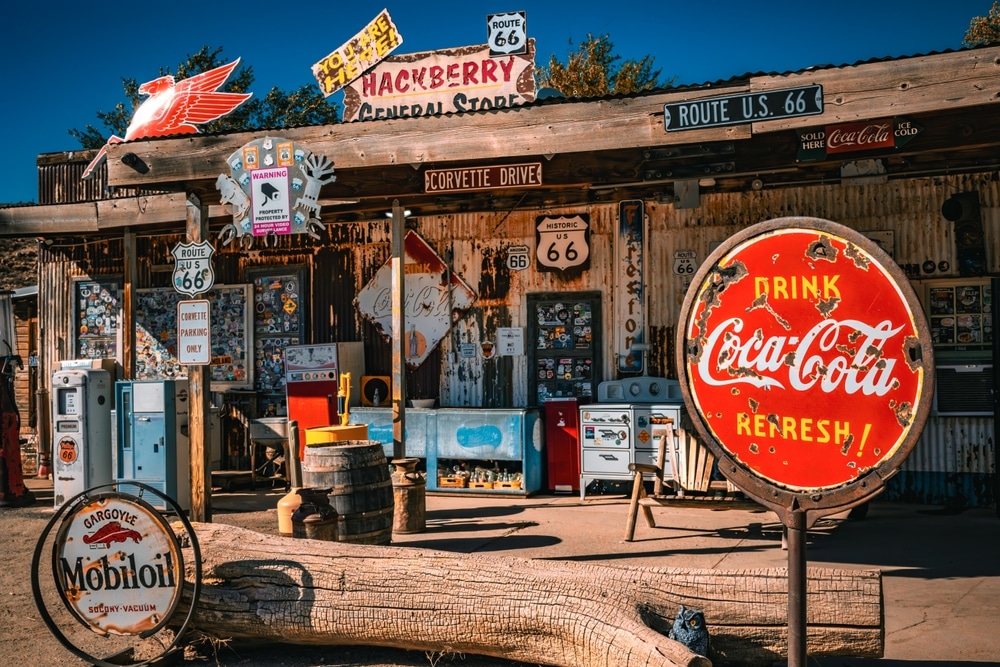
The crown jewel of Hackberry, this iconic Route 66 stop is a vintage lover’s paradise. The store features an eclectic mix of antique cars, retro gas pumps, road signs, and 1950s memorabilia. Inside, you’ll find souvenirs, cold drinks, snacks, and photo ops galore. It’s not just a stop—it’s an experience.
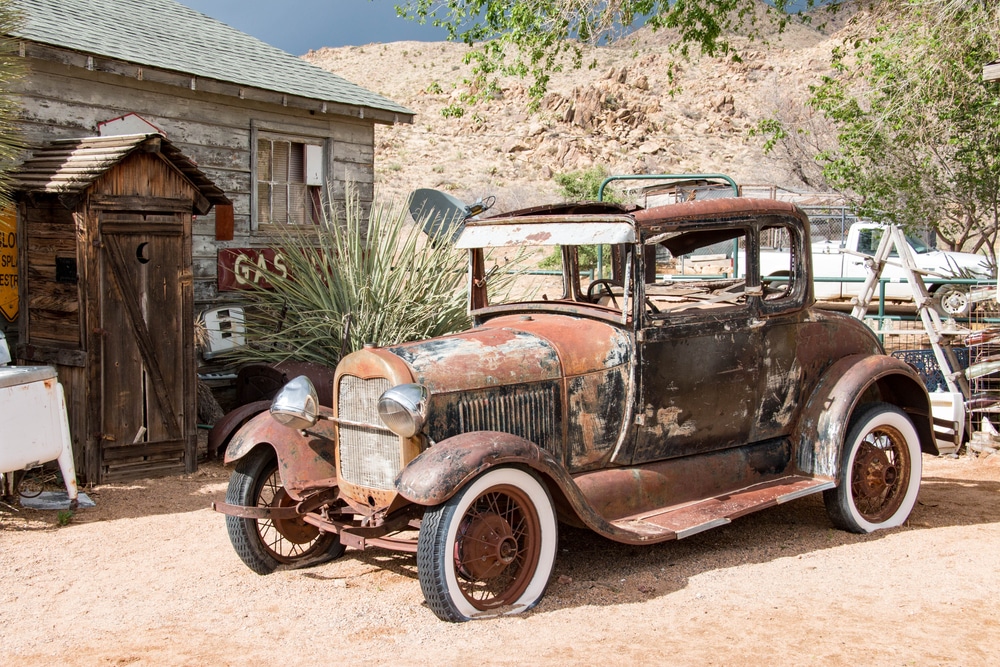
Scattered around the Hackberry General Store are dozens of beautifully rusted classic cars and trucks. These vintage vehicles make for incredible photo backdrops and transport you straight into the golden age of Route 66 travel.
Hackberry is one of the most authentic Route 66 towns left in Arizona. Drive the surrounding stretch of “The Mother Road,” spotting original highway markers, roadside diners, and kitschy attractions. It’s perfect for road trip enthusiasts and history buffs.

Hackberry’s pioneer cemetery offers a quiet, reflective place to explore the lives of early settlers and miners. Tucked into the desert landscape, it’s a reminder of the town’s 19th-century origins and the harsh realities of frontier life.

Hackberry began as a mining town in the late 1800s. While many original sites are now ruins or private property, the surrounding area still holds remnants of mining equipment, tailings, and shafts visible from nearby trails and roads.

Just east of Hackberry, the Peacock Mountains offer a rugged backdrop and scenic routes for off-road vehicles or high-clearance cars. It’s a great way to explore the natural desert landscape and spot wildlife such as deer, coyotes, and birds of prey.

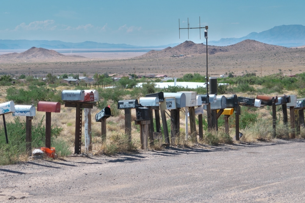
The Mojave Desert offers a stark and stunning beauty around Hackberry. From sun-bleached rocks to towering saguaro cacti and vibrant sunsets, photographers will find no shortage of inspiration in the open skies and rolling hills.

Unlike some of the busier Route 66 stops, Hackberry is quiet and uncrowded. It offers a tranquil break from the highway where you can take in the silence of the desert and truly slow down.
Behind the weathered headstones and fading newspaper accounts lie the human stories that give Hackberry’s history its emotional resonance. Among the most compelling narratives preserved in the pioneer cemetery is that of the town’s founder, Jim Music. Born James Madison Music in Kentucky in 1832, he embodied the restless pioneer spirit that drove America’s westward expansion. Census records and newspaper accounts trace his journey from Kentucky to California during the Gold Rush, then to Nevada’s Comstock Lode before his arrival in northwestern Arizona in 1874.
Music’s discovery of silver in the Peacock Mountains launched Hackberry’s mining era, but his ambitions extended beyond mere prospecting. Newspaper accounts describe his efforts to attract additional settlers, his donation of land for the community’s first school, and his leadership in petitioning for a post office. When he died in 1895 after a fall from his horse, the Mohave County Miner eulogized him as “a rough diamond whose generosity was known to every prospector and cowboy in the county.” His elaborate grave marker, reportedly paid for by subscription from fellow miners and community members, stands as testament to the respect he commanded.
The community cemetery contains the grave of Elizabeth Sherman, whose life spans Hackberry’s transition from mining camp to railroad town to highway stop. Born in 1880, newspaper accounts describe her arrival as a schoolteacher in 1899, her marriage to station agent William Sherman in 1902, and her subsequent roles as postmistress and telephone operator. After her husband’s death in 1929, she operated a small roadside store catering to early automobile travelers on Route 66 until her own death in 1952. As one of Hackberry’s last original residents, her life encapsulated the community’s full historical arc.
A more poignant story emerges from a cluster of graves in the pioneer cemetery belonging to the Rodriguez family. According to church records and newspaper accounts, Francisco Rodriguez came to Hackberry in 1886 as a railroad section worker, bringing his wife Maria and their young children. Over the next decade, Maria gave birth to five more children, but the family’s story is marked by tragedy. Four of their children died before age five, their small graves arranged in a row with simple crosses. This high childhood mortality was not uncommon in frontier communities, where limited medical care and vulnerable water supplies made diseases particularly dangerous for the young.
Despite these losses, census records show the Rodriguez family persisted in Hackberry until approximately 1915, with Francisco eventually becoming a naturalized citizen and establishing a small mercantile business. Their experience illuminates both the hardships faced by immigrant families and the opportunities for social mobility that frontier communities sometimes provided despite prevailing discrimination.
Court records and newspaper accounts preserve the controversial story of Chang Liu, whose grave in the community cemetery bears both Chinese characters and an anglicized name. Arriving as a railroad worker around 1900, Liu established a laundry business that flourished despite period discrimination. In 1914, he became embroiled in a legal battle when he attempted to purchase a building on Hackberry’s main street, challenging prevailing social norms about Chinese business ownership. The case reached the territorial supreme court, which ultimately ruled in his favor in a decision that foreshadowed later civil rights advances. His successful business operated until his death in 1932, providing a counter-narrative to simplistic views of frontier race relations.
Perhaps the most colorful character associated with Hackberry was Joseph “Shotgun” Richards, whose 1906 grave in the pioneer cemetery bears the epitaph “He died with his boots on.” Newspaper accounts and court records describe Richards as a self-appointed town protector whose methods often strayed beyond legal boundaries. After allegedly shooting three cattle rustlers in separate incidents, he earned both his nickname and a reputation that kept Hackberry relatively peaceful during the otherwise lawless 1890s. While modern sensibilities might question his vigilante approach, contemporary accounts suggest the community largely appreciated his presence during a period when official law enforcement rarely visited the remote settlement.
Together, these individual stories illuminate the diverse experiences that collectively constituted life in a frontier community—the ambitions and disappointments, the personal tragedies and small triumphs that played out against the backdrop of Hackberry’s brief but significant history.
| Category | Details |
|---|---|
| Name | Hackberry, Arizona |
| Type | Living ghost town / Route 66 stop |
| County | Mohave County |
| Founded | Circa 1874 (mining origins); townsite developed in 1880s |
| Status | Sparsely populated; partially active as a tourist stop |
| Population (Historic) | ~200–300 during mining and rail peak |
| Population (Current) | Estimated under 100; limited private residences |
| Historical Significance | Founded as a silver mining camp; later became a Route 66 service town |
| Mine Name | Hackberry Mine (named after a nearby hackberry tree) |
| Main Industries (Historic) | Silver mining, later tourism and roadside services |
| Decline Factors | Mine closure, Route 66 bypass by I-40 |
| Modern Revival | Popular nostalgia stop on Historic Route 66 with gift shops and photo ops |
| Key Attraction | Hackberry General Store — a restored 1930s-style gas station with memorabilia |
| Remnants Today | Old buildings, signage, vintage cars, Route 66 ephemera |
| Access | Located on Historic Route 66, between Kingman and Peach Springs |
| Geographic Setting | High desert terrain in the foothills of the Peacock Mountains |
| Elevation | Approx. 3,500 feet (1,067 meters) |
| Climate | Hot summers, mild winters – typical Mojave Desert climate |
| Best For | Route 66 travelers, photographers, ghost town and Americana enthusiasts |
Hackberry’s origins date to 1874 when prospectors discovered silver deposits in the nearby Peacock Mountains. Among these early miners was a man named Jim Music who established the first significant claim in the area. The settlement that grew around these mines took its name from the desert hackberry trees that dotted the surrounding landscape, providing rare patches of shade in this arid environment.
Unlike the explosive growth that characterized Arizona mining boomtowns like Tombstone or Jerome, Hackberry’s development followed a more modest trajectory. The initial mining operations attracted a small but steady population, estimated at around 100 residents by the late 1870s. These early inhabitants were primarily single men engaged in mining activities, with a smaller number of merchants, saloonkeepers, and service providers establishing businesses to meet their needs.
The pivotal moment in Hackberry’s development came in 1882 when the Atlantic & Pacific Railroad (later to become part of the Atchison, Topeka & Santa Fe Railway) established a station at the settlement. This new transportation connection immediately elevated Hackberry’s importance as a shipping point for ore from the surrounding mining districts and as a supply center for ranching operations that were expanding throughout the region.
Hackberry’s peak population occurred between 1895 and 1910, when approximately 400-500 residents called the town home. This era coincided with improved silver extraction methods and the expansion of cattle ranching in Mohave County. The town boasted several saloons, two hotels, a school, blacksmith shops, a Wells Fargo office, and numerous residential structures scattered along and around its main thoroughfare.
The community’s development paralleled Arizona’s broader transition from frontier territory to established state. When Hackberry was founded, Arizona had been a U.S. territory for just over a decade, still struggling with Apache conflicts that would not be fully resolved until the 1886 surrender of Geronimo. By the time the town reached its peak, Arizona was on the cusp of statehood, which would finally arrive in 1912.
During this period, Hackberry served as a microcosm of Arizona’s diverse population. Census records and cemetery markers reveal a community that included Anglo-American miners and merchants, Mexican laborers, European immigrants (particularly Irish and Cornish miners), and a small number of Chinese workers associated with the railroad. This cultural tapestry reflected the complex social dynamics of territorial Arizona, where opportunity and discrimination often existed side by side.
Contemporary visitors to Hackberry encounter a landscape where nature and history coexist in compelling tension. While much of the original town has vanished, significant remnants provide tangible connections to its past. The most prominent surviving structure is the historic Hackberry General Store, which has been restored and repurposed as a nostalgic Route 66 museum and gift shop. Though not original to the mining era, this 1930s building now serves as the primary draw for tourists, housing an eclectic collection of vintage automobiles, road signs, and memorabilia from the heyday of America’s “Mother Road.”
Beyond this commercial attraction, more authentic remnants of Hackberry’s earlier incarnations require a more discerning eye. Foundation outlines of the railroad station can still be traced approximately 100 yards from the general store. The station’s concrete platform, though cracked and weathered, remains visible along what was once the Atlantic & Pacific Railroad track bed.
Scattered across the surrounding landscape are the deteriorating remnants of several stone and adobe structures dating to the mining era. These include partial walls of what was once the town’s schoolhouse, the stone foundations of the Hackberry Hotel, and eroding adobe bricks from various residential structures. Mining infrastructure is evident in the form of tailings piles, prospect holes, and the collapsed entrance to the Music Mine on the hillside northeast of the main settlement.
Water infrastructure—critical to any desert community—can be observed in the form of an old windmill tower that once pumped water from Hackberry’s wells, along with sections of the primitive pipeline system that distributed this precious resource throughout the town. Several stone cisterns, their concrete linings cracked and exposed, mark the locations of once-important water storage facilities.
The town’s street pattern remains partially discernible, with the main thoroughfare now incorporated into a local access road that parallels Route 66. Secondary roads have largely reverted to desert, though careful observers can trace their former routes through subtle depressions and vegetation patterns in the landscape.
Current preservation efforts focus primarily on the Route 66-era general store rather than the earlier mining and railroad structures. The site is privately owned, with varying levels of access to different portions of the former town. While the general store welcomes visitors daily, many of the original mining-era remains lie on private property with restricted access.
Hackberry’s remote location and the harsh desert climate have inadvertently aided preservation by limiting development pressures. However, these same factors contribute to ongoing deterioration of adobe and wooden structures exposed to extreme temperature fluctuations, occasional flash floods, and persistent wind erosion.
Perched on a gentle rise approximately a quarter-mile northwest of the town center, the Hackberry Pioneer Cemetery offers one of the most poignant connections to the community’s past. Established around 1876, shortly after the first mining claims were staked, this burial ground contains approximately 60-70 marked graves, though local historians suggest the actual number of interments may be considerably higher due to unmarked burials and degraded markers.
The cemetery occupies a roughly rectangular plot measuring approximately 100 by 150 feet, enclosed by a simple barbed wire fence with a metal gate. No formal paths divide the cemetery, with graves arranged in loose family groupings rather than rigid rows. The setting offers expansive views of the surrounding desert landscape, creating a peaceful final resting place despite the harsh environment.
The grave markers span the technological and economic spectrum of territorial Arizona. The oldest identifiable memorials are simple wooden crosses and stone cairns, most now severely weathered with any original inscriptions lost to the elements. By the 1890s, more substantial markers appear—sandstone and marble headstones transported to this remote location via the railroad, their cost and craftsmanship reflecting the relative prosperity of the deceased or their surviving family members.
The most elaborate monument belongs to Jim Music, the town’s founder, who died in 1895. His grave is marked by a substantial marble obelisk inscribed with Masonic symbols and the epitaph “A Pioneer Who Found Rest.” The monument’s size and quality speak to Music’s prominence in the community and the respect accorded to Hackberry’s founding figure.
Among the most revealing patterns evident in the cemetery are the numerous child graves, many bearing death dates during the summers of 1887 and 1896—likely indicating outbreaks of childhood diseases such as diphtheria or scarlet fever. These small markers, often decorated with lamb or dove motifs symbolizing innocence, provide stark evidence of the precarious nature of childhood on the Arizona frontier.
Another notable feature is a section containing approximately 15 graves with Hispanic surnames, primarily dating from the 1890s to early 1900s. These markers, several featuring Catholic crosses and Spanish inscriptions, document the significant Mexican and Mexican-American presence in Hackberry’s mining and railroad operations.
The cemetery’s state of preservation varies considerably across its expanse. Natural erosion has taken a toll on many markers, with sandstone monuments particularly susceptible to weathering in the harsh desert environment. Several graves show evidence of periodic maintenance and restoration efforts, particularly those of prominent families or community figures, while others have been left to the mercy of the elements.
In addition to the Pioneer Cemetery, Hackberry contains a second, smaller burial ground often referred to as the Community Cemetery or New Cemetery. Located approximately a half-mile east of the town center, this burial ground was established around 1910 when the original cemetery was perceived as approaching capacity and reflects the evolution of Hackberry’s community identity in its later development phases.
This second cemetery occupies a more level site than its predecessor, covering about 75 by 100 feet with approximately 40 identifiable grave sites. Unlike the pioneer cemetery’s somewhat haphazard arrangement, the community cemetery features more orderly rows and a clearer demarcation between family plots, reflecting the increased organization and civic structure of Hackberry as it matured.
The demographic makeup of this cemetery offers insights into Hackberry’s shifting population. While the pioneer cemetery primarily contains miners, early merchants, and their families, the community cemetery includes more railroad workers, ranchers, and those associated with Highway 66-era businesses. The later cemetery also shows greater ethnic diversity, with sections containing graves of Italian railroad workers and a small area with markers bearing Chinese characters, likely associated with the small community of Chinese merchants and railroad workers who established themselves in the town after 1900.
Burial practices evolved noticeably between the two cemeteries. The community cemetery features more commercially produced monuments, with concrete and granite markers predominating over the handcrafted sandstone and wooden markers common in the pioneer cemetery. Several family plots in the newer cemetery are enclosed by decorative iron fencing or concrete borders—luxury additions rarely seen in the earlier burial ground.
Maintenance patterns also differ significantly between the two sites. While the pioneer cemetery primarily received attention from descendants and historical societies, the community cemetery benefited from periodic maintenance by civic organizations like the Elks Lodge and local church groups into the 1950s, long after most of the town had been abandoned. This care is evident in the better-preserved condition of many markers and the presence of planted non-native vegetation, including several mature juniper trees and yucca plants that continue to thrive despite decades of neglect.
Together, these two burial grounds provide a layered record of Hackberry’s development, decline, and changing social composition across its approximately 80 years as an active community. The transition between the cemeteries mirrors broader changes in American funeral practices during the early 20th century, when burial increasingly shifted from family-managed tradition to commercial service.
Although Hackberry never supported its own dedicated newspaper, the town’s activities, developments, and concerns found expression through regional publications that served as the collective voice for smaller communities across Mohave County. Primary among these was the Mohave County Miner, established in Mineral Park in 1882 and later relocated to Kingman, which regularly featured correspondence from Hackberry throughout the community’s existence.
This newspaper coverage provides invaluable insights into daily life in Hackberry beyond what physical artifacts alone can reveal. The Mohave County Miner maintained a regular “Hackberry Notes” column written by local correspondents, typically the postmaster, schoolteacher, or a prominent merchant. These columns documented everything from mining developments and railroad schedules to social events, weather conditions, and personal milestones of community members.
Through these newspaper accounts, we learn of the substantial silver ore shipment from the Music Mine in September 1883 that reportedly yielded $15,000 (approximately $400,000 in modern value); the devastating flash flood of August 1898 that washed out 300 feet of railroad track and temporarily isolated the community; and the elaborate Independence Day celebration of 1902 featuring horse races, a brass band brought in by train from Kingman, and a community dance that lasted until dawn.
The political leanings of Hackberry residents emerge through election results reported in the newspaper, showing the community’s shift from predominantly Democratic in the 1880s to solidly Republican by the early 1900s—a change that paralleled the increasing influence of the railroad company and mine owners in local affairs. Letters to the editor from Hackberry residents frequently advocated for improved county roads, requested greater law enforcement presence to manage saloon-related disturbances, and debated the merits of territorial statehood.
Significant coverage was devoted to the construction of Hackberry’s school in 1897, a community effort that the newspaper characterized as evidence that “even in remote mining districts, the commitment to education demonstrates the civilized character of Arizona’s citizens”—language that reflects the territorial-era concern with proving Arizona’s readiness for statehood.
The newspaper also documented Hackberry’s darker moments, including an 1893 shooting at the Silver Dollar Saloon that left two miners dead, and a 1905 smallpox outbreak that resulted in a temporary quarantine of the community. These incidents appear alongside birth announcements, wedding celebrations, and accounts of community dances and baseball games, presenting a complex picture of frontier life with its full measure of triumphs and tragedies.
As Hackberry declined following World War I, newspaper mentions became increasingly infrequent, shifting from regular community columns to occasional references in regional mining and transportation news. The last significant coverage came during the realignment of Route 66 in the 1930s, which brought brief renewed attention to the area before the town faded from regular newspaper accounts altogether.
The Mohave County Miner’s archives, maintained by the Mohave Museum of History and Arts in Kingman, represent the most comprehensive collection of documentation about Hackberry’s development, daily life, and eventual decline, preserving the community’s voice long after its physical presence has largely vanished from the landscape.
No single factor shaped Hackberry’s destiny more profoundly than its relationship with the railroad. When the Atlantic & Pacific Railroad established a station at Hackberry in 1882, it transformed what had been a minor mining camp into a significant transportation hub and commercial center for northwestern Arizona.
The railroad’s physical infrastructure dominated Hackberry’s landscape. The station building, constructed of locally quarried stone with wooden trim, served as both passenger depot and freight office. Adjacent to it stood a water tower vital for replenishing the steam engines that traversed this arid region. A section house housed railroad employees responsible for maintaining the tracks in either direction, while a small railyard included a siding where ore cars could be loaded without interrupting through traffic.
Hackberry’s strategic importance to the railroad stemmed from its location approximately halfway between Kingman and Seligman, making it an ideal servicing point for eastbound trains that had just completed the challenging climb from the Colorado River valley. The community also served as a shipping point for several mining districts that lacked direct rail access, including the Peacock Mountains, the Cerbat Range, and the distant Sandy Valley mines.
By 1890, Hackberry’s station processed impressive volumes of both freight and passengers. Company records indicate that approximately 200 tons of silver and copper ore shipped weekly from the station during peak mining periods. Livestock shipments became increasingly significant as ranching expanded in the region, with an estimated 5,000 head of cattle passing through Hackberry’s stock pens annually by the early 1900s.
Passenger service connected Hackberry to both western population centers like Los Angeles and eastern destinations including Chicago. In 1892, the westbound California Limited made daily stops at Hackberry, while the eastbound Chicago Express provided service in the opposite direction. These trains brought mail, merchandise, and new residents while carrying away ore, cattle, and the occasional departed citizen seeking opportunities elsewhere.
The railroad transformed daily life in numerous ways. Most obviously, it provided employment—approximately 15-20 residents worked directly for the railroad as station agents, track maintenance crews, and telegraph operators. The Williams Fork Telegraph Line, completed in 1887, ran alongside the tracks and gave Hackberry near-instantaneous communication with the outside world, a revolutionary development for a remote desert community.
More subtly, the railroad shaped Hackberry’s physical development and social character. The town’s commercial district aligned itself perpendicular to the tracks rather than parallel, creating a distinctive T-shaped settlement pattern still discernible in aerial photographs today. The railway’s regular schedule imposed a new time discipline on the community, with local businesses and social activities increasingly organized around train arrivals and departures.
The railroad’s influence also manifested in the community’s architecture, as manufactured building materials like milled lumber, sheet metal, and plate glass became readily available, gradually replacing the crude log and adobe structures of the earliest settlement phase. By 1900, several homes in Hackberry featured Victorian architectural elements that would have been impossible to transport to the location before rail service.
The relationship between Hackberry and the railroad entered its decline phase after 1910, when improved locomotives reduced the need for frequent water and service stops. The Atlantic & Pacific, by then absorbed into the Atchison, Topeka & Santa Fe system, gradually downgraded Hackberry from a full-service station to a flag stop, where trains halted only when passengers or freight required loading or unloading.
The final blow came in 1936 when the Santa Fe Railway closed Hackberry station entirely as part of a modernization program. While tracks remained in place and trains continued to pass through, they no longer stopped at Hackberry, severing the community’s vital connection to the outside world. Within a decade, most remaining businesses had closed, and the majority of residents had departed, leaving behind structures that would gradually succumb to the desert environment.
Today, the railroad’s legacy remains visible in Hackberry’s landscape. The raised track bed cuts a straight line through the settlement, though the rails themselves were removed during a 1980s track realignment project. Stone foundations of the station and water tower persist, while scattered rail spikes, telegraph insulators, and other artifacts continue to emerge from the soil after heavy rains, tangible reminders of the transportation network that briefly brought this remote location into the mainstream of American commerce.
Hackberry’s decline unfolded as a gradual process rather than a sudden collapse, with multiple factors contributing to the community’s diminishing fortunes over several decades. The first significant setback came around 1919 when declining silver prices and increasing extraction costs rendered the Music Mine and several smaller operations economically unviable. As mining activities contracted, approximately 30% of the population departed, primarily single men employed in the industry.
This initial decline might have stabilized into a smaller but sustainable community centered on the railroad and ranching had other factors not intervened. The 1920s brought technological changes that further undermined Hackberry’s economic foundation. The Santa Fe Railway’s transition from steam to diesel locomotives significantly reduced the need for frequent water stops and service stations along its routes. In 1924, the railway closed Hackberry’s section house and reduced station personnel from five employees to just two, eliminating several steady jobs that had supported local families.
Simultaneously, the advent of automobile transportation began reshaping regional connectivity. The designation of the National Old Trails Road (which passed through Hackberry) as part of Route 66 in 1926 initially seemed to offer economic salvation, as several businesses reoriented toward serving automobile travelers. The Hackberry General Store, Johnson’s Café, and two small auto courts opened during this period, temporarily offsetting some losses from mining and railroad contraction.
However, this highway-based economy proved short-lived. In 1936, two significant blows fell in quick succession. First, the Santa Fe Railway closed Hackberry station entirely, ending passenger service and requiring all shipping to be handled through more distant Kingman or Seligman. Second, Route 66 was realigned approximately a half-mile south of the original townsite, bypassing most existing businesses. While some operations relocated to the new highway alignment, most lacked the capital to rebuild during the lingering Depression.
By 1940, Hackberry’s population had dwindled to fewer than 100 residents, mostly elderly individuals with longtime ties to the community and a few ranching families whose operations were sufficiently distant from the newer transportation corridors to make relocation impractical. The school closed in 1945 when enrollment fell below the required minimum of 10 students, with remaining children bused to Kingman.
The final phase of abandonment occurred between 1950 and 1965, as the last original residents passed away or relocated to communities with better medical facilities and services. By 1960, only three occupied structures remained in the original townsite, with a handful of additional residences scattered along the Route 66 corridor. The post office, which had operated continuously since 1878, closed in 1964, marking the official end of Hackberry as a recognized community.
Property records indicate that many abandoned structures were systematically salvaged for building materials, with lumber, windows, and fixtures often repurposed in Kingman or other growing communities. This salvage activity, combined with occasional flash floods and the harsh desert environment, accelerated the physical disappearance of the town’s built environment. Adobe structures melted back into the earth, wooden buildings collapsed, and even stone foundations were gradually buried by windblown sand.
The 1978 bypassing of Route 66 by Interstate 40 three miles to the south might have erased Hackberry’s last connection to the outside world. However, this same period saw the beginning of historical interest in Route 66 culture, leading to the establishment of the Hackberry General Store as a nostalgic tourist stop in the 1990s. While emphasizing the highway era rather than the community’s deeper mining and railroad history, this development has nevertheless kept Hackberry’s name on maps and in travel guides, ensuring that this ghost town, unlike many others, maintains at least a tenuous connection to contemporary awareness.
Hackberry’s cultural and historical significance extends well beyond its modest physical remains, offering insights into multiple aspects of Arizona’s developmental narrative. From an archaeological perspective, the site presents a valuable case study in the evolution of a multi-phase frontier settlement, with material evidence spanning Native American use of the spring, early mining operations, railroad development, and highway transportation—all overlapping in a relatively compact geographic area.
The town has been documented in several archaeological surveys, most extensively in a 1992 Bureau of Land Management study that identified 37 distinct feature complexes including building foundations, mining infrastructure, railroad facilities, and refuse deposits. This layered archaeological record provides uncommon opportunities to study changing patterns of material culture, construction techniques, and consumption habits across approximately 80 years of continuous but evolving occupation.
For historians of Arizona’s territorial period, Hackberry offers a counterpoint to the more commonly studied mining boomtowns like Tombstone or Jerome. Its more modest scale and diversified economic base—combining mining, transportation, and ranching—more accurately represents the typical experience of frontier communities than the exceptional boom-and-bust cycles of the famous silver and copper giants. The community’s gradual development and decline mirrors the broader regional pattern whereby most early settlements eventually faded as transportation networks and economic activities consolidated around fewer, larger population centers.
Hackberry holds particular significance in transportation history as a community that experienced the complete succession of frontier-era connectivity—from isolated outpost to railroad town to highway stop to ghost town—all within a single human lifetime. This transportation evolution is literally inscribed in the landscape, with Indian trails, wagon roads, railroad grades, early automobile routes, and modern highway alignments all visible within a one-mile radius of the original townsite.
For the regional Hualapai Tribe, Hackberry Spring represents a traditional water source with cultural significance predating European-American settlement. Tribal oral histories reference the spring as a gathering place and temporary camp along seasonal migration routes. Contemporary Hualapai cultural preservation efforts have documented several sites near Hackberry with religious and cultural importance, though specific details remain protected information within the tribal community.
In the context of Route 66 heritage, Hackberry has achieved disproportionate recognition relative to its historical size. The restored general store has been featured in numerous documentaries and travel guides focused on America’s “Mother Road,” becoming one of the most photographed stops along the historic highway. While this attention primarily focuses on the road’s mid-20th century heyday rather than the community’s earlier history, it has nevertheless raised awareness of Hackberry and contributed to broader interest in its multi-layered past.
The community’s dual cemeteries hold significance for genealogical researchers and demographic historians studying migration patterns in the American Southwest. Burial records and gravestone inscriptions document the diverse origins of Hackberry’s residents, with birthplaces ranging from eastern states to European countries to Chinese provinces—physical evidence of the global population movements that shaped Arizona’s development.
Hackberry achieved formal heritage recognition in 2002 when the original townsite and associated mining features were listed on the National Register of Historic Places as the “Hackberry Mining District Historic Area.” This designation acknowledges the site’s research potential and historical significance while providing limited protection for its archaeological resources. The Route 66 corridor through Hackberry, including the general store, has received separate recognition through its inclusion in the National Historic Route 66 Corridor designation established by Congress in 1999.
The preservation status of Hackberry’s two cemeteries reflects both the challenges of maintaining historical resources in remote locations and the persistence of memory within descendant communities. Unlike many ghost town burial grounds that have been completely abandoned, both cemeteries continue to receive periodic maintenance and commemorative attention, though through different channels and with varying degrees of formality.
The Pioneer Cemetery benefits from the attention of the Mohave Pioneers Historical Society, which has conducted documentation projects recording gravestone inscriptions, mapping burial locations, and researching biographical information about those interred there. In 1986, society volunteers erected a simple signpost identifying the cemetery and listing the names of known individuals buried within. While not providing regular maintenance, the society organizes occasional cleanup events, most recently in 2018 when approximately twenty volunteers cleared vegetation and repaired several damaged grave markers.
More consistent attention comes from descendants of those buried in the cemetery, several of whom maintain family connections to the Kingman area. The Rodriguez family graves, for instance, continue to receive regular visits from great-grandchildren of Francisco and Maria, who place flowers at the site each November during Día de los Muertos observations. Similarly, Jim Music’s prominent grave receives periodic maintenance from members of the Kingman Masonic Lodge, honoring his status as an early member of that organization.
Conservation challenges at the Pioneer Cemetery include erosion from occasional flash flooding, vegetation encroachment, and damage from free-ranging cattle. The site’s remote location also makes it vulnerable to vandalism, with several incidents of grave marker damage reported over the past decades. The cemetery’s location on public land administered by the Bureau of Land Management theoretically provides legal protection under the Archaeological Resources Protection Act, but limited agency resources mean that enforcement is minimal.
The Community Cemetery presents a somewhat different preservation profile. Located closer to Route 66, it has benefited from greater visibility and accessibility. A more formal entrance with a metal archway was installed in 1997 through the efforts of the Historic Route 66 Association of Arizona, which occasionally incorporates the cemetery into heritage tourism activities. The association has also produced a simple brochure identifying notable graves and explaining burial customs visible in the cemetery.
This cemetery has been more thoroughly documented, with a complete photographic inventory of remaining markers conducted in 2001 and updated in 2015. This documentation effort revealed significant deterioration of certain markers, particularly the concrete monuments popular in the 1920s-1940s period, many of which have developed serious cracking due to extreme temperature fluctuations.
Memorial practices at both cemeteries reflect the diverse cultural traditions of those buried within them. The Hispanic section of the Pioneer Cemetery shows evidence of traditional Catholic commemorative practices, including small niches for candles incorporated into several grave markers and decorative elements featuring religious iconography. In the Community Cemetery, the Chinese section maintains distinctive funerary traditions, with evidence of food offerings and the burning of spirit money during annual Qingming observances.
An interesting pattern of renewed commemoration has emerged in recent decades, with descendants who have no personal memory of Hackberry nevertheless seeking connection to their ancestral past through cemetery visits. Genealogical research, facilitated by online resources, has led many individuals to discover previously unknown family connections to the community. Several graves that had been neglected for decades now receive periodic visitation, with new memorial markers sometimes placed alongside deteriorating originals.
The future preservation of both cemeteries remains uncertain, dependent on the continuing interest of historical organizations, descendant communities, and public land managers. Climate change presents additional challenges, with increasing aridity and more extreme weather events potentially accelerating the deterioration of already fragile markers. Documentation efforts thus take on added importance, ensuring that the information contained in these burial grounds persists even if the physical markers eventually succumb to the harsh desert environment.
For those wishing to experience Hackberry’s multifaceted history firsthand, respectful visitation requires preparation, awareness, and sensitivity to both historical and contemporary concerns. The site’s remote location, divided ownership, and fragile resources present both challenges and opportunities for meaningful engagement with this ghost town and its cemeteries.
Access to Hackberry is relatively straightforward via Historic Route 66, which remains a maintained paved road running parallel to Interstate 40. The Hackberry General Store, open daily during daylight hours, provides a useful orientation point and offers some historical information, though primarily focused on the Route 66 era. Visitors should note that while the store welcomes tourists, many surrounding properties including portions of the original townsite are privately owned, with access restrictions clearly marked by fencing and signage.
The Pioneer Cemetery is located on public land administered by the Bureau of Land Management and can be reached via a dirt road that branches northwest from Route 66 approximately a quarter-mile west of the general store. This unpaved access requires a high-clearance vehicle during dry conditions and becomes impassable after rainfall. Visitors should register their presence at the small kiosk at the cemetery entrance, both for safety purposes and to assist the BLM in tracking visitation patterns for resource management.
The Community Cemetery lies on county-maintained property accessible via a short gravel road immediately east of the general store. A simple fence surrounds this burial ground, with a gate that should be left as found (either open or closed) to respect local livestock management practices. While more accessible than the pioneer cemetery, this site receives no regular maintenance beyond occasional volunteer efforts, and visitors should be prepared for potentially overgrown conditions.
Ethical visitation of both cemeteries demands awareness that these are burial sites deserving appropriate respect. Photography for personal documentation or research purposes is generally acceptable, but visitors should avoid touching or leaning on grave markers, many of which have become fragile with age. Collection of any items, including seemingly insignificant artifacts like pottery fragments or weathered wood, is prohibited by federal law at the Pioneer Cemetery and by county ordinance at the Community Cemetery.
Weather considerations are paramount when planning a visit to Hackberry. Summer temperatures regularly exceed 100°F, making early morning or late afternoon visits advisable during hot months. Winter brings its own challenges, with occasional snow and biting winds that sweep across the exposed landscape. Spring (March-May) and fall (September-November) generally offer the most comfortable conditions for exploring the site, though visitors should always bring adequate water, sun protection, and appropriate footwear for uneven terrain.
Visitors interested in deeper historical understanding beyond physical exploration have several resources available. The Mohave Museum of History and Arts in Kingman maintains extensive archives related to Hackberry, including photographs, newspaper accounts, and oral histories recorded from former residents. The museum’s research library is open to the public by appointment. Additionally, the BLM Kingman Field Office can provide information about archaeological resources and land access issues for those planning more extensive exploration of the area.
Photography guidelines balance documentation interests with preservation concerns. General photography of the landscape, ruins, and cemetery features is welcomed and encouraged, with many photographers finding the interplay of historic structures and desert environment particularly compelling. However, any photography involving ground disturbance, artifact manipulation, or commercial purposes requires permits from the relevant land managers.
Those seeking authentic engagement with Hackberry’s history should consider expanding their itinerary to include related sites that provide context for the community’s development. The Powerhouse Visitor Center in Kingman offers exhibits on regional mining history; the Historic Railroad Depot (also in Kingman) illuminates the transportation networks that shaped Hackberry’s destiny; and the nearby Chloride ghost town provides a comparative example of another mining community with a different developmental trajectory.
We use cookies to improve your experience on our site. By using our site, you consent to cookies.
Manage your cookie preferences below:
Essential cookies enable basic functions and are necessary for the proper function of the website.