The morning sun illuminates the stark beauty of Ajo’s landscape, casting long shadows across the open-pit mine that dominates the eastern edge of town. Unlike many of Arizona’s mining communities that flared briefly before fading into ghost towns, Ajo represents a different story—one of remarkable persistence through boom and bust cycles. Nestled in the Sonoran Desert of southwestern Arizona, approximately 43 miles from the Mexican border, this community still stands as a living testament to Arizona’s mining heritage, though much diminished from its heyday. The town’s Spanish name, meaning “garlic” (though some argue it derives from a Tohono O’odham word for paint), reflects the cultural crossroads where Anglo, Mexican, and Native American influences have converged for generations.

Beyond the plaza, Ajo features distinctive architectural styles reflecting its development as a company town. The neighborhoods showcase Spanish Colonial Revival, Craftsman, and vernacular mining camp designs. St. Catherine’s Church, with its twin bell towers, stands as an impressive example of Mission Revival style. The former railway depot represents classic territorial architecture. Walking tours highlight these diverse structures and explain their historical context within the development of this planned community, which significantly differed from the haphazard growth typical of many Western mining settlements.
The Sonoran Desert surrounding Ajo hosts remarkable plant diversity, showcased in the community’s botanical garden. Educational displays identify native species and explain their ecological adaptations to extreme conditions. The ethnobotanical section highlights plants traditionally used by the Tohono O’odham people for food, medicine, fiber, and ceremonial purposes. Demonstration gardens illustrate desert-appropriate landscaping techniques for residential settings. The garden serves as a living classroom for sustainability practices appropriate to arid environments, including water harvesting and xeriscaping principles.

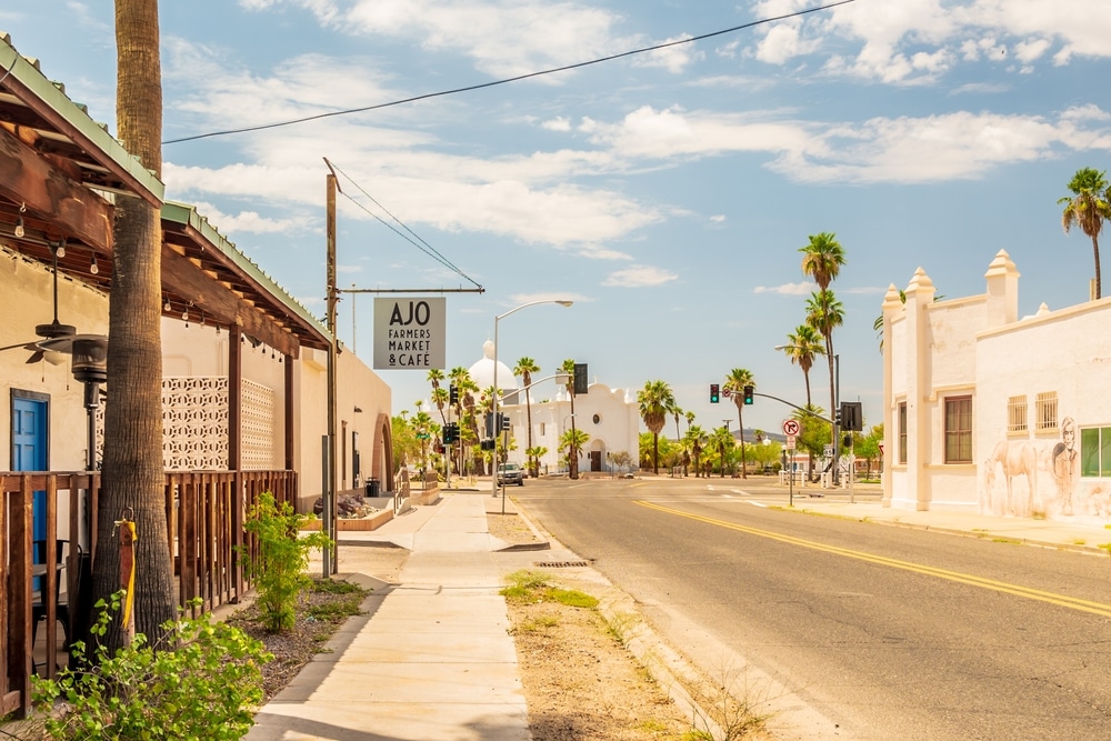
The centerpiece of Ajo is its distinctive Spanish Colonial Revival plaza, designed in 1917 by noted architects Lescher & Mahoney. The plaza features a central park with a gazebo surrounded by arcaded buildings painted in soft desert hues. The meticulously restored Curley School anchors one end, while the former Phelps Dodge Mercantile building dominates another. This planned community space represents one of Arizona’s finest examples of early 20th-century company town design. The plaza continues to serve as a community gathering place, hosting markets, concerts, and cultural events throughout the year.

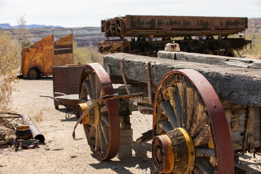
Ajo’s identity is deeply intertwined with copper mining, which drove its development for nearly a century. The New Cornelia open-pit mine, begun in 1911, was once among the largest copper operations in Arizona. Though mining ceased in 1985, the massive pit remains visible from several overlooks. The Ajo Historical Society Museum displays mining equipment, historical photographs, and personal accounts documenting the community’s industrial heritage. Mining architecture remains evident throughout town, from the imposing administration buildings to the modest miners’ cottages in surrounding neighborhoods.

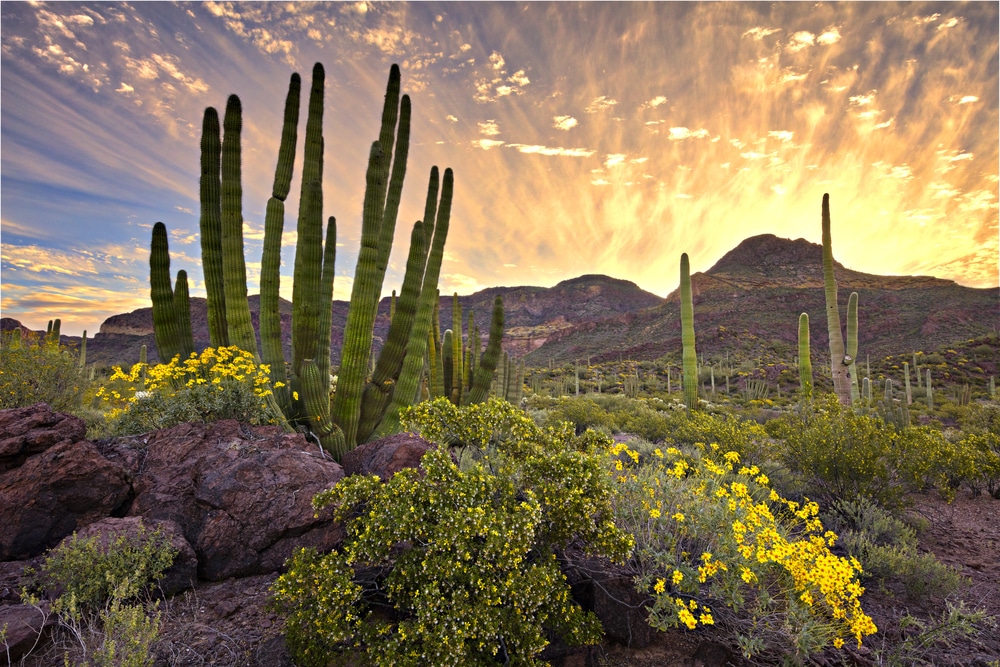
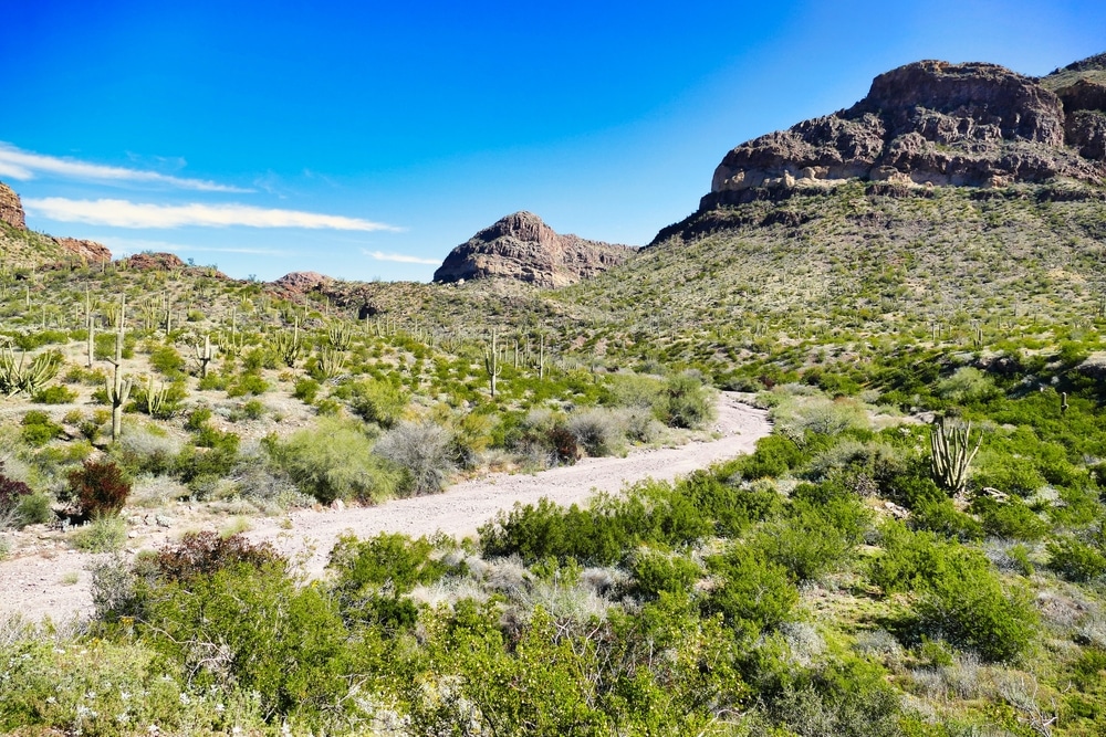
Situated within the Sonoran Desert, Ajo is surrounded by spectacular arid landscapes. The nearby Cabeza Prieta National Wildlife Refuge and Organ Pipe Cactus National Monument showcase pristine desert environments with exceptional biodiversity. Distinctive flora includes saguaro, organ pipe, and senita cacti, along with ironwood trees, ocotillo, and numerous wildflower species that bloom spectacularly after seasonal rains. The rugged Ajo Mountains provide a dramatic backdrop to the town, with their distinctive volcanic silhouettes particularly striking at sunrise and sunset.

The diverse habitats surrounding Ajo attract both resident desert specialists and seasonal migrants. Over 200 bird species have been documented in the area, including Gila woodpeckers, cactus wrens, pyrrhuloxias, and various raptors. The Cabeza Prieta National Wildlife Refuge provides critical habitat for endangered species like the masked bobwhite quail. Seasonal tanks (desert water holes) concentrate bird activity, creating exceptional viewing opportunities. Local bird walks led by experienced naturalists introduce visitors to specialized adaptations that allow avian species to thrive in this challenging environment.

Located just 43 miles from the Mexican border, Ajo embodies a blend of cultures reflecting its position in the borderlands. Mexican culinary influences are evident in local restaurants serving regional specialties. The annual International Day celebration highlights cross-border connections through music, dance, art, and food. The complex realities of border issues are respectfully explored through community dialogues and arts programming that recognize the human dimensions of migration and cultural exchange in this desert corridor.
Minimal light pollution and clear desert air make Ajo an exceptional destination for astronomical observation. The surrounding public lands offer unobstructed horizons and dark skies rarely found near populated areas. Amateur astronomers regularly gather at designated viewing sites to observe celestial phenomena. The annual Dark Sky Festival features guided stargazing, telescope viewing stations, and educational programming about astronomical features visible in the southern Arizona skies. The tradition of nighttime sky watching connects modern visitors with indigenous peoples who navigated by these same stars for millennia.
Behind the industrial statistics and corporate history of Ajo lie countless human stories that illuminate the lived experience of this distinctive mining community. Cemetery markers, newspaper accounts, and oral histories collected by the Ajo Historical Society preserve something of these individual narratives that collectively create a richer understanding of Ajo’s past.
Thomas Jefferson Beatty (1868-1925) – Among the more substantial markers in the Pioneer Cemetery lies Beatty, an early prospector who first arrived in the Ajo area in 1898. According to accounts in the Border Vidette, Beatty established several claims in the district before selling his interests to the nascent New Cornelia company in 1911. Unlike many early prospectors who moved on to new strikes, Beatty remained in Ajo during its transition to corporate control, working as a consultant for the mining company until his death from silicosis, a common miner’s disease caused by years of inhaling rock dust. His grave marker, featuring carved mining tools and the Masonic square and compass, reflects both his occupation and his role in establishing Ajo’s Masonic lodge in 1918. Beatty represents the bridge between Ajo’s individualistic frontier period and its later corporate development.
María Dolores Valencia (1893-1942) – A simple but well-maintained grave in the Hispanic section of the Ajo Cemetery commemorates Valencia, who established one of the first businesses in “Mexican Town” not directly controlled by the mining company. According to family accounts preserved by the Historical Society, Valencia arrived from Sonora in 1917 and opened a small restaurant serving workers from the nearby mine. As her business prospered, she expanded to include a boarding house for single miners and eventually a small general store. The Copper News occasionally mentioned her establishments, particularly noting celebrations held there during Mexican holidays. Valencia’s grave is still decorated regularly by descendants who remain in Ajo, including grandchildren and great-grandchildren who carry on family stories of her entrepreneurial spirit in a company-dominated environment.
Sam Roberts (1902-1958) – A military-style marker in the Ajo Cemetery commemorates Roberts, who served as editor of the Copper News from 1949 to 1958. Under his leadership, the newspaper navigated the complex dynamics of a company town experiencing both Cold War prosperity and labor tensions. Roberts had previously worked as a miner before shrapnel wounds sustained during World War I led him to pursue journalism instead. His editorial approach walked a careful line—generally supportive of the mining company that provided the community’s economic foundation while occasionally advocating for improved safety measures and community amenities. Roberts died suddenly of a heart attack while at his desk in the newspaper office, with his final editorial left unfinished in his typewriter—a moment preserved in local memory as symbolic of his dedication to the community’s voice.
José Miguel Flores (1915-1983) – A bilingual marker in the Ajo Cemetery tells the story of Flores, who worked for the Tucson, Cornelia and Gila Bend Railroad for 42 years, rising from track maintenance to become the first Mexican-American conductor on the line. His long career spanned the railroad’s transition from steam to diesel power and its gradual decline alongside mining operations. Oral histories recorded by the Ajo Historical Society include Flores’ recollections of changing technology and social dynamics within the railroad workforce. His detailed knowledge of the TC&GB’s operations made him a valuable resource for younger workers, earning him the nickname “El Profesor” among Hispanic railroad employees. His funeral in 1983 was attended by colleagues from throughout the railroad’s history, with a symbolic final whistle blown at the Ajo depot in his honor.
Beyond these individual stories, broader patterns emerge from Ajo’s human record. Cemetery demographics reveal the hazards of mining work, with numerous young men’s graves bearing dates that coincide with documented accidents at the mine. Family plots often contain multiple infant graves, testament to high child mortality rates that persisted well into the 20th century despite company-provided medical facilities. Newspaper social columns track the gradual integration of Ajo’s initially segregated community, with increasing mentions of cross-cultural events and organizations in the post-World War II period.
| Feature | Details |
|---|---|
| Location | Pima County, southwestern Arizona, approximately 43 miles from the Mexican border |
| Founded | 1847 as mining camp; developed significantly in early 1900s |
| Status | Semi-ghost town/small unincorporated community (not fully abandoned) |
| Population | Approximately 3,000 residents (down from peak of 7,000+) |
| Etymology | Named after the Spanish word for “garlic” (possibly referring to wild garlic growing in the area) |
| Economic History | Home to one of Arizona’s largest copper mines (New Cornelia Mine) |
| Mining Operation | Run by Phelps Dodge Corporation until 1985 closure |
| Architecture | Features Spanish Colonial Revival style in town center |
| Notable Structures | Curley School (repurposed as artist residences), Plaza and Historic District |
| Town Design | Planned community designed by architects John Greenway and William Kenyon |
| Plaza | Distinctive central plaza with arcaded buildings |
| Current Economy | Tourism, retirement community, border patrol operations |
| Nearby Attractions | Organ Pipe Cactus National Monument (33 miles away), Cabeza Prieta National Wildlife Refuge |
| Cultural Significance | Rich mining history, Native American heritage, proximity to Mexico |
| Climate | Hot desert climate with mild winters and very hot summers |
| Elevation | 1,759 feet (536 m) |
| Annual Events | Sonoran Shindig, seasonal festivals |
| Museum | Ajo Historical Society Museum showcasing mining and local history |
| Outdoor Recreation | Desert hiking, wildlife viewing, photography |
| Modern Relevance | Becoming known for affordable living for retirees and artists |
Unlike many Arizona ghost towns that were completely abandoned, Ajo represents a “living ghost town” – a community that experienced significant decline after its main industry collapsed but continues to exist with a smaller population. The town’s well-preserved Spanish Colonial center and mining history make it a unique example of Arizona’s industrial past.
Ajo’s mining history began long before European settlement, with archaeological evidence suggesting the Hohokam people extracted copper from surface deposits as early as 1000 CE. The Tohono O’odham people who later inhabited the region also utilized the distinctive green and blue copper minerals for ceremonial paint and trading purposes. These indigenous mining activities left minimal environmental impact but established Ajo as a site of mineral extraction centuries before industrial mining would transform the landscape.
The first documented European awareness of Ajo’s mineral wealth came in 1750 when Spanish explorers noted copper outcroppings in the area. Small-scale Spanish mining operations followed, though political instability in the region limited their development. After the Gadsden Purchase brought the area under American control in 1853, prospectors began staking claims around Ajo, with the first significant American mining attempt occurring in 1855 when Peter M. Brady established the Arizona Mining and Trading Company.
The remoteness of Ajo and the technical challenges of processing its particular copper ore initially hampered development. Early mining efforts were sporadic and largely unsuccessful due to transportation difficulties, Apache resistance, and the limitations of available technology. The area remained sparsely populated through the territorial period, with only small groups of hardy miners attempting to wrest copper from the resistant landscape.
Ajo’s transformation began in earnest when John Campbell Greenway, a former Rough Rider and mining engineer, recognized the potential of the area’s low-grade copper deposits. In 1911, he secured financial backing from the Calumet and Arizona Mining Company to develop what would become the New Cornelia Copper Company. Greenway brought revolutionary technologies to Ajo, including a new leaching process for extracting copper from carbonate ores and later the first successful implementation of the flotation process for sulfide ores in the Southwest.
Under Greenway’s direction, Ajo evolved from a scattered mining camp into a planned company town. Between 1916 and 1917, the Cornelia Copper Company constructed not just industrial facilities but an entire community featuring Spanish Colonial Revival architecture, designed by notable architects William Lacy and Louis Empie. The result was one of Arizona’s most distinctive and deliberately planned mining communities.
At its peak in the 1950s, Ajo’s population swelled to approximately 7,000 residents, sustained primarily by the copper mine that by then was operated by Phelps Dodge Corporation, which had absorbed the New Cornelia operations. The community thrived with a diverse population that included Anglo-American managers and engineers, Mexican and Mexican-American miners, and Tohono O’odham workers, each group contributing to Ajo’s unique cultural character.
Unlike many Arizona mining communities that have vanished entirely or exist only as tourist attractions, Ajo remains inhabited, though profoundly changed since mining operations ceased in 1985. Today’s visitor finds a community of approximately 3,000 residents who have adapted to a post-mining economy focused on tourism, border security operations, and retiree migration.
The physical layout of Ajo reflects its planned origins, with the distinctive Spanish Colonial Revival plaza serving as the town center. The Curley School, another architectural landmark, has been repurposed as artists’ housing and studios, becoming a symbol of the community’s creative reinvention. Many original company houses remain occupied, though some neighborhoods have declined as population has decreased.
Most dramatic is the massive open-pit mine that stretches nearly a mile across and 1,100 feet deep on the town’s eastern edge. Now silent after generations of continuous operation, the terraced pit with its oxidized copper minerals creating bands of green, blue, and red serves as both a striking visual landmark and an inescapable reminder of the industry that built Ajo. Though no longer actively mined, the site remains under the ownership of Freeport-McMoRan, successor to Phelps Dodge, with minimal reclamation efforts.
Visitors can learn about Ajo’s mining heritage at the Ajo Historical Society Museum, housed in the former railway depot, which preserves artifacts, photographs, and oral histories documenting the community’s evolution. The New Cornelia Open Pit Mining Lookout provides views of the enormous excavation that produced over 6 billion pounds of copper during its operational lifetime.
Approximately one mile northwest of Ajo’s plaza lies the Ajo Pioneer Cemetery, established around 1897 to serve the early mining community. This burial ground predates the planned company town and contains graves of prospectors, miners, and their families who sought their fortunes in Ajo before corporate development transformed the area.
The cemetery occupies a gentle slope facing east toward the Batamote Mountains, enclosed by a simple chain-link fence with a wrought iron entrance gate. Desert vegetation—creosote, ocotillo, and various cacti—grows between and sometimes directly on grave sites, creating a distinctively Sonoran landscape of remembrance.
Approximately 200 graves are visible, though cemetery records suggest additional unmarked burials may exist. The oldest legible markers date to the late 1890s, with burials continuing until approximately 1917, when the newer Ajo Cemetery was established closer to the expanding company town. The transition between cemeteries roughly corresponds with the shift from small-scale, individualistic mining efforts to corporate, industrialized extraction under the New Cornelia Copper Company.
The Pioneer Cemetery’s markers tell a story of hardship and cultural diversity on Arizona’s mining frontier. Simple wooden crosses, now weathered to near illegibility, stand alongside more substantial stone markers bearing names that reflect the international character of early mining camps—English, Irish, Mexican, Chinese, and Tohono O’odham among them. Several markers bear only first names or “Unknown Miner,” testifying to the anonymity that often accompanied death in remote mining regions.
Particularly poignant are multiple graves from 1908-1909, suggesting a disease outbreak, possibly influenza or typhoid, that swept through the camp. The clustering of death dates offers silent testimony to the health challenges of early desert mining communities where medical care was minimal and living conditions often primitive.
The cemetery has suffered from decades of exposure to harsh desert conditions, with many markers fallen, broken, or rendered illegible by weathering. Sporadic restoration efforts by the Ajo Historical Society have documented existing graves and repaired some markers, though the site’s remote location and limited resources have hampered comprehensive preservation.
In contrast to the Pioneer Cemetery’s informal arrangement and weathered simplicity, the Ajo Cemetery established in 1917 reflects the more structured social organization of the company town period. Located approximately half a mile east of the town plaza, this larger burial ground continues to serve the community today, providing a continuous record of Ajo’s demographic and cultural evolution over more than a century.
The Ajo Cemetery’s layout reveals much about the community’s social structure during the company town era. Originally, the cemetery was informally divided into sections reflecting the tripartite division of Ajo itself: the “American” section primarily contained graves of Anglo managers, engineers, and their families; the “Mexican” section served Ajo’s substantial Hispanic population; while a third area contained graves of Tohono O’odham workers. These divisions, though never officially marked or mandated, mirrored the residential segregation in Ajo, where housing and amenities were allocated according to ethnicity and company position.
As social attitudes evolved through the mid-twentieth century, these divisions became less rigid, with later burials distributed throughout the cemetery regardless of ethnicity. Today, the cemetery serves as a physical record of Ajo’s gradual integration, though the pattern of earlier burials still preserves evidence of once-strict social boundaries.
Grave markers in the Ajo Cemetery span from simple wooden crosses to elaborate family monuments, reflecting not just personal preferences but economic status within the mining community. Company managers’ graves typically feature substantial granite headstones, while miners’ graves often display more modest markers, some decorated with mining tools or symbols reflecting their occupation. Many Hispanic graves feature distinctive cultural elements including colorful tile work, religious imagery, and Spanish inscriptions, while Tohono O’odham graves sometimes incorporate traditional desert materials and designs.
The cemetery continued to evolve as Ajo itself changed. Military service markers became prominent following World War II, when many of Ajo’s young men entered the armed forces. The post-mining period after 1985 is reflected in changing epitaphs that increasingly mention occupations beyond mining as the community diversified economically.
Today, the Ajo Cemetery remains actively used, maintained through a combination of municipal services and volunteer efforts. Annual cleaning events, particularly around Día de los Muertos in November, bring community members together to care for family plots and maintain the grounds, creating an important link between current residents and Ajo’s multi-layered past.
Throughout its evolution from mining camp to company town to post-industrial community, Ajo has been served by several newspapers that documented daily life and helped forge community identity. The history of these publications mirrors the larger story of the town itself, from individualistic frontier beginnings through corporate consolidation to current adaptation.
The earliest known newspaper serving the Ajo area was the Border Vidette, published in Tucson from 1898 to 1915. Though not based in Ajo itself, this regional publication regularly carried news of mining developments, claim disputes, and occasional human interest stories from the early mining camp. The distance between Tucson and Ajo meant coverage was sporadic and often delayed, reflecting the isolation of the early mining community.
As Ajo developed into a company town after 1916, the New Cornelia Copper Company recognized the value of a local newspaper both for practical communication and community cohesion. In 1916, the company supported the establishment of the Ajo Copper News, which would become the community’s primary publication for over 70 years. Initially operating from a small adobe building near the plaza, the paper moved to more substantial quarters on Morondo Avenue in 1920 as its operations expanded.
Under its longest-serving editor, W.D. “Bill” Cronin, who led the paper from 1922 to 1949, the Copper News walked a careful line between serving as company mouthpiece and representing broader community interests. The paper’s editorial position generally supported mining company policies and promoted industrial development, but it also provided space for community announcements, local sports coverage, and personal milestones that helped forge a shared identity among Ajo’s diverse population.
The newspaper’s archives provide an invaluable window into daily life in a company mining town. Regular columns like “Mexican Town Notes” and later “Indian Village News” acknowledged the community’s diversity while simultaneously reinforcing its social divisions. Coverage of labor issues was notably circumspect during periods of union organizing and strikes, reflecting the paper’s economic dependence on mining operations.
The Copper News reached its peak circulation in the 1950s when it served approximately 7,000 residents with twice-weekly editions. The publication’s physical production reflected Ajo’s industrial character, with printing equipment operated largely by men who had transferred from mining work due to injuries or health conditions that prevented continued underground labor.
As Ajo’s mining operations contracted in the 1970s and ultimately ceased in 1985, the Copper News struggled to maintain viability. Publication frequency reduced to weekly, and page counts diminished as both population and advertising revenue declined. The paper finally ceased regular publication in 1988, leaving Ajo without a dedicated local voice for several years.
Since 1996, the community has been served by the Ajo Copper News & Review, a monthly publication with more limited scope than its predecessor but continuing the tradition of local journalism. This newer publication focuses primarily on community events, historical retrospectives, and economic development efforts, reflecting Ajo’s current priorities as it navigates post-industrial identity.
Ajo’s development as a major copper producer was inextricably linked to railroad access, with transportation infrastructure proving as crucial as mining technology in transforming this remote desert location into an industrial center. The evolution of rail connections to Ajo reflects broader patterns in Western resource development, where extraction economies depended on efficient transportation networks.
Early mining efforts in the Ajo area were severely constrained by transportation limitations. Before railroad access, copper ore had to be hauled by mule-drawn wagons over rough desert roads to Gila Bend, the nearest railhead approximately 43 miles away, making large-scale production economically unfeasible. This isolation led to the failure of several early mining ventures despite the known richness of local copper deposits.
The transformative moment in Ajo’s transportation history came in 1916 when the Tucson, Cornelia and Gila Bend Railroad (TC&GB) completed a standard-gauge line connecting Ajo to the Southern Pacific mainline at Gila Bend. This 43-mile spur was financed and controlled by the New Cornelia Copper Company specifically to support mining operations. The railroad’s name reflected its corporate ties, with “Cornelia” referring to the company rather than a geographic location.
The TC&GB was constructed primarily for freight service, particularly outbound copper and inbound coal, machinery, and supplies. However, it also offered passenger service that ended Ajo’s isolation, with daily trains connecting to Southern Pacific routes that provided access to Tucson, Phoenix, and beyond. The passenger depot, built in Spanish Colonial Revival style to match other company town buildings, stood as an architectural landmark and symbolic gateway to the outside world.
Physical infrastructure supporting railroad operations became a significant part of Ajo’s industrial landscape. A railyard with multiple sidings, a roundhouse for locomotive maintenance, coal and water facilities, and loading platforms for copper products expanded the town’s footprint and created additional employment beyond direct mining operations. The distinctive sounds of steam locomotives and later diesel engines became part of Ajo’s daily soundtrack, marking time as reliably as shift whistles at the mine.
Railway operations directly employed dozens of Ajo residents as engineers, conductors, brakemen, maintenance workers, and station personnel. These railroad jobs were generally considered desirable positions within the mining community’s occupational hierarchy, offering relative safety compared to underground work and often better pay than common mining labor. Railroad employees frequently formed their own social networks within Ajo, with shared terminology and experiences creating bonds beyond ethnic divisions that characterized other aspects of community life.
The railroad’s influence extended beyond transportation to community development patterns. TC&GB tracks effectively formed a boundary between the “American” section of town and Mexican and Indian Town, reinforcing social divisions through physical infrastructure. Railroad facilities became landmarks around which other development oriented, with businesses established near the depot to capture traffic from arriving passengers and workers.
As mining operations expanded through the mid-twentieth century, rail traffic intensified, with multiple daily freight movements handling thousands of tons of copper products and mining supplies. This peak period of activity coincided with the railroad’s transition from steam to diesel power in the late 1940s and early 1950s, a technological shift that reduced both employment and the vivid sensory experience of steam operations that had previously characterized Ajo’s railroad.
The TC&GB’s fortunes declined in tandem with mining operations in the 1970s and early 1980s. As copper production decreased, so did rail traffic, with service reductions occurring incrementally until the closure of mining operations in 1985 rendered the railroad largely superfluous. The line was officially abandoned in 1986, with tracks removed shortly thereafter. The former right-of-way remains visible as a linear scar across the desert landscape, while the depot building was preserved and repurposed as the Ajo Historical Society Museum, maintaining a physical connection to the community’s railroad heritage.
Unlike many Arizona mining communities that experienced complete abandonment, Ajo underwent a more gradual transformation as mining operations contracted and eventually ceased. This process of industrial decline and community adaptation represents an important variation in the ghost town narrative, illustrating how some resource-dependent settlements evolve rather than disappear.
Ajo’s mining operations remained robust through the post-World War II economic boom, with Phelps Dodge Corporation (which acquired the New Cornelia properties in 1931) continuing to invest in technological improvements and expanded production through the 1950s and 1960s. The mine’s workforce reached its peak around 1952 with approximately 1,200 employees supporting a total community population approaching 7,000 residents.
The first signals of decline appeared in the late 1960s as increasing mechanization reduced workforce needs despite continued production. The oil crisis and economic stagnation of the 1970s further impacted operations, with copper prices fluctuating dramatically and making long-term planning difficult. Phelps Dodge implemented a series of layoffs during this period, reducing the workforce by approximately 30% between 1974 and 1982.
The decisive turning point came in 1983 when a combination of factors—falling copper prices, increasing production costs, labor disputes, and international competition—led Phelps Dodge to announce a temporary suspension of operations. This “temporary” closure became permanent in 1985 when the corporation determined that resumed production would not be economically viable given market conditions and the increasing depth required for ore extraction.
The cessation of mining operations set in motion profound changes for Ajo. Unlike the dramatic overnight exoduses that characterized some mining town closures, Ajo’s population decline occurred more gradually. Many younger workers and families relocated to other mining operations in Arizona or beyond, while others sought employment in border security operations, tourism, or service industries. Some longtime residents, particularly retirees with pensions from the mining company, chose to remain in Ajo despite the economic uncertainty, drawn by affordable housing, established social networks, and the desert environment.
Ajo’s physical infrastructure felt the impact of this transition unevenly. The company housing that had accommodated miners and their families was sold to occupants or investors, creating a private housing market where none had effectively existed before. Some neighborhoods maintained their character and appearance while others experienced gradual deterioration as maintenance declined. Community facilities built during the company town era—schools, the hospital, recreational venues—faced funding challenges as population and tax base diminished.
The town’s commercial district centered on the Spanish Colonial Revival plaza experienced significant contraction, with many businesses closing as purchasing power decreased. The landscape of abandoned commercial buildings created visible evidence of economic distress, though the architectural integrity of the plaza itself remained largely intact due to its distinctive design and construction quality.
Through the 1990s and early 2000s, Ajo’s population stabilized around 3,000-3,500 residents, approximately half its peak number. This stabilization reflected the community’s partially successful transition to a post-mining economy based on several pillars: border security employment (with the nearby Border Patrol station providing steady jobs), tourism and seasonal residents attracted by affordable housing and scenic desert landscapes, arts and cultural initiatives centered around the repurposed Curley School, and a modest retirement community drawn by climate and low cost of living.
The massive open-pit mine remains the most visible reminder of Ajo’s industrial past, a mile-wide void dominating the landscape east of town. Environmental remediation has been minimal, with Freeport-McMoRan (which acquired Phelps Dodge in 2007) maintaining the site primarily to prevent safety hazards and manage tailings piles rather than to restore the natural environment. Periodic rumors of resumed mining operations based on technological advances or rising copper prices circulate through the community but have not materialized into concrete development plans.
Ajo occupies a distinctive place in Arizona’s mining history, significant not only for its copper production but as an exceptionally well-planned and architecturally noteworthy company town. Unlike many mining communities that grew organically with minimal planning, Ajo represents a deliberate attempt to create an ideal industrial community reflecting early 20th century Progressive Era ideals about corporate paternalism and social engineering.
The town’s Spanish Colonial Revival architecture, particularly evident in the central plaza and key civic buildings, has been recognized for its historical importance through listing on the National Register of Historic Places in 1995. This architectural legacy, designed by notable architects William Lacy and Louis Empie, represents one of the most comprehensive implementations of the style in Arizona and reflects mining company efforts to create a distinctive community aesthetic that acknowledged the region’s Hispanic heritage while presenting a carefully managed public image.
For the Tohono O’odham Nation, whose traditional territories encompass the Ajo area, the community represents a complex legacy of displacement, employment opportunity, and cultural exchange. Archaeological evidence confirms O’odham use of the area’s mineral resources for centuries before industrial mining began. During the active mining period, many tribal members worked in lower-status positions within the mine or railroad, while facing housing segregation and other discriminatory practices. Today, the Nation maintains connections to Ajo through tribal members who continue to live in the community and through cultural events that acknowledge shared heritage.
The massive open-pit mine itself holds significance as an example of human impact on the natural landscape and evolving attitudes toward industrial sites. What was once celebrated as an engineering achievement and economic engine is increasingly viewed through additional lenses including environmental impact, landscape aesthetics, and questions of corporate responsibility for post-industrial spaces. The mine’s sheer scale—visible from space in satellite imagery—makes it an important case study in human modification of desert environments.
Ajo’s railroading heritage, though less visible than its mining legacy, maintains historical significance through the preserved depot building and the role the Tucson, Cornelia and Gila Bend Railroad played in southern Arizona’s transportation development. As one of the last significant mining railroads constructed in Arizona, the TC&GB represents the culmination of a transportation pattern that shaped the state’s economic geography throughout the territorial and early statehood periods.
The dual cemeteries of Ajo—Pioneer and Community—have experienced different preservation trajectories reflecting their distinct historical roles and current significance. These burial grounds not only contain individual memorials but constitute important collective spaces where community memory and identity are maintained across generations.
The Pioneer Cemetery, with its older and more fragile markers, has faced significant conservation challenges. Its remote location approximately a mile from the current town center has limited regular visitation and maintenance. Beginning in the 1980s, the Ajo Historical Society initiated documentation efforts to record grave locations and transcribe fading inscriptions before they were lost completely to weathering. A more comprehensive restoration project in 2003 repaired some damaged markers, cleared invasive vegetation, and installed a new entrance gate with an interpretive sign explaining the cemetery’s significance.
Despite these efforts, the Pioneer Cemetery continues to deteriorate under harsh desert conditions. Wood markers have largely disintegrated, while stone monuments show significant erosion from windblown sand and extreme temperature fluctuations. The Historical Society conducts annual cleanup events that maintain basic accessibility but cannot fully address the cumulative impacts of time and environment on these fragile historical resources.
In contrast, the Community Cemetery remains actively used, receiving regular maintenance from both municipal services and family members who maintain individual plots. The cemetery’s evolution continues, with newer sections reflecting contemporary memorial practices while historic areas preserve earlier traditions. Maintenance practices respect the distinctive character of different cultural traditions represented in the cemetery, particularly evident during Día de los Muertos observances when many Hispanic graves receive elaborate decorations.
Memorial practices in Ajo reflect the community’s cultural diversity. Anglo-American traditions emphasizing perpetual care and permanent monuments exist alongside Hispanic customs including colorful decorations, food offerings, and regular family visitation, particularly on significant dates. Tohono O’odham burial practices have evolved to incorporate elements of Catholic tradition while maintaining certain indigenous ceremonial aspects, creating a distinctive syncretic approach to remembrance.
The industrial decline that transformed Ajo had significant implications for cemetery maintenance. During the company town period, Phelps Dodge provided substantial support for community infrastructure including partial funding for cemetery upkeep. After mining ceased, this corporate support disappeared, requiring development of alternative maintenance approaches based on volunteer efforts, minimal municipal services, and family responsibility for individual graves. This transition parallels broader changes in Ajo’s governance and community organization following the end of corporate paternalism.
For those wishing to experience Ajo’s mining heritage and distinctive community character, ethical visitation approaches are essential to preserving fragile resources and respecting current residents. Unlike many Arizona mining sites that exist as depopulated ghost towns, Ajo remains a living community navigating complex economic and social transitions.
The primary historical attractions—the Spanish Colonial Revival plaza, the massive open-pit mine viewpoint, and the Ajo Historical Society Museum in the former railroad depot—are all publicly accessible with established visitation protocols. The plaza features informational plaques explaining architectural features and historical significance, while the mine lookout includes safety barriers and interpretive signage contextualizing the industrial landscape.
Cemetery visitation requires particular sensitivity. The Community Cemetery permits respectful visits during daylight hours, though visitors should remain on established paths and avoid disturbing gravesites or memorial offerings. Photography for personal or research purposes is generally acceptable if conducted discreetly and without disrupting any ongoing memorial activities. The more fragile Pioneer Cemetery should be approached with additional care, avoiding any contact with historic markers and remaining mindful of potential hazards including uneven ground and desert wildlife.
The greatest preservation challenges facing Ajo today involve balancing economic revitalization with heritage conservation. Development pressures occasionally threaten historic structures, while limited resources constrain maintenance of cultural landscapes. Visitors can contribute positively by patronizing local businesses that occupy historic buildings, participating in heritage events organized by the Historical Society, and sharing accurate information about Ajo’s significance rather than promoting it simply as a curiosity or photography backdrop.
As afternoon shadows lengthen across Ajo’s plaza and the massive open pit mine glows copper-red in the setting sun, the community’s unique position in Arizona’s mining heritage becomes clear. Neither entirely abandoned nor fully transformed, Ajo exists in a liminal state that challenges simple categorization as either ghost town or living community. This ambiguous status makes it particularly valuable for understanding the complex trajectories of resource-dependent settlements and their evolution over time.
The pioneer miners whose weathered grave markers stand in the old cemetery could scarcely have imagined the industrial complex that would eventually dominate the landscape, extracting over six billion pounds of copper from beneath the Sonoran Desert. Nor could the engineers and planners who created the model company town have foreseen how their carefully designed community would adapt to a post-industrial future, finding new purposes for buildings originally constructed to serve corporate efficiency and control.
Ajo’s story encompasses the broader narratives of Arizona’s development—indigenous resource use, Spanish exploration, Anglo-American industrial capitalism, corporate paternalism, labor relations, environmental impact, and post-industrial adaptation. Its railroad connected isolated desert resources to global markets, while its newspaper chronicled the daily life of a community whose diversity reflected the complex cultural intermingling characteristic of the borderlands.
Today, as Ajo navigates an uncertain future shaped by border politics, climate change, tourism development, and the lingering legacy of industrial extraction, its cemeteries and historic landscapes continue to speak to the impermanence of human endeavors. The Pioneer Cemetery, gradually returning to the desert from which it was carved, stands as counterpoint to the engineered permanence of the enormous mine pit—a reminder that even our most substantial marks upon the land exist within natural timeframes that extend far beyond human generations.
Yet in this apparent impermanence lies something enduring—the stories of individuals and families who built lives in this harsh landscape, creating community across cultural boundaries and adapting to changing economic realities. Their collective experience, preserved in cemetery markers, newspaper archives, oral histories, and the very layout of the town itself, offers valuable perspectives on resilience, cultural exchange, and the complex relationships between corporations, communities, and the natural environment that continue to shape Arizona’s development today.
We use cookies to improve your experience on our site. By using our site, you consent to cookies.
Manage your cookie preferences below:
Essential cookies enable basic functions and are necessary for the proper function of the website.
Statistics cookies collect information anonymously. This information helps us understand how visitors use our website.
Marketing cookies are used to follow visitors to websites. The intention is to show ads that are relevant and engaging to the individual user.