In the scorching summer of 1861, as the American Civil War erupted across the nation, a group of Southern sympathizers gathered in a dusty adobe building in Mesilla, New Mexico Territory, to declare allegiance to a cause thousands of miles from the nearest Confederate state. Their audacious proclamation would create the Confederate Territory of Arizona—a vast expanse of desert and mountains that existed more in ambition than reality, lasting barely a year before Union forces swept it away like a desert mirage.
The Desert Divided
The story of Confederate Arizona begins not with military conquest but with frustration and neglect. By 1860, settlers in the southern portion of New Mexico Territory—which then included present-day Arizona—felt abandoned by the territorial government in Santa Fe. The Butterfield Overland Mail route had brought prosperity to towns like Tucson and Mesilla, but Apache raids terrorized settlements, and the distant territorial capital seemed indifferent to their plight.
“The people of Arizona are compelled to protect themselves against the savages,” wrote Sylvester Mowry, a prominent mine owner near present-day Patagonia, in early 1861. “The government having failed to afford us protection, we must look elsewhere for aid.” This sentiment, shared by many Anglo and Hispanic settlers in southern Arizona, would soon find expression in an unexpected alliance with the Confederate cause.
When news of South Carolina’s secession reached the territory in early 1861, it found receptive ears among Southern-born settlers who dominated the region’s mining and ranching industries. Many had arrived from Texas, bringing enslaved people to work in the mines despite Mexico’s earlier abolition of slavery. The Mowry Mine, the Patagonia Mine, and others near present-day Tubac employed this controversial labor system, creating economic ties to the Southern cause.
The Confederacy Stakes Its Claim
On March 16, 1861, citizens in Mesilla held a convention and voted to secede from the United States, aligning themselves with the newly formed Confederate States of America. They declared the creation of the Territory of Arizona, encompassing all of present-day Arizona and New Mexico south of the 34th parallel—a line running roughly through present-day Phoenix.
The Confederate Congress officially organized the Territory of Arizona on January 18, 1862, appointing John Baylor as territorial governor. Baylor, a Texan whose brutal policies toward Apache peoples would later lead to his removal, established the territorial capital at Mesilla. The territory’s boundaries were ambitious: from the Texas border to the Colorado River, including the vital southern route to California.
Colonel John R. Baylor’s proclamation establishing Confederate control reveals the racial attitudes underlying the territorial government: “The Congress of the Confederate States has awarded to the citizens of Arizona a liberal and just government, which will protect them in the enjoyment of their property of every kind.” This “property” explicitly included enslaved people, though census records show fewer than twenty enslaved individuals in the entire territory.
The California Column Approaches
The Confederate dream of controlling the Southwest faced immediate challenges. While Southern sympathizers controlled key settlements like Tucson, Tubac, and Mesilla, they lacked the military force to defend such a vast territory. The California Column, commanded by Colonel James H. Carleton, began its march from Fort Yuma in April 1862, determined to secure Arizona for the Union and keep California’s gold from reaching Confederate hands.
Captain Sherod Hunter’s Confederate Arizona Rangers, numbering fewer than 100 men, represented the entirety of official Confederate military presence in what is now Arizona. Hunter occupied Tucson in February 1862, raising the Confederate flag over the old presidio, but his position was untenable. Local Hispanic residents, many with family ties to Mexico, showed little enthusiasm for either side in what they viewed as an Anglo civil war.
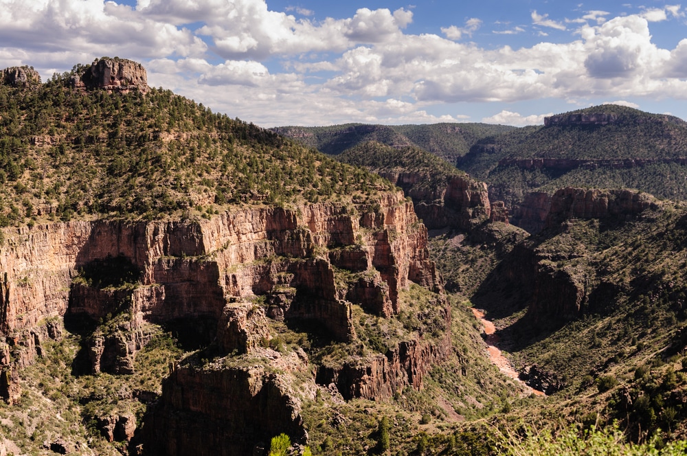
The only significant military engagement in Arizona occurred at Picacho Pass, forty miles northwest of Tucson, on April 15, 1862. This skirmish—sometimes called the “Battle of Picacho Peak”—saw Union Captain William P. Calloway and two enlisted men killed in a confused fight among the desert vegetation. Though tactically insignificant, it marked the westernmost battle of the Civil War and signaled the beginning of the end for Confederate Arizona.
Desert Realities vs. Confederate Dreams
The Confederacy’s grand vision for Arizona included establishing ports on the Gulf of California, mining precious metals to fund the war effort, and creating a transcontinental railroad route under Southern control. Jefferson Davis himself, having served as U.S. Secretary of War, understood the strategic importance of controlling the 32nd parallel route to the Pacific.
However, these ambitions crashed against harsh realities. Apache leaders like Cochise and Mangas Coloradas saw the Confederate presence as no different from any other encroachment on their lands. Raids intensified throughout 1861-1862, making travel dangerous and mining operations nearly impossible. The Overland Mail had ceased operations, cutting the economic lifeline many settlements depended upon.
Dr. Isaiah Woods, a physician in Tucson during this period, wrote: “The Confederates promise protection from the Apache, but they have neither the men nor supplies to make good on such promises. We are more isolated than ever, caught between warring Americans and defending Apache.”
The Union Prevails
By May 1862, Hunter had evacuated Tucson without firing a shot, retreating eastward as Carleton’s column approached. Union forces reoccupied Tucson on May 20, 1862, finding a town largely deserted by Anglo residents but still populated by its Mexican and Indigenous inhabitants. The California Column continued eastward, driving Confederate forces from the territory by July 1862.
The Union victory at Glorieta Pass in New Mexico (March 26-28, 1862) had already shattered Confederate hopes of controlling the Southwest. With their supply trains destroyed, Texas Confederate forces retreated down the Rio Grande Valley, abandoning any pretense of holding Arizona.
On February 24, 1863, President Abraham Lincoln signed the Arizona Organic Act, creating the Union Territory of Arizona—but with boundaries running north-south rather than east-west, effectively erasing the Confederate territorial configuration. The new capital was established at Prescott, far from the Southern sympathizer strongholds of Tucson and Mesilla.
Legacy of a Lost Cause in the Desert
The Confederate Territory of Arizona lasted barely thirteen months, controlling its claimed territory for even less time. Yet its brief existence left lasting marks on Arizona’s development. The Civil War accelerated federal investment in the territory, bringing military posts that would become modern cities and infrastructure that enabled eventual statehood in 1912.
The racial dynamics of Confederate Arizona also shaped the territory’s future. While slavery never took deep root in Arizona’s desert soil, the racial hierarchies promoted by Confederate sympathizers influenced territorial and early state laws. Arizona wouldn’t repeal its anti-miscegenation laws until 1962, a century after Confederate forces abandoned Tucson.
Indigenous peoples, particularly Apache bands, found themselves facing intensified military campaigns after the Civil War, as Union veterans were deployed to “pacify” the territory. The same Colonel Carleton who drove out the Confederates would institute brutal policies against Native peoples, including the forced Long Walk of the Navajo.
Modern Historical Interpretation
Today, historical markers across southern Arizona acknowledge this Confederate chapter, though often with minimal context. The Picacho Peak State Park preserves the battlefield site, while museums in Tucson and Tubac display artifacts from this turbulent period. Annual Civil War reenactments at Picacho Peak draw thousands of visitors, though these events increasingly emphasize education over romanticism.
The territorial configuration proposed by the Confederacy—dividing present-day Arizona and New Mexico along an east-west line—reveals how different our modern state boundaries might have been. This alternative geography would have created states oriented toward different economic and cultural centers, potentially altering the entire development of the Southwest.
Visit the History
Picacho Peak State Park
📍 Address: 15520 E Interstate 10, Picacho, AZ 85141
📞 Phone: (520) 466-3183
🌐 Website: azstateparks.com/picacho
🕒 Hours: Sunrise to 10 PM daily
💰 Admission: $7 per vehicle
♿ Accessibility: Visitor center and some trails are wheelchair accessible
Arizona History Museum
📍 Address: 949 E 2nd Street, Tucson, AZ 85719
📞 Phone: (520) 628-5774
🌐 Website: arizonahistoricalsociety.org
🕒 Hours: Tuesday-Saturday, 10 AM – 4 PM
💰 Admission: $5 adults, $3 seniors/students, free for children under 12
♿ Accessibility: Fully wheelchair accessible
Tubac Presidio State Historic Park
📍 Address: 1 Burruel Street, Tubac, AZ 85646
📞 Phone: (520) 398-2252
🌐 Website: azstateparks.com/tubac
🕒 Hours: Daily 9 AM – 5 PM
💰 Admission: $5 adults, $2 children 7-13
♿ Accessibility: Museum and grounds are wheelchair accessible
Additional Resources
For those interested in deeper exploration of this period, the Arizona Historical Society maintains extensive archives on Civil War-era Arizona. Dr. Andrew Masich’s “Civil War in the Southwest” provides comprehensive coverage of military campaigns, while the University of Arizona’s Special Collections houses primary documents from Confederate sympathizers and Union supporters alike. The annual Picacho Peak Civil War Days (usually held in March) offers living history demonstrations and educational programs about this unique chapter in Arizona history.