The morning sun casts long shadows across weathered asphalt and rusted rails half-buried in the desert floor. Here, in the vast expanses of Arizona, lie the remnants of once-vital transportation arteries that connected isolated communities to the wider world. These ghost highways and railways—abandoned, bypassed, or simply forgotten—tell the story of Arizona’s boom-and-bust cycles, of technological evolution, and of how the movement of people and goods has shaped the state’s development.
From the earliest indigenous trading paths and Spanish colonial routes to the grand railways and highways of the 20th century, Arizona’s landscape is etched with layers of transportation history. Each new technology—stagecoach, steam locomotive, automobile—created its own network, often building upon or alongside its predecessors before eventually being superseded itself.

These ghost transportation corridors are more than just abandoned infrastructure—they’re tangible connections to Arizona’s pioneering past. They reveal how transportation technology has repeatedly reshaped human geography, determining which communities would thrive and which would fade away. They show how even the most essential infrastructure eventually becomes historical artifact as technologies and travel patterns evolve.
By exploring these forgotten pathways, we gain perspective on our own transportation networks and the inevitable transitions they too will undergo. The ghost highways and railways of Arizona remind us that all infrastructure, no matter how vital it once seemed, exists within historical currents that eventually render it obsolete.
Each article provides detailed information on a specific ghost transportation route, including:
Whether you’re a history enthusiast, a photographer seeking unique landscapes, or simply curious about Arizona’s transportation heritage, these articles offer both practical information and evocative storytelling that brings these silent corridors back to life.
| Name | Type | Era | Location | Historical Significance | Current Status | Notable Features |
|---|---|---|---|---|---|---|
| Route 66 | Highway | 1926-1985 | Northern Arizona (Kingman to Lupton) | “Main Street of America,” key migration route west | Decommissioned; portions preserved as Historic Route 66 | Iconic stops: Hackberry General Store, Wigwam Motel, Jack Rabbit Trading Post |
| Plank Road | Highway | 1915-1926 | Yuma County (crossing Imperial Sand Dunes) | First road across the dunes; made of wooden planks | Remnants preserved as historical site | Wooden planks laid across shifting sand dunes; engineering marvel of its time |
| Apache Trail | Highway | 1905-Present | Central Arizona (east of Phoenix) | Built to transport materials for Roosevelt Dam | Partially active; sections washed out in 2019 fires | Spectacular canyon views; original unpaved sections remain |
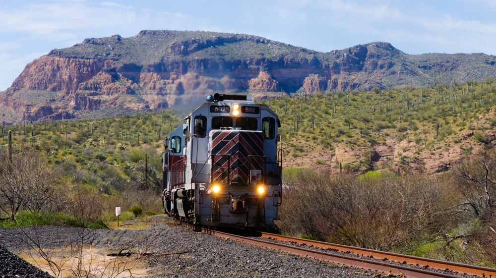
| Santa Fe Railway Mainline | Railway | 1880s-1960s | Northern Arizona (parallel to I-40) | Major transcontinental route | Active but realigned in places | Ghost stations, abandoned water towers, original stone bridges |
| Arizona & California Railroad | Railway | 1903-1991 | Western Arizona (Parker to Cadiz, CA) | Connected to mining districts | Partially abandoned; some sections still active | Abandoned stations, trestles crossing desert washes |
| Arizona Eastern Railway | Railway | 1904-1930s | Eastern Arizona (Globe to Miami) | Served copper mining districts | Portions abandoned; some sections repurposed | Tunnels, trestles through rugged terrain |
| Beale Wagon Road | Highway | 1857-1880s | Northern Arizona (aligned near modern I-40) | First federally funded wagon road through AZ | Traces visible in remote areas | Built by Army officer Edward Beale using experimental camel corps |
| Atlantic & Pacific Railroad | Railway | 1880s-1897 | Northern Arizona | Predecessor to Santa Fe Railway | Absorbed into larger system; some sections abandoned | Historic tunnels, remote sidings, abandoned maintenance facilities |
| US Highway 80 | Highway | 1926-1977 | Southern Arizona (Yuma to New Mexico) | Major east-west route before I-10 | Decommissioned; sections remain as state/local roads | Ghost tourist courts, abandoned gas stations, historic bridges |
| Tucson, Cornelia & Gila Bend Railroad | Railway | 1916-1985 | Southern Arizona (Gila Bend to Ajo) | Served New Cornelia copper mine | Abandoned | Remains of trestles, roadbed visible in desert |
| Arizona & New Mexico Railway | Railway | 1883-Present | Eastern Arizona to New Mexico | Mining and timber transport | Partially active, some abandoned branches | Historic depots, mining spurs |
| Jerome-Prescott Highway | Highway | 1920s-1950s | Central Arizona mountains | Connected mining town of Jerome to Prescott | Partially preserved as scenic byway | Hairpin turns, ghost sections reclaimed by nature |
| Arizona & Utah Railway | Railway | 1899-1933 | Northern Arizona | Connected to Grand Canyon mines | Abandoned | Visible grades, tunnel remains |
| Phoenix & Eastern Railroad | Railway | 1901-1910 | Central Arizona | Intended transcontinental route | Partially abandoned | Historic bridges, desert rights-of-way |
| Old Verde Highway | Highway | 1920s-1950s | Central Arizona | Connected Phoenix to Verde Valley | Mostly abandoned, replaced by I-17 | Concrete sections visible paralleling modern highway |
| Morenci Southern Railway | Railway | 1901-1922 | Eastern Arizona | Served copper mines | Abandoned | Spectacular trestles, mountain grades |
| Geronimo Trail | Highway | Pre-1900s-1920s | Southern Arizona mountains | Historic Apache route later used by settlers | Traces remain as unpaved forest roads | Remote mountain passes, historic significance to Apache resistance |
| Coronado Railroad | Railway | 1880s-1940s | Southeastern Arizona | Mining district connection | Abandoned | Remote grades in border country |
| Old Yuma Trail | Highway | Pre-1900s | Western Arizona desert | Ancient Native American trail later used by settlers | Traces visible in remote areas | Desert water holes, historic significance |
| Butterfield Overland Mail Route | Stagecoach | 1858-1861 | Southern Arizona | First regular mail/passenger service | Visible traces in remote areas | Stage stops, water holes, historic route markers |
We use cookies to improve your experience on our site. By using our site, you consent to cookies.
Manage your cookie preferences below:
Essential cookies enable basic functions and are necessary for the proper function of the website.
Statistics cookies collect information anonymously. This information helps us understand how visitors use our website.
Monetize your website by displaying targeted ads and earning revenue from clicks and impressions.
Google Analytics is a powerful tool that tracks and analyzes website traffic for informed marketing decisions.
Service URL: policies.google.com (opens in a new window)
You can find more information about our Cookie Policy and Privacy Policy.