
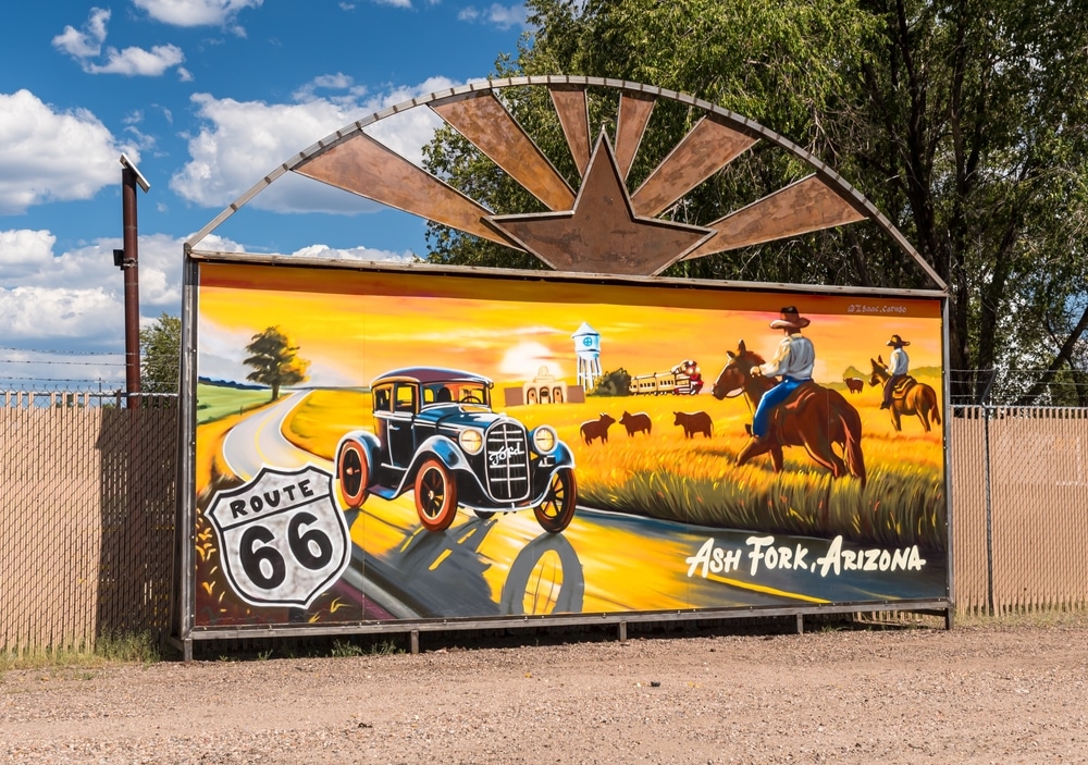
Exploring Ash Fork Arizona
Ash Fork: The Flagstone Capital of the World Tucked away in northern Arizona, just off Interstate 40, lies the small but historically rich town of
Welcome to the definitive resource on Arizona, where you’ll discover the remarkable diversity and rich heritage of the Grand Canyon State. Our comprehensive collection of information spans Arizona’s varied landscapes, from the iconic red rock formations of Sedona to the saguaro-studded Sonoran Desert, from ancient Native settlements to modern desert cities, and from deep canyons to soaring mountain forests. Whether you’re researching Arizona’s natural wonders, cultural heritage, or regional characteristics, you’ll find detailed, authoritative content throughout our site.
Arizona’s distinctive regions each offer their own character, landscapes, and attractions. Our regional guides provide in-depth exploration of the geographical, historical, and cultural elements that define these diverse areas of the state.
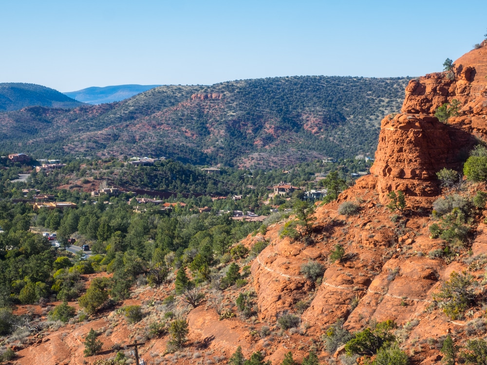
Northern Arizona stands as a captivating realm where ancient landscapes meet vibrant communities, where the Colorado River carves through millennia of geological history, and where diverse cultures have left their enduring imprint. This remarkable region stretches from the Grand Canyon’s majestic rim to the verdant ponderosa forests of the Mogollon Rim, and from the red rock formations of Sedona to the volcanic fields surrounding Flagstaff.
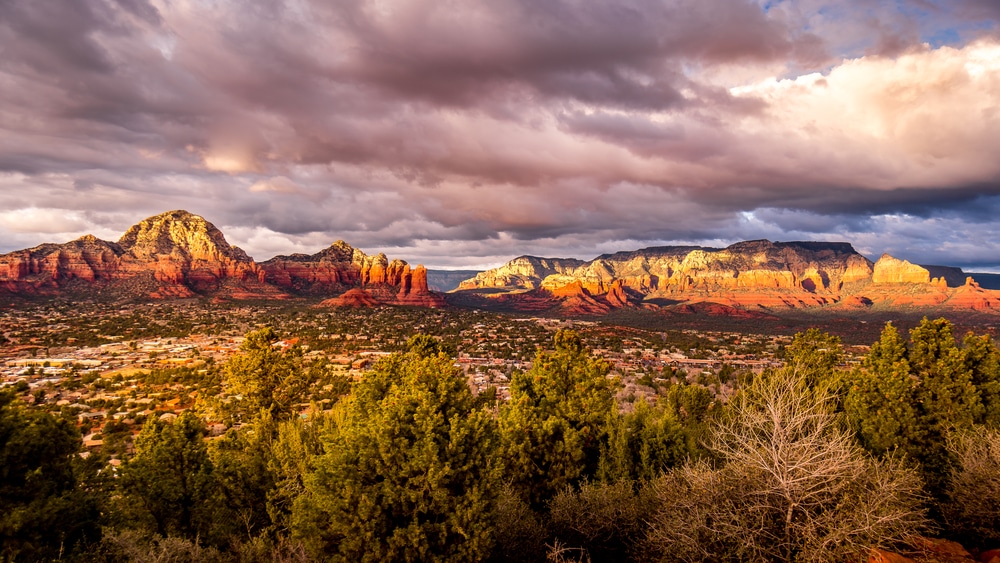
Communities including Flagstaff, Sedona, Prescott, Williams, Winslow, and Jerome each offer distinctive experiences while contributing to Northern Arizona’s collective character. Discover the university town energy of Flagstaff, the red rock vistas of Sedona, the historic Route 66 nostalgia of Williams and Winslow, and the reborn mining town turned artistic haven of Jerome.
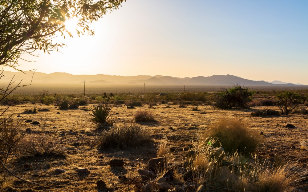
Southern Arizona captivates with its striking landscapes, rich cultural tapestry, and year-round outdoor adventures. This distinct region stretches from the saguaro-studded Sonoran Desert to the unexpected “sky island” mountain ranges that rise dramatically from the desert floor.
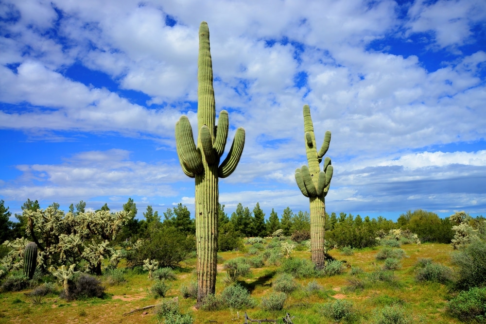
The iconic Sonoran Desert—the only place on earth where the majestic saguaro cactus grows wild—serves as the backdrop for an incredible range of ecosystems. The region’s “sky islands” create a natural phenomenon where mountain ranges rise like archipelagos from the desert floor, each supporting distinct biological communities that change dramatically with elevation.
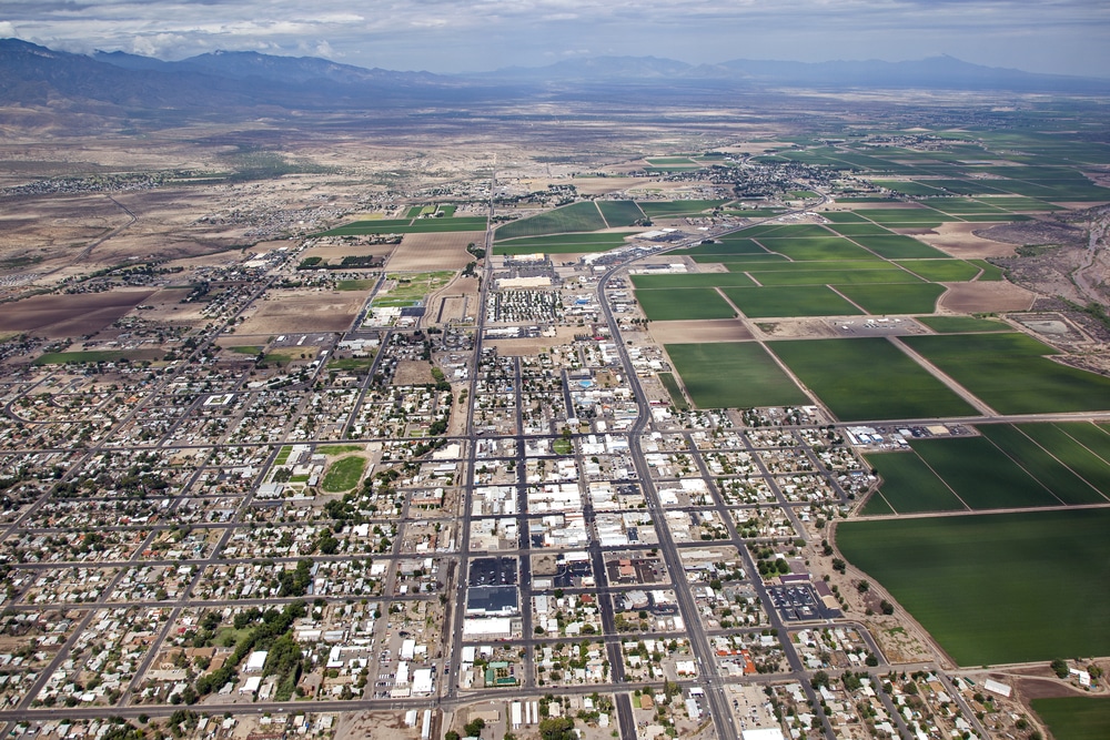
Central Arizona stands as a testament to human ingenuity against the backdrop of stunning Sonoran Desert landscapes. This vibrant region stretches across the sun-drenched Valley of the Sun and encompasses metropolitan Phoenix and its surrounding communities, extending outward to where urban innovation gradually gives way to rugged desert wilderness.
Defined by its dramatic mountain silhouettes, iconic saguaro cacti, and life-giving waterways including the Salt, Verde, and Gila Rivers, Central Arizona represents a dynamic blend of natural wonder and human achievement. The story of this land began thousands of years ago with the Hohokam people, whose sophisticated canal systems first transformed the desert into agricultural prosperity.
Eastern Arizona represents one of the Southwest’s most captivating yet overlooked treasures—a land where rugged mountain ranges rise dramatically from desert floors, where the Colorado River and its tributaries carve ancient pathways through stunning landscapes, and where thousands of years of human history unfold across a backdrop of extraordinary natural beauty.
This remarkable region stretches from the pine-covered Mogollon Rim in the north to the Sonoran Desert’s northern reaches in the south, encompassing dramatic elevation changes that create distinct ecological zones and climate variations. The towering Mogollon Rim—a 200-mile escarpment rising 2,000 feet—marks the southern edge of the Colorado Plateau, creating a natural boundary between the highland forests and the lower desert region
Western Arizona stands as a testament to nature’s remarkable contrasts and human perseverance. This vast region stretches along Arizona’s western border, defined by the mighty Colorado River that carves its way through desert landscapes, creating a lifeline of blue amidst golden sands and rugged mountains.
Geographically, Western Arizona encompasses everything from the high desert plateaus near the Grand Canyon’s western rim to the low desert valleys bordering California and Mexico. The Colorado River system not only forms the state’s western boundary but also creates a series of lakes and reservoirs that have transformed parts of this arid region into unexpected water recreation paradises.
Arizona’s landscape is defined by its remarkable federal lands, which cover approximately 38% of the state’s total area. These protected territories showcase some of the world’s most spectacular natural wonders, from the awe-inspiring depths of the Grand Canyon to the ancient petrified forests and towering saguaro cacti that have become iconic symbols of the American Southwest.
Arizona hosts three magnificent national parks that showcase the state’s most extraordinary landscapes. Grand Canyon National Park, a UNESCO World Heritage Site, protects one of Earth’s most spectacular geological wonders—a mile-deep chasm carved by the Colorado River over millions of years. Petrified Forest National Park preserves one of the world’s largest concentrations of petrified wood alongside colorful badlands of the Painted Desert. Saguaro National Park, divided into east and west districts flanking Tucson, protects forests of the nation’s largest cactus within the Sonoran Desert ecosystem.
Complementing these parks are 17 national monuments, each preserving unique natural and cultural treasures. From the ancient pueblos of Wupatki to the towering red cliffs of Vermilion Cliffs, these monuments protect specific features of scientific or historical importance.
Six national forests blanket Arizona’s higher elevations, covering over 11 million acres of diverse woodland and mountain terrain. The Coconino National Forest surrounds Flagstaff with ponderosa pine forests and dramatic red rock formations. The vast Tonto National Forest protects watersheds crucial to central Arizona’s water supply while spanning six ecological zones from desert to pine-covered mountains.
Unlike more restrictive designations, national forests operate under a multiple-use mandate, balancing recreation, wildlife habitat, watershed protection, sustainable timber harvesting, and grazing. These forests contain 36 designated wilderness areas where development and mechanized travel are prohibited to preserve natural conditions.
The Bureau of Land Management administers approximately 12.2 million acres of Arizona’s public lands—generally lower-elevation desert and semi-desert landscapes surrounding the national forests. These vast, open territories represent America’s truly multiple-use public lands, managed under a balanced approach that permits diverse activities from recreation to responsible resource development.
BLM lands offer some of Arizona’s most accessible public recreation opportunities, with minimal restrictions for activities like dispersed camping, target shooting in designated areas, and off-highway vehicle use on established routes.
Arizona’s nine National Wildlife Refuges protect critical habitat for migratory birds, endangered species, and native wildlife across 1.7 million acres of diverse ecosystems. These refuges, managed by the U.S. Fish and Wildlife Service, prioritize wildlife conservation while offering compatible recreational opportunities.
The expansive Cabeza Prieta National Wildlife Refuge in southwestern Arizona protects 860,000 acres of Sonoran Desert habitat for the endangered Sonoran pronghorn and more than 275 bird species, while Buenos Aires National Wildlife Refuge in southern Arizona features rare desert grasslands supporting the endangered masked bobwhite quail.
Arizona’s landscape is defined by its remarkable federal lands, which cover approximately 38% of the state’s total area. These protected territories showcase some of the world’s most spectacular natural wonders, from the awe-inspiring depths of the Grand Canyon to the ancient petrified forests and towering saguaro cacti that have become iconic symbols of the American Southwest.
Arizona’s desert parks showcase the stunning beauty and surprising diversity of the Sonoran Desert ecosystem—home to the iconic saguaro cactus and countless other specialized desert species. Parks like Lost Dutchman, Catalina, and Picacho Peak preserve some of the most spectacular desert landscapes in North America, where dramatic geological formations create unforgettable silhouettes against Arizona’s famous blue skies.
Perhaps most recognizable from Interstate 10, Picacho Peak’s distinctive profile marks the site of the westernmost battle of the Civil War. For cave enthusiasts, Kartchner Caverns presents a completely different desert wonder—a living limestone cave system with spectacular formations that continues to grow through active water seepage.
Arizona’s history comes alive through a remarkable collection of state historic parks that preserve pivotal chapters in the region’s development—from prehistoric settlements to Spanish colonial outposts, mining boomtowns, and territorial governance sites.
The Tubac Presidio State Historic Park protects Arizona’s oldest European settlement, while the Tombstone Courthouse State Historic Park houses artifacts and exhibits from the town’s famous silver mining era. Jerome State Historic Park occupies the former mansion of mining magnate James Douglas, offering a glimpse into Arizona’s copper mining heritage with stunning views of the Verde Valley from its mountainside perch.
In a state defined by its arid climate, Arizona’s riparian parks protect crucial water resources that have sustained life in the region for thousands of years. These parks showcase the striking contrast between flowing water and desert landscapes, creating biological hotspots that support remarkably diverse plant and animal communities.
Dead Horse Ranch State Park serves as the centerpiece of the Verde River Greenway, preserving a lush riverside habitat with excellent opportunities for bird watching, fishing, and paddling. Along the Colorado River, parks like Lake Havasu, Cattail Cove, and Buckskin Mountain offer access to the state’s western water playground with developed beaches, boat launches, and scenic shoreline trails.
While many associate Arizona with desert landscapes, the state’s mountain parks offer surprisingly lush forests, cool mountain streams, and alpine-like conditions that provide welcome relief during summer months and snow-covered landscapes in winter.
Fool Hollow Lake Recreation Area near Show Low exemplifies this high-country experience with its pine-studded shores and excellent fishing opportunities at 6,300 feet elevation. Perhaps no mountain park captures visitors’ imagination quite like Slide Rock State Park near Sedona, where Oak Creek has carved a natural water slide through red sandstone, creating one of Arizona’s most beloved summer destinations.
The sun-bleached ruins scattered across Arizona’s landscape tell stories of ambition, prosperity, and ultimate abandonment. From the towering mountains of the north to the searing deserts of the south, Arizona’s ghost towns stand as compelling monuments to the boom-and-bust cycles that defined the American West.
These forgotten communities—once vibrant centers of mining, commerce, and frontier life—emerged rapidly between the 1860s and early 1900s as prospectors discovered rich deposits of silver, gold, and copper throughout the territory. What began with individual prospectors swinging pickaxes soon transformed into industrial operations with stamp mills, smelters, and shaft mines that employed hundreds. Towns appeared virtually overnight, complete with saloons, hotels, and opera houses.
Today, these abandoned settlements exist on a spectrum of preservation. Some, like Jerome and Tombstone, have reinvented themselves as tourist destinations where visitors can walk historic streets and enter preserved buildings. Others remain as authentic ruins—crumbling adobe walls, weathered wooden structures, and silent mine shafts reclaimed by the desert.
The story of Arizona’s ghost towns is inseparably tied to the mineral wealth hidden beneath its rugged terrain. The territory’s first significant mineral rush began after the 1858 Gadsden Purchase secured the southern portion of Arizona from Mexico. Prospectors soon discovered substantial silver deposits in places like Tombstone, creating one of the richest silver districts in American history.
While silver dominated southern Arizona, gold fever swept the central and northern mountains. Mining camps like Goldfield, Oatman, and Wickenburg emerged as prospectors extracted placer gold from streambeds before developing hard rock mines. By the 1880s, copper became Arizona’s dominant mineral, transforming small operations into industrial behemoths that built company towns like Jerome, Bisbee, and Clifton.
Jerome (Yavapai County) perches dramatically on Cleopatra Hill overlooking the Verde Valley. Once known as the “Billion Dollar Copper Camp,” this former mining giant produced over 3 million pounds of copper monthly at its peak. After near-total abandonment in the 1950s, Jerome reinvented itself as an arts community and tourism destination.
Tombstone (Cochise County) earned its nickname as “The Town Too Tough to Die” by surviving both mining decline and devastating fires. The site of the famous 1881 O.K. Corral gunfight now features daily reenactments, preserved buildings including the Bird Cage Theatre, and the iconic Boot Hill Cemetery with its colorful epitaphs.
Vulture City (Maricopa County) outside Wickenburg features impressive ruins of Arizona’s most productive gold mine, which yielded over $200 million in precious metals. The assay office, Wickenburg’s cabin, and the hanging tree where 18 gold thieves reportedly met their end remain visible.
Fairbank (Cochise County) along the San Pedro River served as an important transportation hub for Tombstone’s mines. This National Conservation Area site managed by the Bureau of Land Management features a meticulously preserved schoolhouse that now serves as a museum.
In a state renowned for its arid landscapes and iconic desert vistas, Arizona’s abundant lakes offer a refreshing surprise to visitors and residents alike. These diverse bodies of water—ranging from vast reservoirs to intimate alpine pools—provide crucial ecological habitats and recreational havens across the state’s varied terrain.
Arizona’s engineering legacy is prominently displayed in its impressive reservoir lakes, created through ambitious dam projects that transformed the state’s water landscape throughout the 20th century.
Lake Powell, formed by the massive Glen Canyon Dam, stands as perhaps the most visually stunning with its maze of red rock canyons stretching across the Arizona-Utah border. Lake Mead, created by the historic Hoover Dam, represents another engineering marvel as America’s largest reservoir by volume when full. Roosevelt Lake, nestled in the Tonto Basin, offers the largest storage capacity of any lake entirely within Arizona.
In striking contrast to the vast reservoirs, Arizona’s natural lakes and desert oases represent rare ecological treasures in the arid Southwest. These water bodies—formed through various geological processes rather than human engineering—harbor unique ecosystems and provide glimpses into Arizona’s natural hydrological systems.
Mormon Lake, located south of Flagstaff, stands as Arizona’s largest natural lake when filled to capacity. Stoneman Lake, a rare natural sinkhole lake, occupies a collapsed limestone depression near the Mogollon Rim. Desert oases like Arivaca Lake in southern Arizona represent critical wildlife habitats, particularly for migratory birds traversing the arid landscapes.
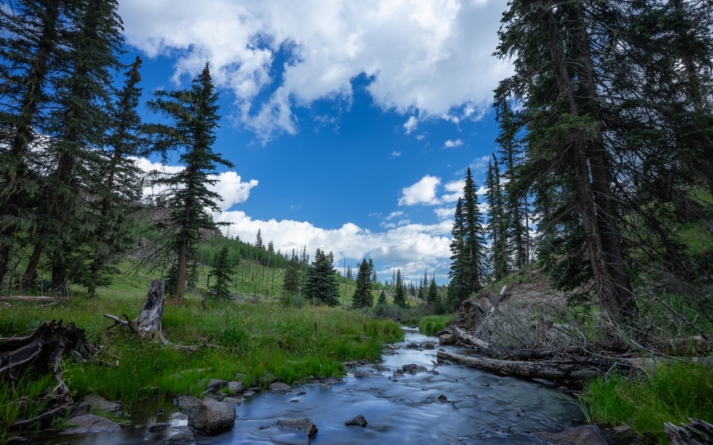
Tucked away in Arizona’s mountainous regions lies a collection of stunning high-elevation lakes that offer a completely different experience from their desert counterparts. These alpine and forest lakes, primarily concentrated along the Mogollon Rim and in the White Mountains, provide cool refuges during summer months and showcase Arizona’s surprising ecological diversity.
Blue Ridge Reservoir (C.C. Cragin) exemplifies these hidden treasures with its narrow, winding canyon waters surrounded by towering pines. The White Mountains region hosts numerous gem-like lakes including Big Lake, Crescent Lake, and Lee Valley Lake, situated at elevations above 9,000 feet.
Arizona’s commitment to providing water recreation extends into its urban centers, where a network of managed lakes creates accessible outdoor opportunities for residents and visitors. These carefully designed water features demonstrate innovative approaches to urban planning that incorporate both recreational and ecological values into city landscapes.
Tempe Town Lake stands as the premier example of urban water transformation in Arizona. Created by damming a portion of the normally dry Salt River bed in metropolitan Phoenix, this 2-mile-long lake hosts everything from kayaking to dragon boat races in the heart of the city.
For thousands of years before Arizona became a state, Indigenous peoples have called this diverse landscape home. Today, 22 federally recognized tribal nations continue their ancestral connections to these lands, maintaining rich cultural traditions while building vibrant contemporary communities.
Long before European contact, sophisticated civilizations flourished throughout what is now Arizona. These ancient cultures developed remarkable innovations in agriculture, architecture, art, and social organization—creating legacies that continue to influence the region today.
The Hohokam people transformed the Sonoran Desert through an elaborate canal system that irrigated vast agricultural fields. In northern Arizona, Ancestral Puebloan communities constructed magnificent cliff dwellings and multi-story structures that showcase advanced architectural knowledge. Sites like Canyon de Chelly, Wupatki, and Betatakin stand as testaments to their engineering skill and cultural sophistication.
Arizona’s 22 federally recognized tribes represent sovereign nations with inherent rights to self-governance. This tribal sovereignty—recognized through treaties, laws, and government-to-government relationships—means each tribal nation maintains its own governmental structures, legal systems, and community priorities.
These sovereign tribal communities range dramatically in size and population. The Navajo Nation spans over 27,000 square miles across three states, with more than 300,000 enrolled tribal members. Apache communities, O’odham peoples, river tribes, tribes of the Colorado Plateau, and Yavapai communities each maintain distinct linguistic, cultural, and historical backgrounds.
Arizona’s Native nations maintain vibrant cultural traditions that continue to evolve while remaining deeply rooted in ancestral knowledge. These living traditions represent some of the oldest continuous cultural practices in North America.
Languages form the foundation of tribal identity and knowledge systems. Traditional arts flourish throughout Arizona’s tribal communities, including Hopi katsina carvings, Navajo weaving, Apache basketry, O’odham pottery, and Zuni fetish carving. Ceremonial cycles continue to mark seasonal transitions and life passages, while food traditions connect tribal communities to ancestral knowledge.
Today’s tribal nations balance cultural preservation with economic development, creating communities that honor traditional values while building sustainable futures. This balance has produced innovative approaches to tribal enterprise, education, and environmental stewardship.
Tribal economic initiatives span diverse sectors, including gaming enterprises, shopping districts, agriculture, recreation, and hospitality. Education represents a crucial priority, with tribes operating their own school systems that integrate cultural knowledge alongside conventional academics.
Ash Fork: The Flagstone Capital of the World Tucked away in northern Arizona, just off Interstate 40, lies the small but historically rich town of

────────────────────────────── Ajo, Arizona• Ajo Elks Lodge #1576 Annual Golf Tournament – Held on April 12, 2025 at the Ajo Community Golf Course on Mead Road. Registration
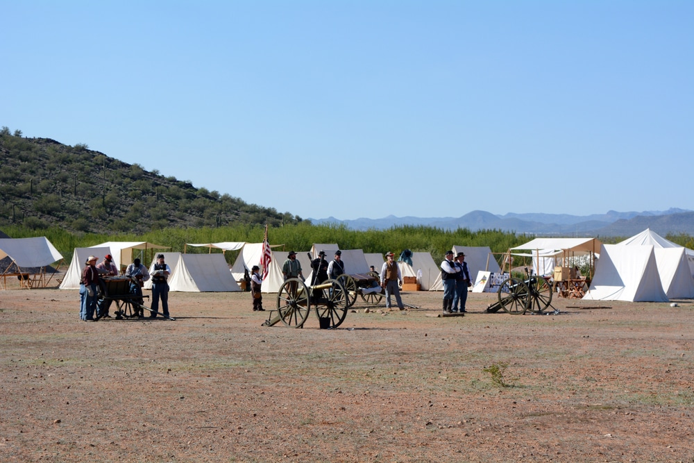
The morning of April 15, 1862, broke clear and cool over the stark granite peak of Picacho Pass, halfway between Phoenix and Tucson. Union cavalry
August in the high country of central Arizona brings a celebration that has become synonymous with summer’s peak harvest season and the natural beauty of
August brings one of northeastern Arizona’s most anticipated community celebrations to the historic town of St. Johns, where the 83rd Annual Apache County Fair continues
October arrives in the Gila Valley with the scent of autumn in the air and the promise of Arizona’s most cherished community traditions. This year
We use cookies to improve your experience on our site. By using our site, you consent to cookies.
Manage your cookie preferences below:
Essential cookies enable basic functions and are necessary for the proper function of the website.